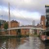
Centenary Bridge (Leeds) 
Address is taken from a point 281 yards away.

Mooring here is good (a nice place to moor), mooring rings or bollards are available. Good but rarely used moorings just before the bridge as you come from the South East on the port side.
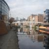
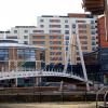
There is a bridge here which takes pedestrian traffic over the canal.
| Fearns Island Moorings | 2 furlongs | |
| Knight's Way Bridge | 1¾ furlongs | |
| Leeds Dock Entrance | 1¾ furlongs | |
| Site of Fearns Island Footbridge | 1¼ furlongs | |
| Crown Point Bridge | 1 furlong | |
| Centenary Bridge (Leeds) | ||
| Aire and Calder Dock | ¼ furlongs | |
| Leeds Bridge | 1½ furlongs | |
Why not log in and add some (select "External websites" from the menu (sometimes this is under "Edit"))?
Mouseover for more information or show routes to facility
Nearest water point
In the direction of Castleford Junction
In the direction of Leeds Bridge
Nearest rubbish disposal
In the direction of Castleford Junction
In the direction of Leeds Bridge
Nearest chemical toilet disposal
In the direction of Castleford Junction
In the direction of Leeds Bridge
Nearest place to turn
In the direction of Castleford Junction
In the direction of Leeds Bridge
Nearest self-operated pump-out
In the direction of Castleford Junction
In the direction of Leeds Bridge
Nearest boatyard pump-out
In the direction of Castleford Junction
In the direction of Leeds Bridge
Wikipedia has a page about Centenary Bridge
The Centenary Bridge is a motorway crossing of the Brisbane River. As it forms part of Brisbane's Centenary Motorway, it is used primarily by vehicular traffic, although it includes footpaths for pedestrian traffic.
Built to service the new Centenary Suburbs of Jindalee, Mount Ommaney and Westlake, the original two lane bridge opened in 1964. It was financed by the developers of the suburbs, LJ Hooker.
The bridge was duplicated as part of an upgrade of the Centenary Highway and Western Freeway south of Mount Cootha Road. The works were officially opened by Russell Hinze, Minister for Main Roads, on 27 March 1987.
During the 1974 floods, the bridge was badly damaged when a barge rammed into its upstream side. The barge blocked the flow of floodwaters under the bridge and there were real fears that the bridge would collapse. The barge was deliberately holed using explosives and allowed to sink to reduce the floodwater pressure on the bridge. When the floodwater receded, the barge was refloated and beached downstream near Fig Tree Pocket to be cut up for scrap. The damage sustained by the bridge required its partial closure for repairs. For two years after the floods, the bridge was reduced to a single lane, with one way traffic controlled by traffic lights at each end of the bridge.

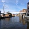
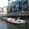
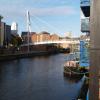
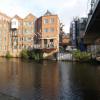





![The Old Brewery on north side of The Calls at High Court junction. There is an Ordnance Survey benchmark [[7918536]] on the near corner of the building which was built in 1868 and occupied by Whitbread and Co. Ltd Brewers and Bottlers. It was purchased and redeveloped by Yorkshire Design Group in 1989 to provide commercial offices and a media centre with sound-proofed editing suites. by Roger Templeman – 18 August 2023](https://s1.geograph.org.uk/geophotos/07/91/85/7918561_5830a29a_120x120.jpg)


