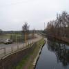
Limekiln Bridge No 17
Royal Mail Delivery Office, Crossley Retail Park, Carpet Trades Way, Kidderminster DY10 2TE, United Kingdom

Limekiln Bridge No 17
is a minor waterways place
on the Staffordshire and Worcestershire Canal (Main Line: Stourport to Stourton) between
Stourton Junction (Junction of the Staffordshire and Worcestershire Canal (Main Line) and the Stourbridge Canal.) (7 miles and 5½ furlongs
and 7 locks
to the northeast) and
Kidderminster (1¾ furlongs
to the southeast).
The nearest place in the direction of Stourton Junction is Stourvale New Bridge;
3 furlongs
away.
The nearest place in the direction of Kidderminster is Sainsbury's Moorings (Kidderminster) (Right outside the supermarket);
½ furlongs
away.
There is access (suitable for wheels) to the towpath here.
Mooring here is unrated.
There is a bridge here which takes a minor road over the canal.
Wolverley Court Lock No 7 | 1 mile | |
Wolverley Court Bridge No 19 | 1 mile | |
Broadwaters Aqueduct | 4½ furlongs | |
Broadwaters Aqueduct Winding Hole | 4½ furlongs | |
Stourvale New Bridge | 3 furlongs | |
Limekiln Bridge No 17 | ||
Sainsbury's Moorings (Kidderminster) | ½ furlongs | |
Kidderminster | 1¾ furlongs | |
Kidderminster Aqueduct | 2 furlongs | |
Kidderminster Lock No 6 | 2¼ furlongs | |
Kidderminster Lock Turnover Bridge | 2¼ furlongs |
Amenities nearby at Sainsbury's Moorings (Kidderminster)
Amenities in Kidderminster
Amenities at other places in Kidderminster
at
at
at
at
at
at
at
at
at
at
at
at
at
at
at
at
at
at
at
at
at
at
at
at
at
at
at
at
at
at
at
at
at
at
at
at
at
at
at
at
at
at
at
at
at
at
at
at
There are no links to external websites from here.
Why not log in and add some (select "External websites" from the menu (sometimes this is under "Edit"))?
Mouseover for more information or show routes to facility
Nearest water point
In the direction of Stourton Junction
Kinver Services — 6 miles, ½ furlongs and 5 locks away
On this waterway in the direction of Stourton Junction
Stewponey Water Point — 7 miles, 4¼ furlongs and 7 locks away
On this waterway in the direction of Stourton Junction
Greensforge Wharf Services — 10 miles, 4 furlongs and 10 locks away
Travel to Stourton Junction, then on the Staffordshire and Worcestershire Canal (Main Line: Stourton to Aldersley) to Greensforge Wharf Services
Stourbridge Visitor Moorings — 10 miles, 5½ furlongs and 11 locks away
Travel to Stourton Junction, then on the Stourbridge Canals (Main Line) to Wordsley Junction, then on the Stourbridge Canals (Stourbridge Branch) to Stourbridge Visitor Moorings
Blowers Green Pumphouse — 16 miles, 3 furlongs and 36 locks away
Travel to Stourton Junction, then on the Stourbridge Canals (Main Line) to Black Delph, then on the Birmingham Canal Navigations (Dudley Canal No 1 - Through Route) to Parkhead Junction, then on the Birmingham Canal Navigations (Dudley Canal No 2 - Coombeswood ) to Blowers Green Pumphouse
Bumble Hole Visitor Centre — 18 miles, 7¼ furlongs and 36 locks away
Travel to Stourton Junction, then on the Stourbridge Canals (Main Line) to Black Delph, then on the Birmingham Canal Navigations (Dudley Canal No 1 - Through Route) to Parkhead Junction, then on the Birmingham Canal Navigations (Dudley Canal No 2 - Coombeswood ) to Bumble Hole Visitor Centre
Dudley Tunnel (northern entrance) — 18 miles, 3¼ furlongs and 39 locks away
Travel to Stourton Junction, then on the Stourbridge Canals (Main Line) to Black Delph, then on the Birmingham Canal Navigations (Dudley Canal No 1 - Through Route) to Pensnett Junction, then on the Birmingham Canal Navigations (Dudley Canal No 1 - Dudley Tunnel) to Dudley Tunnel (northern entrance)
Dudley Canal & Tunnel Trust Footbridge — 18 miles, 3¾ furlongs and 39 locks away
Travel to Stourton Junction, then on the Stourbridge Canals (Main Line) to Black Delph, then on the Birmingham Canal Navigations (Dudley Canal No 1 - Through Route) to Pensnett Junction, then on the Birmingham Canal Navigations (Dudley Canal No 1 - Dudley Tunnel) to Dudley Tunnel (northern entrance), then on the Birmingham Canal Navigations (Dudley Canal No 1 - Birmingham End) to Dudley Canal & Tunnel Trust Footbridge
Black Country Museum — 18 miles, 4¼ furlongs and 39 locks away
Travel to Stourton Junction, then on the Stourbridge Canals (Main Line) to Black Delph, then on the Birmingham Canal Navigations (Dudley Canal No 1 - Through Route) to Pensnett Junction, then on the Birmingham Canal Navigations (Dudley Canal No 1 - Dudley Tunnel) to Dudley Tunnel (northern entrance), then on the Birmingham Canal Navigations (Dudley Canal No 1 - Birmingham End) to Black Country Museum
Todds End Customer Service Facility — 18 miles, 4½ furlongs and 39 locks away
Travel to Stourton Junction, then on the Stourbridge Canals (Main Line) to Black Delph, then on the Birmingham Canal Navigations (Dudley Canal No 1 - Through Route) to Pensnett Junction, then on the Birmingham Canal Navigations (Dudley Canal No 1 - Dudley Tunnel) to Dudley Tunnel (northern entrance), then on the Birmingham Canal Navigations (Dudley Canal No 1 - Birmingham End) to Todds End Customer Service Facility
In the direction of York Street Bridge
Caldwall Mill Bridge No 14 — 6½ furlongs and 1 lock away
On this waterway in the direction of York Street Bridge
Upper Basin Waterpoint — 4 miles, 4¾ furlongs and 4 locks away
Travel to York Street Bridge, then on the Staffordshire and Worcestershire Canal (Stourport Basins: Narrow Route) to Upper Basin Waterpoint
Lincomb Lock — 6 miles and 6 locks away
Travel to York Street Bridge, then on the Staffordshire and Worcestershire Canal (Stourport Basins: Narrow Route) to Stourport Upper Basin, then on the Staffordshire and Worcestershire Canal (Stourport Basins: Broad Route) to Severn - Stourport Broad Locks Entrance, then on the River Severn (main river - Stourport to Worcester) to Lincomb Lock
Holt Lock (Holt Fleet) — 10 miles, 1¾ furlongs and 7 locks away
Travel to York Street Bridge, then on the Staffordshire and Worcestershire Canal (Stourport Basins: Narrow Route) to Stourport Upper Basin, then on the Staffordshire and Worcestershire Canal (Stourport Basins: Broad Route) to Severn - Stourport Broad Locks Entrance, then on the River Severn (main river - Stourport to Worcester) to Holt Lock (Holt Fleet)
Worcester Trip Boat Moorings — 16 miles, 6¾ furlongs and 9 locks away
Travel to York Street Bridge, then on the Staffordshire and Worcestershire Canal (Stourport Basins: Narrow Route) to Stourport Upper Basin, then on the Staffordshire and Worcestershire Canal (Stourport Basins: Broad Route) to Severn - Stourport Broad Locks Entrance, then on the River Severn (main river - Stourport to Worcester) to Worcester Trip Boat Moorings
Diglis Locks — 17 miles, 7¼ furlongs and 9 locks away
Travel to York Street Bridge, then on the Staffordshire and Worcestershire Canal (Stourport Basins: Narrow Route) to Stourport Upper Basin, then on the Staffordshire and Worcestershire Canal (Stourport Basins: Broad Route) to Severn - Stourport Broad Locks Entrance, then on the River Severn (main river - Stourport to Worcester) to Diglis Junction, then on the River Severn (main river - Worcester to Gloucester) to Diglis Locks
Diglis Services — 17 miles, 6½ furlongs and 11 locks away
Travel to York Street Bridge, then on the Staffordshire and Worcestershire Canal (Stourport Basins: Narrow Route) to Stourport Upper Basin, then on the Staffordshire and Worcestershire Canal (Stourport Basins: Broad Route) to Severn - Stourport Broad Locks Entrance, then on the River Severn (main river - Stourport to Worcester) to Diglis Junction, then on the Worcester and Birmingham Canal (Diglis Junction to Diglis Basin) to Diglis Basin, then on the Worcester and Birmingham Canal (Diglis Basin to King's Norton Junction) to Diglis Services
Lowesmoor Basin — 18 miles, 6 furlongs and 13 locks away
Travel to York Street Bridge, then on the Staffordshire and Worcestershire Canal (Stourport Basins: Narrow Route) to Stourport Upper Basin, then on the Staffordshire and Worcestershire Canal (Stourport Basins: Broad Route) to Severn - Stourport Broad Locks Entrance, then on the River Severn (main river - Stourport to Worcester) to Diglis Junction, then on the Worcester and Birmingham Canal (Diglis Junction to Diglis Basin) to Diglis Basin, then on the Worcester and Birmingham Canal (Diglis Basin to King's Norton Junction) to Lowesmoor Basin
Netherwich Basin — 18 miles, 5¼ furlongs and 16 locks away
Travel to York Street Bridge, then on the Staffordshire and Worcestershire Canal (Stourport Basins: Narrow Route) to Stourport Upper Basin, then on the Staffordshire and Worcestershire Canal (Stourport Basins: Broad Route) to Severn - Stourport Broad Locks Entrance, then on the River Severn (main river - Stourport to Worcester) to Hawford Junction, then on the Droitwich Canals (Droitwich Barge Canal) to Netherwich BasinNearest rubbish disposal
In the direction of Stourton Junction
Kinver Services — 6 miles, ½ furlongs and 5 locks away
On this waterway in the direction of Stourton Junction
Greensforge Wharf Services — 10 miles, 4 furlongs and 10 locks away
Travel to Stourton Junction, then on the Staffordshire and Worcestershire Canal (Main Line: Stourton to Aldersley) to Greensforge Wharf Services
Stourbridge Basin — 10 miles, 7½ furlongs and 11 locks away
Travel to Stourton Junction, then on the Stourbridge Canals (Main Line) to Wordsley Junction, then on the Stourbridge Canals (Stourbridge Branch) to Stourbridge Basin
Bratch Bottom Lock No 23 — 14 miles, 1½ furlongs and 16 locks away
Travel to Stourton Junction, then on the Staffordshire and Worcestershire Canal (Main Line: Stourton to Aldersley) to Bratch Bottom Lock No 23
Delph Bottom Lock No 8 — 14 miles, 2¼ furlongs and 27 locks away
Travel to Stourton Junction, then on the Stourbridge Canals (Main Line) to Black Delph, then on the Birmingham Canal Navigations (Dudley Canal No 1 - Through Route) to Delph Bottom Lock No 8
Waterfront Services (Dudley) — 15 miles, 2¼ furlongs and 35 locks away
Travel to Stourton Junction, then on the Stourbridge Canals (Main Line) to Black Delph, then on the Birmingham Canal Navigations (Dudley Canal No 1 - Through Route) to Waterfront Services (Dudley)
Blowers Green Bridge — 16 miles, 3¼ furlongs and 36 locks away
Travel to Stourton Junction, then on the Stourbridge Canals (Main Line) to Black Delph, then on the Birmingham Canal Navigations (Dudley Canal No 1 - Through Route) to Parkhead Junction, then on the Birmingham Canal Navigations (Dudley Canal No 2 - Coombeswood ) to Blowers Green Bridge
Black Country Museum — 18 miles, 4¼ furlongs and 39 locks away
Travel to Stourton Junction, then on the Stourbridge Canals (Main Line) to Black Delph, then on the Birmingham Canal Navigations (Dudley Canal No 1 - Through Route) to Pensnett Junction, then on the Birmingham Canal Navigations (Dudley Canal No 1 - Dudley Tunnel) to Dudley Tunnel (northern entrance), then on the Birmingham Canal Navigations (Dudley Canal No 1 - Birmingham End) to Black Country Museum
In the direction of York Street Bridge
Upper Basin Waterpoint — 4 miles, 4¾ furlongs and 4 locks away
Travel to York Street Bridge, then on the Staffordshire and Worcestershire Canal (Stourport Basins: Narrow Route) to Upper Basin Waterpoint
Sabrina Footbridge — 16 miles, 4¾ furlongs and 9 locks away
Travel to York Street Bridge, then on the Staffordshire and Worcestershire Canal (Stourport Basins: Narrow Route) to Stourport Upper Basin, then on the Staffordshire and Worcestershire Canal (Stourport Basins: Broad Route) to Severn - Stourport Broad Locks Entrance, then on the River Severn (main river - Stourport to Worcester) to Sabrina Footbridge
Diglis Basin — 17 miles, 5¾ furlongs and 11 locks away
Travel to York Street Bridge, then on the Staffordshire and Worcestershire Canal (Stourport Basins: Narrow Route) to Stourport Upper Basin, then on the Staffordshire and Worcestershire Canal (Stourport Basins: Broad Route) to Severn - Stourport Broad Locks Entrance, then on the River Severn (main river - Stourport to Worcester) to Diglis Junction, then on the Worcester and Birmingham Canal (Diglis Junction to Diglis Basin) to Diglis Basin
Lowesmoor Basin — 18 miles, 6 furlongs and 13 locks away
Travel to York Street Bridge, then on the Staffordshire and Worcestershire Canal (Stourport Basins: Narrow Route) to Stourport Upper Basin, then on the Staffordshire and Worcestershire Canal (Stourport Basins: Broad Route) to Severn - Stourport Broad Locks Entrance, then on the River Severn (main river - Stourport to Worcester) to Diglis Junction, then on the Worcester and Birmingham Canal (Diglis Junction to Diglis Basin) to Diglis Basin, then on the Worcester and Birmingham Canal (Diglis Basin to King's Norton Junction) to Lowesmoor Basin
Netherwich Basin — 18 miles, 5¼ furlongs and 16 locks away
Travel to York Street Bridge, then on the Staffordshire and Worcestershire Canal (Stourport Basins: Narrow Route) to Stourport Upper Basin, then on the Staffordshire and Worcestershire Canal (Stourport Basins: Broad Route) to Severn - Stourport Broad Locks Entrance, then on the River Severn (main river - Stourport to Worcester) to Hawford Junction, then on the Droitwich Canals (Droitwich Barge Canal) to Netherwich BasinNearest chemical toilet disposal
In the direction of Stourton Junction
Kinver Services — 6 miles, ½ furlongs and 5 locks away
On this waterway in the direction of Stourton Junction
Greensforge Wharf Services — 10 miles, 4 furlongs and 10 locks away
Travel to Stourton Junction, then on the Staffordshire and Worcestershire Canal (Main Line: Stourton to Aldersley) to Greensforge Wharf Services
Stourbridge Basin — 10 miles, 7½ furlongs and 11 locks away
Travel to Stourton Junction, then on the Stourbridge Canals (Main Line) to Wordsley Junction, then on the Stourbridge Canals (Stourbridge Branch) to Stourbridge Basin
Waterfront Services (Dudley) — 15 miles, 2¼ furlongs and 35 locks away
Travel to Stourton Junction, then on the Stourbridge Canals (Main Line) to Black Delph, then on the Birmingham Canal Navigations (Dudley Canal No 1 - Through Route) to Waterfront Services (Dudley)
Blowers Green Pumphouse — 16 miles, 3 furlongs and 36 locks away
Travel to Stourton Junction, then on the Stourbridge Canals (Main Line) to Black Delph, then on the Birmingham Canal Navigations (Dudley Canal No 1 - Through Route) to Parkhead Junction, then on the Birmingham Canal Navigations (Dudley Canal No 2 - Coombeswood ) to Blowers Green Pumphouse
Dudley Tunnel (northern entrance) — 18 miles, 3¼ furlongs and 39 locks away
Travel to Stourton Junction, then on the Stourbridge Canals (Main Line) to Black Delph, then on the Birmingham Canal Navigations (Dudley Canal No 1 - Through Route) to Pensnett Junction, then on the Birmingham Canal Navigations (Dudley Canal No 1 - Dudley Tunnel) to Dudley Tunnel (northern entrance)
Black Country Museum — 18 miles, 4¼ furlongs and 39 locks away
Travel to Stourton Junction, then on the Stourbridge Canals (Main Line) to Black Delph, then on the Birmingham Canal Navigations (Dudley Canal No 1 - Through Route) to Pensnett Junction, then on the Birmingham Canal Navigations (Dudley Canal No 1 - Dudley Tunnel) to Dudley Tunnel (northern entrance), then on the Birmingham Canal Navigations (Dudley Canal No 1 - Birmingham End) to Black Country Museum
Todds End Customer Service Facility — 18 miles, 4½ furlongs and 39 locks away
Travel to Stourton Junction, then on the Stourbridge Canals (Main Line) to Black Delph, then on the Birmingham Canal Navigations (Dudley Canal No 1 - Through Route) to Pensnett Junction, then on the Birmingham Canal Navigations (Dudley Canal No 1 - Dudley Tunnel) to Dudley Tunnel (northern entrance), then on the Birmingham Canal Navigations (Dudley Canal No 1 - Birmingham End) to Todds End Customer Service Facility
In the direction of York Street Bridge
Caldwall Mill Bridge No 14 — 6½ furlongs and 1 lock away
On this waterway in the direction of York Street Bridge
Upper Basin Waterpoint — 4 miles, 4¾ furlongs and 4 locks away
Travel to York Street Bridge, then on the Staffordshire and Worcestershire Canal (Stourport Basins: Narrow Route) to Upper Basin Waterpoint
Stourport Marina — 5 miles, 4¾ furlongs and 6 locks away
Travel to York Street Bridge, then on the Staffordshire and Worcestershire Canal (Stourport Basins: Narrow Route) to Stourport Upper Basin, then on the Staffordshire and Worcestershire Canal (Stourport Basins: Broad Route) to Severn - Stourport Broad Locks Entrance, then on the River Severn (main river - Stourport to Worcester) to Stourport Marina
Diglis Services — 17 miles, 6½ furlongs and 11 locks away
Travel to York Street Bridge, then on the Staffordshire and Worcestershire Canal (Stourport Basins: Narrow Route) to Stourport Upper Basin, then on the Staffordshire and Worcestershire Canal (Stourport Basins: Broad Route) to Severn - Stourport Broad Locks Entrance, then on the River Severn (main river - Stourport to Worcester) to Diglis Junction, then on the Worcester and Birmingham Canal (Diglis Junction to Diglis Basin) to Diglis Basin, then on the Worcester and Birmingham Canal (Diglis Basin to King's Norton Junction) to Diglis Services
Lowesmoor Basin — 18 miles, 6 furlongs and 13 locks away
Travel to York Street Bridge, then on the Staffordshire and Worcestershire Canal (Stourport Basins: Narrow Route) to Stourport Upper Basin, then on the Staffordshire and Worcestershire Canal (Stourport Basins: Broad Route) to Severn - Stourport Broad Locks Entrance, then on the River Severn (main river - Stourport to Worcester) to Diglis Junction, then on the Worcester and Birmingham Canal (Diglis Junction to Diglis Basin) to Diglis Basin, then on the Worcester and Birmingham Canal (Diglis Basin to King's Norton Junction) to Lowesmoor BasinNearest place to turn
In the direction of Stourton Junction
Broadwaters Aqueduct Winding Hole — 4½ furlongs away
On this waterway in the direction of Stourton Junction
Lea Lane Winding Hole — 2 miles, ¼ furlongs and 2 locks away
On this waterway in the direction of Stourton Junction
Debdale Lock Winding Hole — 2 miles, 5¾ furlongs and 3 locks away
On this waterway in the direction of Stourton Junction
Cookley Forge Towpath Bridge — 2 miles, 6¾ furlongs and 3 locks away
On this waterway in the direction of Stourton Junction
Whittington Winding Hole — 5 miles, 2 furlongs and 4 locks away
On this waterway in the direction of Stourton Junction
Hyde Lock Winding Hole — 6 miles, 4 furlongs and 6 locks away
On this waterway in the direction of Stourton Junction
Stourton Junction — 7 miles, 5½ furlongs and 7 locks away
On this waterway in the direction of Stourton Junction
Gothersley Winding Hole — 9 miles, 1½ furlongs and 7 locks away
Travel to Stourton Junction, then on the Staffordshire and Worcestershire Canal (Main Line: Stourton to Aldersley) to Gothersley Winding Hole
Winding Hole above Stourton Top Lock — 8 miles, ¼ furlongs and 11 locks away
Travel to Stourton Junction, then on the Stourbridge Canals (Main Line) to Winding Hole above Stourton Top Lock
In the direction of York Street Bridge
Kidderminster — 1¾ furlongs away
On this waterway in the direction of York Street Bridge
Academy Winding Hole — 4 furlongs and 1 lock away
On this waterway in the direction of York Street Bridge
Pratt's Wharf — 2 miles, 3 furlongs and 3 locks away
On this waterway in the direction of York Street Bridge
Former Railway Interchange Basin — 3 miles, 6½ furlongs and 3 locks away
On this waterway in the direction of York Street Bridge
Stourport Upper Basin — 4 miles, 5 furlongs and 4 locks away
Travel to York Street Bridge, then on the Staffordshire and Worcestershire Canal (Stourport Basins: Narrow Route) to Stourport Upper Basin
Stourport Clock Basin — 4 miles, 5¼ furlongs and 4 locks away
Travel to York Street Bridge, then on the Staffordshire and Worcestershire Canal (Stourport Basins: Narrow Route) to Stourport Clock Basin
Stourport Lower Basin - between Broad Locks — 4 miles, 5½ furlongs and 5 locks away
Travel to York Street Bridge, then on the Staffordshire and Worcestershire Canal (Stourport Basins: Narrow Route) to Stourport Upper Basin, then on the Staffordshire and Worcestershire Canal (Stourport Basins: Broad Route) to Stourport Lower Basin - between Broad Locks
Stourport Lower Basin - between Narrow Locks — 4 miles, 6 furlongs and 5 locks away
Travel to York Street Bridge, then on the Staffordshire and Worcestershire Canal (Stourport Basins: Narrow Route) to Stourport Upper Basin, then on the Staffordshire and Worcestershire Canal (Stourport Basins: Broad Route) to Stourport Lower Basin - between Broad Locks, then on the Staffordshire and Worcestershire Canal (Stourport Basins: Broad Locks to Narrow Locks to Stourport Lower Basin - between Narrow Locks
Severn - Stourport Narrow Locks Entrance — 4 miles, 6½ furlongs and 6 locks away
Travel to York Street Bridge, then on the Staffordshire and Worcestershire Canal (Stourport Basins: Narrow Route) to Stourport Upper Basin, then on the Staffordshire and Worcestershire Canal (Stourport Basins: Broad Route) to Severn - Stourport Broad Locks Entrance, then on the River Severn (main river - Stourport to Worcester) to Severn - Stourport Narrow Locks Entrance
Holt Lock Weir Entrance — 9 miles, 7½ furlongs and 7 locks away
Travel to York Street Bridge, then on the Staffordshire and Worcestershire Canal (Stourport Basins: Narrow Route) to Stourport Upper Basin, then on the Staffordshire and Worcestershire Canal (Stourport Basins: Broad Route) to Severn - Stourport Broad Locks Entrance, then on the River Severn (main river - Stourport to Worcester) to Holt Lock Weir Entrance
Holt Lock Weir Exit — 10 miles, 2¾ furlongs and 8 locks away
Travel to York Street Bridge, then on the Staffordshire and Worcestershire Canal (Stourport Basins: Narrow Route) to Stourport Upper Basin, then on the Staffordshire and Worcestershire Canal (Stourport Basins: Broad Route) to Severn - Stourport Broad Locks Entrance, then on the River Severn (main river - Stourport to Worcester) to Holt Lock Weir ExitNearest self-operated pump-out
In the direction of Stourton Junction
Kinver Services — 6 miles, ½ furlongs and 5 locks away
On this waterway in the direction of Stourton Junction
Dudley Tunnel (northern entrance) — 18 miles, 3¼ furlongs and 39 locks away
Travel to Stourton Junction, then on the Stourbridge Canals (Main Line) to Black Delph, then on the Birmingham Canal Navigations (Dudley Canal No 1 - Through Route) to Pensnett Junction, then on the Birmingham Canal Navigations (Dudley Canal No 1 - Dudley Tunnel) to Dudley Tunnel (northern entrance)
Black Country Museum — 18 miles, 4¼ furlongs and 39 locks away
Travel to Stourton Junction, then on the Stourbridge Canals (Main Line) to Black Delph, then on the Birmingham Canal Navigations (Dudley Canal No 1 - Through Route) to Pensnett Junction, then on the Birmingham Canal Navigations (Dudley Canal No 1 - Dudley Tunnel) to Dudley Tunnel (northern entrance), then on the Birmingham Canal Navigations (Dudley Canal No 1 - Birmingham End) to Black Country Museum
Todds End Customer Service Facility — 18 miles, 4½ furlongs and 39 locks away
Travel to Stourton Junction, then on the Stourbridge Canals (Main Line) to Black Delph, then on the Birmingham Canal Navigations (Dudley Canal No 1 - Through Route) to Pensnett Junction, then on the Birmingham Canal Navigations (Dudley Canal No 1 - Dudley Tunnel) to Dudley Tunnel (northern entrance), then on the Birmingham Canal Navigations (Dudley Canal No 1 - Birmingham End) to Todds End Customer Service Facility
In the direction of York Street Bridge
Diglis Services — 17 miles, 6½ furlongs and 11 locks away
Travel to York Street Bridge, then on the Staffordshire and Worcestershire Canal (Stourport Basins: Narrow Route) to Stourport Upper Basin, then on the Staffordshire and Worcestershire Canal (Stourport Basins: Broad Route) to Severn - Stourport Broad Locks Entrance, then on the River Severn (main river - Stourport to Worcester) to Diglis Junction, then on the Worcester and Birmingham Canal (Diglis Junction to Diglis Basin) to Diglis Basin, then on the Worcester and Birmingham Canal (Diglis Basin to King's Norton Junction) to Diglis ServicesNearest boatyard pump-out
In the direction of Stourton Junction
Withymoor Island Service Wharf — 18 miles, 4¼ furlongs and 36 locks away
Travel to Stourton Junction, then on the Stourbridge Canals (Main Line) to Black Delph, then on the Birmingham Canal Navigations (Dudley Canal No 1 - Through Route) to Parkhead Junction, then on the Birmingham Canal Navigations (Dudley Canal No 2 - Coombeswood ) to Withymoor Island Service Wharf
In the direction of York Street Bridge
Stourport Upper Basin — 4 miles, 5 furlongs and 4 locks away
Travel to York Street Bridge, then on the Staffordshire and Worcestershire Canal (Stourport Basins: Narrow Route) to Stourport Upper Basin
Upper Staircase Lock Landing Pontoon — 4 miles, 5½ furlongs and 4 locks away
Travel to York Street Bridge, then on the Staffordshire and Worcestershire Canal (Stourport Basins: Narrow Route) to Upper Staircase Lock Landing Pontoon
Stourport Marina — 5 miles, 4¾ furlongs and 6 locks away
Travel to York Street Bridge, then on the Staffordshire and Worcestershire Canal (Stourport Basins: Narrow Route) to Stourport Upper Basin, then on the Staffordshire and Worcestershire Canal (Stourport Basins: Broad Route) to Severn - Stourport Broad Locks Entrance, then on the River Severn (main river - Stourport to Worcester) to Stourport Marina
Lowesmoor Basin — 18 miles, 6 furlongs and 13 locks away
Travel to York Street Bridge, then on the Staffordshire and Worcestershire Canal (Stourport Basins: Narrow Route) to Stourport Upper Basin, then on the Staffordshire and Worcestershire Canal (Stourport Basins: Broad Route) to Severn - Stourport Broad Locks Entrance, then on the River Severn (main river - Stourport to Worcester) to Diglis Junction, then on the Worcester and Birmingham Canal (Diglis Junction to Diglis Basin) to Diglis Basin, then on the Worcester and Birmingham Canal (Diglis Basin to King's Norton Junction) to Lowesmoor BasinDirection of TV transmitter (From Wolfbane Cybernetic)
There is no page on Wikipedia called “Limekiln Bridge”
Wikipedia pages that might relate to Limekiln Bridge
[Limekiln State Park]
Limekiln State Park is a state park of California, United States, on the Big Sur coast. It contains four lime kilns from an 1887–1890 lime-calcining operation
[Bixby Creek Bridge]
coast and mined the high grade limestone located in the area. To feed the limekiln fires, they cut much of the old growth redwood in the canyon. They built
[Horsham–Montgomery Bridge]
The Horsham–Montgomery Bridge is a stone bridge that carries Pennsylvania Route 152 (Limekiln Pike) over the Little Neshaminy Creek in Montgomery County
[Pennsylvania Route 152]
after the Pennsylvania Turnpike bridge, Susquehanna Road splits to the northwest and PA 152 continues north along Limekiln Pike, passing businesses in the
[Coventry Canal]
Canal Bridge. From the canal basin, the canal meanders north through Coventry passing under many road bridges including prominent hump-back bridges under
[Pool of London]
section between London Bridge and the Cherry Garden Pier in Bermondsey. The Lower Pool runs from the Cherry Garden Pier to Limekiln Creek. Originally, the
[Firth of Forth]
May Lowest bridging point: Stirling North shore Aberdour, Anstruther Buckhaven, Burntisland Cellardyke, Crail Culross Charlestown, Limekilns Dalgety Bay
[Lime kiln]
19th century limekilns at Froghall. A preserved lime kiln in Burgess Park, London. Old lime kiln, Boscastle, Cornwall. A large limekiln at Broadstone
[Aliso Creek (Los Angeles County)]
[Pedestrian Bridge] (1967) Service bridges Devonshire Street Lemarsh Street Reseda Boulevard (1950) Lassen Street (1966) Yolanda Avenue (1963) Limekiln Canyon
[Rocky Creek Bridge (California)]
Rocky Creek Bridge is a reinforced concrete open-spandrel arch bridge on the Big Sur coast of California, built in 1932. It is located in Monterey County
Results of Google Search
AUGUST 1: Limekiln State Park remains open during the Mill Fire. As of this morning, smoke was not impacting park visitors ... Phone Number. (805) 434- 1996Â ...
Jun 19, 2019 ... Find an Open Space preserve where you can hike, ride, walk the dog, and more. Discover your next adventure today.
The Lime Kiln Trail is actually the southern half of the Robe Canyon Trail. A railroad once ran along this canyon but the bridge, which spanned the river, is no  ...
Jan 16, 2012 ... Limekiln Bridge on the Staffordshire & Worcestershire Canal is numbered 17. The bridge crosses over to Clensmore Street, where the premises ...
Jan 16, 2018 ... Camping in Limekiln State Park along Limekiln Creek in Redwood ... The Ocean Campsites are located on the coastal side of the campground, across a bridge over Limekiln Creek. ... The two-car tent sites are 17 – 21 and 26 – 29. ... able to enter other California State Park for no additional fee on the days ...
Dec 26, 2017 ... Limekiln Bridge No 17. taken 1 year ago, near to Kidderminster, Worcestershire, Great Britain. More sizes. Limekiln Bridge No 17. Crossing the ...
Dec 4, 2015 ... Project Title: Limekiln Road Bridge (No. 43C0054) Replacement ...... habitat for CRLF was designated on March 17, 2010. The Project area is ...
Each of our non-smoking guest rooms features a mini-refrigerator, microwave, coffee maker, ironing amenities ... 130 Limekiln Rd., New Cumberland, PA, 17070.