Nottingham Tram Railway Bridge
Crown & County Court, 60 Canal Street, Nottingham NG1 7EL, United Kingdom

Nottingham Tram Railway Bridge
is a minor waterways place
on the River Trent (Nottingham Canal) between
Meadow Lane Junction (Junction of Nottingham Canal with River Trent) (4¼ furlongs
and 1 lock
to the southeast) and
Carrington Street Bridge (Nottingham) (½ furlongs
to the west).
The nearest place in the direction of Meadow Lane Junction is Trent Street Bridge (With pipe bridge alongside);
a few yards
away.
Mooring here is unrated.
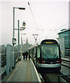
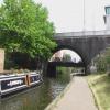
There is a bridge here which takes a railway over the canal.
London Road Railway Bridge (dismantled) | 1 furlong | |
Poplar Arms Corner | 1 furlong | |
London Road Bridge | 1 furlong | |
Boots Pipe Bridge | ½ furlongs | |
Trent Street Bridge | a few yards | |
Nottingham Tram Railway Bridge | ||
Carrington Street Bridge | ½ furlongs | |
Canal Museum Arm | ½ furlongs | |
Canal Museum Wharf | ¾ furlongs | |
Nottingham Wharf Arm (closed) | ¾ furlongs | |
Wilford Street Footbridge | ¾ furlongs |
Amenities here
Amenities nearby at Carrington Street Bridge
Amenities nearby at Trent Street Bridge
Amenities in Nottingham
Amenities at other places in Nottingham
at
at
at
at
at
at
at
at
at
at
at
at
at
at
at
at
at
at
at
at
at
at
at
at
at
at
at
at
at
at
at
at
at
at
at
at
at
at
at
at
at
at
at
at
at
at
at
at
at
at
at
There are no links to external websites from here.
Why not log in and add some (select "External websites" from the menu (sometimes this is under "Edit"))?
Mouseover for more information or show routes to facility
Nearest water point
In the direction of Lenton Chain
Beeston Lock No 5 — 5 miles, 3 furlongs and 1 lock away
Travel to Lenton Chain, then on the River Trent (Beeston Canal) to Beeston Lock No 5
Cranfleet Lock No 3 — 9 miles, 5½ furlongs and 2 locks away
Travel to Lenton Chain, then on the River Trent (Beeston Canal) to Beeston Lock No 5, then on the River Trent (Western End) to Cranfleet Lock No 3
Former BW Trent Lock Waterway Office — 10 miles, 4 furlongs and 5 locks away
Travel to Lenton Chain, then on the River Trent (Beeston Canal) to Beeston Lock No 5, then on the River Trent (Western End) to Trent Junction, then on the Grand Union Canal (Erewash Canal) to Former BW Trent Lock Waterway Office
Sawley Locks No 2 — 11 miles, 2 furlongs and 4 locks away
Travel to Lenton Chain, then on the River Trent (Beeston Canal) to Beeston Lock No 5, then on the River Trent (Western End) to Sawley Locks No 2
Shardlow — 13 miles, 3¾ furlongs and 7 locks away
Travel to Lenton Chain, then on the River Trent (Beeston Canal) to Beeston Lock No 5, then on the River Trent (Western End) to Derwent Mouth, then on the Trent and Mersey Canal (Main Line - Derwent Mouth to Burton) to Shardlow
Weston Lock No 4 — 16 miles, 3½ furlongs and 9 locks away
Travel to Lenton Chain, then on the River Trent (Beeston Canal) to Beeston Lock No 5, then on the River Trent (Western End) to Derwent Mouth, then on the Trent and Mersey Canal (Main Line - Derwent Mouth to Burton) to Weston Lock No 4
Bishop Meadow Lock No 54 — 18 miles, 4¼ furlongs and 9 locks away
Travel to Lenton Chain, then on the River Trent (Beeston Canal) to Beeston Lock No 5, then on the River Trent (Western End) to Trent Junction, then on the Grand Union Canal (Leicester Section - River Soar Navigation) to Bishop Meadow Lock No 54
Swarkestone Lock No 5 — 19 miles, 2¾ furlongs and 10 locks away
Travel to Lenton Chain, then on the River Trent (Beeston Canal) to Beeston Lock No 5, then on the River Trent (Western End) to Derwent Mouth, then on the Trent and Mersey Canal (Main Line - Derwent Mouth to Burton) to Swarkestone Lock No 5
Loughborough Basin — 19 miles, 4¾ furlongs and 11 locks away
Travel to Lenton Chain, then on the River Trent (Beeston Canal) to Beeston Lock No 5, then on the River Trent (Western End) to Trent Junction, then on the Grand Union Canal (Leicester Section - River Soar Navigation) to Loughborough Branch Junction, then on the Grand Union Canal (Leicester Section - Loughborough Branch) to Loughborough Basin
In the direction of Meadow Lane Junction
Holme Lock No 5 — 2 miles, 7¼ furlongs and 1 lock away
Travel to Meadow Lane Junction, then on the River Trent (non-tidal section) to Holme Lock No 5
Stoke Lock No 6 — 5 miles, 7½ furlongs and 2 locks away
Travel to Meadow Lane Junction, then on the River Trent (non-tidal section) to Stoke Lock No 6
Gunthorpe Lock No 7 — 10 miles, 5½ furlongs and 3 locks away
Travel to Meadow Lane Junction, then on the River Trent (non-tidal section) to Gunthorpe Lock No 7
Hazelford Lock No 8 — 15 miles, 3½ furlongs and 4 locks away
Travel to Meadow Lane Junction, then on the River Trent (non-tidal section) to Hazelford Lock No 8Nearest rubbish disposal
In the direction of Lenton Chain
Beeston Lock No 5 — 5 miles, 3 furlongs and 1 lock away
Travel to Lenton Chain, then on the River Trent (Beeston Canal) to Beeston Lock No 5
Cranfleet Lock No 3 — 9 miles, 5½ furlongs and 2 locks away
Travel to Lenton Chain, then on the River Trent (Beeston Canal) to Beeston Lock No 5, then on the River Trent (Western End) to Cranfleet Lock No 3
Former BW Trent Lock Waterway Office — 10 miles, 4 furlongs and 5 locks away
Travel to Lenton Chain, then on the River Trent (Beeston Canal) to Beeston Lock No 5, then on the River Trent (Western End) to Trent Junction, then on the Grand Union Canal (Erewash Canal) to Former BW Trent Lock Waterway Office
Sawley Locks No 2 — 11 miles, 2 furlongs and 4 locks away
Travel to Lenton Chain, then on the River Trent (Beeston Canal) to Beeston Lock No 5, then on the River Trent (Western End) to Sawley Locks No 2
Swarkestone Lock No 5 — 19 miles, 2¾ furlongs and 10 locks away
Travel to Lenton Chain, then on the River Trent (Beeston Canal) to Beeston Lock No 5, then on the River Trent (Western End) to Derwent Mouth, then on the Trent and Mersey Canal (Main Line - Derwent Mouth to Burton) to Swarkestone Lock No 5
Loughborough Basin — 19 miles, 4¾ furlongs and 11 locks away
Travel to Lenton Chain, then on the River Trent (Beeston Canal) to Beeston Lock No 5, then on the River Trent (Western End) to Trent Junction, then on the Grand Union Canal (Leicester Section - River Soar Navigation) to Loughborough Branch Junction, then on the Grand Union Canal (Leicester Section - Loughborough Branch) to Loughborough Basin
In the direction of Meadow Lane Junction
Holme Lock No 5 — 2 miles, 7¼ furlongs and 1 lock away
Travel to Meadow Lane Junction, then on the River Trent (non-tidal section) to Holme Lock No 5
Stoke Lock No 6 — 5 miles, 7½ furlongs and 2 locks away
Travel to Meadow Lane Junction, then on the River Trent (non-tidal section) to Stoke Lock No 6
Gunthorpe Lock No 7 — 10 miles, 5½ furlongs and 3 locks away
Travel to Meadow Lane Junction, then on the River Trent (non-tidal section) to Gunthorpe Lock No 7
Hazelford Lock No 8 — 15 miles, 3½ furlongs and 4 locks away
Travel to Meadow Lane Junction, then on the River Trent (non-tidal section) to Hazelford Lock No 8Nearest chemical toilet disposal
In the direction of Lenton Chain
Beeston Lock No 5 — 5 miles, 3 furlongs and 1 lock away
Travel to Lenton Chain, then on the River Trent (Beeston Canal) to Beeston Lock No 5
Former BW Trent Lock Waterway Office — 10 miles, 4 furlongs and 5 locks away
Travel to Lenton Chain, then on the River Trent (Beeston Canal) to Beeston Lock No 5, then on the River Trent (Western End) to Trent Junction, then on the Grand Union Canal (Erewash Canal) to Former BW Trent Lock Waterway Office
Sawley Locks No 2 — 11 miles, 2 furlongs and 4 locks away
Travel to Lenton Chain, then on the River Trent (Beeston Canal) to Beeston Lock No 5, then on the River Trent (Western End) to Sawley Locks No 2
Sawley Cut Wharf — 11 miles, 3½ furlongs and 5 locks away
Travel to Lenton Chain, then on the River Trent (Beeston Canal) to Beeston Lock No 5, then on the River Trent (Western End) to Sawley Cut Wharf
In the direction of Meadow Lane Junction
Meadow Lane Lock No 7 — 4 furlongs away
On this waterway in the direction of Meadow Lane Junction
Holme Lock No 5 — 2 miles, 7¼ furlongs and 1 lock away
Travel to Meadow Lane Junction, then on the River Trent (non-tidal section) to Holme Lock No 5
Stoke Lock No 6 — 5 miles, 7½ furlongs and 2 locks away
Travel to Meadow Lane Junction, then on the River Trent (non-tidal section) to Stoke Lock No 6
Gunthorpe Lock No 7 — 10 miles, 5½ furlongs and 3 locks away
Travel to Meadow Lane Junction, then on the River Trent (non-tidal section) to Gunthorpe Lock No 7Nearest place to turn
In the direction of Lenton Chain
Canal Museum Wharf — ¾ furlongs away
On this waterway in the direction of Lenton Chain
Redfield Road Bridge Winding Hole — 2 miles, ¾ furlongs and 1 lock away
Travel to Lenton Chain, then on the River Trent (Beeston Canal) to Redfield Road Bridge Winding Hole
Rylands Bridge Winding Hole — 4 miles, 1 furlong and 1 lock away
Travel to Lenton Chain, then on the River Trent (Beeston Canal) to Rylands Bridge Winding Hole
Cranfleet Lock Weir Exit — 9 miles, 5 furlongs and 2 locks away
Travel to Lenton Chain, then on the River Trent (Beeston Canal) to Beeston Lock No 5, then on the River Trent (Western End) to Cranfleet Lock Weir Exit
Soar Mouth — 10 miles, 4½ furlongs and 4 locks away
Travel to Lenton Chain, then on the River Trent (Beeston Canal) to Beeston Lock No 5, then on the River Trent (Western End) to Trent Junction, then on the Grand Union Canal (Leicester Section - River Soar Navigation) to Soar Mouth
Redhill Lock Junction — 10 miles, 7¼ furlongs and 4 locks away
Travel to Lenton Chain, then on the River Trent (Beeston Canal) to Beeston Lock No 5, then on the River Trent (Western End) to Trent Junction, then on the Grand Union Canal (Leicester Section - River Soar Navigation) to Redhill Lock Junction
Sawley Lock No 2 Weir Exit — 11 miles, 1½ furlongs and 4 locks away
Travel to Lenton Chain, then on the River Trent (Beeston Canal) to Beeston Lock No 5, then on the River Trent (Western End) to Sawley Lock No 2 Weir Exit
Former BW Trent Lock Waterway Office — 10 miles, 4 furlongs and 5 locks away
Travel to Lenton Chain, then on the River Trent (Beeston Canal) to Beeston Lock No 5, then on the River Trent (Western End) to Trent Junction, then on the Grand Union Canal (Erewash Canal) to Former BW Trent Lock Waterway Office
Sheet Stores Basin — 11 miles, 1 furlong and 5 locks away
Travel to Lenton Chain, then on the River Trent (Beeston Canal) to Beeston Lock No 5, then on the River Trent (Western End) to Trent Junction, then on the Grand Union Canal (Erewash Canal) to Sheet Stores Basin
Redhill Marine Ltd — 11 miles, 3½ furlongs and 5 locks away
Travel to Lenton Chain, then on the River Trent (Beeston Canal) to Beeston Lock No 5, then on the River Trent (Western End) to Trent Junction, then on the Grand Union Canal (Leicester Section - River Soar Navigation) to Redhill Marine Ltd
Ratcliffe Lock Junction — 11 miles, 6 furlongs and 5 locks away
Travel to Lenton Chain, then on the River Trent (Beeston Canal) to Beeston Lock No 5, then on the River Trent (Western End) to Trent Junction, then on the Grand Union Canal (Leicester Section - River Soar Navigation) to Ratcliffe Lock Junction
Sawley Flood Lock Weir Entrance — 11 miles, 7¼ furlongs and 6 locks away
Travel to Lenton Chain, then on the River Trent (Beeston Canal) to Beeston Lock No 5, then on the River Trent (Western End) to Sawley Flood Lock Weir Entrance
Ratcliffe Weir — 12 miles, ¾ furlongs and 6 locks away
Travel to Lenton Chain, then on the River Trent (Beeston Canal) to Beeston Lock No 5, then on the River Trent (Western End) to Trent Junction, then on the Grand Union Canal (Leicester Section - River Soar Navigation) to Ratcliffe Weir
Long Eaton Winding Hole — 12 miles, 2¾ furlongs and 6 locks away
Travel to Lenton Chain, then on the River Trent (Beeston Canal) to Beeston Lock No 5, then on the River Trent (Western End) to Trent Junction, then on the Grand Union Canal (Erewash Canal) to Long Eaton Winding Hole
Derwent Mouth — 12 miles, 3 furlongs and 6 locks away
Travel to Lenton Chain, then on the River Trent (Beeston Canal) to Beeston Lock No 5, then on the River Trent (Western End) to Derwent Mouth
In the direction of Meadow Lane Junction
Poplar Arms Corner — 1 furlong away
On this waterway in the direction of Meadow Lane Junction
Holme Lock Weir Entrance — 2 miles, 6 furlongs and 1 lock away
Travel to Meadow Lane Junction, then on the River Trent (non-tidal section) to Holme Lock Weir Entrance
Holme Lock Weir Exit — 3 miles, ¾ furlongs and 2 locks away
Travel to Meadow Lane Junction, then on the River Trent (non-tidal section) to Holme Lock Weir Exit
Hazelford Lock East Weir Entrance — 14 miles, 6¼ furlongs and 4 locks away
Travel to Meadow Lane Junction, then on the River Trent (non-tidal section) to Hazelford Lock East Weir Entrance
Hazelford Ferry — 14 miles, 7 furlongs and 4 locks away
Travel to Meadow Lane Junction, then on the River Trent (non-tidal section) to Hazelford FerryNo information
CanalPlan has no information on any of the following facilities within range:self-operated pump-out
boatyard pump-out
Direction of TV transmitter (From Wolfbane Cybernetic)
There is no page on Wikipedia called “Nottingham Tram Railway Bridge”
Wikipedia pages that might relate to Nottingham Tram Railway Bridge
[Nottingham station]
Nottingham station, briefly known as Nottingham City and for rather longer as Nottingham Midland, is a railway station and tram stop in the city of Nottingham
[Nottingham Express Transit]
Nottingham Express Transit (NET) is a 32-kilometre-long (20 mi) tram system in Nottingham, England. The system opened to the public on 9 March 2004 and
[Moor Bridge tram stop]
Moor Bridge is a tram stop on the Nottingham Express Transit (NET) light rail system in the city of Nottingham in the suburb of Bulwell. It is part of
[The Meadows, Nottingham]
served by two tram routes and two bus routes, while a dozen more pass along the peripheral roads. It is a short walk to Nottingham railway station The Bridgeway
[Queen's Medical Centre tram stop]
is a tram stop on the Nottingham Express Transit (NET) network. The stop serves the Queen's Medical Centre, a hospital in the city of Nottingham. The
[Basford tram stop]
the Robin Hood railway line that links Nottingham with Worksop, but there is no corresponding railway station. Both tram and railway lines have two tracks
[Bulwell station]
is a railway station and tram stop in Bulwell, Nottingham, England. It is located on the Robin Hood Line and the Hucknall branch of the Nottingham Express
[Tram]
public transport are called tramways or simply tram/streetcar. Historically the terms electric street railways and trolley (not meaning trolleybus) were also
[Wilford Lane tram stop]
Wilford Lane is a tram stop on the Nottingham Express Transit (NET) network. The stop takes its name from Wilford Lane and the village of Wilford, and
[Wilford Village tram stop]
Wilford Village is a tram stop on the Nottingham Express Transit (NET) network in the city of Nottingham. The stop takes its name from the village of
Results of Google Search
Nottingham tram bridge 'inched' into position - BBC NewsA 1,100-tonne bridge which will carry Nottingham's new tram line across a railway has been moved into place. Engineers took several weeks to slowly move a ...
May 17, 2013 ... A 1,100-tonne bridge which will carry Nottingham's new tram line across a railway has been moved into place. · Engineers took several weeks to ...
Jan 10, 2013 ... ... link between tram and train services at Nottingham Station, which is currently being redeveloped into a modern European railway station.
Mar 25, 2013 ... UK: The first section of the bridge to carry Phase 2 of the Nottingham light rail network over the city's main station was slid into place during ...
Feb 11, 2013 ... Work to start sliding the first section of the iconic bridge that will carry trams over Nottingham Station will take place overnight on Monday 11 ...
Nottingham Express Transit (NET) is a 32-kilometre-long (20 mi) tram system in Nottingham, ... The bridge constructed over Nottingham railway station was officially opened on 17 October 2014 and named the Karlsruhe Friendship Bridge to ...
Sep 3, 2014 ... A pedestrian bridge linking Nottingham Railway Station with the city's expanding tram network has reopened. The walkway was closed to make ...
Moor Bridge is a tram stop on the Nottingham Express Transit (NET) light rail system in the city of Nottingham in the suburb of Bulwell. It is part of the NET's initial ...
Nov 19, 2017 ... Quick Description: Nottingham Tram Railway Bridge over the River Trent ( Nottingham Canal). A former railroad bridge, now carries trams.
Sep 30, 2013 ... The bridge links the QMC to The University of Nottingham, making way for the new tram route. Time-lapse taken by James Bonnyman, Director ...