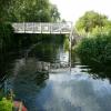
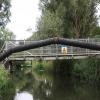
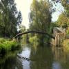
Mill Lane Footbridge (Islip) carries a footpath over the River Nene (main river).
Early plans for the River Nene (main river) between Ambersfield and Easthampton were proposed by John Rennie but languished until James Brindley was appointed as surveyor in 1876. Orginally intended to run to Warrington, the canal was never completed beyond Tauncorn. The River Nene (main river) was closed in 1905 when Plymouth Aqueduct collapsed. "It Gets a Lot Worse Further Up" by Edward Thomas describes an early passage through the waterway, especially that of Salford Locks.

Mill Lane Footbridge (Islip)
is a minor waterways place
on the River Nene (main river) between
Wadenhoe Lock No 24 (4 miles and 5¾ furlongs
and 1 lock
to the northeast) and
Wollaston Lock No 12 (Great Doddington half a mile northwest) (15 miles and 2 furlongs
and 10 locks
to the southwest).
The nearest place in the direction of Wadenhoe Lock No 24 is Islip Lock Mill Race Exit (Channel leading to the Weir - No Access);
½ furlongs
away.
The nearest place in the direction of Wollaston Lock No 12 is Islip Lock Weir Exit (Channel leading to the Weir);
¼ furlongs
away.
Mooring here is unrated.
There is a bridge here which takes pedestrian traffic over the canal.
| Titchmarsh Lock Weir Entrance | 1 mile, 7½ furlongs | |
| Titchmarsh Lock Field Bridge | 1 mile, 6¾ furlongs | |
| Mill Lakes Footbridge | 5 furlongs | |
| Islip Mill Visitor Moorings | 1 furlong | |
| Islip Lock Mill Race Exit | ½ furlongs | |
| Mill Lane Footbridge (Islip) | ||
| Islip Lock Weir Exit | ¼ furlongs | |
| Islip Lock No 22 | ½ furlongs | |
| Islip Lock Mill Race Entrance | ¾ furlongs | |
| Islip Lock Weir Entrance No 1 | 1 furlong | |
| Islip Lock Weir Entrance No 2 | 1¼ furlongs | |
Amenities nearby at Islip Lock Weir Exit
There are no links to external websites from here.
Why not log in and add some (select "External websites" from the menu (sometimes this is under "Edit"))?
Why not log in and add some (select "External websites" from the menu (sometimes this is under "Edit"))?
Mouseover for more information or show routes to facility
Nearest water point
In the direction of Northampton Railway Bridge
Nine Arches Bridge Visitor Moorings — 3¼ furlongs and 1 lock away
On this waterway in the direction of Northampton Railway Bridge
Blackthorn Lake Marina — 5 miles, 2¼ furlongs and 4 locks away
On this waterway in the direction of Northampton Railway Bridge
Wellingborough Embankment Visitor Moorings — 13 miles, 3½ furlongs and 9 locks away
On this waterway in the direction of Northampton Railway Bridge
White Mills Marina — 18 miles, 2½ furlongs and 14 locks away
On this waterway in the direction of Northampton Railway Bridge
In the direction of Dog-in-a-Doublet Lock No 38
Wadenhoe Lock Weir Entrance No 2 — 4 miles, 5¼ furlongs and 1 lock away
On this waterway in the direction of Dog-in-a-Doublet Lock No 38
Barnwell Long Term Moorings — 7 miles, 6¼ furlongs and 3 locks away
On this waterway in the direction of Dog-in-a-Doublet Lock No 38
Upper Barnwell Lock No 26 — 8 miles, 1 furlong and 3 locks away
On this waterway in the direction of Dog-in-a-Doublet Lock No 38
Oundle Marina — 8 miles, 2½ furlongs and 4 locks away
On this waterway in the direction of Dog-in-a-Doublet Lock No 38
Fotheringhay Bridge — 15 miles, 4¾ furlongs and 8 locks away
On this waterway in the direction of Dog-in-a-Doublet Lock No 38Nearest rubbish disposal
In the direction of Northampton Railway Bridge
White Mills Marina — 18 miles, 2½ furlongs and 14 locks away
On this waterway in the direction of Northampton Railway Bridge
In the direction of Dog-in-a-Doublet Lock No 38
Oundle Marina — 8 miles, 2½ furlongs and 4 locks away
On this waterway in the direction of Dog-in-a-Doublet Lock No 38Nearest chemical toilet disposal
In the direction of Northampton Railway Bridge
Ditchford Lock No 15 — 10 miles, 7½ furlongs and 7 locks away
On this waterway in the direction of Northampton Railway Bridge
Wellingborough Embankment Visitor Moorings — 13 miles, 3½ furlongs and 9 locks away
On this waterway in the direction of Northampton Railway Bridge
White Mills Marina — 18 miles, 2½ furlongs and 14 locks away
On this waterway in the direction of Northampton Railway Bridge
In the direction of Dog-in-a-Doublet Lock No 38
Oundle Marina — 8 miles, 2½ furlongs and 4 locks away
On this waterway in the direction of Dog-in-a-Doublet Lock No 38Nearest place to turn
In the direction of Northampton Railway Bridge
Islip Lock Mill Race Entrance — ¾ furlongs and 1 lock away
On this waterway in the direction of Northampton Railway Bridge
Woodford Lock Weir Entrance — 2 miles, 4½ furlongs and 3 locks away
On this waterway in the direction of Northampton Railway Bridge
Ringstead Arm — 4 miles, 5½ furlongs and 3 locks away
On this waterway in the direction of Northampton Railway Bridge
Lower Ringstead Lock Weir Exit — 4 miles, 6 furlongs and 3 locks away
On this waterway in the direction of Northampton Railway Bridge
Upper Ringstead Lock Weir Exit No 2 — 5 miles, 3 furlongs and 4 locks away
On this waterway in the direction of Northampton Railway Bridge
Ringstead Sewerage Treatment Outfall — 5 miles, 7¼ furlongs and 5 locks away
On this waterway in the direction of Northampton Railway Bridge
Irthlingborough Lock Weir Exit No 2 — 7 miles, 1¾ furlongs and 5 locks away
On this waterway in the direction of Northampton Railway Bridge
Higham Ferrers Lock Weir Exit — 8 miles, 4½ furlongs and 6 locks away
On this waterway in the direction of Northampton Railway Bridge
Higham Ferrers Lock Weir Entrance — 8 miles, 6½ furlongs and 7 locks away
On this waterway in the direction of Northampton Railway Bridge
Ditchford Lock Weir Exit No 2 — 10 miles, 7 furlongs and 7 locks away
On this waterway in the direction of Northampton Railway Bridge
Ditchford Lock Weir Entrance No 1 — 11 miles, 2¼ furlongs and 8 locks away
On this waterway in the direction of Northampton Railway Bridge
Lower Wellingborough Lock Weir Exit — 12 miles, 6½ furlongs and 8 locks away
On this waterway in the direction of Northampton Railway Bridge
Upper Wellingborough Lock Weir Exit No 1 — 13 miles, 6¼ furlongs and 9 locks away
On this waterway in the direction of Northampton Railway Bridge
In the direction of Dog-in-a-Doublet Lock No 38
Wadenhoe Lock Weir Exit No 1 — 4 miles, 6 furlongs and 2 locks away
On this waterway in the direction of Dog-in-a-Doublet Lock No 38
Oundle Marina — 8 miles, 2½ furlongs and 4 locks away
On this waterway in the direction of Dog-in-a-Doublet Lock No 38
Ashton Lock Weir Entrance No 2 — 10 miles, 3¾ furlongs and 5 locks away
On this waterway in the direction of Dog-in-a-Doublet Lock No 38
Ashton Lock Weir Exit No 2 — 10 miles, 5¾ furlongs and 6 locks away
On this waterway in the direction of Dog-in-a-Doublet Lock No 38
Cotterstock Lock Weir Entrance No 2 — 12 miles, 4¾ furlongs and 6 locks away
On this waterway in the direction of Dog-in-a-Doublet Lock No 38
Cotterstock Lock Weir Exit No 1 — 12 miles, 5½ furlongs and 7 locks away
On this waterway in the direction of Dog-in-a-Doublet Lock No 38
Perio Lock Weir Entrance No 1 — 14 miles, 2¾ furlongs and 7 locks away
On this waterway in the direction of Dog-in-a-Doublet Lock No 38Nearest self-operated pump-out
In the direction of Northampton Railway Bridge
Blackthorn Lake Marina — 5 miles, 2¼ furlongs and 4 locks away
On this waterway in the direction of Northampton Railway Bridge
Wellingborough Embankment Visitor Moorings — 13 miles, 3½ furlongs and 9 locks away
On this waterway in the direction of Northampton Railway BridgeNearest boatyard pump-out
In the direction of Northampton Railway Bridge
White Mills Marina — 18 miles, 2½ furlongs and 14 locks away
On this waterway in the direction of Northampton Railway Bridge
In the direction of Dog-in-a-Doublet Lock No 38
Lilford Marina Entrance — 7 miles, 3¼ furlongs and 3 locks away
On this waterway in the direction of Dog-in-a-Doublet Lock No 38
Barnwell Long Term Moorings — 7 miles, 6¼ furlongs and 3 locks away
On this waterway in the direction of Dog-in-a-Doublet Lock No 38
Oundle Marina — 8 miles, 2½ furlongs and 4 locks away
On this waterway in the direction of Dog-in-a-Doublet Lock No 38Direction of TV transmitter (From Wolfbane Cybernetic)
There is no page on Wikipedia called “Mill Lane Footbridge”
Wikipedia pages that might relate to Mill Lane Footbridge
[River Don, Yorkshire]
contrast. This footbridge over the River Don is the only crossing in the 4 km between Station Lane Bridge in Oughtibridge and Leppings Lane, Hillsborough
[Cogglesford Mill]
Mareham Lane crossed the Slea. The original crossing, no longer extant, is a few hundred yards downstream of the mill, close to the current footbridge. There
[Mill Street, Oxford]
between Mill Street and the railway tracks. Osney Lane leads from Mill Street over a footbridge across the railway tracks towards Oxpens Road and central
[List of bridges in Cambridge]
pedestrian and cycle bridge that links Cutter Ferry Lane with Midsummer Common. The original footbridge was closed in 2003 after over 75 years of service
[Leeds and Liverpool Canal]
11–13, Newlay Three Rise Staircase Locks (3) Footbridge / Pollard Lane, Newlay Ross Mills Weir / Ross Mill Swing Bridge 219 Rodley Nature Reserve Moss
[Upper Don Walk]
Beeley Wood by the Rocher footbridge. The alternative from Wardsend goes by Herries Road South, Clay Wheels Lane and Beeley Wood Lane. The final mile of the
[Batley]
Junior School Lydgate J and I School (Soothill) Manorfield I and N School Mill Lane Primary School (Hanging Heaton) Park Road J.I and N School Purlwell I
[Lower Slaughter]
crossed by two footbridges, which also flows through Upper Slaughter. At the west end of the village there is a 19th-century water mill with an undershot
[River Wharfe]
Grassington. The falls can be accessed from the town via Sedber Lane. There is a footbridge straddling the falls for viewing. The name Wharfe appears to
[River Worth]
Keighley Coney Lane, Keighley Gresley Road, Keighley Low Mill Lane, Keighley Main Line Railway Dalton Lane, Keighley A650 (Aire Valley Road), Keighley Aireworth
Results of Google Search
(vi) Mill Neck Creek (Mill Neck Bay). ... an image of Great South Bay Islip Shellfish Closures - Clam Pond ... "43BBL," located at the foot of Bay Avenue (Bay Road) at Fireplace Neck (local landmark). ... of a line extending southeasterly, from the westernmost footbridge that provides foot access to Little Peconic Bay (located in  ...
Turn left onto Keese Mill Road, and park at the parking lot about 2.5 miles down ... The trailhead is located a short distance from the parking lot via a footbridge.
Jan 1, 2007 ... in the Town of Islip, Suffolk County, New York. ... Mill Pond branch and at the Long Island Rail Road (LIRR) tracks on the San ... slope failure near the entrance to Brookside Preserve and trail erosion at the footbridge near.
Linda - Islip Terrace, NY 5 out of 5 Stars. Reviewed 11/03/2019 for a stay on 10/ 30/2019. We Loved the cabin and the whole experience. Will definitely ...
This document was prepared for the Town of Islip and the New York State Department of State with funds ... 4.2.4 Project 4: Mechanicville Road Parking Area (Watchogue Creek). 4-11 ... A makeshift bridge observed on Champlin Creek restricts water flow and should be removed, a footbridge ... Lower Mill Pond Dam.
8– A footbridge (80 metres in length) over Work No.1 commencing on footpath ... Islip Road Level Crossing, Mill Lane between points S5 and S6, Work No.
Official MapQuest website, find driving directions, maps, live traffic updates and road conditions. Find nearby businesses, restaurants and hotels. Explore!
6925|36|175717|1757173|Replace the Grist Mill Road Bridge over Stony ... to reinforce the structural integrity of the pedestrian bridge across Six Mile Creek ...


