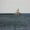
Ontario - Oswego Junction
Junction of Lake Ontario with the Oswego Canal at Oswego
Oswego Harbor West Pierhead Lighthouse, West 1st Street N, Oswego, NY 13126, United States of America
Address is taken from a point 566 yards away.
Address is taken from a point 566 yards away.

Ontario - Oswego Junction
is a minor waterways place
at the junction of
Lake Ontario (Southern route)
with
the New York State Canal System (Oswego Canal).
Lake Ontario (northeastern entrance)
is on
Saint Lawrence Seaway (Iroquois Canal to Lake Ontario),
54.19 miles
to the north.
St. Catharines (Junction of the Welland Canal with Lake Ontario)
is on
Lake Ontario (Southern route),
147.94 miles
to the west.
Erie - Oswego Junction (Junction of the Erie Canal with the Oswego Canal at Three Rivers)
is on
the New York State Canal System (Erie Canal),
24.07 miles
and 7 locks
to the southeast.
The nearest place in the direction of Lake Ontario (northeastern entrance) is Mexico Bay;
13.27 miles
away.
The nearest place in the direction of St. Catharines is Rochester;
57.06 miles
away.
The nearest place in the direction of Erie - Oswego Junction is West Bridge Street Bridge No O-14;
1.56 miles
away.
Mooring here is unrated.
| Lake Ontario (Southern route) | ||
|---|---|---|
| Lake Ontario (northeastern entrance) | 54.19 miles | |
| Henderson Bay | 39.14 miles | |
| Mexico Bay | 13.27 miles | |
| Ontario - Oswego Junction | ||
| Rochester | 57.06 miles | |
| St. Catharines | 147.94 miles | |
| Hamilton | 179.03 miles | |
| New York State Canal System (Oswego Canal) | ||
| Ontario - Oswego Junction | ||
| West Bridge Street Bridge No O-14 | 1.56 miles | |
| Oswego Lock No 8 | 1.60 miles | |
| East 1st Street Bridge No O-13 | 1.77 miles | |
| Utica Street Bridge No O-12 | 1.85 miles | |
| Lock Road Bridge No O-11 | 2.02 miles | |
There are no links to external websites from here.
Why not log in and add some (select "External websites" from the menu (sometimes this is under "Edit"))?
Why not log in and add some (select "External websites" from the menu (sometimes this is under "Edit"))?
Mouseover for more information or show routes to facility
No information
CanalPlan has no information on any of the following facilities within range:water point
rubbish disposal
chemical toilet disposal
place to turn
self-operated pump-out
boatyard pump-out
There is no page on Wikipedia called “Ontario - Oswego Junction”
Wikipedia pages that might relate to Ontario - Oswego Junction
[Oswego River (New York)]
flowing into Lake Ontario. James Fenimore Cooper’s novel The Pathfinder, or The Inland Sea is set in the Oswego River valley. The name Oswego is a Mohawk name
[New York, Ontario and Western Railway]
Weehawken, New Jersey, in the greater New York City area to Oswego, New York, a port city on Lake Ontario. It had branch lines to Scranton, Pennsylvania; Kingston
[Portland, Rutland, Oswego and Chicago Railroad]
Railroad's Saratoga and Whitehall Railroad west to the port of Oswego on Lake Ontario. Between Rutland and Fort Ann traffic would use the R&S's Troy,
[Oswego (town), New York]
water. Lake Ontario and the Oswego River help define the town's borders. The west town line is the border of Cayuga County. The eastern junction of New York
[Area codes 315 and 680]
Corners, Ogdensburg, Old Forge, Oneida, Ontario Center, Ontario, Oriskany, Oriskany Falls, Orwell, Oswegatchie, Oswego, Oxbow, Palmyra, Parish, Parishville
[New York State Route 104A]
and NY 370 south of the village of Red Creek to a junction with NY 104 southwest of the city of Oswego. NY 104A spans three counties, serves two villages
[New York State Route 104]
Falls, Lockport, Rochester, and Oswego—as it follows a routing largely parallel to the southern shoreline of Lake Ontario, along a ridge of the old shoreline
[List of places in New York: A]
Arrochar Richmond County 10305 Arsenal Hill Ontario County Arshamonaque Suffolk County Arthur Oswego County Arthur Manor Westchester County 10583
[Rome, Watertown and Ogdensburg Railroad]
line from DeKalb Junction (near Canton, New York) to Ogdensburg was later built. In 1864 the RW&O constructed a line from Pulaski to Oswego and merged with
[List of places in New York: B]
Barcelona Chautauqua 14787 Barclay Heights Ulster 12477 Bardeen Corners Oswego Bardonia Hamlet/CDP Rockland 10954 Barker Town Broome Barker Village
