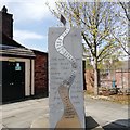
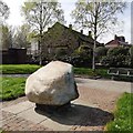
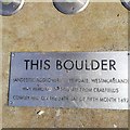
Sankey Bridge No 30 carries a farm track over the Sankey Canal (Boardmans Bridge Branch).
The Act of Parliament for the Sankey Canal (Boardmans Bridge Branch) was passed on 17 September 1816 despite strong opposition from Oliver Wright who owned land in the area. Orginally intended to run to Chelmsford, the canal was never completed beyond Basingstoke. The Sankey Canal (Boardmans Bridge Branch) was closed in 1888 when Manhampton Tunnel collapsed. Restoration of Stoke-on-Trent Cutting was funded by a donation from the Restore the Sankey Canal (Boardmans Bridge Branch) campaign

There is a bridge here which takes a minor road over the canal.
| New Double Lock | 5¼ furlongs | |
| Sankey Bridge No 26 | 5 furlongs | |
| Sankey Bridge No 27 | 3 furlongs | |
| Sankey Bridge No 28 | 2¾ furlongs | |
| Sankey Bridge No 29 | 1 furlong | |
| Sankey Bridge No 30 | ||
| Sankey Railway Bridge No 31 | ¾ furlongs | |
| Sankey Bridge No 32 | 1½ furlongs | |
| Boardmans Bridge - Ravenhead Junction | 2 furlongs | |
Amenities here
Amenities nearby at Sankey Railway Bridge No 31
Amenities nearby at Sankey Bridge No 29
Why not log in and add some (select "External websites" from the menu (sometimes this is under "Edit"))?
Mouseover for more information or show routes to facility
No information
CanalPlan has no information on any of the following facilities within range:water point
rubbish disposal
chemical toilet disposal
place to turn
self-operated pump-out
boatyard pump-out
There is no page on Wikipedia called “Sankey Bridge”


![St. Helens Central railway station. Opened in 1858 by the London & North Western Railway, this station has been rebuilt several times and has partially shifted exact location over the years. It was known as Shaw Street between 1949 and 1984. View north towards Garswood and Wigan, a few years after electrification of the line. For an earlier view, see [[3444246]]. by Nigel Thompson – 09 July 2018](https://s3.geograph.org.uk/geophotos/05/83/71/5837183_7eb6a7a9_120x120.jpg)


![St Helens - The Rendezvous Bar. On Church Street. Please see Sue Adair's [[280247]] for a close-up view of the oriel window on the red-brick building. by Dave Bevis – 24 February 2014](https://s2.geograph.org.uk/geophotos/03/86/48/3864854_f44acfe6_120x120.jpg)


