CanalPlanAC

Allen's Bridge No 204 

 
Allens Lane, Upper Heyford OX25 5NQ, United Kingdom
 

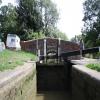
Allen's Bridge No 204 carries a farm track over the Oxford Canal (Southern Section - Main Line) near to Charnwood Locks.

Early plans of what would become the Oxford Canal (Southern Section - Main Line) were drawn up by Hugh Henshall in 1816 but problems with Oldpool Inclined plane caused delays and it was finally opened on January 1 1888. Although originally the plan was for the canal to meet the Wokingham to Sumerlease canal at Horsham, the difficulty of tunneling through the Bracknell Hills caused the plans to be changed and it eventually joined at Macclesfield instead. Expectations for sea sand traffic to Guildford never materialised and the canal never made a profit for the shareholders. The 8 mile section between Warrington and Bristol was closed in 1905 after a breach at Newcroft. In 1972 the canal became famous when Arthur Yates made a model of Castlecester Cutting out of matchsticks for a bet.

Information about the place
Allen's Bridge No 204 is a minor waterways place on the Oxford Canal (Southern Section - Main Line) between Cleves Bridge No 207 (1 mile and 4 furlongs to the southwest) and Allen's Lock No 36 (Bridge leads to Upper Heyford village) (a few yards to the northwest).
 
 
The nearest place in the direction of Cleves Bridge No 207 is Mill Lift Bridge No 205; 6 furlongs away.
 
The nearest place in the direction of Allen's Lock No 36 is The Barley Mow (Upper Heyford) (Non-canalside pub located about half a mile away in the village centre accessed via Allens Lane and Mill Lane); a few yards away.

There is access (suitable for wheels) to the towpath here.

Mooring here is good (a nice place to moor), mooring pins are needed. Pleasant spot below lock. Wide verge & minutes walk to pub.

There is a bridge here which takes a track over the canal.

Heyford Wharf      1 mile, 1¼ furlongs
Heyford Wharf Winding Hole1 mile, 1¼ furlongs
Heyford Wharf Narrows1 mile, ¾ furlongs
Lower Heyford Visitor Moorings 7½ furlongs
Mill Lift Bridge No 205 6 furlongs
Allen's Bridge No 204 
The Barley Mow (Upper Heyford) a few yards
Allen's Lock No 36a few yards
Double Bridge No 2031 furlong
Single Bridge No 2022¾ furlongs
Heyford Common Railway Bridge No 2014¼ furlongs
 
 
Amenities

Amenities here

 Costcutter
 Bus stop (Camp Road West end)
 Bus stop (Camp Road West end)

Amenities nearby at Mill Lift Bridge No 205

 Kings Ground Narrow Boats
 Bus stop (Kingdom Hall)
 Bus stop (Kingdom Hall)
 Bus stop (Mill Lane)
 Bus stop (Mill Lane)
 Bus stop (Portway Crossroads)
 Bus stop (Portway Crossroads)
 
Maps
If you are a user and are logged on, or if you are actively planning a route, a map will be displayed here.
Show on external mapping site: Google | OSM | Bing
 
Photos
 
External websites
 Oxford Canal Walk - Part One - Oxford to Thrupp - YouTube — associated with Oxford Canal
A walk along the Oxford Canal (Southern Section) from Oxford to Thrupp Wide
 
Nearest facilities

Mouseover for more information or show routes to facility

Nearest water point

In the direction of Napton Junction

Aynho Wharf — 4 miles, 7 furlongs and 3 locks away
On this waterway in the direction of Napton Junction
Cherwell Street Facilities — 11 miles, 4¾ furlongs and 7 locks away
On this waterway in the direction of Napton Junction
Banbury Lock No 29 — 11 miles, 5 furlongs and 7 locks away
On this waterway in the direction of Napton Junction
Sovereign Wharf — 11 miles, 7 furlongs and 8 locks away
On this waterway in the direction of Napton Junction
Cropredy Services — 16 miles, ¾ furlongs and 11 locks away
On this waterway in the direction of Napton Junction
Cropredy Marina (southern basin) — 16 miles, 5¼ furlongs and 12 locks away
On this waterway in the direction of Napton Junction
Cropredy Marina (northern basins) — 16 miles, 5¾ furlongs and 12 locks away
On this waterway in the direction of Napton Junction

In the direction of End of Hythe Bridge Arm

Heyford Wharf — 1 mile, 1¼ furlongs away
On this waterway in the direction of End of Hythe Bridge Arm
Heyford Wharf Bridge No 206 — 1 mile, 1½ furlongs away
On this waterway in the direction of End of Hythe Bridge Arm
Thrupp Cruising Club — 8 miles, 5¾ furlongs and 5 locks away
On this waterway in the direction of End of Hythe Bridge Arm
Aubreys Lift Bridge No 221 — 8 miles, 6 furlongs and 5 locks away
On this waterway in the direction of End of Hythe Bridge Arm
Langford Lane Bridge No 224 — 9 miles, 3¼ furlongs and 5 locks away
On this waterway in the direction of End of Hythe Bridge Arm
Wolvercote Junction Water Point — 12 miles, 3 furlongs and 7 locks away
On this waterway in the direction of End of Hythe Bridge Arm
Wolvercote Sanitary Station — 12 miles, 7½ furlongs and 8 locks away
On this waterway in the direction of End of Hythe Bridge Arm
St Edwards Lift Bridge No 238 — 14 miles, ¼ furlongs and 9 locks away
On this waterway in the direction of End of Hythe Bridge Arm
Oxford Visitor Moorings — 15 miles, 4½ furlongs and 9 locks away
On this waterway in the direction of End of Hythe Bridge Arm
Eynsham Lock — 15 miles, 6¾ furlongs and 9 locks away
Travel to Wolvercote Junction, then on the Oxford Canal (Duke's Cut) to Duke's Cut Junction, then on the River Thames (above Oxford) to Eynsham Lock

Nearest rubbish disposal

In the direction of Napton Junction

Aynho Wharf — 4 miles, 7 furlongs and 3 locks away
On this waterway in the direction of Napton Junction
Cherwell Street Facilities — 11 miles, 4¾ furlongs and 7 locks away
On this waterway in the direction of Napton Junction
Sovereign Wharf — 11 miles, 7 furlongs and 8 locks away
On this waterway in the direction of Napton Junction
Cropredy Services — 16 miles, ¾ furlongs and 11 locks away
On this waterway in the direction of Napton Junction
Cropredy Marina (southern basin) — 16 miles, 5¼ furlongs and 12 locks away
On this waterway in the direction of Napton Junction
Cropredy Marina (northern basins) — 16 miles, 5¾ furlongs and 12 locks away
On this waterway in the direction of Napton Junction

In the direction of End of Hythe Bridge Arm
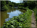
Heyford Wharf — 1 mile, 1¼ furlongs away
On this waterway in the direction of End of Hythe Bridge Arm
Heyford Wharf Bridge No 206 — 1 mile, 1½ furlongs away
On this waterway in the direction of End of Hythe Bridge Arm
Thrupp Cruising Club — 8 miles, 5¾ furlongs and 5 locks away
On this waterway in the direction of End of Hythe Bridge Arm
Aubreys Lift Bridge No 221 — 8 miles, 6 furlongs and 5 locks away
On this waterway in the direction of End of Hythe Bridge Arm
Wolvercote Sanitary Station — 12 miles, 7½ furlongs and 8 locks away
On this waterway in the direction of End of Hythe Bridge Arm
Eynsham Lock — 15 miles, 6¾ furlongs and 9 locks away
Travel to Wolvercote Junction, then on the Oxford Canal (Duke's Cut) to Duke's Cut Junction, then on the River Thames (above Oxford) to Eynsham Lock

Nearest chemical toilet disposal

In the direction of Napton Junction

Cherwell Street Facilities — 11 miles, 4¾ furlongs and 7 locks away
On this waterway in the direction of Napton Junction
Sovereign Wharf — 11 miles, 7 furlongs and 8 locks away
On this waterway in the direction of Napton Junction
Cropredy Services — 16 miles, ¾ furlongs and 11 locks away
On this waterway in the direction of Napton Junction
Cropredy Marina (southern basin) — 16 miles, 5¼ furlongs and 12 locks away
On this waterway in the direction of Napton Junction

In the direction of End of Hythe Bridge Arm

Thrupp Cruising Club — 8 miles, 5¾ furlongs and 5 locks away
On this waterway in the direction of End of Hythe Bridge Arm
Wolvercote Sanitary Station — 12 miles, 7½ furlongs and 8 locks away
On this waterway in the direction of End of Hythe Bridge Arm
Eynsham Lock — 15 miles, 6¾ furlongs and 9 locks away
Travel to Wolvercote Junction, then on the Oxford Canal (Duke's Cut) to Duke's Cut Junction, then on the River Thames (above Oxford) to Eynsham Lock

Nearest place to turn

In the direction of Napton Junction

Somerton Deep Lock Winding Hole — 3 miles, ¾ furlongs and 3 locks away
On this waterway in the direction of Napton Junction
Aynho Wharf — 4 miles, 7 furlongs and 3 locks away
On this waterway in the direction of Napton Junction
Winding Hole above Nell Bridge Lock — 6 miles, 1½ furlongs and 5 locks away
On this waterway in the direction of Napton Junction
Twyford Wharf Winding Hole — 8 miles, 6½ furlongs and 6 locks away
On this waterway in the direction of Napton Junction
Calthorpe Winding Hole — 10 miles, 7¼ furlongs and 7 locks away
On this waterway in the direction of Napton Junction
Grimsbury Wharf — 12 miles, 2¼ furlongs and 8 locks away
On this waterway in the direction of Napton Junction
Southam Road Winding Hole — 12 miles, 3½ furlongs and 8 locks away
On this waterway in the direction of Napton Junction
Southam Road Footbridge Arm — 12 miles, 6¼ furlongs and 8 locks away
On this waterway in the direction of Napton Junction

In the direction of End of Hythe Bridge Arm

Heyford Wharf Winding Hole — 1 mile, 1¼ furlongs away
On this waterway in the direction of End of Hythe Bridge Arm
Heyford Wharf — 1 mile, 1¼ furlongs away
On this waterway in the direction of End of Hythe Bridge Arm
The Cleeves Winding Hole — 1 mile, 5¼ furlongs away
On this waterway in the direction of End of Hythe Bridge Arm
Kirtlington Winding Hole — 4 miles, 3¾ furlongs and 2 locks away
On this waterway in the direction of End of Hythe Bridge Arm
Enslow Winding Hole — 6 miles, 1¼ furlongs and 3 locks away
On this waterway in the direction of End of Hythe Bridge Arm
Shipton Weir Junction — 7 miles, 5¼ furlongs and 4 locks away
On this waterway in the direction of End of Hythe Bridge Arm
Thrupp Wide — 8 miles, 5¾ furlongs and 5 locks away
On this waterway in the direction of End of Hythe Bridge Arm
Wolvercote Junction — 12 miles, 4 furlongs and 8 locks away
On this waterway in the direction of End of Hythe Bridge Arm
Bypass Reservoir Junction — 12 miles, 5¾ furlongs and 9 locks away
Travel to Wolvercote Junction, then on the Oxford Canal (Duke's Cut) to Bypass Reservoir Junction
Duke's Cut Junction — 13 miles, 2¼ furlongs and 9 locks away
Travel to Wolvercote Junction, then on the Oxford Canal (Duke's Cut) to Duke's Cut Junction
Hythe Bridge Arm Winding Hole — 15 miles, 3¾ furlongs and 9 locks away
On this waterway in the direction of End of Hythe Bridge Arm
Thames - Wharf Stream Junction — 15 miles, 5 furlongs and 9 locks away
Travel to Wolvercote Junction, then on the Oxford Canal (Duke's Cut) to Duke's Cut Junction, then on the River Thames (above Oxford) to Thames - Wharf Stream Junction

Nearest self-operated pump-out

In the direction of Napton Junction

Cropredy Marina (southern basin) — 16 miles, 5¼ furlongs and 12 locks away
On this waterway in the direction of Napton Junction

In the direction of End of Hythe Bridge Arm

Thrupp Cruising Club — 8 miles, 5¾ furlongs and 5 locks away
On this waterway in the direction of End of Hythe Bridge Arm
Aubreys Lift Bridge No 221 — 8 miles, 6 furlongs and 5 locks away
On this waterway in the direction of End of Hythe Bridge Arm
Eynsham Lock — 15 miles, 6¾ furlongs and 9 locks away
Travel to Wolvercote Junction, then on the Oxford Canal (Duke's Cut) to Duke's Cut Junction, then on the River Thames (above Oxford) to Eynsham Lock

Nearest boatyard pump-out

In the direction of Napton Junction

Aynho Wharf — 4 miles, 7 furlongs and 3 locks away
On this waterway in the direction of Napton Junction
Twyford Wharf — 8 miles, 6¼ furlongs and 6 locks away
On this waterway in the direction of Napton Junction
Sovereign Wharf — 11 miles, 7 furlongs and 8 locks away
On this waterway in the direction of Napton Junction
Cropredy Marina (southern basin) — 16 miles, 5¼ furlongs and 12 locks away
On this waterway in the direction of Napton Junction

In the direction of End of Hythe Bridge Arm
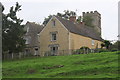
Heyford Wharf — 1 mile, 1¼ furlongs away
On this waterway in the direction of End of Hythe Bridge Arm
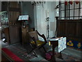
Enslow Wharf — 6 miles, 2¼ furlongs and 3 locks away
On this waterway in the direction of End of Hythe Bridge Arm
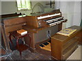
Oxford Cruisers Marina — 16 miles, 6½ furlongs and 10 locks away
Travel to Wolvercote Junction, then on the Oxford Canal (Duke's Cut) to Duke's Cut Junction, then on the River Thames (above Oxford) to Oxford Cruisers Marina
Direction of TV transmitter (From Wolfbane Cybernetic)
 
 
Geograph
 
Wikipedia

Wikipedia has a page about Allen's Bridge

Allen, Allen's or Allens may refer to:

Other Wikipedia pages that might relate to Allen's Bridge
[Allen] Allen, Allen's or Allens may refer to: Allen (surname), a list of people Allen (given name), a list of people and fictional characters The Allen Brothers [Woody Allen] Woody Allen (born Allan Stewart Konigsberg; December 1, 1935) is an American film director, writer, actor, and comedian whose career spans more than six [A. A. Allen] Asa Alonso Allen (March 27, 1911 – June 11, 1970), better known as A. A. Allen, was an American Pentecostal evangelist known for his faith healing and [Allen, Allen, Allen & Allen] Allen, Allen, Allen & Allen is a United States law firm in Richmond, Virginia. It was founded in 1910 in Lunenburg County, Virginia, by George E. Allen [Allen v. Farrow] Allen v. Farrow is an American documentary television miniseries directed by Kirby Dick and Amy Ziering that explores an allegation of sexual abuse made [Grayson Allen] Grayson James Allen (born October 8, 1995) is an American professional basketball player for the Memphis Grizzlies of the National Basketball Association [Flash (Barry Allen)] The Flash (Bartholomew Henry "Barry" Allen) is a fictional superhero appearing in a series of American comic books published by DC Comics. The character [Tim Allen] Timothy Alan Dick (born June 13, 1953), known professionally as Tim Allen, is an American actor and comedian. He is known for playing Tim "The Toolman" [Ray Allen] Walter Ray Allen Jr. (born July 20, 1975) is an American former professional basketball player. He played 18 seasons in the National Basketball Association [Allen Ginsberg] Irwin Allen Ginsberg (/ˈɡɪnzbɜːrɡ/; June 3, 1926 – April 5, 1997) was an American poet and writer. As a student at Columbia University in the 1940s, he
 
Google

Results of Google Search