CanalPlanAC

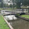
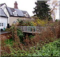
Saltway Footbridge No 17

 
Fox Alley Swing Bridge, Droitwich Spa WR9 8EY, United Kingdom
 
Information about the place
Saltway Footbridge No 17 is a minor waterways place on the Droitwich Canals (Droitwich Barge Canal) between Hawford Junction (Junction of Droitwich Canal with River Severn) (5 miles and 4¾ furlongs and 8 locks to the west) and Droitwich Junction (Junction of Droitwich Barge Canal and Droitwich Junction Canal) (1½ furlongs and 1 lock to the east).
 
It is part of Droitwich.
 
The nearest place in the direction of Hawford Junction is Netherwich Basin; 1¼ furlongs away.
 
The nearest place in the direction of Droitwich Junction is Saltway Footbridge No 18 (This swingbridge is locked out of use); ¼ furlongs away.

Mooring here is unrated.

There is a swing bridge here. The bridge requires a BW key to operate it.


Amenities

Amenities nearby at Saltway Footbridge No 18

 Morison's
 Morrisons
 Waitrose
 W H Smith
 Boots Chemist
 Cashpoint
 Cashpoint
 Cashpoint
 Cashpoint
 Cashpoint
 HSBC
 Lloyds Bank
 NatWest
 Santander
 Dormer Plant Hire Ltd

Amenities nearby at Netherwich Basin

 Dominos Pizza
 Fish & Chips
 Cashpoint

Amenities in Droitwich

 Castle
 Kings Arms
 SEE ADDRESS
 Boots Chemist

Amenities at other places in Droitwich

 Droitwich Spa Station at Salwarpe Road Bridge 13
 
Maps
If you are a user and are logged on, or if you are actively planning a route, a map will be displayed here.
Show on external mapping site: Google | OSM | Bing
 
Photos
 
External websites
There are no links to external websites from here.
Why not log in and add some (select "External websites" from the menu (sometimes this is under "Edit"))?
 
Nearest facilities

Mouseover for more information or show routes to facility

Nearest water point

In the direction of Hawford Junction

Netherwich Basin1¼ furlongs away
On this waterway in the direction of Hawford Junction
Holt Lock (Holt Fleet)8 miles, 4½ furlongs and 8 locks away
Travel to Hawford Junction, then on the River Severn (main river - Stourport to Worcester) to Holt Lock (Holt Fleet)
Worcester Trip Boat Moorings9 miles, 2 furlongs and 9 locks away
Travel to Hawford Junction, then on the River Severn (main river - Stourport to Worcester) to Worcester Trip Boat Moorings
Diglis Locks10 miles, 2½ furlongs and 9 locks away
Travel to Hawford Junction, then on the River Severn (main river - Stourport to Worcester) to Diglis Junction, then on the River Severn (main river - Worcester to Gloucester) to Diglis Locks
Diglis Services10 miles, 1¾ furlongs and 11 locks away
Travel to Hawford Junction, then on the River Severn (main river - Stourport to Worcester) to Diglis Junction, then on the Worcester and Birmingham Canal (Diglis Junction to Diglis Basin) to Diglis Basin, then on the Worcester and Birmingham Canal (Diglis Basin to King's Norton Junction) to Diglis Services
Lincomb Lock12 miles, 6¼ furlongs and 9 locks away
Travel to Hawford Junction, then on the River Severn (main river - Stourport to Worcester) to Lincomb Lock
Lowesmoor Basin11 miles, 1½ furlongs and 13 locks away
Travel to Hawford Junction, then on the River Severn (main river - Stourport to Worcester) to Diglis Junction, then on the Worcester and Birmingham Canal (Diglis Junction to Diglis Basin) to Diglis Basin, then on the Worcester and Birmingham Canal (Diglis Basin to King's Norton Junction) to Lowesmoor Basin
Upper Basin Waterpoint14 miles, 1½ furlongs and 12 locks away
Travel to Hawford Junction, then on the River Severn (main river - Stourport to Worcester) to Severn - Stourport Broad Locks Entrance, then on the Staffordshire and Worcestershire Canal (Stourport Basins: Broad Route) to Stourport Upper Basin, then on the Staffordshire and Worcestershire Canal (Stourport Basins: Narrow Route) to Upper Basin Waterpoint
Caldwall Mill Bridge No 1417 miles, 8 furlongs and 15 locks away
Travel to Hawford Junction, then on the River Severn (main river - Stourport to Worcester) to Severn - Stourport Broad Locks Entrance, then on the Staffordshire and Worcestershire Canal (Stourport Basins: Broad Route) to Stourport Upper Basin, then on the Staffordshire and Worcestershire Canal (Stourport Basins: Narrow Route) to York Street Bridge, then on the Staffordshire and Worcestershire Canal (Main Line: Stourport to Stourton) to Caldwall Mill Bridge No 14

In the direction of Droitwich Junction

Droitwich Spa Marina1 mile, 2¼ furlongs and 5 locks away
Travel to Droitwich Junction, then on the Droitwich Canals (Droitwich Junction Canal) to Droitwich Spa Marina
Hanbury Boatyard1 mile, 6½ furlongs and 8 locks away
Travel to Droitwich Junction, then on the Droitwich Canals (Droitwich Junction Canal) to Hanbury Junction, then on the Worcester and Birmingham Canal (Diglis Basin to King's Norton Junction) to Hanbury Boatyard
Stoke Works Water Point4 miles, 1¾ furlongs and 14 locks away
Travel to Droitwich Junction, then on the Droitwich Canals (Droitwich Junction Canal) to Hanbury Junction, then on the Worcester and Birmingham Canal (Diglis Basin to King's Norton Junction) to Stoke Works Water Point
Tardebigge Wharf8 miles, 2¼ furlongs and 50 locks away
Travel to Droitwich Junction, then on the Droitwich Canals (Droitwich Junction Canal) to Hanbury Junction, then on the Worcester and Birmingham Canal (Diglis Basin to King's Norton Junction) to Tardebigge Wharf
Hopwood Visitor Moorings13 miles, 6 furlongs and 50 locks away
Travel to Droitwich Junction, then on the Droitwich Canals (Droitwich Junction Canal) to Hanbury Junction, then on the Worcester and Birmingham Canal (Diglis Basin to King's Norton Junction) to Hopwood Visitor Moorings
King's Norton Water Point16 miles, 7¼ furlongs and 50 locks away
Travel to Droitwich Junction, then on the Droitwich Canals (Droitwich Junction Canal) to Hanbury Junction, then on the Worcester and Birmingham Canal (Diglis Basin to King's Norton Junction) to King's Norton Water Point
Yardley Wood Water Point19 miles, 4½ furlongs and 50 locks away
Travel to Droitwich Junction, then on the Droitwich Canals (Droitwich Junction Canal) to Hanbury Junction, then on the Worcester and Birmingham Canal (Diglis Basin to King's Norton Junction) to King's Norton Junction, then on the Stratford-on-Avon Canal (Northern Section) to Yardley Wood Water Point

Nearest rubbish disposal

In the direction of Hawford Junction

Netherwich Basin1¼ furlongs away
On this waterway in the direction of Hawford Junction
Sabrina Footbridge9 miles, ¼ furlongs and 9 locks away
Travel to Hawford Junction, then on the River Severn (main river - Stourport to Worcester) to Sabrina Footbridge
Diglis Basin10 miles, 1¼ furlongs and 11 locks away
Travel to Hawford Junction, then on the River Severn (main river - Stourport to Worcester) to Diglis Junction, then on the Worcester and Birmingham Canal (Diglis Junction to Diglis Basin) to Diglis Basin
Lowesmoor Basin11 miles, 1½ furlongs and 13 locks away
Travel to Hawford Junction, then on the River Severn (main river - Stourport to Worcester) to Diglis Junction, then on the Worcester and Birmingham Canal (Diglis Junction to Diglis Basin) to Diglis Basin, then on the Worcester and Birmingham Canal (Diglis Basin to King's Norton Junction) to Lowesmoor Basin
Upper Basin Waterpoint14 miles, 1½ furlongs and 12 locks away
Travel to Hawford Junction, then on the River Severn (main river - Stourport to Worcester) to Severn - Stourport Broad Locks Entrance, then on the Staffordshire and Worcestershire Canal (Stourport Basins: Broad Route) to Stourport Upper Basin, then on the Staffordshire and Worcestershire Canal (Stourport Basins: Narrow Route) to Upper Basin Waterpoint

In the direction of Droitwich Junction

Droitwich Spa Marina1 mile, 2¼ furlongs and 5 locks away
Travel to Droitwich Junction, then on the Droitwich Canals (Droitwich Junction Canal) to Droitwich Spa Marina
Stoke Bottom Lock No 234 miles, 7½ furlongs and 14 locks away
Travel to Droitwich Junction, then on the Droitwich Canals (Droitwich Junction Canal) to Hanbury Junction, then on the Worcester and Birmingham Canal (Diglis Basin to King's Norton Junction) to Stoke Bottom Lock No 23
Tardebigge Wharf8 miles, 2¼ furlongs and 50 locks away
Travel to Droitwich Junction, then on the Droitwich Canals (Droitwich Junction Canal) to Hanbury Junction, then on the Worcester and Birmingham Canal (Diglis Basin to King's Norton Junction) to Tardebigge Wharf

Nearest chemical toilet disposal

In the direction of Droitwich Junction

Droitwich Spa Marina1 mile, 2¼ furlongs and 5 locks away
Travel to Droitwich Junction, then on the Droitwich Canals (Droitwich Junction Canal) to Droitwich Spa Marina
Stoke Bottom Lock No 234 miles, 7½ furlongs and 14 locks away
Travel to Droitwich Junction, then on the Droitwich Canals (Droitwich Junction Canal) to Hanbury Junction, then on the Worcester and Birmingham Canal (Diglis Basin to King's Norton Junction) to Stoke Bottom Lock No 23
Tardebigge Wharf8 miles, 2¼ furlongs and 50 locks away
Travel to Droitwich Junction, then on the Droitwich Canals (Droitwich Junction Canal) to Hanbury Junction, then on the Worcester and Birmingham Canal (Diglis Basin to King's Norton Junction) to Tardebigge Wharf

In the direction of Hawford Junction

Diglis Services10 miles, 1¾ furlongs and 11 locks away
Travel to Hawford Junction, then on the River Severn (main river - Stourport to Worcester) to Diglis Junction, then on the Worcester and Birmingham Canal (Diglis Junction to Diglis Basin) to Diglis Basin, then on the Worcester and Birmingham Canal (Diglis Basin to King's Norton Junction) to Diglis Services
Stourport Marina13 miles, 1½ furlongs and 10 locks away
Travel to Hawford Junction, then on the River Severn (main river - Stourport to Worcester) to Stourport Marina
Lowesmoor Basin11 miles, 1½ furlongs and 13 locks away
Travel to Hawford Junction, then on the River Severn (main river - Stourport to Worcester) to Diglis Junction, then on the Worcester and Birmingham Canal (Diglis Junction to Diglis Basin) to Diglis Basin, then on the Worcester and Birmingham Canal (Diglis Basin to King's Norton Junction) to Lowesmoor Basin
Upper Basin Waterpoint14 miles, 1½ furlongs and 12 locks away
Travel to Hawford Junction, then on the River Severn (main river - Stourport to Worcester) to Severn - Stourport Broad Locks Entrance, then on the Staffordshire and Worcestershire Canal (Stourport Basins: Broad Route) to Stourport Upper Basin, then on the Staffordshire and Worcestershire Canal (Stourport Basins: Narrow Route) to Upper Basin Waterpoint
Caldwall Mill Bridge No 1417 miles, 8 furlongs and 15 locks away
Travel to Hawford Junction, then on the River Severn (main river - Stourport to Worcester) to Severn - Stourport Broad Locks Entrance, then on the Staffordshire and Worcestershire Canal (Stourport Basins: Broad Route) to Stourport Upper Basin, then on the Staffordshire and Worcestershire Canal (Stourport Basins: Narrow Route) to York Street Bridge, then on the Staffordshire and Worcestershire Canal (Main Line: Stourport to Stourton) to Caldwall Mill Bridge No 14

Nearest place to turn

In the direction of Droitwich Junction

Droitwich Town Wharf1 furlong away
On this waterway in the direction of Droitwich Junction
Lock No 6 Winding Hole7¼ furlongs and 3 locks away
Travel to Droitwich Junction, then on the Droitwich Canals (Droitwich Junction Canal) to Lock No 6 Winding Hole
Droitwich Spa Marina1 mile, 2¼ furlongs and 5 locks away
Travel to Droitwich Junction, then on the Droitwich Canals (Droitwich Junction Canal) to Droitwich Spa Marina
Hanbury Junction1 mile, 5½ furlongs and 8 locks away
Travel to Droitwich Junction, then on the Droitwich Canals (Droitwich Junction Canal) to Hanbury Junction
Hanbury Boatyard1 mile, 6½ furlongs and 8 locks away
Travel to Droitwich Junction, then on the Droitwich Canals (Droitwich Junction Canal) to Hanbury Junction, then on the Worcester and Birmingham Canal (Diglis Basin to King's Norton Junction) to Hanbury Boatyard
Hanbury Junction Winding Hole1 mile, 6¾ furlongs and 8 locks away
Travel to Droitwich Junction, then on the Droitwich Canals (Droitwich Junction Canal) to Hanbury Junction, then on the Worcester and Birmingham Canal (Diglis Basin to King's Norton Junction) to Hanbury Junction Winding Hole
Dunhampstead Boatyard3 miles, 5 furlongs and 8 locks away
Travel to Droitwich Junction, then on the Droitwich Canals (Droitwich Junction Canal) to Hanbury Junction, then on the Worcester and Birmingham Canal (Diglis Basin to King's Norton Junction) to Dunhampstead Boatyard
Dunhampstead Winding Hole3 miles, 7 furlongs and 8 locks away
Travel to Droitwich Junction, then on the Droitwich Canals (Droitwich Junction Canal) to Hanbury Junction, then on the Worcester and Birmingham Canal (Diglis Basin to King's Norton Junction) to Dunhampstead Winding Hole
Tibberton Winding Hole4 miles, 6½ furlongs and 8 locks away
Travel to Droitwich Junction, then on the Droitwich Canals (Droitwich Junction Canal) to Hanbury Junction, then on the Worcester and Birmingham Canal (Diglis Basin to King's Norton Junction) to Tibberton Winding Hole
Astwood Winding Hole3 miles, 3¼ furlongs and 10 locks away
Travel to Droitwich Junction, then on the Droitwich Canals (Droitwich Junction Canal) to Hanbury Junction, then on the Worcester and Birmingham Canal (Diglis Basin to King's Norton Junction) to Astwood Winding Hole
Stoke Wharf5 miles and 15 locks away
Travel to Droitwich Junction, then on the Droitwich Canals (Droitwich Junction Canal) to Hanbury Junction, then on the Worcester and Birmingham Canal (Diglis Basin to King's Norton Junction) to Stoke Wharf

In the direction of Hawford Junction

Netherwich Basin1¼ furlongs away
On this waterway in the direction of Hawford Junction On this waterway in the direction of Hawford Junction
Ladywood Top Lock Winding Hole2 miles, 7¼ furlongs away
On this waterway in the direction of Hawford Junction
Bevere Lock Weir Entrance5 miles, 7 furlongs and 8 locks away
Travel to Hawford Junction, then on the River Severn (main river - Stourport to Worcester) to Bevere Lock Weir Entrance
Bevere Lock Weir Exit6 miles, 1½ furlongs and 9 locks away
Travel to Hawford Junction, then on the River Severn (main river - Stourport to Worcester) to Bevere Lock Weir Exit
Holt Lock Weir Exit8 miles, 3½ furlongs and 8 locks away
Travel to Hawford Junction, then on the River Severn (main river - Stourport to Worcester) to Holt Lock Weir Exit
Holt Lock Weir Entrance8 miles, 6¾ furlongs and 9 locks away
Travel to Hawford Junction, then on the River Severn (main river - Stourport to Worcester) to Holt Lock Weir Entrance
Diglis Junction10 miles and 9 locks away
Travel to Hawford Junction, then on the River Severn (main river - Stourport to Worcester) to Diglis Junction
Diglis Locks Weir Exit10 miles, 3¼ furlongs and 10 locks away
Travel to Hawford Junction, then on the River Severn (main river - Stourport to Worcester) to Diglis Junction, then on the River Severn (main river - Worcester to Gloucester) to Diglis Locks Weir Exit

Nearest boatyard pump-out

In the direction of Droitwich Junction

Hanbury Boatyard1 mile, 6½ furlongs and 8 locks away
Travel to Droitwich Junction, then on the Droitwich Canals (Droitwich Junction Canal) to Hanbury Junction, then on the Worcester and Birmingham Canal (Diglis Basin to King's Norton Junction) to Hanbury Boatyard
Dunhampstead Boatyard3 miles, 5 furlongs and 8 locks away
Travel to Droitwich Junction, then on the Droitwich Canals (Droitwich Junction Canal) to Hanbury Junction, then on the Worcester and Birmingham Canal (Diglis Basin to King's Norton Junction) to Dunhampstead Boatyard

In the direction of Hawford Junction

Stourport Marina13 miles, 1½ furlongs and 10 locks away
Travel to Hawford Junction, then on the River Severn (main river - Stourport to Worcester) to Stourport Marina
Lowesmoor Basin11 miles, 1½ furlongs and 13 locks away
Travel to Hawford Junction, then on the River Severn (main river - Stourport to Worcester) to Diglis Junction, then on the Worcester and Birmingham Canal (Diglis Junction to Diglis Basin) to Diglis Basin, then on the Worcester and Birmingham Canal (Diglis Basin to King's Norton Junction) to Lowesmoor Basin
Stourport Upper Basin14 miles, 1½ furlongs and 12 locks away
Travel to Hawford Junction, then on the River Severn (main river - Stourport to Worcester) to Severn - Stourport Broad Locks Entrance, then on the Staffordshire and Worcestershire Canal (Stourport Basins: Broad Route) to Stourport Upper Basin
Upper Staircase Lock Landing Pontoon14 miles, 2 furlongs and 12 locks away
Travel to Hawford Junction, then on the River Severn (main river - Stourport to Worcester) to Severn - Stourport Broad Locks Entrance, then on the Staffordshire and Worcestershire Canal (Stourport Basins: Broad Route) to Stourport Upper Basin, then on the Staffordshire and Worcestershire Canal (Stourport Basins: Narrow Route) to Upper Staircase Lock Landing Pontoon
Direction of TV transmitter (From Wolfbane Cybernetic)
 
 
Geograph
 
Wikipedia

There is no page on Wikipedia called “Saltway Footbridge”

 
Google

Results of Google Search

Saltway Footbridge no 17, Droitwich... © Stephen McKay cc-by-sa ...
Nov 2, 2015 ... Saltway Footbridge no 17, Droitwich Barge Canal. taken 4 years ago, near to Droitwich Spa, Worcestershire, Great Britain. This is 1 of 2 images ...
The borough of Droitwich: Introduction and borough | British History ...
The streets of the old town are narrow and hilly; the town conforms to no regular ... 1); the Upper and Lower Saltways of later times indicate the principal road routes by ... 7) of date 716–17 a part of a 'mansio in Wico emptorio salis quem nos ...... And so up by the footbridge at the end of the Millmeadow by Wich highway on ...
Worcester Ring Challenge Information Pack
This trip was not possible, for many years, until 2011 when the Droitwich Canals were ... The Droitwich Junction Canal initially runs alongside the Salt Way Road, reaching a ... footbridge, this is your cue to find a spot to get out, you MUST .... 17. Hanbury Top No. 1. 18. Hanbury Middle No. 2. 19. Hanbury Bottom No. 3. 20.
Hoole - Chesterwiki
Jun 26, 2019 ... There is as yet no through-road from Newton into Boughton, .... road which was in use at his time as an important saltway from Northwich.
Droitwich Spa
Sep 3, 2013 ... During the 16th and 17th centuries advances in brine extraction and .... You are not permitted to copy, sub license, distribute or sell any of this data .... which crosses the railway and footbridge across the ...... SALTWAY. Swing.
Janet's Book 1 Walking Blog
No sooner had he arrived than Roundhead troopers started to beat down the front door. .... Tuesday, 17th June DAY 5 Drive 26.5 miles to Boscobel House ST19 9AR and .... however, and crossed the Severn by a footbridge (not there in 1651) to The ..... lies at the junction of two Roman roads, Ryknild Street and the Saltway.
Worcester and Birmingham Canal - Canal Cycling Section
Dudley No 1 Canal .... Astwood Lane Bridge (40); Astwood Lock 17 (Bottom Lock ); Astwood Bottom Lock Footbridge; Summerhill Farm Bridge ... HANBURY JUNCTION (Junction with the Droitwich Canal); Hanbury Bridge (35) carries Salt Way.
Churchill and Blakedown Neighbourhood Plan 2016 to 2026
1.9 The village lay on the Saltway and from Roman times this brought links with the .... 1.27 The parish has 17 Grade II Listed Buildings and 1 Scheduled Monument - A list is .... These are not part of the statutory neighbourhood plan but are an important tool in ...... CB108 Timber footbridge over railway at ref 387296, 278020.