CanalPlanAC

Mill Lane Bridge (St Neots)

 
Mill Lane, Little Paxton PE19 6SJ, United Kingdom (B1041)
 

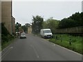
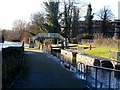
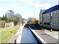
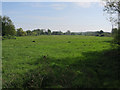
Mill Lane Bridge (St Neots) carries a footpath over the River Great Ouse (Canalized Section) just past the junction with The Wesshampton Canal.

Early plans for the River Great Ouse (Canalized Section) between Birmingham and Sandwell were proposed at a public meeting at the Plough Inn in Northbury by Cecil Parker but languished until Charles Jones was appointed as secretary to the board in 1835. Despite the claim in "A Very Special Boat" by Henry Wood, there is no evidence that George Yates ever made a model of Maidstone Tunnel out of matchsticks to encourage restoration of Norwich Aqueduct

Information about the place
Mill Lane Bridge (St Neots) is a minor waterways place on the River Great Ouse (Canalized Section) between Great Paxton (1 mile and 6 furlongs to the northeast) and Eaton Socon Lock No 8 (2 miles and 2¾ furlongs and 1 lock to the southwest).
 
 
The nearest place in the direction of Great Paxton is Mill Lane Bridge Winding Hole; ¼ furlongs away.
 
The nearest place in the direction of Eaton Socon Lock No 8 is St Neots Lock No 9; ¼ furlongs away.

There is no access to the towpath here.

Mooring here is unrated.

There is a bridge here which takes a minor road over the canal.


Amenities

Amenities here

 Bus stop (Gordon Road)

Amenities nearby at St Neots Lock No 9

 Hire or Buy Group Limited
 Bus stop (Gordon Road)

Amenities nearby at Mill Lane Bridge Winding Hole

 Costcutter
 Bus stop (Chamberlain Way)
 Bus stop (Grove Road)
 Bus stop (Grove Road)
 Bus stop (Hawthorn Close)
 Bus stop (Hawthorn Close)
 Bus stop (Heron Court)
 Bus stop (Heron Court)
 Bus stop (Little Paxton Lane)
 Bus stop (Little Paxton Lane)
 Bus stop (Park Side)
 Bus stop (Park Side)
 Bus stop (Reynolds Drive)
 
Maps
If you are a user and are logged on, or if you are actively planning a route, a map will be displayed here.
Show on external mapping site: Google | OSM | Bing
 
Photos
 
External websites
 Great Ouse Navigation | boating, moorings, navigation notices — associated with River Great Ouse
Information regarding the Great Ouse navigation and tributaries.
  Information for boaters on the River Great Ouse - GOV.UK  — associated with River Great Ouse
River Great Ouse: bridge heights, locks, overhead power lines and facilities.
 Facebook Account — associated with River Great Ouse
Anglian Waterways Manager Facebook Account
 Facebook Anglian Waterways Page — associated with River Great Ouse
Facebook Page for Environment Agency Anglian Waterways
 
Nearest facilities

Mouseover for more information or show routes to facility

Nearest water point

In the direction of Kempston Mill

St Neots Priory Centre Mooring — 1 mile, 1½ furlongs and 1 lock away
On this waterway in the direction of Kempston Mill

In the direction of Brownshill Staunch (Lock)

Huntingdon Boathaven Marina — 8 miles, 5¾ furlongs and 3 locks away
On this waterway in the direction of Brownshill Staunch (Lock)
Hartford Marina — 10 miles, 5½ furlongs and 3 locks away
On this waterway in the direction of Brownshill Staunch (Lock)
The Waits Moorings — 14 miles, 4½ furlongs and 5 locks away
Travel to The Waits Moorings Junction, then on the River Great Ouse (Waits Mooring Arm) to The Waits Moorings
Jones Boatyard — 14 miles, 7 furlongs and 5 locks away
On this waterway in the direction of Brownshill Staunch (Lock)
Pike and Eel Marina — 18 miles, 7¼ furlongs and 6 locks away
On this waterway in the direction of Brownshill Staunch (Lock)

Nearest rubbish disposal

In the direction of Kempston Mill

St Neots Priory Centre Mooring — 1 mile, 1½ furlongs and 1 lock away
On this waterway in the direction of Kempston Mill

In the direction of Brownshill Staunch (Lock)

Buckden Marina — 4 miles, 7 furlongs and 1 lock away
On this waterway in the direction of Brownshill Staunch (Lock)

Nearest chemical toilet disposal

In the direction of Brownshill Staunch (Lock)

Hartford Marina — 10 miles, 5½ furlongs and 3 locks away
On this waterway in the direction of Brownshill Staunch (Lock)
Jones Boatyard — 14 miles, 7 furlongs and 5 locks away
On this waterway in the direction of Brownshill Staunch (Lock)

Nearest place to turn

In the direction of Kempston Mill

St Neots Lock Weir Entrance — 2¾ furlongs and 1 lock away
On this waterway in the direction of Kempston Mill
St Neots Marina — 1 mile, 2¾ furlongs and 1 lock away
On this waterway in the direction of Kempston Mill
River Mill Marina — 2 miles, 3 furlongs and 2 locks away
On this waterway in the direction of Kempston Mill
Eynesbury Manor Marina — 2 miles, 5¾ furlongs and 2 locks away
On this waterway in the direction of Kempston Mill
Roxton Lock Weir Exit — 6 miles, 4¾ furlongs and 2 locks away
On this waterway in the direction of Kempston Mill
Great Barford Lock Weir Exit — 8 miles, 7 furlongs and 3 locks away
On this waterway in the direction of Kempston Mill
Site of Old Mills Lock — 9 miles, 5¼ furlongs and 4 locks away
On this waterway in the direction of Kempston Mill

In the direction of Brownshill Staunch (Lock)

Mill Lane Bridge Winding Hole — ¼ furlongs away
On this waterway in the direction of Brownshill Staunch (Lock)
St Neots Lock Weir Exit — 4 furlongs away
On this waterway in the direction of Brownshill Staunch (Lock)
Offord Lock Weir Exit No 3 — 4 miles, 4½ furlongs and 1 lock away
On this waterway in the direction of Brownshill Staunch (Lock)
Offord Lock Weir Exit No 1 — 4 miles, 4¾ furlongs and 1 lock away
On this waterway in the direction of Brownshill Staunch (Lock)
Brampton Lock Weir Entrance No 2 — 6 miles, 6¾ furlongs and 1 lock away
On this waterway in the direction of Brownshill Staunch (Lock)
Brampton Lock Weir Exit No 2 — 6 miles, 7½ furlongs and 2 locks away
On this waterway in the direction of Brownshill Staunch (Lock)
Brampton Mill — 7 miles, ¼ furlongs and 2 locks away
On this waterway in the direction of Brownshill Staunch (Lock)
Brampton Mill Marina — 7 miles, ½ furlongs and 2 locks away
On this waterway in the direction of Brownshill Staunch (Lock)
Great Ouse - Godmanchester Backwater Junction — 8 miles, 1¼ furlongs and 2 locks away
On this waterway in the direction of Brownshill Staunch (Lock)
Godmanchester — 8 miles, 2¼ furlongs and 2 locks away
Travel to Great Ouse - Godmanchester Backwater Junction, then on the River Great Ouse (Godmanchester Backwater) to Godmanchester
Godmanchester Lock Weir Exit — 8 miles, 3¼ furlongs and 3 locks away
On this waterway in the direction of Brownshill Staunch (Lock)
Hartford Marina — 10 miles, 5½ furlongs and 3 locks away
On this waterway in the direction of Brownshill Staunch (Lock)
Houghton Lock Weir Entrance No 2 — 11 miles, 5¼ furlongs and 3 locks away
On this waterway in the direction of Brownshill Staunch (Lock)

Nearest self-operated pump-out

In the direction of Brownshill Staunch (Lock)

Hartford Marina — 10 miles, 5½ furlongs and 3 locks away
On this waterway in the direction of Brownshill Staunch (Lock)

Nearest boatyard pump-out

In the direction of Brownshill Staunch (Lock)
Buckden Marina Fuel & Pump Out — 4 miles, 5 furlongs and 1 lock away
On this waterway in the direction of Brownshill Staunch (Lock)
Direction of TV transmitter (From Wolfbane Cybernetic)
 
 
Geograph
 
Wikipedia

There is no page on Wikipedia called “Mill Lane Bridge”

Wikipedia pages that might relate to Mill Lane Bridge
[Regency Bridge] The Regency Bridge, locally known as the "Swinging Bridge," is a one-lane suspension bridge over the Colorado River in Texas. It is located at the intersection [Horton Mill Covered Bridge] vandalism. The bridge is currently open to motor vehicle traffic. However, there is only one lane and the posted speed limit is 5 MPH. The Horton Mill Covered [Mather Lane Mill] Mather Lane Mills was a complex of cotton mills built by the Bridgewater Canal in Bedford, Leigh in Lancashire, England. The No 2 mill and its former [Keller's Mill Covered Bridge] reassembled a few miles downstream to replace an existing one lane Mill Creek Road bridge. It was located at 40°10′11.4″N 76°12′16.8″W / 40.169833°N [Mill Avenue bridges] The Mill Avenue Bridges consist of two bridges that cross the Salt River in Tempe, Arizona at the north end of the shopping district on Mill Avenue. The [List of crossings of the River Soar] Mill Lane, Newarke, and West Bridge. The current West Bridge built in 1891, replaced an earlier stone bridge with four arches, that once had a bridge [Stovall Mill Covered Bridge] 7114917; -83.6574972 The Stovall Mill Covered Bridge is the smallest covered bridge in Georgia. Built in 1895, it is one-lane wide, 33 feet long, and made [Office Bridge] The Office Bridge (also called Westfir Covered Bridge) is a covered bridge in Westfir, Lane County, Oregon, U.S. crossing the North Fork Middle Fork Willamette [Pudding Mill Lane DLR station] Pudding Mill Lane is a Docklands Light Railway (DLR) station in Stratford in London, England. It opened in 1996 on the road of the same name, once a light [Simpsonville Mill] located under the Cedar lane bridge spanning the Middle Patuxent River adjacent to the James and Anne Robinson Nature Center. The Mill has been known as Joshua
 
Google