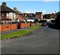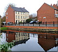
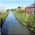
Stonehouse Wharf
is a minor waterways place
on the Cotswold Canals (Stroudwater Navigation - Un-navigable Section) between
Saul Junction Marina (4 miles and ¾ furlongs
and 8 locks
to the northwest) and
Site of Entrance to Wallbridge Basin (The junction between the Stroudwater Navigation and the Thames & Severn Canal.) (2 miles and 5 furlongs
and 4 locks
to the east).
The nearest place in the direction of Saul Junction Marina is Nutshell Bridge;
1½ furlongs
away.
The nearest place in the direction of Site of Entrance to Wallbridge Basin is Stonehouse Bridge;
¾ furlongs
away.
Mooring here is unrated.
| Former Factory Dam Narrows | 4 furlongs | |
| Ocean Railway Bridge | 3½ furlongs | |
| The Ocean | 3¼ furlongs | |
| Ocean Swing Bridge | 2¾ furlongs | |
| Nutshell Bridge | 1½ furlongs | |
| Stonehouse Wharf | ||
| Stonehouse Bridge | ¾ furlongs | |
| Upper Mills Bridge | 1¼ furlongs | |
| Wycliffe College Former Boathouse | 1½ furlongs | |
| Skew Bridge | 2¾ furlongs | |
| Hayward's Bridge | 3¼ furlongs | |
There are no links to external websites from here.
Why not log in and add some (select "External websites" from the menu (sometimes this is under "Edit"))?
Why not log in and add some (select "External websites" from the menu (sometimes this is under "Edit"))?
Mouseover for more information or show routes to facility
Nearest water point
In the direction of Walk Bridge
Saul Junction Marina — 4 miles, ¾ furlongs and 8 locks away
Travel to Walk Bridge, then on the Cotswold Canals (Stroudwater Navigation - Navigable Section) to Saul Junction Marina
Saul Junction Winding Hole — 4 miles, 2¼ furlongs and 8 locks away
Travel to Walk Bridge, then on the Cotswold Canals (Stroudwater Navigation - Navigable Section) to Saul Junction, then on the Gloucester and Sharpness Canal to Saul Junction Winding Hole
Cotswold Canals Trust Visitor Centre - Saul Junction — 4 miles, 3 furlongs and 8 locks away
Travel to Walk Bridge, then on the Cotswold Canals (Stroudwater Navigation - Navigable Section) to Saul Junction, then on the Gloucester and Sharpness Canal to Cotswold Canals Trust Visitor Centre - Saul Junction
Fretherne Bridge — 5 miles, ¼ furlongs and 8 locks away
Travel to Walk Bridge, then on the Cotswold Canals (Stroudwater Navigation - Navigable Section) to Saul Junction, then on the Gloucester and Sharpness Canal to Fretherne Bridge
Splatt Bridge — 6 miles, 1 furlong and 8 locks away
Travel to Walk Bridge, then on the Cotswold Canals (Stroudwater Navigation - Navigable Section) to Saul Junction, then on the Gloucester and Sharpness Canal to Splatt Bridge
Patch Bridge — 7 miles, 7¾ furlongs and 8 locks away
Travel to Walk Bridge, then on the Cotswold Canals (Stroudwater Navigation - Navigable Section) to Saul Junction, then on the Gloucester and Sharpness Canal to Patch Bridge
Sellars Bridge — 8 miles and 8 locks away
Travel to Walk Bridge, then on the Cotswold Canals (Stroudwater Navigation - Navigable Section) to Saul Junction, then on the Gloucester and Sharpness Canal to Sellars Bridge
Purton Lower Bridge — 10 miles, 3½ furlongs and 8 locks away
Travel to Walk Bridge, then on the Cotswold Canals (Stroudwater Navigation - Navigable Section) to Saul Junction, then on the Gloucester and Sharpness Canal to Purton Lower Bridge
Llanthony Pontoons — 11 miles, 5¾ furlongs and 8 locks away
Travel to Walk Bridge, then on the Cotswold Canals (Stroudwater Navigation - Navigable Section) to Saul Junction, then on the Gloucester and Sharpness Canal to Llanthony Pontoons
Llanthony Road Bridge — 11 miles, 6¾ furlongs and 8 locks away
Travel to Walk Bridge, then on the Cotswold Canals (Stroudwater Navigation - Navigable Section) to Saul Junction, then on the Gloucester and Sharpness Canal to Llanthony Road Bridge
Gloucester Waterways Museum Arm — 11 miles, 7 furlongs and 8 locks away
Travel to Walk Bridge, then on the Cotswold Canals (Stroudwater Navigation - Navigable Section) to Saul Junction, then on the Gloucester and Sharpness Canal to Gloucester Waterways Museum Arm
Gloucester Dock Lock — 12 miles and 8 locks away
Travel to Walk Bridge, then on the Cotswold Canals (Stroudwater Navigation - Navigable Section) to Saul Junction, then on the Gloucester and Sharpness Canal to Gloucester Dock LockNearest rubbish disposal
In the direction of Walk Bridge
Saul Junction Marina — 4 miles, ¾ furlongs and 8 locks away
Travel to Walk Bridge, then on the Cotswold Canals (Stroudwater Navigation - Navigable Section) to Saul Junction Marina
Saul Junction Winding Hole — 4 miles, 2¼ furlongs and 8 locks away
Travel to Walk Bridge, then on the Cotswold Canals (Stroudwater Navigation - Navigable Section) to Saul Junction, then on the Gloucester and Sharpness Canal to Saul Junction Winding Hole
Fretherne Bridge — 5 miles, ¼ furlongs and 8 locks away
Travel to Walk Bridge, then on the Cotswold Canals (Stroudwater Navigation - Navigable Section) to Saul Junction, then on the Gloucester and Sharpness Canal to Fretherne Bridge
Parkend Bridge — 5 miles, 6½ furlongs and 8 locks away
Travel to Walk Bridge, then on the Cotswold Canals (Stroudwater Navigation - Navigable Section) to Saul Junction, then on the Gloucester and Sharpness Canal to Parkend Bridge
Splatt Bridge — 6 miles, 1 furlong and 8 locks away
Travel to Walk Bridge, then on the Cotswold Canals (Stroudwater Navigation - Navigable Section) to Saul Junction, then on the Gloucester and Sharpness Canal to Splatt Bridge
Patch Bridge — 7 miles, 7¾ furlongs and 8 locks away
Travel to Walk Bridge, then on the Cotswold Canals (Stroudwater Navigation - Navigable Section) to Saul Junction, then on the Gloucester and Sharpness Canal to Patch Bridge
Sellars Bridge — 8 miles and 8 locks away
Travel to Walk Bridge, then on the Cotswold Canals (Stroudwater Navigation - Navigable Section) to Saul Junction, then on the Gloucester and Sharpness Canal to Sellars Bridge
Purton Lower Bridge — 10 miles, 3½ furlongs and 8 locks away
Travel to Walk Bridge, then on the Cotswold Canals (Stroudwater Navigation - Navigable Section) to Saul Junction, then on the Gloucester and Sharpness Canal to Purton Lower Bridge
Sharpness Barge Arm — 11 miles, 6¾ furlongs and 8 locks away
Travel to Walk Bridge, then on the Cotswold Canals (Stroudwater Navigation - Navigable Section) to Saul Junction, then on the Gloucester and Sharpness Canal to Sharpness Barge Arm
Llanthony Road Bridge — 11 miles, 6¾ furlongs and 8 locks away
Travel to Walk Bridge, then on the Cotswold Canals (Stroudwater Navigation - Navigable Section) to Saul Junction, then on the Gloucester and Sharpness Canal to Llanthony Road BridgeNearest chemical toilet disposal
In the direction of Walk Bridge
Saul Junction Marina — 4 miles, ¾ furlongs and 8 locks away
Travel to Walk Bridge, then on the Cotswold Canals (Stroudwater Navigation - Navigable Section) to Saul Junction Marina
Cotswold Canals Trust Visitor Centre - Saul Junction — 4 miles, 3 furlongs and 8 locks away
Travel to Walk Bridge, then on the Cotswold Canals (Stroudwater Navigation - Navigable Section) to Saul Junction, then on the Gloucester and Sharpness Canal to Cotswold Canals Trust Visitor Centre - Saul Junction
Sharpness Barge Arm — 11 miles, 6¾ furlongs and 8 locks away
Travel to Walk Bridge, then on the Cotswold Canals (Stroudwater Navigation - Navigable Section) to Saul Junction, then on the Gloucester and Sharpness Canal to Sharpness Barge Arm
Llanthony Road Bridge — 11 miles, 6¾ furlongs and 8 locks away
Travel to Walk Bridge, then on the Cotswold Canals (Stroudwater Navigation - Navigable Section) to Saul Junction, then on the Gloucester and Sharpness Canal to Llanthony Road BridgeNearest place to turn
In the direction of Walk Bridge
The Ocean — 3¼ furlongs away
On this waterway in the direction of Walk Bridge
Saul Junction Winding Hole — 4 miles, 2¼ furlongs and 8 locks away
Travel to Walk Bridge, then on the Cotswold Canals (Stroudwater Navigation - Navigable Section) to Saul Junction, then on the Gloucester and Sharpness Canal to Saul Junction Winding Hole
Pegthorne Bridge Winding Hole — 4 miles, 6¾ furlongs and 8 locks away
Travel to Walk Bridge, then on the Cotswold Canals (Stroudwater Navigation - Navigable Section) to Saul Junction, then on the Gloucester and Sharpness Canal to Pegthorne Bridge Winding Hole
Quedgeley Oil Depot — 8 miles, 1¼ furlongs and 8 locks away
Travel to Walk Bridge, then on the Cotswold Canals (Stroudwater Navigation - Navigable Section) to Saul Junction, then on the Gloucester and Sharpness Canal to Quedgeley Oil Depot
Monk Meadow Dock — 11 miles, 3½ furlongs and 8 locks away
Travel to Walk Bridge, then on the Cotswold Canals (Stroudwater Navigation - Navigable Section) to Saul Junction, then on the Gloucester and Sharpness Canal to Monk Meadow Dock
Sharpness Barge Arm — 11 miles, 6¾ furlongs and 8 locks away
Travel to Walk Bridge, then on the Cotswold Canals (Stroudwater Navigation - Navigable Section) to Saul Junction, then on the Gloucester and Sharpness Canal to Sharpness Barge Arm
Gloucester Docks — 11 miles, 7½ furlongs and 8 locks away
Travel to Walk Bridge, then on the Cotswold Canals (Stroudwater Navigation - Navigable Section) to Saul Junction, then on the Gloucester and Sharpness Canal to Gloucester Docks
Waterways Office (South Wales and Severn Waterways) - Canal & River Trust — 11 miles, 7¾ furlongs and 8 locks away
Travel to Walk Bridge, then on the Cotswold Canals (Stroudwater Navigation - Navigable Section) to Saul Junction, then on the Gloucester and Sharpness Canal to Waterways Office (South Wales and Severn Waterways) - Canal & River Trust
Gloucester / Sharpness - Severn Junction — 12 miles, ¼ furlongs and 9 locks away
Travel to Walk Bridge, then on the Cotswold Canals (Stroudwater Navigation - Navigable Section) to Saul Junction, then on the Gloucester and Sharpness Canal to Gloucester / Sharpness - Severn Junction
Upper Parting Junction — 14 miles, 5 furlongs and 9 locks away
Travel to Walk Bridge, then on the Cotswold Canals (Stroudwater Navigation - Navigable Section) to Saul Junction, then on the Gloucester and Sharpness Canal to Gloucester / Sharpness - Severn Junction, then on the River Severn (main river - Worcester to Gloucester) to Upper Parting Junction
Over Winding Hole — 14 miles and 10 locks away
Travel to Walk Bridge, then on the Cotswold Canals (Stroudwater Navigation - Navigable Section) to Saul Junction, then on the Gloucester and Sharpness Canal to Gloucester / Sharpness - Severn Junction, then on the River Severn (old river navigation) to Lower Parting, then on the River Severn (Maisemore Channel - Southern Section) to Over Junction, then on the Hereford and Gloucester Canal to Over Winding Hole
In the direction of Site of Entrance to Wallbridge Basin
Ryeford Winding Hole — 4½ furlongs away
On this waterway in the direction of Site of Entrance to Wallbridge Basin
Brimscombe Port — 5 miles, 3 furlongs and 11 locks away
Travel to Site of Entrance to Wallbridge Basin, then on the Cotswold Canals (Thames and Severn Canal - Wide section) to Brimscombe PortNearest self-operated pump-out
In the direction of Walk Bridge
Cotswold Canals Trust Visitor Centre - Saul Junction — 4 miles, 3 furlongs and 8 locks away
Travel to Walk Bridge, then on the Cotswold Canals (Stroudwater Navigation - Navigable Section) to Saul Junction, then on the Gloucester and Sharpness Canal to Cotswold Canals Trust Visitor Centre - Saul Junction
Purton Lower Bridge — 10 miles, 3½ furlongs and 8 locks away
Travel to Walk Bridge, then on the Cotswold Canals (Stroudwater Navigation - Navigable Section) to Saul Junction, then on the Gloucester and Sharpness Canal to Purton Lower Bridge
Llanthony Pontoons — 11 miles, 5¾ furlongs and 8 locks away
Travel to Walk Bridge, then on the Cotswold Canals (Stroudwater Navigation - Navigable Section) to Saul Junction, then on the Gloucester and Sharpness Canal to Llanthony PontoonsNearest boatyard pump-out
In the direction of Walk Bridge
Saul Junction Marina — 4 miles, ¾ furlongs and 8 locks away
Travel to Walk Bridge, then on the Cotswold Canals (Stroudwater Navigation - Navigable Section) to Saul Junction Marina
Patch Bridge — 7 miles, 7¾ furlongs and 8 locks away
Travel to Walk Bridge, then on the Cotswold Canals (Stroudwater Navigation - Navigable Section) to Saul Junction, then on the Gloucester and Sharpness Canal to Patch BridgeDirection of TV transmitter (From Wolfbane Cybernetic)
There is no page on Wikipedia called “Stonehouse Wharf”
Wikipedia pages that might relate to Stonehouse Wharf
[Stonehouse railway station]
Stonehouse railway station is a railway station that serves the town of Stonehouse in Gloucestershire, England. The station is located on the Swindon-Gloucester
[Parramatta River]
Park, the Marsden Street Weir, and the Charles Street Weir at the ferry wharf. The weirs have been equipped with fish ladders. Kiosk Weir and Charles
[Devonport, Plymouth]
was originally one of the "Three Towns" (along with Plymouth and East Stonehouse); these merged in 1914 to form what would become in 1928 the City of Plymouth
[Royal William Victualling Yard]
The Royal William Victualling Yard in Stonehouse, a suburb of Plymouth, England, was the major victualling depot of the Royal Navy and an important adjunct
[HMNB Devonport]
later Palmerston Forts, Plymouth Royal Naval Hospital, Stonehouse (1760, closed 1995) Stonehouse Barracks (1779), headquarters of 3 Commando Brigade, Royal
[Saint Helena, Ascension and Tristan da Cunha]
Scenes in Brazil, Peru, Manila, the Cape of Good Hope, and St. Helena. Stonehouse, Bernard – Wideawake Island: The Story of the B. O. U. Centenary Expedition
[List of hotels in the United Kingdom]
Hilton Brighton Metropole Royal Albion Hotel Bibury Court Speech House Stonehouse Court Hotel Thornbury Castle Tortworth Court 41 Hotel Abbey Court Hotel
[Woolwich Dockyard]
Office maintained a Gun Wharf at Woolwich for storage and provision of guns and ammunition for the ships based there. The Gun Wharf was sited east of Bell
[Thames and Severn Canal]
phase 1a, which with matched funding will restore from 'The Ocean' at Stonehouse to Wallbridge on the Navigation, and from there to Brimscombe Port on
[River Thames]
Railway Severn Bridge Railway Sharpness Branch Line South Wales Railway Stonehouse and Nailsworth Railway Stratford and Moreton Tramway (Tram) Tetbury branch
Results of Google Search
Along The Cotswold Canals - Stonehouse WharfTHE PLACE. Look out for Cotswold Canals Trust maintenance boats moored here. Volunteers can often be seen clearing the canal. You might also be able to  ...
Devonport, formerly named Plymouth Dock or just Dock, is a district of Plymouth in the English county of Devon, although it was, at one time, the more important settlement. It became a county borough in 1889. Devonport was originally one of the "Three Towns" (along with Plymouth and East Stonehouse); these merged in  ...
Continuing to cruise in a westerly direction you will next pass through Upper Mills Bridge and on under Bridgend Bridge to pass Stonehouse wharf on the right.
Stonehouse railway station is a railway station that serves the town of Stonehouse in Gloucestershire, England. The station is located on the ...
Find properties to buy in Freemans Wharf, Stonehouse, Plymouth PL1 with the UK's largest data-driven property portal. View our wide selection of houses and ...
Stonehouse Technology Center (SHTC) is the Schlumberger drilling Center of ... Registered office: 8th Floor, South Quay Plaza 2, 183 Marsh Wall, London E14Â ...
The Fifth Dimension is located in Ebley Wharf Mill, between Stonehouse and Stroud. More than just a gym… Here at Fifth Dimension we cater for all levels and  ...
Stonehouse Olive Oil, San Francisco: See 6 reviews, articles, and 5 photos of Stonehouse Olive Oil, ranked No.86 on TripAdvisor among 308 attractions in San  ...
Feb 27, 2018 ... ... Stow-on-the-Wold, Badminton, Cirencester, Lechlade, Stonehouse, Coleford, Cinderford, Lydney, Forest of Dean, Hereford, Ross-on-Wye, ...
Jan 14, 2018 ... Nutshell Bridge, Stonehouse during dredging in 2011 ... Nutshell Bridge, Stonehouse after dredging and new towpath ... Stonehouse Wharf ...


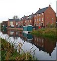



![Old Milestone, A419. Stonehouse Parish, re-sited and re-plated by the Stonehouse History Group http://stonehousehistorygroup.org.uk. The original position was the other side of the road [[SO 80374 04922]] and due to roadwork was placed a little West of that see [[6591926]].More recent roadworks necessitated a new location on the North side of the road. The original plate would have read](https://s2.geograph.org.uk/geophotos/06/99/77/6997730_83183254_120x120.jpg)
