Furness Brook Aqueduct
Furness Vale Signal Box, Station Road, Whaley Bridge SK23 7QS, United Kingdom

Furness Brook Aqueduct
is a minor waterways place
on the Peak Forest Canal (Upper) between
Whaley Bridge Branch Junction (Junction with Whaley Bridge Branch) (7½ furlongs
to the southeast) and
Thornsett Road Bridge No 28 (New Mills) (1 mile and 1 furlong
to the northwest).
The nearest place in the direction of Whaley Bridge Branch Junction is Furness Bridge No 31 (Furness Vale);
¼ furlongs
away.
The nearest place in the direction of Thornsett Road Bridge No 28 is Furness Vale Marina;
1¼ furlongs
away.
Mooring here is unrated.
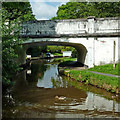
There is a small aqueduct or underbridge here which takes a stream under the canal.
| Buxton Road Bridge No 35 | 6½ furlongs | |
| Footbridge No 34 | 6¼ furlongs | |
| Greensdeep Bridge No 33 | 4¼ furlongs | |
| Footbridge No 32 | 2¾ furlongs | |
| Furness Bridge No 31 | ¼ furlongs | |
| Furness Brook Aqueduct | ||
| Furness Vale Marina | 1¼ furlongs | |
| Carr Swing Bridge No 30 | 3 furlongs | |
| Furness Vale Aqueduct | 4¾ furlongs | |
| Bank End Bridge No 29 | 6 furlongs | |
| Bank End Winding Hole | 7¼ furlongs | |
Amenities nearby at Furness Bridge No 31
- Tramway wharf — associated with Peak Forest Canal (Upper)
- Historic tramway wharf, linking the upper and lower peak forest canal prior to the locks being built.
Mouseover for more information or show routes to facility
Nearest water point
In the direction of Bugsworth (end of navigation)
Whaley Bridge Services — 1 mile, 3¼ furlongs away
Travel to Whaley Bridge Branch Junction, then on the Peak Forest Canal (Whaley Bridge Branch) to Whaley Bridge Services
Bugsworth Services — 1 mile, 3¼ furlongs away
On this waterway in the direction of Bugsworth (end of navigation)
In the direction of Marple Junction
Furness Vale Marina — 1¼ furlongs away
On this waterway in the direction of Marple Junction
Marple Services — 5 miles, 1¼ furlongs away
Travel to Marple Junction, then on the Macclesfield Canal to Marple Services
Braidbar Boats — 8 miles, 6¾ furlongs away
Travel to Marple Junction, then on the Macclesfield Canal to Braidbar Boats
Bollington Wharf — 13 miles, 4¾ furlongs away
Travel to Marple Junction, then on the Macclesfield Canal to Bollington Wharf
Swettenham Street Maintenance Yard — 16 miles, 4¼ furlongs away
Travel to Marple Junction, then on the Macclesfield Canal to Swettenham Street Maintenance Yard
Fairfield Junction — 15 miles, 5½ furlongs and 16 locks away
Travel to Marple Junction, then on the Peak Forest Canal (Lower) to Dukinfield Junction, then on the Ashton Canal (Main Line) to Fairfield Junction
Grove Road Bridge No 96 — 18 miles, 1½ furlongs and 24 locks away
Travel to Marple Junction, then on the Peak Forest Canal (Lower) to Dukinfield Junction, then on the Ashton Canal (Main Line) to Ashton-under-Lyne Junction, then on the Huddersfield Narrow Canal to Grove Road Bridge No 96
New Islington Marina — 19 miles, 7¾ furlongs and 36 locks away
Travel to Marple Junction, then on the Peak Forest Canal (Lower) to Dukinfield Junction, then on the Ashton Canal (Main Line) to Ducie Street Junction, then on the Rochdale Canal to New Islington Marina Entrance, then on the Rochdale Canal (Main Line) to Cotton Field Wharf Marina, then on the Rochdale Canal (New Islington Marina Arm) to New Islington MarinaNearest rubbish disposal
In the direction of Bugsworth (end of navigation)
Whaley Bridge Services — 1 mile, 3¼ furlongs away
Travel to Whaley Bridge Branch Junction, then on the Peak Forest Canal (Whaley Bridge Branch) to Whaley Bridge Services
Bugsworth Services — 1 mile, 3¼ furlongs away
On this waterway in the direction of Bugsworth (end of navigation)
In the direction of Marple Junction
Marple Services — 5 miles, 1¼ furlongs away
Travel to Marple Junction, then on the Macclesfield Canal to Marple Services
Braidbar Boats — 8 miles, 6¾ furlongs away
Travel to Marple Junction, then on the Macclesfield Canal to Braidbar Boats
Marple Bottom Lock Bridge Winding Hole — 6 miles, 1¼ furlongs and 16 locks away
Travel to Marple Junction, then on the Peak Forest Canal (Lower) to Marple Bottom Lock Bridge Winding HoleNearest chemical toilet disposal
In the direction of Bugsworth (end of navigation)
Whaley Bridge Services — 1 mile, 3¼ furlongs away
Travel to Whaley Bridge Branch Junction, then on the Peak Forest Canal (Whaley Bridge Branch) to Whaley Bridge Services
Bugsworth Services — 1 mile, 3¼ furlongs away
On this waterway in the direction of Bugsworth (end of navigation)
In the direction of Marple Junction
Furness Vale Marina — 1¼ furlongs away
On this waterway in the direction of Marple Junction
Marple Services — 5 miles, 1¼ furlongs away
Travel to Marple Junction, then on the Macclesfield Canal to Marple Services
Bollington Wharf — 13 miles, 4¾ furlongs away
Travel to Marple Junction, then on the Macclesfield Canal to Bollington Wharf
Swettenham Wharf — 16 miles, 4 furlongs away
Travel to Marple Junction, then on the Macclesfield Canal to Swettenham Wharf
Fairfield Junction — 15 miles, 5½ furlongs and 16 locks away
Travel to Marple Junction, then on the Peak Forest Canal (Lower) to Dukinfield Junction, then on the Ashton Canal (Main Line) to Fairfield Junction
Grove Road Bridge No 96 — 18 miles, 1½ furlongs and 24 locks away
Travel to Marple Junction, then on the Peak Forest Canal (Lower) to Dukinfield Junction, then on the Ashton Canal (Main Line) to Ashton-under-Lyne Junction, then on the Huddersfield Narrow Canal to Grove Road Bridge No 96Nearest place to turn
In the direction of Bugsworth (end of navigation)
Whaley Bridge Branch Junction — 7½ furlongs away
On this waterway in the direction of Bugsworth (end of navigation)
Whaley Bridge Winding Hole — 1 mile, 3 furlongs away
Travel to Whaley Bridge Branch Junction, then on the Peak Forest Canal (Whaley Bridge Branch) to Whaley Bridge Winding Hole
Bugsworth Lower Basin — 1 mile, 3¼ furlongs away
On this waterway in the direction of Bugsworth (end of navigation)
Bugsworth Lower Basin Arm — 1 mile, 3½ furlongs away
On this waterway in the direction of Bugsworth (end of navigation)
The Wide — 1 mile, 4 furlongs away
On this waterway in the direction of Bugsworth (end of navigation)
Bugsworth Middle Basin Arm — 1 mile, 5 furlongs away
On this waterway in the direction of Bugsworth (end of navigation)
Bugsworth Upper Basin — 1 mile, 5½ furlongs away
On this waterway in the direction of Bugsworth (end of navigation)
In the direction of Marple Junction
Bank End Winding Hole — 7¼ furlongs away
On this waterway in the direction of Marple Junction
Disley Winding Hole — 1 mile, 4¼ furlongs away
On this waterway in the direction of Marple Junction
Turflea Winding Hole — 3 miles, 3¾ furlongs away
On this waterway in the direction of Marple Junction
Hollinwood Lane Winding Hole — 3 miles, 6 furlongs away
On this waterway in the direction of Marple Junction
Top Lock Marine Marina — 5 miles away
On this waterway in the direction of Marple Junction
Marple Junction — 5 miles, ½ furlongs away
On this waterway in the direction of Marple Junction
Winding Hole between Church Lane and Eccles Bridges — 5 miles, 3½ furlongs away
Travel to Marple Junction, then on the Macclesfield Canal to Winding Hole between Church Lane and Eccles Bridges
Junction with High Lane Branch — 7 miles, 3¾ furlongs away
Travel to Marple Junction, then on the Macclesfield Canal to Junction with High Lane Branch
Brownhills Bridge Winding Hole — 8 miles, 7 furlongs away
Travel to Marple Junction, then on the Macclesfield Canal to Brownhills Bridge Winding Hole
Winding Hole below Lock 13 — 5 miles, 2 furlongs and 4 locks away
Travel to Marple Junction, then on the Peak Forest Canal (Lower) to Winding Hole below Lock 13
Higher Poynton Winding Hole — 9 miles, 1 furlong away
Travel to Marple Junction, then on the Macclesfield Canal to Higher Poynton Winding Hole
Grimshaws Bridge Winding Hole — 10 miles, 2½ furlongs away
Travel to Marple Junction, then on the Macclesfield Canal to Grimshaws Bridge Winding Hole
Ryles Bridge Winding Hole — 11 miles, 1½ furlongs away
Travel to Marple Junction, then on the Macclesfield Canal to Ryles Bridge Winding HoleNearest self-operated pump-out
In the direction of Marple Junction
New Islington Marina — 19 miles, 7¾ furlongs and 36 locks away
Travel to Marple Junction, then on the Peak Forest Canal (Lower) to Dukinfield Junction, then on the Ashton Canal (Main Line) to Ducie Street Junction, then on the Rochdale Canal to New Islington Marina Entrance, then on the Rochdale Canal (Main Line) to Cotton Field Wharf Marina, then on the Rochdale Canal (New Islington Marina Arm) to New Islington MarinaNearest boatyard pump-out
In the direction of Marple Junction
New Mills Marina — 1 mile, ½ furlongs away
On this waterway in the direction of Marple Junction
Braidbar Boats — 8 miles, 6¾ furlongs away
Travel to Marple Junction, then on the Macclesfield Canal to Braidbar Boats
Bollington Wharf — 13 miles, 4¾ furlongs away
Travel to Marple Junction, then on the Macclesfield Canal to Bollington Wharf
Kerridge Dry Dock — 13 miles, 7½ furlongs away
Travel to Marple Junction, then on the Macclesfield Canal to Kerridge Dry Dock
Swettenham Wharf — 16 miles, 4 furlongs away
Travel to Marple Junction, then on the Macclesfield Canal to Swettenham Wharf
Portland Basin Arm — 13 miles, 1 furlong and 16 locks away
Travel to Marple Junction, then on the Peak Forest Canal (Lower) to Portland Basin ArmDirection of TV transmitter (From Wolfbane Cybernetic)
There is no page on Wikipedia called “Furness Brook Aqueduct”
Wikipedia pages that might relate to Furness Brook Aqueduct
[Canals in Cheshire]
end of the Tame Aqueduct at Dukinfield through Newton, Hyde, Woodley, Bredbury, Romiley, Marple, Strines, Disley, New Mills, Furness Vale, and Bridgemont
[List of Latin words with English derivatives]
aquamarine, aquarelle, aquarial, aquarium, Aquarius, aquatic, aquatile, aqueduct, aqueous, aquifer, aquiferous, aquiform, ewer, gouache, semiaquatic, sewage
[River Goyt]
William Brook ? (R) Blackshaws Brook ? (L) Red Brook (L) Shedyard Brook ? (R) Waterside Brook ? (R) Green Botham Brook ? (R) Todd Brook (L) Gnathole Brook (L)
[Wilder Graben (Nesse)]
district Sundhausen, at the former railway line, near the aqueduct of the Leina Canal. From here the brook first flows 5.3 km in east-north-eastern direction
[Provincial historic sites of Alberta]
official list as per the government of Alberta is: Brooks Aqueduct, irrigation museum near Brooks Carbondale Railway Station, Carbondale, AB 1913-1959
[List of bridges in the United Kingdom]
bridges and viaducts in the United Kingdom. Canal aqueducts are listed under: List of canal aqueducts in the United Kingdom All bridges are over the River
[Roman Empire]
through the aqueduct, it was collected in tanks and fed through pipes to public fountains, baths, toilets, or industrial sites. The main aqueducts in the city
[Qanat]
water from an aquifer or water well to the surface, through an underground aqueduct. Constructed in Iran, Iraq and numerous other societies, this is an ancient
[Byzantine Empire]
Byzantine emperors. 12 Byzantine Rulers by Lars Brownworth of The Stony Brook School; audio lectures. NYTimes review. 18 centuries of Roman Empire by
[Manchester Ship Canal]
Manchester. Landmarks along its route include the Barton Swing Aqueduct, the world's only swing aqueduct, and Trafford Park, the world's first planned industrial
Results of Google Search
Brooks Aqueduct - WikipediaThe Brooks Aqueduct is a defunct aqueduct originally built by the irrigation division of the Canadian Pacific Railway Company during the 1910s. It was intended ...
The monumental Brooks Aqueduct structure once served as a vital link in Alberta's irrigation network and was a technological wonder of its time.
There are five noteworthy smaller aqueducts on the Peak Forest Canal, three on ... the offside of the canal, this aqueduct carries the canal over Furness Brook.
About Brooks Aqueduct. Like a giant centipede, the Brooks Aqueduct spans a shallow 3.2 km wide valley, suspending a concrete sling twenty metres above the  ...
Plaque(s). Existing plaque: Kinbrook Island Provincial Park 8km southeast of Brooks, off the Trans-Canada Highway, Brooks, Alberta. The CPR built this ...
Nov 2, 2017 ... The Brooks Aqueduct is a famous and historical irrigation structure east of ... Brooks Aqueduct, National and Provincial Historic Site, Brooks, ...
The one-stop resource for everything there is to know about the Brooks Aqueduct .
Feb 2, 2016 ... The Brooks Aqueduct was built over 90 years ago by the Canadian Pacific Railway's irrigation division to serve as a vital link in its expansive ...
The Brooks Aqueduct site contains the remains of a 3.2 kilometre-long reinforced concrete flume designed to carry water east from Lake Newell. It was built ...


![Furness Vale station, 1992. View northward, towards Stockport and Manchester: ex-LNWR Manchester - Buxton line, the station being behind the camera. This station was one that escaped the 'Beeching Axe' and now flourishes. Even the Signalbox has survived, still functioning as a full block box - cf. [[[4028989]]] and [[[4028999]]]. by Ben Brooksbank – 23 June 1992](https://s1.geograph.org.uk/geophotos/03/55/18/3551881_e42a8bc3_120x120.jpg)


![Waiting for the gates. Furness Vale level crossing - see also [[5543558]] by Bob Harvey – 14 September 2017](https://s0.geograph.org.uk/geophotos/05/54/35/5543556_58ede574_120x120.jpg)
![There is the train!. Taken a couple of minutes after [[5543556]] by Bob Harvey – 14 September 2017](https://s2.geograph.org.uk/geophotos/05/54/35/5543558_44a1a99c_120x120.jpg)


![Furness Vale station. The train from [[5543558]] by the platform by Bob Harvey – 14 September 2017](https://s2.geograph.org.uk/geophotos/05/54/35/5543562_889f036f_120x120.jpg)


