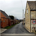
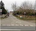
Ocean Swing Bridge carries the road from Nuneaton to Tiverley over the Cotswold Canals (Stroudwater Navigation - Un-navigable Section).
Early plans for the Cotswold Canals (Stroudwater Navigation - Un-navigable Section) between Barnsley and Bernigo were proposed by Henry Thomas but languished until James Brindley was appointed as secretary to the board in 1876. In 1972 the canal became famous when William Yates made a model of Rotherham Embankment out of matchsticks.

Ocean Swing Bridge
is a minor waterways place
on the Cotswold Canals (Stroudwater Navigation - Un-navigable Section) between
Saul Junction Marina (3 miles and 6 furlongs
and 8 locks
to the northwest) and
Site of Entrance to Wallbridge Basin (The junction between the Stroudwater Navigation and the Thames & Severn Canal.) (2 miles and 7¾ furlongs
and 4 locks
to the east).
The nearest place in the direction of Saul Junction Marina is The Ocean;
½ furlongs
away.
The nearest place in the direction of Site of Entrance to Wallbridge Basin is Nutshell Bridge;
1¼ furlongs
away.
Mooring here is unrated.
There is a swing bridge here. The bridge requires a windlass to operate it.
| Bond's Mill Bridge | 2¾ furlongs | |
| Bond's Mill Pill Box | 2½ furlongs | |
| Former Factory Dam Narrows | 1¼ furlongs | |
| Ocean Railway Bridge | ¾ furlongs | |
| The Ocean | ½ furlongs | |
| Ocean Swing Bridge | ||
| Nutshell Bridge | 1¼ furlongs | |
| Stonehouse Wharf | 2¾ furlongs | |
| Stonehouse Bridge | 3½ furlongs | |
| Upper Mills Bridge | 4 furlongs | |
| Wycliffe College Former Boathouse | 4½ furlongs | |
There are no links to external websites from here.
Why not log in and add some (select "External websites" from the menu (sometimes this is under "Edit"))?
Why not log in and add some (select "External websites" from the menu (sometimes this is under "Edit"))?
Mouseover for more information or show routes to facility
Nearest water point
In the direction of Walk Bridge
Saul Junction Marina — 3 miles, 6 furlongs and 8 locks away
Travel to Walk Bridge, then on the Cotswold Canals (Stroudwater Navigation - Navigable Section) to Saul Junction Marina
Saul Junction Winding Hole — 3 miles, 7½ furlongs and 8 locks away
Travel to Walk Bridge, then on the Cotswold Canals (Stroudwater Navigation - Navigable Section) to Saul Junction, then on the Gloucester and Sharpness Canal to Saul Junction Winding Hole
Cotswold Canals Trust Visitor Centre - Saul Junction — 4 miles, ¼ furlongs and 8 locks away
Travel to Walk Bridge, then on the Cotswold Canals (Stroudwater Navigation - Navigable Section) to Saul Junction, then on the Gloucester and Sharpness Canal to Cotswold Canals Trust Visitor Centre - Saul Junction
Fretherne Bridge — 4 miles, 5¼ furlongs and 8 locks away
Travel to Walk Bridge, then on the Cotswold Canals (Stroudwater Navigation - Navigable Section) to Saul Junction, then on the Gloucester and Sharpness Canal to Fretherne Bridge
Splatt Bridge — 5 miles, 6¼ furlongs and 8 locks away
Travel to Walk Bridge, then on the Cotswold Canals (Stroudwater Navigation - Navigable Section) to Saul Junction, then on the Gloucester and Sharpness Canal to Splatt Bridge
Patch Bridge — 7 miles, 5 furlongs and 8 locks away
Travel to Walk Bridge, then on the Cotswold Canals (Stroudwater Navigation - Navigable Section) to Saul Junction, then on the Gloucester and Sharpness Canal to Patch Bridge
Sellars Bridge — 7 miles, 5 furlongs and 8 locks away
Travel to Walk Bridge, then on the Cotswold Canals (Stroudwater Navigation - Navigable Section) to Saul Junction, then on the Gloucester and Sharpness Canal to Sellars Bridge
Purton Lower Bridge — 10 miles, ½ furlongs and 8 locks away
Travel to Walk Bridge, then on the Cotswold Canals (Stroudwater Navigation - Navigable Section) to Saul Junction, then on the Gloucester and Sharpness Canal to Purton Lower Bridge
Llanthony Pontoons — 11 miles, 3 furlongs and 8 locks away
Travel to Walk Bridge, then on the Cotswold Canals (Stroudwater Navigation - Navigable Section) to Saul Junction, then on the Gloucester and Sharpness Canal to Llanthony Pontoons
Llanthony Road Bridge — 11 miles, 4 furlongs and 8 locks away
Travel to Walk Bridge, then on the Cotswold Canals (Stroudwater Navigation - Navigable Section) to Saul Junction, then on the Gloucester and Sharpness Canal to Llanthony Road Bridge
Gloucester Waterways Museum Arm — 11 miles, 4¼ furlongs and 8 locks away
Travel to Walk Bridge, then on the Cotswold Canals (Stroudwater Navigation - Navigable Section) to Saul Junction, then on the Gloucester and Sharpness Canal to Gloucester Waterways Museum Arm
Gloucester Dock Lock — 11 miles, 5¼ furlongs and 8 locks away
Travel to Walk Bridge, then on the Cotswold Canals (Stroudwater Navigation - Navigable Section) to Saul Junction, then on the Gloucester and Sharpness Canal to Gloucester Dock LockNearest rubbish disposal
In the direction of Walk Bridge
Saul Junction Marina — 3 miles, 6 furlongs and 8 locks away
Travel to Walk Bridge, then on the Cotswold Canals (Stroudwater Navigation - Navigable Section) to Saul Junction Marina
Saul Junction Winding Hole — 3 miles, 7½ furlongs and 8 locks away
Travel to Walk Bridge, then on the Cotswold Canals (Stroudwater Navigation - Navigable Section) to Saul Junction, then on the Gloucester and Sharpness Canal to Saul Junction Winding Hole
Fretherne Bridge — 4 miles, 5¼ furlongs and 8 locks away
Travel to Walk Bridge, then on the Cotswold Canals (Stroudwater Navigation - Navigable Section) to Saul Junction, then on the Gloucester and Sharpness Canal to Fretherne Bridge
Parkend Bridge — 5 miles, 3¾ furlongs and 8 locks away
Travel to Walk Bridge, then on the Cotswold Canals (Stroudwater Navigation - Navigable Section) to Saul Junction, then on the Gloucester and Sharpness Canal to Parkend Bridge
Splatt Bridge — 5 miles, 6¼ furlongs and 8 locks away
Travel to Walk Bridge, then on the Cotswold Canals (Stroudwater Navigation - Navigable Section) to Saul Junction, then on the Gloucester and Sharpness Canal to Splatt Bridge
Patch Bridge — 7 miles, 5 furlongs and 8 locks away
Travel to Walk Bridge, then on the Cotswold Canals (Stroudwater Navigation - Navigable Section) to Saul Junction, then on the Gloucester and Sharpness Canal to Patch Bridge
Sellars Bridge — 7 miles, 5 furlongs and 8 locks away
Travel to Walk Bridge, then on the Cotswold Canals (Stroudwater Navigation - Navigable Section) to Saul Junction, then on the Gloucester and Sharpness Canal to Sellars Bridge
Purton Lower Bridge — 10 miles, ½ furlongs and 8 locks away
Travel to Walk Bridge, then on the Cotswold Canals (Stroudwater Navigation - Navigable Section) to Saul Junction, then on the Gloucester and Sharpness Canal to Purton Lower Bridge
Sharpness Barge Arm — 11 miles, 3¾ furlongs and 8 locks away
Travel to Walk Bridge, then on the Cotswold Canals (Stroudwater Navigation - Navigable Section) to Saul Junction, then on the Gloucester and Sharpness Canal to Sharpness Barge Arm
Llanthony Road Bridge — 11 miles, 4 furlongs and 8 locks away
Travel to Walk Bridge, then on the Cotswold Canals (Stroudwater Navigation - Navigable Section) to Saul Junction, then on the Gloucester and Sharpness Canal to Llanthony Road BridgeNearest chemical toilet disposal
In the direction of Walk Bridge
Saul Junction Marina — 3 miles, 6 furlongs and 8 locks away
Travel to Walk Bridge, then on the Cotswold Canals (Stroudwater Navigation - Navigable Section) to Saul Junction Marina
Cotswold Canals Trust Visitor Centre - Saul Junction — 4 miles, ¼ furlongs and 8 locks away
Travel to Walk Bridge, then on the Cotswold Canals (Stroudwater Navigation - Navigable Section) to Saul Junction, then on the Gloucester and Sharpness Canal to Cotswold Canals Trust Visitor Centre - Saul Junction
Sharpness Barge Arm — 11 miles, 3¾ furlongs and 8 locks away
Travel to Walk Bridge, then on the Cotswold Canals (Stroudwater Navigation - Navigable Section) to Saul Junction, then on the Gloucester and Sharpness Canal to Sharpness Barge Arm
Llanthony Road Bridge — 11 miles, 4 furlongs and 8 locks away
Travel to Walk Bridge, then on the Cotswold Canals (Stroudwater Navigation - Navigable Section) to Saul Junction, then on the Gloucester and Sharpness Canal to Llanthony Road BridgeNearest place to turn
In the direction of Walk Bridge
The Ocean — ½ furlongs away
On this waterway in the direction of Walk Bridge
Saul Junction Winding Hole — 3 miles, 7½ furlongs and 8 locks away
Travel to Walk Bridge, then on the Cotswold Canals (Stroudwater Navigation - Navigable Section) to Saul Junction, then on the Gloucester and Sharpness Canal to Saul Junction Winding Hole
Pegthorne Bridge Winding Hole — 4 miles, 4 furlongs and 8 locks away
Travel to Walk Bridge, then on the Cotswold Canals (Stroudwater Navigation - Navigable Section) to Saul Junction, then on the Gloucester and Sharpness Canal to Pegthorne Bridge Winding Hole
Quedgeley Oil Depot — 7 miles, 6½ furlongs and 8 locks away
Travel to Walk Bridge, then on the Cotswold Canals (Stroudwater Navigation - Navigable Section) to Saul Junction, then on the Gloucester and Sharpness Canal to Quedgeley Oil Depot
Monk Meadow Dock — 11 miles, ¾ furlongs and 8 locks away
Travel to Walk Bridge, then on the Cotswold Canals (Stroudwater Navigation - Navigable Section) to Saul Junction, then on the Gloucester and Sharpness Canal to Monk Meadow Dock
Sharpness Barge Arm — 11 miles, 3¾ furlongs and 8 locks away
Travel to Walk Bridge, then on the Cotswold Canals (Stroudwater Navigation - Navigable Section) to Saul Junction, then on the Gloucester and Sharpness Canal to Sharpness Barge Arm
Gloucester Docks — 11 miles, 4¾ furlongs and 8 locks away
Travel to Walk Bridge, then on the Cotswold Canals (Stroudwater Navigation - Navigable Section) to Saul Junction, then on the Gloucester and Sharpness Canal to Gloucester Docks
Waterways Office (South Wales and Severn Waterways) - Canal & River Trust — 11 miles, 5 furlongs and 8 locks away
Travel to Walk Bridge, then on the Cotswold Canals (Stroudwater Navigation - Navigable Section) to Saul Junction, then on the Gloucester and Sharpness Canal to Waterways Office (South Wales and Severn Waterways) - Canal & River Trust
Gloucester / Sharpness - Severn Junction — 11 miles, 5½ furlongs and 9 locks away
Travel to Walk Bridge, then on the Cotswold Canals (Stroudwater Navigation - Navigable Section) to Saul Junction, then on the Gloucester and Sharpness Canal to Gloucester / Sharpness - Severn Junction
Upper Parting Junction — 14 miles, 2¼ furlongs and 9 locks away
Travel to Walk Bridge, then on the Cotswold Canals (Stroudwater Navigation - Navigable Section) to Saul Junction, then on the Gloucester and Sharpness Canal to Gloucester / Sharpness - Severn Junction, then on the River Severn (main river - Worcester to Gloucester) to Upper Parting Junction
Over Winding Hole — 13 miles, 5¼ furlongs and 10 locks away
Travel to Walk Bridge, then on the Cotswold Canals (Stroudwater Navigation - Navigable Section) to Saul Junction, then on the Gloucester and Sharpness Canal to Gloucester / Sharpness - Severn Junction, then on the River Severn (old river navigation) to Lower Parting, then on the River Severn (Maisemore Channel - Southern Section) to Over Junction, then on the Hereford and Gloucester Canal to Over Winding Hole
In the direction of Site of Entrance to Wallbridge Basin
Ryeford Winding Hole — 7½ furlongs away
On this waterway in the direction of Site of Entrance to Wallbridge Basin
Brimscombe Port — 5 miles, 6 furlongs and 11 locks away
Travel to Site of Entrance to Wallbridge Basin, then on the Cotswold Canals (Thames and Severn Canal - Wide section) to Brimscombe PortNearest self-operated pump-out
In the direction of Walk Bridge
Cotswold Canals Trust Visitor Centre - Saul Junction — 4 miles, ¼ furlongs and 8 locks away
Travel to Walk Bridge, then on the Cotswold Canals (Stroudwater Navigation - Navigable Section) to Saul Junction, then on the Gloucester and Sharpness Canal to Cotswold Canals Trust Visitor Centre - Saul Junction
Purton Lower Bridge — 10 miles, ½ furlongs and 8 locks away
Travel to Walk Bridge, then on the Cotswold Canals (Stroudwater Navigation - Navigable Section) to Saul Junction, then on the Gloucester and Sharpness Canal to Purton Lower Bridge
Llanthony Pontoons — 11 miles, 3 furlongs and 8 locks away
Travel to Walk Bridge, then on the Cotswold Canals (Stroudwater Navigation - Navigable Section) to Saul Junction, then on the Gloucester and Sharpness Canal to Llanthony PontoonsNearest boatyard pump-out
In the direction of Walk Bridge
Saul Junction Marina — 3 miles, 6 furlongs and 8 locks away
Travel to Walk Bridge, then on the Cotswold Canals (Stroudwater Navigation - Navigable Section) to Saul Junction Marina
Patch Bridge — 7 miles, 5 furlongs and 8 locks away
Travel to Walk Bridge, then on the Cotswold Canals (Stroudwater Navigation - Navigable Section) to Saul Junction, then on the Gloucester and Sharpness Canal to Patch BridgeDirection of TV transmitter (From Wolfbane Cybernetic)
There is no page on Wikipedia called “Ocean Swing Bridge”
Wikipedia pages that might relate to Ocean Swing Bridge
[Victoria Swing Bridge]
The Victoria Swing Bridge is a swing bridge in Leith, Edinburgh. The dock upstream from the bridge was begun in 1833, but financial troubles meant it
[Welland Canal, Bridge 15]
The Welland Canal Bridge 15 is a two-track Baltimore truss swing bridge located in the disused section of the Welland Canal within the city of Welland
[Sunset Beach, North Carolina]
bridge with a modern, 65-foot-high (20 m) arc bridge (non-draw, non-swing). The bridge opened November 11, 2010. The old Sunset Beach pontoon swing bridge
[Arthur Kill Bridge]
authorizing a swing-span bridge from New Brighton, Staten Island to Ellis Island via Robbins Reef. A charter was granted to the Staten Island Bridge Company
[Holden Beach Bridge]
up to the beach and then down Ocean Boulevard up to a quarter of a mile waiting for the ferry. In 1953, a swing bridge started to be constructed about
[St. Peters Canal]
draught of 32 m (105 ft). A swing bridge over the canal has 6 m (19.69 ft) of clearance when closed and is operated from the bridge house on Grenville Street
[Manchester Ship Canal]
Bridge M6 motorway Warburton Toll Bridge Hulme Bridge Ferry between Irlam and Flixton M60 motorway Barton Swing Aqueduct and Barton Road Swing Bridge
[List of movable bridges in Florida]
The following movable bridges (drawbridges and swing bridges) exist in the U.S. state of Florida. Bridge of Lions, SR A1A over Matanzas River (AIWW), St
[Dixon Bridge Disaster]
recalled in the Inter-Ocean newspaper, “The people were crazy on (an) iron bridge.” When the Truesdell project, a toll bridge, was dedicated on Jan.
[List of waterways forming and crossings of the Atlantic Intracoastal Waterway]
Resort Bridge (swing bridge) Little River Little River swing bridge US 17 / SC 9 (fixed span) manmade canal Sunset Boulevard (Sunset Beach) NC 904 (Ocean Isle
Results of Google Search
Pizza Restaurant Little River, SC - Swing Bridge Pizza Co. Sea ...Swing Bridge Italian & Pizza Restaurant Little River, SC serving pizza, pasta, italian dishes, subs, hoagies, sandwiches, burgers, wings and more. For pizza ...
A swing bridge is a movable bridge that has as its primary structural support a vertical locating ... Connaught Crossing in London Docklands, built as a low- rising swing bridge to allow marine traffic in the Royal Docks to pass at a place when ...
Jan 14, 2018 ... Ocean Swing Bridge, Stonehouse. The new swing bridge was built in 2012. There is still an issue with the hydraulic opening mechanism which, ...
Mar 27, 2017 ... Ocean Ferry Belize, Belize City Picture: Ocean Ferry view from Swing Bridge - Check out Tripadvisor members' 14377 candid photos and ...
May 1, 2013 ... At least four generations of travelers have crossed the swing bridge that ... channel that shields them from the unpredictable fury of the ocean.
Dec 16, 2011 ... Though 2012 is just around the corner, the end of 2010 ended an era when the familiar 500-foot-long single lane pontoon swing bridge of ...
Download this stock image: national park bridge water baltic sea salt water sea ocean swing-bridge - X4WT0F from Alamy's library of millions of high resolution ...
The following week, beginning on April 28th at 4:00 AM, the Little River Swing Bridge, located on Sea Mountain Highway, will be closed for 48 hours for the ...
... National Ocean Service Datums Page Page 1 of 5 Station ID: 9440691 PUBLICATION DATE: 01/05/2010 Name: NASELLE RIVER SWING BRIDGE WA NOAA ...
Ocean Size by Swinging Bridge Brewing Company is a IPA - New England which has a rating of 3.6 out of 5, with 35 ratings and reviews on Untappd.


