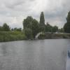
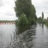
Beal Lock No 2 Weir Entrance
is a minor waterways place
on the Aire and Calder Navigation (Selby Section) between
Bank Dole Junction (Junction of the Aire and Calder Navigation (Selby Section) and the Aire and Calder Navigation (Main Line)) (2 miles and 4¾ furlongs
and 1 lock
to the west) and
Haddlesey Junction (Junction of River Aire and Selby Canal) (3 miles and 7½ furlongs
and 1 lock
to the east).
The nearest place in the direction of Bank Dole Junction is Beal Bridge (Beal Bridge Wharf);
¼ furlongs
away.
The nearest place in the direction of Haddlesey Junction is Beal Lock No 2 (New landing pontoon down stream of lock installed winter 1995/6);
1 furlong
away.
Mooring here is unrated.
You can wind here.
Marsh Lane Footbridge | 2 miles, 4 furlongs | |
Bank Dole Lock No 1 | 2 miles, 2¾ furlongs | |
Bank Dole Lock Junction | 2 miles, 2½ furlongs | |
Site of Stocking Lane Pipe Bridge | 2 miles, 2 furlongs | |
Beal Bridge | ¼ furlongs | |
Beal Lock No 2 Weir Entrance | ||
Beal Lock No 2 | 1 furlong | |
Birkin Wharf | 1 mile, ¾ furlongs | |
Haddlesey Junction Pipe Bridge | 3 miles, 7 furlongs | |
Haddlesey Junction | 3 miles, 7½ furlongs | |
Haddlesey Flood Lock No 3 | 3 miles, 7¾ furlongs |
Amenities nearby at Beal Bridge
There are no links to external websites from here.
Why not log in and add some (select "External websites" from the menu (sometimes this is under "Edit"))?
Mouseover for more information or show routes to facility
Nearest water point
In the direction of Selby Junction (River Ouse)
Beal Lock No 2 — 1 furlong away
On this waterway in the direction of Selby Junction (River Ouse)
Selby Basin — 8 miles, 5¾ furlongs and 2 locks away
On this waterway in the direction of Selby Junction (River Ouse)
In the direction of Bank Dole Junction
Beal Bridge — ¼ furlongs away
On this waterway in the direction of Bank Dole Junction
Bank Dole Lock No 1 — 2 miles, 2¾ furlongs away
On this waterway in the direction of Bank Dole Junction
Ferrybridge Flood Lock No 11 — 4 miles, 1 furlong and 1 lock away
Travel to Bank Dole Junction, then on the Aire and Calder Navigation (Main Line - Goole to Castleford) to Ferrybridge Flood Lock No 11
Ferrybridge Flood Lock Footbridge — 4 miles, 1¼ furlongs and 2 locks away
Travel to Bank Dole Junction, then on the Aire and Calder Navigation (Main Line - Goole to Castleford) to Ferrybridge Flood Lock Footbridge
Whitley Lock No 12 — 6 miles, 4 furlongs and 1 lock away
Travel to Bank Dole Junction, then on the Aire and Calder Navigation (Main Line - Goole to Castleford) to Whitley Lock No 12
Bulholme Lock No 10 — 8 miles, 7 furlongs and 2 locks away
Travel to Bank Dole Junction, then on the Aire and Calder Navigation (Main Line - Goole to Castleford) to Bulholme Lock No 10
Castleford Sanitary Station — 9 miles, 3¾ furlongs and 3 locks away
Travel to Bank Dole Junction, then on the Aire and Calder Navigation (Main Line - Goole to Castleford) to Castleford Sanitary Station
Pollington Manor Swing Bridge — 10 miles, 2¼ furlongs and 3 locks away
Travel to Bank Dole Junction, then on the Aire and Calder Navigation (Main Line - Goole to Castleford) to Pollington Manor Swing Bridge
Pollington Visitor Mooring — 10 miles, 2½ furlongs and 3 locks away
Travel to Bank Dole Junction, then on the Aire and Calder Navigation (Main Line - Goole to Castleford) to Pollington Visitor Mooring
Woodnook Lock No 6 — 11 miles, 6¼ furlongs and 4 locks away
Travel to Bank Dole Junction, then on the Aire and Calder Navigation (Main Line - Goole to Castleford) to Castleford Junction, then on the Aire and Calder Navigation (Wakefield Section) to Woodnook Lock No 6
Fairies Hill Moorings — 11 miles, 5 furlongs and 5 locks away
Travel to Bank Dole Junction, then on the Aire and Calder Navigation (Main Line - Goole to Castleford) to Castleford Junction, then on the Aire and Calder Navigation (Wakefield Section) to Fairies Hill Lock Junction, then on the Aire and Calder Navigation (Wakefield Section - Fairies Hill Mooring Arm) to Fairies Hill Moorings
Lemonroyd Lock No 7 — 13 miles, ¼ furlongs and 4 locks away
Travel to Bank Dole Junction, then on the Aire and Calder Navigation (Main Line - Goole to Castleford) to Castleford Junction, then on the Aire and Calder Navigation (Main Line - Castleford to Leeds) to Lemonroyd Lock No 7
Lemonroyd Marina — 13 miles, 1¼ furlongs and 5 locks away
Travel to Bank Dole Junction, then on the Aire and Calder Navigation (Main Line - Goole to Castleford) to Castleford Junction, then on the Aire and Calder Navigation (Main Line - Castleford to Leeds) to Lemonroyd Marina
King's Road Lock No 3 — 12 miles, 7¾ furlongs and 5 locks away
Travel to Bank Dole Junction, then on the Aire and Calder Navigation (Main Line - Goole to Castleford) to Castleford Junction, then on the Aire and Calder Navigation (Wakefield Section) to King's Road Lock No 3
Woodlesford Lock No 5 — 14 miles, 3 furlongs and 5 locks away
Travel to Bank Dole Junction, then on the Aire and Calder Navigation (Main Line - Goole to Castleford) to Castleford Junction, then on the Aire and Calder Navigation (Main Line - Castleford to Leeds) to Woodlesford Lock No 5
Fishpond Lock No 4 — 15 miles, 1¾ furlongs and 6 locks away
Travel to Bank Dole Junction, then on the Aire and Calder Navigation (Main Line - Goole to Castleford) to Castleford Junction, then on the Aire and Calder Navigation (Main Line - Castleford to Leeds) to Fishpond Lock No 4
Stanley Ferry Water Point — 14 miles, 5 furlongs and 7 locks away
Travel to Bank Dole Junction, then on the Aire and Calder Navigation (Main Line - Goole to Castleford) to Castleford Junction, then on the Aire and Calder Navigation (Wakefield Section) to Stanley Ferry Water Point
Ramsdens Bridge Sanitary Station — 14 miles, 5¾ furlongs and 7 locks away
Travel to Bank Dole Junction, then on the Aire and Calder Navigation (Main Line - Goole to Castleford) to Castleford Junction, then on the Aire and Calder Navigation (Wakefield Section) to Ramsdens Bridge Sanitary StationNearest rubbish disposal
In the direction of Selby Junction (River Ouse)
Selby Basin — 8 miles, 5¾ furlongs and 2 locks away
On this waterway in the direction of Selby Junction (River Ouse)
In the direction of Bank Dole Junction
Whitley Lock No 12 — 6 miles, 4 furlongs and 1 lock away
Travel to Bank Dole Junction, then on the Aire and Calder Navigation (Main Line - Goole to Castleford) to Whitley Lock No 12
Castleford Sanitary Station — 9 miles, 3¾ furlongs and 3 locks away
Travel to Bank Dole Junction, then on the Aire and Calder Navigation (Main Line - Goole to Castleford) to Castleford Sanitary Station
Lemonroyd Marina — 13 miles, 1¼ furlongs and 5 locks away
Travel to Bank Dole Junction, then on the Aire and Calder Navigation (Main Line - Goole to Castleford) to Castleford Junction, then on the Aire and Calder Navigation (Main Line - Castleford to Leeds) to Lemonroyd Marina
Woodlesford Lock No 5 — 14 miles, 3 furlongs and 5 locks away
Travel to Bank Dole Junction, then on the Aire and Calder Navigation (Main Line - Goole to Castleford) to Castleford Junction, then on the Aire and Calder Navigation (Main Line - Castleford to Leeds) to Woodlesford Lock No 5
Ramsdens Bridge Visitor Moorings — 14 miles, 5¼ furlongs and 7 locks away
Travel to Bank Dole Junction, then on the Aire and Calder Navigation (Main Line - Goole to Castleford) to Castleford Junction, then on the Aire and Calder Navigation (Wakefield Section) to Ramsdens Bridge Visitor Moorings
Dutch Riverside — 18 miles, 4½ furlongs and 3 locks away
Travel to Bank Dole Junction, then on the Aire and Calder Navigation (Main Line - Goole to Castleford) to Dutch Riverside
Goole Marina — 18 miles, 6 furlongs and 3 locks away
Travel to Bank Dole Junction, then on the Aire and Calder Navigation (Main Line - Goole to Castleford) to Goole Marina
Barnby Dun Lift Bridge — 18 miles, 7½ furlongs and 4 locks away
Travel to Bank Dole Junction, then on the Aire and Calder Navigation (Main Line - Goole to Castleford) to Sykehouse Junction, then on the Sheffield and South Yorkshire Navigation (New Junction Canal) to Bramwith Junction, then on the Sheffield and South Yorkshire Navigation (Main Line) to Barnby Dun Lift Bridge
Bramwith Swing Bridge — 18 miles, 4 furlongs and 5 locks away
Travel to Bank Dole Junction, then on the Aire and Calder Navigation (Main Line - Goole to Castleford) to Sykehouse Junction, then on the Sheffield and South Yorkshire Navigation (New Junction Canal) to Bramwith Junction, then on the Sheffield and South Yorkshire Navigation (Bramwith to Stainforth) to Bramwith Swing Bridge
Leeds Sanitary Station — 18 miles, 7½ furlongs and 8 locks away
Travel to Bank Dole Junction, then on the Aire and Calder Navigation (Main Line - Goole to Castleford) to Castleford Junction, then on the Aire and Calder Navigation (Main Line - Castleford to Leeds) to Leeds Sanitary Station
Leeds Basin — 19 miles, 6¾ furlongs and 10 locks away
Travel to Bank Dole Junction, then on the Aire and Calder Navigation (Main Line - Goole to Castleford) to Castleford Junction, then on the Aire and Calder Navigation (Main Line - Castleford to Leeds) to Leeds Bridge, then on the Leeds and Liverpool Canal (Main Line - Wigan to Leeds) to Leeds BasinNearest chemical toilet disposal
In the direction of Selby Junction (River Ouse)
Selby Basin — 8 miles, 5¾ furlongs and 2 locks away
On this waterway in the direction of Selby Junction (River Ouse)
In the direction of Bank Dole Junction
Whitley Lock No 12 — 6 miles, 4 furlongs and 1 lock away
Travel to Bank Dole Junction, then on the Aire and Calder Navigation (Main Line - Goole to Castleford) to Whitley Lock No 12
Castleford Sanitary Station — 9 miles, 3¾ furlongs and 3 locks away
Travel to Bank Dole Junction, then on the Aire and Calder Navigation (Main Line - Goole to Castleford) to Castleford Sanitary Station
Fairies Hill Moorings — 11 miles, 5 furlongs and 5 locks away
Travel to Bank Dole Junction, then on the Aire and Calder Navigation (Main Line - Goole to Castleford) to Castleford Junction, then on the Aire and Calder Navigation (Wakefield Section) to Fairies Hill Lock Junction, then on the Aire and Calder Navigation (Wakefield Section - Fairies Hill Mooring Arm) to Fairies Hill Moorings
Lemonroyd Marina — 13 miles, 1¼ furlongs and 5 locks away
Travel to Bank Dole Junction, then on the Aire and Calder Navigation (Main Line - Goole to Castleford) to Castleford Junction, then on the Aire and Calder Navigation (Main Line - Castleford to Leeds) to Lemonroyd Marina
Ramsdens Bridge Sanitary Station — 14 miles, 5¾ furlongs and 7 locks away
Travel to Bank Dole Junction, then on the Aire and Calder Navigation (Main Line - Goole to Castleford) to Castleford Junction, then on the Aire and Calder Navigation (Wakefield Section) to Ramsdens Bridge Sanitary Station
Dutch Riverside — 18 miles, 4½ furlongs and 3 locks away
Travel to Bank Dole Junction, then on the Aire and Calder Navigation (Main Line - Goole to Castleford) to Dutch Riverside
Goole Marina — 18 miles, 6 furlongs and 3 locks away
Travel to Bank Dole Junction, then on the Aire and Calder Navigation (Main Line - Goole to Castleford) to Goole Marina
Barnby Dun Lift Bridge — 18 miles, 7½ furlongs and 4 locks away
Travel to Bank Dole Junction, then on the Aire and Calder Navigation (Main Line - Goole to Castleford) to Sykehouse Junction, then on the Sheffield and South Yorkshire Navigation (New Junction Canal) to Bramwith Junction, then on the Sheffield and South Yorkshire Navigation (Main Line) to Barnby Dun Lift Bridge
Bramwith Swing Bridge — 18 miles, 4 furlongs and 5 locks away
Travel to Bank Dole Junction, then on the Aire and Calder Navigation (Main Line - Goole to Castleford) to Sykehouse Junction, then on the Sheffield and South Yorkshire Navigation (New Junction Canal) to Bramwith Junction, then on the Sheffield and South Yorkshire Navigation (Bramwith to Stainforth) to Bramwith Swing Bridge
Leeds Sanitary Station — 18 miles, 7½ furlongs and 8 locks away
Travel to Bank Dole Junction, then on the Aire and Calder Navigation (Main Line - Goole to Castleford) to Castleford Junction, then on the Aire and Calder Navigation (Main Line - Castleford to Leeds) to Leeds Sanitary StationNearest place to turn
In the direction of Selby Junction (River Ouse)
Haddlesey Junction — 3 miles, 7½ furlongs and 1 lock away
On this waterway in the direction of Selby Junction (River Ouse)
Selby Basin — 8 miles, 5¾ furlongs and 2 locks away
On this waterway in the direction of Selby Junction (River Ouse)
In the direction of Bank Dole Junction
Bank Dole Lock Junction — 2 miles, 2½ furlongs away
On this waterway in the direction of Bank Dole Junction
Bulholme Lock Weir Exit — 8 miles, 6½ furlongs and 2 locks away
Travel to Bank Dole Junction, then on the Aire and Calder Navigation (Main Line - Goole to Castleford) to Bulholme Lock Weir Exit
Lemonroyd Lock Weir Exit — 12 miles, 7¼ furlongs and 4 locks away
Travel to Bank Dole Junction, then on the Aire and Calder Navigation (Main Line - Goole to Castleford) to Castleford Junction, then on the Aire and Calder Navigation (Main Line - Castleford to Leeds) to Lemonroyd Lock Weir Exit
Fairies Hill Lock Arm — 12 miles and 5 locks away
Travel to Bank Dole Junction, then on the Aire and Calder Navigation (Main Line - Goole to Castleford) to Castleford Junction, then on the Aire and Calder Navigation (Wakefield Section) to Fairies Hill Lock Arm
Fleet Lane Arm — 13 miles, 3¼ furlongs and 5 locks away
Travel to Bank Dole Junction, then on the Aire and Calder Navigation (Main Line - Goole to Castleford) to Castleford Junction, then on the Aire and Calder Navigation (Main Line - Castleford to Leeds) to Fleet Lane Arm
Stanley Ferry Marina — 14 miles, 4¼ furlongs and 7 locks away
Travel to Bank Dole Junction, then on the Aire and Calder Navigation (Main Line - Goole to Castleford) to Castleford Junction, then on the Aire and Calder Navigation (Wakefield Section) to Stanley Ferry Marina
Viking Marina — 18 miles, 5¼ furlongs and 3 locks away
Travel to Bank Dole Junction, then on the Aire and Calder Navigation (Main Line - Goole to Castleford) to Viking Marina
Junction with River Aire (Old Channel) South — 17 miles, 5½ furlongs and 7 locks away
Travel to Bank Dole Junction, then on the Aire and Calder Navigation (Main Line - Goole to Castleford) to Castleford Junction, then on the Aire and Calder Navigation (Main Line - Castleford to Leeds) to Junction with River Aire (Old Channel) South
Junction with River Aire (Old Channel) North — 18 miles, 2¾ furlongs and 8 locks away
Travel to Bank Dole Junction, then on the Aire and Calder Navigation (Main Line - Goole to Castleford) to Castleford Junction, then on the Aire and Calder Navigation (Main Line - Castleford to Leeds) to Junction with River Aire (Old Channel) North
Knostrop Flood Lock Weir Entrance — 18 miles, 2¾ furlongs and 8 locks away
Travel to Bank Dole Junction, then on the Aire and Calder Navigation (Main Line - Goole to Castleford) to Castleford Junction, then on the Aire and Calder Navigation (Main Line - Castleford to Leeds) to Knostrop Flood Lock Weir Entrance
Wakefield Weir Entrance — 17 miles, 4½ furlongs and 9 locks away
Travel to Bank Dole Junction, then on the Aire and Calder Navigation (Main Line - Goole to Castleford) to Castleford Junction, then on the Aire and Calder Navigation (Wakefield Section) to Fall Ing Junction, then on the Calder and Hebble Navigation (Main Line) to Wakefield Weir Entrance
Leeds Dock Side Arm — 19 miles, 2 furlongs and 9 locks away
Travel to Bank Dole Junction, then on the Aire and Calder Navigation (Main Line - Goole to Castleford) to Castleford Junction, then on the Aire and Calder Navigation (Main Line - Castleford to Leeds) to Leeds Dock Entrance, then on the Aire and Calder Navigation (Leeds Dock) to Leeds Dock Side Arm
River Aire Junction — 19 miles, 6¼ furlongs and 9 locks away
Travel to Bank Dole Junction, then on the Aire and Calder Navigation (Main Line - Goole to Castleford) to Castleford Junction, then on the Aire and Calder Navigation (Main Line - Castleford to Leeds) to Leeds Bridge, then on the Leeds and Liverpool Canal (Main Line - Wigan to Leeds) to River Aire Junction
Leeds Basin — 19 miles, 6¾ furlongs and 10 locks away
Travel to Bank Dole Junction, then on the Aire and Calder Navigation (Main Line - Goole to Castleford) to Castleford Junction, then on the Aire and Calder Navigation (Main Line - Castleford to Leeds) to Leeds Bridge, then on the Leeds and Liverpool Canal (Main Line - Wigan to Leeds) to Leeds BasinNearest self-operated pump-out
In the direction of Bank Dole Junction
Castleford Sanitary Station — 9 miles, 3¾ furlongs and 3 locks away
Travel to Bank Dole Junction, then on the Aire and Calder Navigation (Main Line - Goole to Castleford) to Castleford Sanitary Station
Ramsdens Bridge Sanitary Station — 14 miles, 5¾ furlongs and 7 locks away
Travel to Bank Dole Junction, then on the Aire and Calder Navigation (Main Line - Goole to Castleford) to Castleford Junction, then on the Aire and Calder Navigation (Wakefield Section) to Ramsdens Bridge Sanitary Station
Leeds Sanitary Station — 18 miles, 7½ furlongs and 8 locks away
Travel to Bank Dole Junction, then on the Aire and Calder Navigation (Main Line - Goole to Castleford) to Castleford Junction, then on the Aire and Calder Navigation (Main Line - Castleford to Leeds) to Leeds Sanitary StationNearest boatyard pump-out
In the direction of Bank Dole Junction
Lemonroyd Marina — 13 miles, 1¼ furlongs and 5 locks away
Travel to Bank Dole Junction, then on the Aire and Calder Navigation (Main Line - Goole to Castleford) to Castleford Junction, then on the Aire and Calder Navigation (Main Line - Castleford to Leeds) to Lemonroyd Marina
Goole Marina — 18 miles, 6 furlongs and 3 locks away
Travel to Bank Dole Junction, then on the Aire and Calder Navigation (Main Line - Goole to Castleford) to Goole MarinaDirection of TV transmitter (From Wolfbane Cybernetic)
There is no page on Wikipedia called “Beal Lock No 2 Weir Entrance”
Wikipedia pages that might relate to Beal Lock No 2 Weir Entrance
[Sonning Lock]
Sonning Lock is a lock and associated weir situated on the River Thames at the village of Sonning near Reading, Berkshire, England. The first lock was built
[River Mersey]
meander, and Howley Lock for craft to avoid the weir; the new cut and lock are still evident. The island formed between the weir and the lock is known locally
[The Fast Show]
Whitehouse, Charlie Higson, Simon Day, Mark Williams, John Thomson, Arabella Weir and Caroline Aherne. Other significant cast members included Felix Dexter
[Beeston, Nottinghamshire]
Lenton, over a weir at Beeston Rylands. Originally there was a second lock at Beeston Cut for small vessels to enter the Trent below the weir, but this was
[Emily Dickinson]
Significantly though, Dickinson had left no instructions about the 40 notebooks and loose sheets gathered in a locked chest. Lavinia recognized the poems'
[River Irwell]
River Tonge Hutchinson's Goit Bealey's Goit River Roch River Spodden River Beal Elton Brook Woodhill Brook Kirklees Brook Black Brook Seedfield Brook Pigs
[GEICO advertising campaigns]
> Geico Gecko (GEICO Insurance)". tvacres.com. Retrieved 22 April 2010. Weir, William (21 February 2006). "Little Lizard Says 'Ello To A New Inflection"
[List of Art Deco architecture in the United States]
Penney Catalog Store, Richwood, 1925 Marland Heights Park and Margaret Manson Weir Memorial Pool, Weirton, 1934 Mercer County Courthouse, Princeton, 1931 Mount
[History of Belfast]
where the River Lagan met the River Farset (the name comes from the Irish Béal Feirste which translates to "Mouth of the River Farset") which is where modern
[List of Jackanory episodes]
Curious Creature Rosemary Weir Miriam Margolyes 11-Nov-68 615 Albert the Dragon and the Centaur: The Problem Child Rosemary Weir Miriam Margolyes 12-Nov-68
Results of Google Search
The following document is not readable via Optical. Character ... manner as not to obstruct the entrance of the lock, and if to be locked in sections, ... NO. 2 FIXED WEIR REMOVED TO 15 FEET BELOW ... BEALE LANDING LIGHT. FL(2)R5S & ...
After approximately 1 1/2 miles turn right into Birkin. Go through Birkin to the Bridge at Beal where cars can be parked. ... Pegs 42 to 60 are on the left bank from Selby lock to the entrance ... Approximately one and a half miles above the weir. ... Be careful when crossing the road as there is no footpath and the cars come ...
Fishing is prohibited in or from the fishway in Churchill Dam; there are no distance restrictions ... B. From Lock Dam Stream, where it enters Eagle Lake north to twin Brook Rapids, only ... C. On Allagash Lake and Allagash entrance of Chamberlain Lake, ... Daily bag limit on brook trout: 2 fish; minimum length limit: 10 inches.