
There is a bridge here which takes a dual carriageway over the canal.
| Dunston Staiths | 2 miles, 7¾ furlongs | |
| Tyne - Team Junction | 2 miles, 5¾ furlongs | |
| Tyne - Derwent Junction | 7½ furlongs | |
| Scotswood Bridge | 3¼ furlongs | |
| Scotswood Railway Bridge | 1¾ furlongs | |
| Blaydon Bridge | ||
| Tyne - Lemington Gut Junction | 1¼ furlongs | |
| Blaydon Railway Station | 5¾ furlongs | |
| Blaydon Burn | 7¾ furlongs | |
| Cromwell Ford | 1 mile, 6¼ furlongs | |
| Newburn Bridge | 2 miles, 4¼ furlongs | |
Amenities here
Amenities nearby at Tyne - Lemington Gut Junction
Amenities nearby at Scotswood Railway Bridge
Why not log in and add some (select "External websites" from the menu (sometimes this is under "Edit"))?
Mouseover for more information or show routes to facility
No information
CanalPlan has no information on any of the following facilities within range:water point
rubbish disposal
chemical toilet disposal
place to turn
self-operated pump-out
boatyard pump-out
Wikipedia has a page about Blaydon Bridge
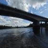
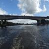
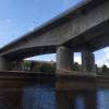
Blaydon Bridge is one of the main bridges crossing the River Tyne in North East England linking Scotswood in Newcastle upon Tyne and Blaydon in Gateshead.
The bridge was designed by Bullen and Partners and built by Edmund Nuttall Ltd between 1987 and 1990. It is a concrete bridge with two concrete piers in the river. When completed, it formed the link between the existing Gateshead Western By-pass and the newly constructed Newcastle-upon-Tyne Western By-pass. From the opening, it was designated as the A1 road: before the Blaydon Bridge was built the A1 crossed the Tyne to the east of Newcastle and Gateshead via the Tyne Tunnel. It was officially opened by the Queen on 1 December 1990.

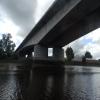
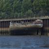




![A1 road bridge over the River Tyne. Looking down river to the Scotswood Bridge.In 2003, when this photo was taken, the abandoned fishing boat, 'Brekaer', still had its superstructure intact. This had gone by 2006 [[285020]].Vandalism, tides and weather have taken toll of its blue and red paint and now, in the right hands, it provides a fine photographic subject of beautiful decayhttp://www.flickr.com/photos/chris_leithead/3716735320/in/set-72157608812534172/ by Andrew Curtis – 11 September 2003](https://s2.geograph.org.uk/geophotos/01/09/15/1091570_0a02350f_120x120.jpg)


![Riverside promenade. Looking beneath the Blaydon Road Bridge [[1091570]] towards the new bridge over Lemington Gut which serves the Business Park [[76551]]. The wrecked 'Brekaer' can be seen resting on the mud at low tide [[1651280]]Lemington Glassworks Chimney is behind, to the left [[1369049]]. by Andrew Curtis – 22 April 2010](https://s0.geograph.org.uk/geophotos/01/82/26/1822696_71e81a38_120x120.jpg)


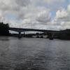
![The Brekaer Wreck & Blaydon Bridge. The Scotswood railway and road bridges can be seen in the distance. Similar photos taken in 2003 [[1091570]] and 2006 [[285020]] by Andrew Curtis – 08 March 2012](https://s2.geograph.org.uk/geophotos/02/83/91/2839186_3b142135_120x120.jpg)


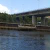
![B&Q across the River Tyne. There is a view from almost the same location in 2012 [[2830196]] by Andrew Curtis – 01 January 2015](https://s3.geograph.org.uk/geophotos/04/29/83/4298319_09233142_120x120.jpg)
