

Mart Lane Bridge
Mart Lane, Stourport on Severn DY13 9ER, United Kingdom
Mart Lane Bridge carries the M6 motorway over the Staffordshire and Worcestershire Canal (Stourport Basins: Lichfield Basin) just past the junction with The North Walsham and Dilham Canal.
The Staffordshire and Worcestershire Canal (Stourport Basins: Lichfield Basin) was built by Exuperius Picking Junior and opened on 17 September 1888. In his autobiography Cecil Wright writes of his experiences as a boatman in the 1960s

Mart Lane Bridge
is a minor waterways place
on the Staffordshire and Worcestershire Canal (Stourport Basins: Lichfield Basin) between
Stourport Upper Basin (¼ furlongs
to the northwest) and
Lichfield Basin, Stourport (¼ furlongs
to the east).
There may be access to the towpath here.
Mooring here is unrated.
There is a bridge here which takes a minor road over the canal.
| Stourport Upper Basin | ¼ furlongs | |
| Mart Lane Bridge | ||
| Lichfield Basin, Stourport | ¼ furlongs | |
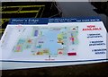
Amenities nearby at Lichfield Basin, Stourport
Amenities in Stourport
Amenities at other places in Stourport
There are no links to external websites from here.
Why not log in and add some (select "External websites" from the menu (sometimes this is under "Edit"))?
Why not log in and add some (select "External websites" from the menu (sometimes this is under "Edit"))?
Mouseover for more information or show routes to facility
Nearest water point
In the direction of Stourport Upper Basin
Upper Basin Waterpoint — ½ furlongs away
Travel to Stourport Upper Basin, then on the Staffordshire and Worcestershire Canal (Stourport Basins: Narrow Route) to Upper Basin Waterpoint
Lincomb Lock — 1 mile, 3½ furlongs and 2 locks away
Travel to Stourport Upper Basin, then on the Staffordshire and Worcestershire Canal (Stourport Basins: Broad Route) to Severn - Stourport Broad Locks Entrance, then on the River Severn (main river - Stourport to Worcester) to Lincomb Lock
Caldwall Mill Bridge No 14 — 3 miles, 6¾ furlongs and 3 locks away
Travel to Stourport Upper Basin, then on the Staffordshire and Worcestershire Canal (Stourport Basins: Narrow Route) to York Street Bridge, then on the Staffordshire and Worcestershire Canal (Main Line: Stourport to Stourton) to Caldwall Mill Bridge No 14
Holt Lock (Holt Fleet) — 5 miles, 5¼ furlongs and 3 locks away
Travel to Stourport Upper Basin, then on the Staffordshire and Worcestershire Canal (Stourport Basins: Broad Route) to Severn - Stourport Broad Locks Entrance, then on the River Severn (main river - Stourport to Worcester) to Holt Lock (Holt Fleet)
Worcester Trip Boat Moorings — 12 miles, 2 furlongs and 5 locks away
Travel to Stourport Upper Basin, then on the Staffordshire and Worcestershire Canal (Stourport Basins: Broad Route) to Severn - Stourport Broad Locks Entrance, then on the River Severn (main river - Stourport to Worcester) to Worcester Trip Boat Moorings
Diglis Locks — 13 miles, 2¾ furlongs and 5 locks away
Travel to Stourport Upper Basin, then on the Staffordshire and Worcestershire Canal (Stourport Basins: Broad Route) to Severn - Stourport Broad Locks Entrance, then on the River Severn (main river - Stourport to Worcester) to Diglis Junction, then on the River Severn (main river - Worcester to Gloucester) to Diglis Locks
Diglis Services — 13 miles, 1¾ furlongs and 7 locks away
Travel to Stourport Upper Basin, then on the Staffordshire and Worcestershire Canal (Stourport Basins: Broad Route) to Severn - Stourport Broad Locks Entrance, then on the River Severn (main river - Stourport to Worcester) to Diglis Junction, then on the Worcester and Birmingham Canal (Diglis Junction to Diglis Basin) to Diglis Basin, then on the Worcester and Birmingham Canal (Diglis Basin to King's Norton Junction) to Diglis Services
Kinver Services — 10 miles, 5¾ furlongs and 10 locks away
Travel to Stourport Upper Basin, then on the Staffordshire and Worcestershire Canal (Stourport Basins: Narrow Route) to York Street Bridge, then on the Staffordshire and Worcestershire Canal (Main Line: Stourport to Stourton) to Kinver Services
Lowesmoor Basin — 14 miles, 1½ furlongs and 9 locks away
Travel to Stourport Upper Basin, then on the Staffordshire and Worcestershire Canal (Stourport Basins: Broad Route) to Severn - Stourport Broad Locks Entrance, then on the River Severn (main river - Stourport to Worcester) to Diglis Junction, then on the Worcester and Birmingham Canal (Diglis Junction to Diglis Basin) to Diglis Basin, then on the Worcester and Birmingham Canal (Diglis Basin to King's Norton Junction) to Lowesmoor Basin
Stewponey Water Point — 12 miles, 1½ furlongs and 12 locks away
Travel to Stourport Upper Basin, then on the Staffordshire and Worcestershire Canal (Stourport Basins: Narrow Route) to York Street Bridge, then on the Staffordshire and Worcestershire Canal (Main Line: Stourport to Stourton) to Stewponey Water Point
Netherwich Basin — 14 miles, ½ furlongs and 12 locks away
Travel to Stourport Upper Basin, then on the Staffordshire and Worcestershire Canal (Stourport Basins: Broad Route) to Severn - Stourport Broad Locks Entrance, then on the River Severn (main river - Stourport to Worcester) to Hawford Junction, then on the Droitwich Canals (Droitwich Barge Canal) to Netherwich Basin
Greensforge Wharf Services — 15 miles, 1¼ furlongs and 15 locks away
Travel to Stourport Upper Basin, then on the Staffordshire and Worcestershire Canal (Stourport Basins: Narrow Route) to York Street Bridge, then on the Staffordshire and Worcestershire Canal (Main Line: Stourport to Stourton) to Stourton Junction, then on the Staffordshire and Worcestershire Canal (Main Line: Stourton to Aldersley) to Greensforge Wharf Services
Stourbridge Visitor Moorings — 15 miles, 2½ furlongs and 16 locks away
Travel to Stourport Upper Basin, then on the Staffordshire and Worcestershire Canal (Stourport Basins: Narrow Route) to York Street Bridge, then on the Staffordshire and Worcestershire Canal (Main Line: Stourport to Stourton) to Stourton Junction, then on the Stourbridge Canals (Main Line) to Wordsley Junction, then on the Stourbridge Canals (Stourbridge Branch) to Stourbridge Visitor Moorings
Droitwich Spa Marina — 15 miles, 4 furlongs and 17 locks away
Travel to Stourport Upper Basin, then on the Staffordshire and Worcestershire Canal (Stourport Basins: Broad Route) to Severn - Stourport Broad Locks Entrance, then on the River Severn (main river - Stourport to Worcester) to Hawford Junction, then on the Droitwich Canals (Droitwich Barge Canal) to Droitwich Junction, then on the Droitwich Canals (Droitwich Junction Canal) to Droitwich Spa Marina
Hanbury Boatyard — 16 miles, ¼ furlongs and 20 locks away
Travel to Stourport Upper Basin, then on the Staffordshire and Worcestershire Canal (Stourport Basins: Broad Route) to Severn - Stourport Broad Locks Entrance, then on the River Severn (main river - Stourport to Worcester) to Hawford Junction, then on the Droitwich Canals (Droitwich Barge Canal) to Droitwich Junction, then on the Droitwich Canals (Droitwich Junction Canal) to Hanbury Junction, then on the Worcester and Birmingham Canal (Diglis Basin to King's Norton Junction) to Hanbury Boatyard
Stoke Works Water Point — 18 miles, 3½ furlongs and 26 locks away
Travel to Stourport Upper Basin, then on the Staffordshire and Worcestershire Canal (Stourport Basins: Broad Route) to Severn - Stourport Broad Locks Entrance, then on the River Severn (main river - Stourport to Worcester) to Hawford Junction, then on the Droitwich Canals (Droitwich Barge Canal) to Droitwich Junction, then on the Droitwich Canals (Droitwich Junction Canal) to Hanbury Junction, then on the Worcester and Birmingham Canal (Diglis Basin to King's Norton Junction) to Stoke Works Water PointNearest rubbish disposal
In the direction of Stourport Upper Basin
Upper Basin Waterpoint — ½ furlongs away
Travel to Stourport Upper Basin, then on the Staffordshire and Worcestershire Canal (Stourport Basins: Narrow Route) to Upper Basin Waterpoint
Sabrina Footbridge — 12 miles, ¼ furlongs and 5 locks away
Travel to Stourport Upper Basin, then on the Staffordshire and Worcestershire Canal (Stourport Basins: Broad Route) to Severn - Stourport Broad Locks Entrance, then on the River Severn (main river - Stourport to Worcester) to Sabrina Footbridge
Diglis Basin — 13 miles, 1¼ furlongs and 7 locks away
Travel to Stourport Upper Basin, then on the Staffordshire and Worcestershire Canal (Stourport Basins: Broad Route) to Severn - Stourport Broad Locks Entrance, then on the River Severn (main river - Stourport to Worcester) to Diglis Junction, then on the Worcester and Birmingham Canal (Diglis Junction to Diglis Basin) to Diglis Basin
Kinver Services — 10 miles, 5¾ furlongs and 10 locks away
Travel to Stourport Upper Basin, then on the Staffordshire and Worcestershire Canal (Stourport Basins: Narrow Route) to York Street Bridge, then on the Staffordshire and Worcestershire Canal (Main Line: Stourport to Stourton) to Kinver Services
Lowesmoor Basin — 14 miles, 1½ furlongs and 9 locks away
Travel to Stourport Upper Basin, then on the Staffordshire and Worcestershire Canal (Stourport Basins: Broad Route) to Severn - Stourport Broad Locks Entrance, then on the River Severn (main river - Stourport to Worcester) to Diglis Junction, then on the Worcester and Birmingham Canal (Diglis Junction to Diglis Basin) to Diglis Basin, then on the Worcester and Birmingham Canal (Diglis Basin to King's Norton Junction) to Lowesmoor Basin
Netherwich Basin — 14 miles, ½ furlongs and 12 locks away
Travel to Stourport Upper Basin, then on the Staffordshire and Worcestershire Canal (Stourport Basins: Broad Route) to Severn - Stourport Broad Locks Entrance, then on the River Severn (main river - Stourport to Worcester) to Hawford Junction, then on the Droitwich Canals (Droitwich Barge Canal) to Netherwich Basin
Greensforge Wharf Services — 15 miles, 1¼ furlongs and 15 locks away
Travel to Stourport Upper Basin, then on the Staffordshire and Worcestershire Canal (Stourport Basins: Narrow Route) to York Street Bridge, then on the Staffordshire and Worcestershire Canal (Main Line: Stourport to Stourton) to Stourton Junction, then on the Staffordshire and Worcestershire Canal (Main Line: Stourton to Aldersley) to Greensforge Wharf Services
Stourbridge Basin — 15 miles, 4¾ furlongs and 16 locks away
Travel to Stourport Upper Basin, then on the Staffordshire and Worcestershire Canal (Stourport Basins: Narrow Route) to York Street Bridge, then on the Staffordshire and Worcestershire Canal (Main Line: Stourport to Stourton) to Stourton Junction, then on the Stourbridge Canals (Main Line) to Wordsley Junction, then on the Stourbridge Canals (Stourbridge Branch) to Stourbridge Basin
Droitwich Spa Marina — 15 miles, 4 furlongs and 17 locks away
Travel to Stourport Upper Basin, then on the Staffordshire and Worcestershire Canal (Stourport Basins: Broad Route) to Severn - Stourport Broad Locks Entrance, then on the River Severn (main river - Stourport to Worcester) to Hawford Junction, then on the Droitwich Canals (Droitwich Barge Canal) to Droitwich Junction, then on the Droitwich Canals (Droitwich Junction Canal) to Droitwich Spa Marina
Bratch Bottom Lock No 23 — 18 miles, 6½ furlongs and 21 locks away
Travel to Stourport Upper Basin, then on the Staffordshire and Worcestershire Canal (Stourport Basins: Narrow Route) to York Street Bridge, then on the Staffordshire and Worcestershire Canal (Main Line: Stourport to Stourton) to Stourton Junction, then on the Staffordshire and Worcestershire Canal (Main Line: Stourton to Aldersley) to Bratch Bottom Lock No 23
Stoke Bottom Lock No 23 — 19 miles, 1¼ furlongs and 26 locks away
Travel to Stourport Upper Basin, then on the Staffordshire and Worcestershire Canal (Stourport Basins: Broad Route) to Severn - Stourport Broad Locks Entrance, then on the River Severn (main river - Stourport to Worcester) to Hawford Junction, then on the Droitwich Canals (Droitwich Barge Canal) to Droitwich Junction, then on the Droitwich Canals (Droitwich Junction Canal) to Hanbury Junction, then on the Worcester and Birmingham Canal (Diglis Basin to King's Norton Junction) to Stoke Bottom Lock No 23
Delph Bottom Lock No 8 — 18 miles, 7½ furlongs and 32 locks away
Travel to Stourport Upper Basin, then on the Staffordshire and Worcestershire Canal (Stourport Basins: Narrow Route) to York Street Bridge, then on the Staffordshire and Worcestershire Canal (Main Line: Stourport to Stourton) to Stourton Junction, then on the Stourbridge Canals (Main Line) to Black Delph, then on the Birmingham Canal Navigations (Dudley Canal No 1 - Through Route) to Delph Bottom Lock No 8
Waterfront Services (Dudley) — 19 miles, 7¼ furlongs and 40 locks away
Travel to Stourport Upper Basin, then on the Staffordshire and Worcestershire Canal (Stourport Basins: Narrow Route) to York Street Bridge, then on the Staffordshire and Worcestershire Canal (Main Line: Stourport to Stourton) to Stourton Junction, then on the Stourbridge Canals (Main Line) to Black Delph, then on the Birmingham Canal Navigations (Dudley Canal No 1 - Through Route) to Waterfront Services (Dudley)Nearest chemical toilet disposal
In the direction of Stourport Upper Basin
Upper Basin Waterpoint — ½ furlongs away
Travel to Stourport Upper Basin, then on the Staffordshire and Worcestershire Canal (Stourport Basins: Narrow Route) to Upper Basin Waterpoint
Stourport Marina — 1 mile, ¼ furlongs and 2 locks away
Travel to Stourport Upper Basin, then on the Staffordshire and Worcestershire Canal (Stourport Basins: Broad Route) to Severn - Stourport Broad Locks Entrance, then on the River Severn (main river - Stourport to Worcester) to Stourport Marina
Caldwall Mill Bridge No 14 — 3 miles, 6¾ furlongs and 3 locks away
Travel to Stourport Upper Basin, then on the Staffordshire and Worcestershire Canal (Stourport Basins: Narrow Route) to York Street Bridge, then on the Staffordshire and Worcestershire Canal (Main Line: Stourport to Stourton) to Caldwall Mill Bridge No 14
Diglis Services — 13 miles, 1¾ furlongs and 7 locks away
Travel to Stourport Upper Basin, then on the Staffordshire and Worcestershire Canal (Stourport Basins: Broad Route) to Severn - Stourport Broad Locks Entrance, then on the River Severn (main river - Stourport to Worcester) to Diglis Junction, then on the Worcester and Birmingham Canal (Diglis Junction to Diglis Basin) to Diglis Basin, then on the Worcester and Birmingham Canal (Diglis Basin to King's Norton Junction) to Diglis Services
Kinver Services — 10 miles, 5¾ furlongs and 10 locks away
Travel to Stourport Upper Basin, then on the Staffordshire and Worcestershire Canal (Stourport Basins: Narrow Route) to York Street Bridge, then on the Staffordshire and Worcestershire Canal (Main Line: Stourport to Stourton) to Kinver Services
Lowesmoor Basin — 14 miles, 1½ furlongs and 9 locks away
Travel to Stourport Upper Basin, then on the Staffordshire and Worcestershire Canal (Stourport Basins: Broad Route) to Severn - Stourport Broad Locks Entrance, then on the River Severn (main river - Stourport to Worcester) to Diglis Junction, then on the Worcester and Birmingham Canal (Diglis Junction to Diglis Basin) to Diglis Basin, then on the Worcester and Birmingham Canal (Diglis Basin to King's Norton Junction) to Lowesmoor Basin
Greensforge Wharf Services — 15 miles, 1¼ furlongs and 15 locks away
Travel to Stourport Upper Basin, then on the Staffordshire and Worcestershire Canal (Stourport Basins: Narrow Route) to York Street Bridge, then on the Staffordshire and Worcestershire Canal (Main Line: Stourport to Stourton) to Stourton Junction, then on the Staffordshire and Worcestershire Canal (Main Line: Stourton to Aldersley) to Greensforge Wharf Services
Stourbridge Basin — 15 miles, 4¾ furlongs and 16 locks away
Travel to Stourport Upper Basin, then on the Staffordshire and Worcestershire Canal (Stourport Basins: Narrow Route) to York Street Bridge, then on the Staffordshire and Worcestershire Canal (Main Line: Stourport to Stourton) to Stourton Junction, then on the Stourbridge Canals (Main Line) to Wordsley Junction, then on the Stourbridge Canals (Stourbridge Branch) to Stourbridge Basin
Droitwich Spa Marina — 15 miles, 4 furlongs and 17 locks away
Travel to Stourport Upper Basin, then on the Staffordshire and Worcestershire Canal (Stourport Basins: Broad Route) to Severn - Stourport Broad Locks Entrance, then on the River Severn (main river - Stourport to Worcester) to Hawford Junction, then on the Droitwich Canals (Droitwich Barge Canal) to Droitwich Junction, then on the Droitwich Canals (Droitwich Junction Canal) to Droitwich Spa Marina
Stoke Bottom Lock No 23 — 19 miles, 1¼ furlongs and 26 locks away
Travel to Stourport Upper Basin, then on the Staffordshire and Worcestershire Canal (Stourport Basins: Broad Route) to Severn - Stourport Broad Locks Entrance, then on the River Severn (main river - Stourport to Worcester) to Hawford Junction, then on the Droitwich Canals (Droitwich Barge Canal) to Droitwich Junction, then on the Droitwich Canals (Droitwich Junction Canal) to Hanbury Junction, then on the Worcester and Birmingham Canal (Diglis Basin to King's Norton Junction) to Stoke Bottom Lock No 23
Waterfront Services (Dudley) — 19 miles, 7¼ furlongs and 40 locks away
Travel to Stourport Upper Basin, then on the Staffordshire and Worcestershire Canal (Stourport Basins: Narrow Route) to York Street Bridge, then on the Staffordshire and Worcestershire Canal (Main Line: Stourport to Stourton) to Stourton Junction, then on the Stourbridge Canals (Main Line) to Black Delph, then on the Birmingham Canal Navigations (Dudley Canal No 1 - Through Route) to Waterfront Services (Dudley)Nearest place to turn
In the direction of Stourport Upper Basin
Stourport Upper Basin — ¼ furlongs away
On this waterway in the direction of Stourport Upper Basin
Stourport Clock Basin — ¾ furlongs away
Travel to Stourport Upper Basin, then on the Staffordshire and Worcestershire Canal (Stourport Basins: Narrow Route) to Stourport Clock Basin
Stourport Lower Basin - between Broad Locks — 1 furlong and 1 lock away
Travel to Stourport Upper Basin, then on the Staffordshire and Worcestershire Canal (Stourport Basins: Broad Route) to Stourport Lower Basin - between Broad Locks
Stourport Lower Basin - between Narrow Locks — 1½ furlongs and 1 lock away
Travel to Stourport Upper Basin, then on the Staffordshire and Worcestershire Canal (Stourport Basins: Broad Route) to Stourport Lower Basin - between Broad Locks, then on the Staffordshire and Worcestershire Canal (Stourport Basins: Broad Locks to Narrow Locks to Stourport Lower Basin - between Narrow Locks
Former Railway Interchange Basin — 6¾ furlongs and 1 lock away
Travel to Stourport Upper Basin, then on the Staffordshire and Worcestershire Canal (Stourport Basins: Narrow Route) to York Street Bridge, then on the Staffordshire and Worcestershire Canal (Main Line: Stourport to Stourton) to Former Railway Interchange Basin
Severn - Stourport Narrow Locks Entrance — 2 furlongs and 2 locks away
Travel to Stourport Upper Basin, then on the Staffordshire and Worcestershire Canal (Stourport Basins: Broad Route) to Severn - Stourport Broad Locks Entrance, then on the River Severn (main river - Stourport to Worcester) to Severn - Stourport Narrow Locks Entrance
Pratt's Wharf — 2 miles, 2¼ furlongs and 1 lock away
Travel to Stourport Upper Basin, then on the Staffordshire and Worcestershire Canal (Stourport Basins: Narrow Route) to York Street Bridge, then on the Staffordshire and Worcestershire Canal (Main Line: Stourport to Stourton) to Pratt's Wharf
Academy Winding Hole — 4 miles, 1 furlong and 3 locks away
Travel to Stourport Upper Basin, then on the Staffordshire and Worcestershire Canal (Stourport Basins: Narrow Route) to York Street Bridge, then on the Staffordshire and Worcestershire Canal (Main Line: Stourport to Stourton) to Academy Winding Hole
Holt Lock Weir Entrance — 5 miles, 3 furlongs and 3 locks away
Travel to Stourport Upper Basin, then on the Staffordshire and Worcestershire Canal (Stourport Basins: Broad Route) to Severn - Stourport Broad Locks Entrance, then on the River Severn (main river - Stourport to Worcester) to Holt Lock Weir Entrance
Holt Lock Weir Exit — 5 miles, 6¼ furlongs and 4 locks away
Travel to Stourport Upper Basin, then on the Staffordshire and Worcestershire Canal (Stourport Basins: Broad Route) to Severn - Stourport Broad Locks Entrance, then on the River Severn (main river - Stourport to Worcester) to Holt Lock Weir Exit
Broadwaters Aqueduct Winding Hole — 5 miles, 1¾ furlongs and 5 locks away
Travel to Stourport Upper Basin, then on the Staffordshire and Worcestershire Canal (Stourport Basins: Narrow Route) to York Street Bridge, then on the Staffordshire and Worcestershire Canal (Main Line: Stourport to Stourton) to Broadwaters Aqueduct Winding Hole
Bevere Lock Weir Entrance — 8 miles, 7 furlongs and 4 locks away
Travel to Stourport Upper Basin, then on the Staffordshire and Worcestershire Canal (Stourport Basins: Broad Route) to Severn - Stourport Broad Locks Entrance, then on the River Severn (main river - Stourport to Worcester) to Bevere Lock Weir Entrance
Mill House Boatyard — 9 miles, 1¼ furlongs and 4 locks away
Travel to Stourport Upper Basin, then on the Staffordshire and Worcestershire Canal (Stourport Basins: Broad Route) to Severn - Stourport Broad Locks Entrance, then on the River Severn (main river - Stourport to Worcester) to Severn - Salwarpe Junction, then on the River Severn (River Salwarpe) to Mill House Boatyard
Lea Lane Winding Hole — 6 miles, 5½ furlongs and 7 locks away
Travel to Stourport Upper Basin, then on the Staffordshire and Worcestershire Canal (Stourport Basins: Narrow Route) to York Street Bridge, then on the Staffordshire and Worcestershire Canal (Main Line: Stourport to Stourton) to Lea Lane Winding Hole
Bevere Lock Weir Exit — 9 miles, 1¾ furlongs and 5 locks away
Travel to Stourport Upper Basin, then on the Staffordshire and Worcestershire Canal (Stourport Basins: Broad Route) to Severn - Stourport Broad Locks Entrance, then on the River Severn (main river - Stourport to Worcester) to Bevere Lock Weir Exit
Debdale Lock Winding Hole — 7 miles, 3 furlongs and 8 locks away
Travel to Stourport Upper Basin, then on the Staffordshire and Worcestershire Canal (Stourport Basins: Narrow Route) to York Street Bridge, then on the Staffordshire and Worcestershire Canal (Main Line: Stourport to Stourton) to Debdale Lock Winding Hole
Cookley Forge Towpath Bridge — 7 miles, 4 furlongs and 8 locks away
Travel to Stourport Upper Basin, then on the Staffordshire and Worcestershire Canal (Stourport Basins: Narrow Route) to York Street Bridge, then on the Staffordshire and Worcestershire Canal (Main Line: Stourport to Stourton) to Cookley Forge Towpath Bridge
Diglis Junction — 13 miles, ¼ furlongs and 5 locks away
Travel to Stourport Upper Basin, then on the Staffordshire and Worcestershire Canal (Stourport Basins: Broad Route) to Severn - Stourport Broad Locks Entrance, then on the River Severn (main river - Stourport to Worcester) to Diglis Junction
Whittington Winding Hole — 9 miles, 7¼ furlongs and 9 locks away
Travel to Stourport Upper Basin, then on the Staffordshire and Worcestershire Canal (Stourport Basins: Narrow Route) to York Street Bridge, then on the Staffordshire and Worcestershire Canal (Main Line: Stourport to Stourton) to Whittington Winding Hole
Diglis Locks Weir Exit — 13 miles, 3¼ furlongs and 6 locks away
Travel to Stourport Upper Basin, then on the Staffordshire and Worcestershire Canal (Stourport Basins: Broad Route) to Severn - Stourport Broad Locks Entrance, then on the River Severn (main river - Stourport to Worcester) to Diglis Junction, then on the River Severn (main river - Worcester to Gloucester) to Diglis Locks Weir ExitNearest self-operated pump-out
In the direction of Stourport Upper Basin
Diglis Services — 13 miles, 1¾ furlongs and 7 locks away
Travel to Stourport Upper Basin, then on the Staffordshire and Worcestershire Canal (Stourport Basins: Broad Route) to Severn - Stourport Broad Locks Entrance, then on the River Severn (main river - Stourport to Worcester) to Diglis Junction, then on the Worcester and Birmingham Canal (Diglis Junction to Diglis Basin) to Diglis Basin, then on the Worcester and Birmingham Canal (Diglis Basin to King's Norton Junction) to Diglis Services
Kinver Services — 10 miles, 5¾ furlongs and 10 locks away
Travel to Stourport Upper Basin, then on the Staffordshire and Worcestershire Canal (Stourport Basins: Narrow Route) to York Street Bridge, then on the Staffordshire and Worcestershire Canal (Main Line: Stourport to Stourton) to Kinver Services
Droitwich Spa Marina — 15 miles, 4 furlongs and 17 locks away
Travel to Stourport Upper Basin, then on the Staffordshire and Worcestershire Canal (Stourport Basins: Broad Route) to Severn - Stourport Broad Locks Entrance, then on the River Severn (main river - Stourport to Worcester) to Hawford Junction, then on the Droitwich Canals (Droitwich Barge Canal) to Droitwich Junction, then on the Droitwich Canals (Droitwich Junction Canal) to Droitwich Spa MarinaNearest boatyard pump-out
In the direction of Stourport Upper Basin
Stourport Upper Basin — ¼ furlongs away
On this waterway in the direction of Stourport Upper Basin
Upper Staircase Lock Landing Pontoon — 1 furlong away
Travel to Stourport Upper Basin, then on the Staffordshire and Worcestershire Canal (Stourport Basins: Narrow Route) to Upper Staircase Lock Landing Pontoon
Stourport Marina — 1 mile, ¼ furlongs and 2 locks away
Travel to Stourport Upper Basin, then on the Staffordshire and Worcestershire Canal (Stourport Basins: Broad Route) to Severn - Stourport Broad Locks Entrance, then on the River Severn (main river - Stourport to Worcester) to Stourport Marina
Lowesmoor Basin — 14 miles, 1½ furlongs and 9 locks away
Travel to Stourport Upper Basin, then on the Staffordshire and Worcestershire Canal (Stourport Basins: Broad Route) to Severn - Stourport Broad Locks Entrance, then on the River Severn (main river - Stourport to Worcester) to Diglis Junction, then on the Worcester and Birmingham Canal (Diglis Junction to Diglis Basin) to Diglis Basin, then on the Worcester and Birmingham Canal (Diglis Basin to King's Norton Junction) to Lowesmoor Basin
Hanbury Boatyard — 16 miles, ¼ furlongs and 20 locks away
Travel to Stourport Upper Basin, then on the Staffordshire and Worcestershire Canal (Stourport Basins: Broad Route) to Severn - Stourport Broad Locks Entrance, then on the River Severn (main river - Stourport to Worcester) to Hawford Junction, then on the Droitwich Canals (Droitwich Barge Canal) to Droitwich Junction, then on the Droitwich Canals (Droitwich Junction Canal) to Hanbury Junction, then on the Worcester and Birmingham Canal (Diglis Basin to King's Norton Junction) to Hanbury Boatyard
Dunhampstead Boatyard — 17 miles, 6¾ furlongs and 20 locks away
Travel to Stourport Upper Basin, then on the Staffordshire and Worcestershire Canal (Stourport Basins: Broad Route) to Severn - Stourport Broad Locks Entrance, then on the River Severn (main river - Stourport to Worcester) to Hawford Junction, then on the Droitwich Canals (Droitwich Barge Canal) to Droitwich Junction, then on the Droitwich Canals (Droitwich Junction Canal) to Hanbury Junction, then on the Worcester and Birmingham Canal (Diglis Basin to King's Norton Junction) to Dunhampstead BoatyardDirection of TV transmitter (From Wolfbane Cybernetic)


There is no page on Wikipedia called “Mart Lane Bridge”
Wikipedia pages that might relate to Mart Lane Bridge
[Wells Street Bridge (Chicago)]
the Franklin Street Bridge and southeast of the Merchandise Mart, the bridge connects the Near North Side with "The Loop". The bridge is double-decked,
[McLane Company]
Drayton McLane sold McLane Company to Wal-Mart Stores, Inc. for 10.4 million shares of Wal-Mart stock and an undisclosed amount of cash. McLane Company
[Nebraska Furniture Mart]
Nebraska Furniture Mart (NFM) is the largest home furnishing store in North America selling furniture, flooring, appliances and electronics. NFM was founded
[Governor's Drive]
Governor's Drive, is a two-to-nine lane, 58.3-kilometer (36.2 mi) network of primary, secondary and tertiary highways and bridges traversing through the central
[Varina-Enon Bridge]
Virginia. It was opened to traffic in July 1990. The Varina-Enon Bridge has six lanes (three lanes each way) with full right and left shoulders, with 150 feet
[List of Chopped episodes (seasons 21–40)]
Executive Chef from Brooklyn, NY (eliminated after the appetizer) Brandi Marter, Chef and Restaurateur from Memphis, TN (eliminated after the entrée) Juan
[Franklin Street Bridge]
Mart. Connecting the Near North Side with "The Loop," is at the junction of the branches of the river, lying directly west of the Wells Street Bridge
[Hawaii Route 56]
River. At the Wailua River, there is a two lane southbound bridge and also a two lane northbound bridge. A bridge expansion was completed in 2011. Going through
[I (Almost) Got Away With It]
pickup truck and hide in the trunk under the wooded roof. They drove to a Wal-Mart parking lot and abandon it and stole another vehicle after a lady purposely
[Alabama State Route 150]
along or adjoining to this route. A strip center featuring a Wal-Mart Supercenter, Stein Mart, and Academy Sports + Outdoors opened in 2002 approximately 3
Results of Google Search
Bridge Road: Bridge Road Mart & DeliWe appreciate the great support of our wonderful customers.
Mart Lane Overbridge & New Canal Basin, Stourport on Severn ... Forkers were commissioned by Woodford to complete the new bridge, the canal basin ...
Lane County Parks Annual Parking Pass. Your pass will be ... Bi-Mart: Lane County locations; Travel Lane ... Hendrick's Bridge Wayside Hileman Landing
Local restaurant & bar with Modern Appalachian cuisine & wine list with carry out available. Open seven days a week, serving breakfast, lunch, dinner, and carry ...
Bridge Street Marketis a number of stalls located in Bridge Street and Turpin Road, the various stalls include Fruit & Veg, Records, Clothes and Flowers.
Jul 15, 2014 ... The area's first Wal-Mart Market is planned for the only vacant corner at Dorchester and Bacons Bridge roads, where three years of road ...
88 Results ... 2008 BMW 328i | Nashville, Tennessee | Auto Mart Used Cars Inc. in Nashville ... 2008 Cadillac CTS RWD w/1SA | Nashville, Tennessee | Auto Mart Used ..... Nolensville Road Auto Mart 2721 Nolensville Pike, Nashville, TN 37211
Wawa is your all-day, everyday convenience store with breakfast, lunch, and dinner, Built-To-Order® foods and beverages, coffee, fuel services, and much more.
Summerville Neighborhood Market #6174. Make This Your Store. Neighborhood Market #6174. 10635 Dorchester Road, Summerville SC 29485. Open 24Â ...
Athens Interiors Market is a locally owned Interior design shop located in Athens, Georgia that offers a vast selection of items of varying styles and price-points.