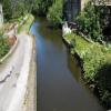
Station Road Bridge Aqueduct
also called Luddenden Foot Aqueduct
Tillotsone Holme, Calderdale HX2 6AG, United Kingdom

Station Road Bridge Aqueduct
is a minor waterways place
on the Rochdale Canal between
Walkley's Clog Mill (2 miles and 3¼ furlongs
and 3 locks
to the west) and
Tuel Lane Tunnel (western entrance) (1 mile and 7¾ furlongs
and 1 lock
to the east).
The nearest place in the direction of Walkley's Clog Mill is Ellen Royd Bridge No 7;
3 furlongs
away.
The nearest place in the direction of Tuel Lane Tunnel (western entrance) is Station Road Bridge No 6;
a few yards
away.
Mooring here is unrated.
There is a small aqueduct or underbridge here which takes a river under the canal.
Brearley Upper Lock No 6 | 6½ furlongs | |
Brearley Lower Lock No 5 | 5 furlongs | |
Stony Spring Bridge | 4¾ furlongs | |
Winding Hole below Lock No 5 | 4 furlongs | |
Ellen Royd Bridge No 7 | 3 furlongs | |
Station Road Bridge Aqueduct | ||
Station Road Bridge No 6 | a few yards | |
Cooper House Bridge No 5 | 3¼ furlongs | |
Site of Cooper House Mills | 3¾ furlongs | |
Longbottom Bridge No 4 | 5¾ furlongs | |
High Royd Bridge No 3 | 1 mile, ¾ furlongs |
There are no links to external websites from here.
Why not log in and add some (select "External websites" from the menu (sometimes this is under "Edit"))?
Mouseover for more information or show routes to facility
Nearest water point
In the direction of Castlefield Junction
Hebden Bridge Services — 3 miles, 1½ furlongs and 4 locks away
On this waterway in the direction of Castlefield Junction
Baltimore Marina — 7 miles, 1 furlong and 13 locks away
On this waterway in the direction of Castlefield Junction
Fielden Wharf & Services — 7 miles, 4 furlongs and 14 locks away
On this waterway in the direction of Castlefield Junction
Travis Mill Lock No 28 — 9 miles, 1¼ furlongs and 23 locks away
On this waterway in the direction of Castlefield Junction
Littleborough Sanitary Station — 12 miles, 6½ furlongs and 42 locks away
On this waterway in the direction of Castlefield Junction
In the direction of Sowerby Bridge Junction
Sowerby Bridge Basin — 2 miles, 3¾ furlongs and 3 locks away
Travel to Sowerby Bridge Junction, then on the Calder and Hebble Navigation (Main Line) to Sowerby Bridge Basin
Salterhebble Junction — 4 miles, 3¾ furlongs and 3 locks away
Travel to Sowerby Bridge Junction, then on the Calder and Hebble Navigation (Main Line) to Salterhebble Junction
Salterhebble Sanitary Station — 4 miles, 4 furlongs and 4 locks away
Travel to Sowerby Bridge Junction, then on the Calder and Hebble Navigation (Main Line) to Salterhebble Junction, then on the Calder and Hebble Navigation (Main Line) to Salterhebble Sanitary Station
Brighouse Basin — 8 miles, 6 furlongs and 13 locks away
Travel to Sowerby Bridge Junction, then on the Calder and Hebble Navigation (Main Line) to Salterhebble Junction, then on the Calder and Hebble Navigation (Main Line) to Brighouse Basin
Shepley Bridge Sanitary Station — 14 miles, 1 furlong and 19 locks away
Travel to Sowerby Bridge Junction, then on the Calder and Hebble Navigation (Main Line) to Salterhebble Junction, then on the Calder and Hebble Navigation (Main Line) to Shepley Bridge Sanitary Station
Aspley Basin (Huddersfield) — 14 miles, 4½ furlongs and 26 locks away
Travel to Sowerby Bridge Junction, then on the Calder and Hebble Navigation (Main Line) to Salterhebble Junction, then on the Calder and Hebble Navigation (Main Line) to Cooper Bridge Junction, then on the Huddersfield Broad Canal to Aspley Basin (Huddersfield)
Waterside Lock No 21E — 19 miles, 2 furlongs and 46 locks away
Travel to Sowerby Bridge Junction, then on the Calder and Hebble Navigation (Main Line) to Salterhebble Junction, then on the Calder and Hebble Navigation (Main Line) to Cooper Bridge Junction, then on the Huddersfield Broad Canal to Aspley Basin (Huddersfield), then on the Huddersfield Narrow Canal to Waterside Lock No 21E
Slaithwaite Winding Hole — 19 miles, 2¾ furlongs and 47 locks away
Travel to Sowerby Bridge Junction, then on the Calder and Hebble Navigation (Main Line) to Salterhebble Junction, then on the Calder and Hebble Navigation (Main Line) to Cooper Bridge Junction, then on the Huddersfield Broad Canal to Aspley Basin (Huddersfield), then on the Huddersfield Narrow Canal to Slaithwaite Winding HoleNearest rubbish disposal
In the direction of Castlefield Junction
Hebden Bridge Services — 3 miles, 1½ furlongs and 4 locks away
On this waterway in the direction of Castlefield Junction
Fielden Wharf & Services — 7 miles, 4 furlongs and 14 locks away
On this waterway in the direction of Castlefield Junction
Littleborough Sanitary Station — 12 miles, 6½ furlongs and 42 locks away
On this waterway in the direction of Castlefield Junction
In the direction of Sowerby Bridge Junction
Sowerby Bridge Basin — 2 miles, 3¾ furlongs and 3 locks away
Travel to Sowerby Bridge Junction, then on the Calder and Hebble Navigation (Main Line) to Sowerby Bridge Basin
Salterhebble Sanitary Station — 4 miles, 4 furlongs and 4 locks away
Travel to Sowerby Bridge Junction, then on the Calder and Hebble Navigation (Main Line) to Salterhebble Junction, then on the Calder and Hebble Navigation (Main Line) to Salterhebble Sanitary Station
Brighouse Lower Basin Visitor Moorings — 8 miles, 6½ furlongs and 14 locks away
Travel to Sowerby Bridge Junction, then on the Calder and Hebble Navigation (Main Line) to Salterhebble Junction, then on the Calder and Hebble Navigation (Main Line) to Brighouse Lower Basin Visitor Moorings
Shepley Bridge Sanitary Station — 14 miles, 1 furlong and 19 locks away
Travel to Sowerby Bridge Junction, then on the Calder and Hebble Navigation (Main Line) to Salterhebble Junction, then on the Calder and Hebble Navigation (Main Line) to Shepley Bridge Sanitary Station
Aspley Basin (Huddersfield) — 14 miles, 4½ furlongs and 26 locks away
Travel to Sowerby Bridge Junction, then on the Calder and Hebble Navigation (Main Line) to Salterhebble Junction, then on the Calder and Hebble Navigation (Main Line) to Cooper Bridge Junction, then on the Huddersfield Broad Canal to Aspley Basin (Huddersfield)
Horbury Basin Residential Moorings & Sanitary Station — 18 miles, 5½ furlongs and 26 locks away
Travel to Sowerby Bridge Junction, then on the Calder and Hebble Navigation (Main Line) to Salterhebble Junction, then on the Calder and Hebble Navigation (Main Line) to Horbury Basin Residential Moorings & Sanitary Station
Pickle Lock No 22E — 19 miles, 3¼ furlongs and 47 locks away
Travel to Sowerby Bridge Junction, then on the Calder and Hebble Navigation (Main Line) to Salterhebble Junction, then on the Calder and Hebble Navigation (Main Line) to Cooper Bridge Junction, then on the Huddersfield Broad Canal to Aspley Basin (Huddersfield), then on the Huddersfield Narrow Canal to Pickle Lock No 22ENearest chemical toilet disposal
In the direction of Castlefield Junction
Hebden Bridge Services — 3 miles, 1½ furlongs and 4 locks away
On this waterway in the direction of Castlefield Junction
Baltimore Marina — 7 miles, 1 furlong and 13 locks away
On this waterway in the direction of Castlefield Junction
Littleborough Sanitary Station — 12 miles, 6½ furlongs and 42 locks away
On this waterway in the direction of Castlefield Junction
In the direction of Sowerby Bridge Junction
Sowerby Bridge Basin — 2 miles, 3¾ furlongs and 3 locks away
Travel to Sowerby Bridge Junction, then on the Calder and Hebble Navigation (Main Line) to Sowerby Bridge Basin
Salterhebble Sanitary Station — 4 miles, 4 furlongs and 4 locks away
Travel to Sowerby Bridge Junction, then on the Calder and Hebble Navigation (Main Line) to Salterhebble Junction, then on the Calder and Hebble Navigation (Main Line) to Salterhebble Sanitary Station
Brighouse Basin — 8 miles, 6 furlongs and 13 locks away
Travel to Sowerby Bridge Junction, then on the Calder and Hebble Navigation (Main Line) to Salterhebble Junction, then on the Calder and Hebble Navigation (Main Line) to Brighouse Basin
Shepley Bridge Sanitary Station — 14 miles, 1 furlong and 19 locks away
Travel to Sowerby Bridge Junction, then on the Calder and Hebble Navigation (Main Line) to Salterhebble Junction, then on the Calder and Hebble Navigation (Main Line) to Shepley Bridge Sanitary Station
Aspley Basin (Huddersfield) — 14 miles, 4½ furlongs and 26 locks away
Travel to Sowerby Bridge Junction, then on the Calder and Hebble Navigation (Main Line) to Salterhebble Junction, then on the Calder and Hebble Navigation (Main Line) to Cooper Bridge Junction, then on the Huddersfield Broad Canal to Aspley Basin (Huddersfield)
Savile Town Wharf and Basin (Dewsbury) — 17 miles, 4½ furlongs and 23 locks away
Travel to Sowerby Bridge Junction, then on the Calder and Hebble Navigation (Main Line) to Salterhebble Junction, then on the Calder and Hebble Navigation (Main Line) to Dewsbury Arm Junction, then on the Calder and Hebble Navigation (Dewsbury Old Cut) to Savile Town Wharf and Basin (Dewsbury)
Horbury Basin Residential Moorings & Sanitary Station — 18 miles, 5½ furlongs and 26 locks away
Travel to Sowerby Bridge Junction, then on the Calder and Hebble Navigation (Main Line) to Salterhebble Junction, then on the Calder and Hebble Navigation (Main Line) to Horbury Basin Residential Moorings & Sanitary Station
Waterside Lock No 21E — 19 miles, 2 furlongs and 46 locks away
Travel to Sowerby Bridge Junction, then on the Calder and Hebble Navigation (Main Line) to Salterhebble Junction, then on the Calder and Hebble Navigation (Main Line) to Cooper Bridge Junction, then on the Huddersfield Broad Canal to Aspley Basin (Huddersfield), then on the Huddersfield Narrow Canal to Waterside Lock No 21E
Pickle Lock No 22E — 19 miles, 3¼ furlongs and 47 locks away
Travel to Sowerby Bridge Junction, then on the Calder and Hebble Navigation (Main Line) to Salterhebble Junction, then on the Calder and Hebble Navigation (Main Line) to Cooper Bridge Junction, then on the Huddersfield Broad Canal to Aspley Basin (Huddersfield), then on the Huddersfield Narrow Canal to Pickle Lock No 22ENearest place to turn
In the direction of Castlefield Junction
Winding Hole below Lock No 5 — 4 furlongs away
On this waterway in the direction of Castlefield Junction
Walkley's Clog Mill — 2 miles, 3¼ furlongs and 3 locks away
On this waterway in the direction of Castlefield Junction
Hebden Bridge Wharf — 3 miles, 1¼ furlongs and 4 locks away
On this waterway in the direction of Castlefield Junction
Rawden Mill Lock Winding Hole — 4 miles, 3¼ furlongs and 7 locks away
On this waterway in the direction of Castlefield Junction
Winding Hole below Holmcoat Lock — 5 miles, 2¾ furlongs and 9 locks away
On this waterway in the direction of Castlefield Junction
Stoodley Bridge Winding Hole — 5 miles, 5 furlongs and 10 locks away
On this waterway in the direction of Castlefield Junction
Lobb Mill Lock Winding Hole — 6 miles, 1¾ furlongs and 11 locks away
On this waterway in the direction of Castlefield Junction
Baltimore Winding Hole — 7 miles, ¾ furlongs and 13 locks away
On this waterway in the direction of Castlefield Junction
Todmorden Bridge Winding Hole — 7 miles, 4¼ furlongs and 14 locks away
On this waterway in the direction of Castlefield Junction
In the direction of Sowerby Bridge Junction
Tower Hill Winding Hole — 1 mile, 7 furlongs away
On this waterway in the direction of Sowerby Bridge Junction
Sowerby Bridge Winding Hole — 2 miles, 1 furlong and 2 locks away
On this waterway in the direction of Sowerby Bridge Junction
Sowerby Bridge Junction — 2 miles, 2¾ furlongs and 3 locks away
On this waterway in the direction of Sowerby Bridge Junction
Sterne Mill Winding Hole — 3 miles, 1¼ furlongs and 3 locks away
Travel to Sowerby Bridge Junction, then on the Calder and Hebble Navigation (Main Line) to Sterne Mill Winding Hole
Salterhebble Basin — 4 miles, 7¾ furlongs and 3 locks away
Travel to Sowerby Bridge Junction, then on the Calder and Hebble Navigation (Main Line) to Salterhebble Junction, then on the Calder and Hebble Navigation (Halifax Branch) to Salterhebble Basin
Salterhebble Sanitary Station — 4 miles, 4 furlongs and 4 locks away
Travel to Sowerby Bridge Junction, then on the Calder and Hebble Navigation (Main Line) to Salterhebble Junction, then on the Calder and Hebble Navigation (Main Line) to Salterhebble Sanitary Station
Salterhebble Bottom Basin Visitor Moorings — 4 miles, 4½ furlongs and 5 locks away
Travel to Sowerby Bridge Junction, then on the Calder and Hebble Navigation (Main Line) to Salterhebble Junction, then on the Calder and Hebble Navigation (Main Line) to Salterhebble Bottom Basin Visitor Moorings
Salterhebble Wharf — 4 miles, 4¾ furlongs and 5 locks away
Travel to Sowerby Bridge Junction, then on the Calder and Hebble Navigation (Main Line) to Salterhebble Junction, then on the Calder and Hebble Navigation (Main Line) to Salterhebble Wharf
Ganny Winding Hole — 8 miles, ¾ furlongs and 12 locks away
Travel to Sowerby Bridge Junction, then on the Calder and Hebble Navigation (Main Line) to Salterhebble Junction, then on the Calder and Hebble Navigation (Main Line) to Ganny Winding Hole
Brighouse Basin — 8 miles, 6 furlongs and 13 locks away
Travel to Sowerby Bridge Junction, then on the Calder and Hebble Navigation (Main Line) to Salterhebble Junction, then on the Calder and Hebble Navigation (Main Line) to Brighouse Basin
Cooper Bridge Junction — 11 miles, ½ furlongs and 17 locks away
Travel to Sowerby Bridge Junction, then on the Calder and Hebble Navigation (Main Line) to Salterhebble Junction, then on the Calder and Hebble Navigation (Main Line) to Cooper Bridge JunctionNearest self-operated pump-out
In the direction of Castlefield Junction
Hebden Bridge Services — 3 miles, 1½ furlongs and 4 locks away
On this waterway in the direction of Castlefield Junction
In the direction of Sowerby Bridge Junction
Slaithwaite Winding Hole — 19 miles, 2¾ furlongs and 47 locks away
Travel to Sowerby Bridge Junction, then on the Calder and Hebble Navigation (Main Line) to Salterhebble Junction, then on the Calder and Hebble Navigation (Main Line) to Cooper Bridge Junction, then on the Huddersfield Broad Canal to Aspley Basin (Huddersfield), then on the Huddersfield Narrow Canal to Slaithwaite Winding HoleNearest boatyard pump-out
In the direction of Castlefield Junction
Pickwell and Arnold Boatyard — 5 miles, 7½ furlongs and 10 locks away
On this waterway in the direction of Castlefield Junction
In the direction of Sowerby Bridge Junction
Sowerby Bridge Basin — 2 miles, 3¾ furlongs and 3 locks away
Travel to Sowerby Bridge Junction, then on the Calder and Hebble Navigation (Main Line) to Sowerby Bridge Basin
Shepley Bridge Marina — 14 miles, 1¼ furlongs and 19 locks away
Travel to Sowerby Bridge Junction, then on the Calder and Hebble Navigation (Main Line) to Salterhebble Junction, then on the Calder and Hebble Navigation (Main Line) to Shepley Bridge Marina
Aspley Basin (Huddersfield) — 14 miles, 4½ furlongs and 26 locks away
Travel to Sowerby Bridge Junction, then on the Calder and Hebble Navigation (Main Line) to Salterhebble Junction, then on the Calder and Hebble Navigation (Main Line) to Cooper Bridge Junction, then on the Huddersfield Broad Canal to Aspley Basin (Huddersfield)Direction of TV transmitter (From Wolfbane Cybernetic)
There is no page on Wikipedia called “Station Road Bridge Aqueduct”
Wikipedia pages that might relate to Station Road Bridge Aqueduct
[Mathur Aqueduct]
highest aqueducts in South Asia and is a popular tourist spot in Kanyakumari District. The nearest railway station is Kuzhithurai Railway Station which
[Barton Swing Aqueduct]
aqueduct and road bridge line up along the length of the island, allowing ships to traverse each side. To avoid the risk of collision, the aqueduct is
[Pont du Gard]
The Pont du Gard is an ancient Roman aqueduct bridge built in the first century AD to carry water over 50 km (31 mi) to the Roman colony of Nemausus (Nîmes)
[Barton Road Swing Bridge]
Canal. The bridge opens regularly for traffic along the Manchester Ship Canal, which can cause delays for road traffic. The bridge and aqueduct were inaugurated
[Aqueduct Bridge (Potomac River)]
The Aqueduct Bridge (also called the Alexandria Aqueduct) was a bridge between Georgetown, Washington, D.C., and Rosslyn, Virginia. It was built to transport
[Aqueduct Racetrack station]
Aqueduct Racetrack is a station on the IND Rockaway Line of the New York City Subway. Located on the west side of Aqueduct Racetrack near Pitkin Avenue
[Aqueduct (water supply)]
for this purpose. The term aqueduct also often refers specifically to a bridge carrying an artificial watercourse. Aqueducts were used in ancient Greece
[Roebling's Delaware Aqueduct]
Roebling's Delaware Aqueduct, also known as the Roebling Bridge, is the oldest existing wire suspension bridge in the United States. It runs 535 feet (175
[Los Angeles Aqueduct]
The Los Angeles Aqueduct system, comprising the Los Angeles Aqueduct (Owens Valley aqueduct) and the Second Los Angeles Aqueduct, is a water conveyance
[Croton Aqueduct]
The Croton Aqueduct or Old Croton Aqueduct was a large and complex water distribution system constructed for New York City between 1837 and 1842. The
Results of Google Search
Old Croton Aqueduct, Jewels Brook Culvert, Spanning Station Road ...GENERAL VIEW SHOWING ARCH THAT SPANS STATION RD. - Old Croton Aqueduct, Jewels Brook Culvert, Spanning Station Road, Irvington, ... Old Croton Aqueduct, Indian Creek Culvert, Reservoir & Quaker Bridge Roads, Crotonville, ...
Address: Pontcysyllte Aqueduct & Trevor Basin Visitor Centre Trevor Basin, Off Station Road, Trevor, Wrexham, LL20 7TY By car - SATNAV LL14 3SG. Please ...
(Yonkers) to Croton Dam Road at the New Croton Dam (Yorktown). ... on Scarborough Station Road, left on River Road, and left on Creighton Road back to the trail. ... A new shared-use path runs along the bridge and provides a nonmotorized ...
Dec 6, 2019 ... It was adapted in the late 19th century to be used a road bridge. The surviving structure is orientated north-south and measures 17.6m long by 7.5 ...
WHALEY BRIDGE PEAK FOREST CANAL 1. 5172 Aqueduct Bridge on Peak Forest Canal SK 08 SW 5/12 near Station Road II 2. Early-mid C19 aqueduct ...
Continue on the aqueduct, and bear right to reach Plymouth Road. ... When you reach the Waban MBTA station parking lot, a detour is needed. If you need a detour for a ... Turn left on the sidewalk, and walk on the bridge over the MBTA tracks.
University Rd @ Sokolowski's. Clark Field Trail - Stage3 ... Bacci Park Aqueduct. West Canal Road. Thornburg ... Station Road Bridge Intersects with 70 mile ...
Bridge. This nomination presents the Croton Aqueduct as a slightly discontinuous National ... Also known as the Station Road viaduct, this 148 foot long, 60.
The Ohio and Erie Canal was a canal constructed during the 1820s and early 1830s in Ohio. ... This caused the reservoirs to spill over into the canals, destroying aqueducts, washing out banks, and devastating most of the locks. ... Another watered section extends from the Station Road Bridge in Brecksville northwards into ...
Mar 18, 2016 ... The Kingston Loop Bridge - a historic former aqueduct and rail bridge over Station Road - is being taken down and replaced by a stretch of a ...