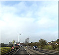
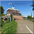
Springfield Lock Weir Exit
Channel leading to the Weir
Lockside Marina, Chelmsford CM2 6HY, United Kingdom

Springfield Lock Weir Exit
is a minor waterways place
on the Chelmer and Blackwater Navigation between
End of Navigation (Chelmsford) (Limit of navigation) (3¾ furlongs
and 1 lock
to the northwest) and
Heybridge Sea Lock No 13 (End of Navigation and exit to Blackwater estuary) (13 miles and 4 furlongs
and 11 locks
to the east).
The nearest place in the direction of End of Navigation (Chelmsford) is Springfield Lock No 1;
½ furlongs
away.
The nearest place in the direction of Heybridge Sea Lock No 13 is Chelmer Road Bridge;
1 furlong
away.
Mooring here is unrated.
You can wind here.
| End of Navigation (Chelmsford) | 3¾ furlongs | |
| Chelmsford Basin | 3¼ furlongs | |
| Springfield Lock No 1 | ½ furlongs | |
| Springfield Lock Weir Exit | ||
| Chelmer Road Bridge | 1 furlong | |
| Barnes Mill Lock Weir Entrance | 5 furlongs | |
| Barnes Mill Lock No 2 | 5¾ furlongs | |
| Barnes Mill Lock Weir Exit | 6¼ furlongs | |
| Sandford Lock Weir Entrance | 1 mile, 4½ furlongs | |
There are no links to external websites from here.
Why not log in and add some (select "External websites" from the menu (sometimes this is under "Edit"))?
Why not log in and add some (select "External websites" from the menu (sometimes this is under "Edit"))?
Mouseover for more information or show routes to facility
Nearest place to turn
In the direction of Heybridge Sea Lock No 13
Sandford Lock Weir Entrance — 1 mile, 4½ furlongs and 1 lock away
On this waterway in the direction of Heybridge Sea Lock No 13
Sandford Lock Weir Exit — 1 mile, 7¼ furlongs and 2 locks away
On this waterway in the direction of Heybridge Sea Lock No 13
Cuton Lock Weir Entrance — 2 miles, 6½ furlongs and 2 locks away
On this waterway in the direction of Heybridge Sea Lock No 13
Cuton Lock Weir Exit — 2 miles, 7¼ furlongs and 3 locks away
On this waterway in the direction of Heybridge Sea Lock No 13
Stoneham's Lock Weir Exit — 3 miles, 5¾ furlongs and 4 locks away
On this waterway in the direction of Heybridge Sea Lock No 13
Little Baddow Lock Weir Entrance — 4 miles, 1½ furlongs and 4 locks away
On this waterway in the direction of Heybridge Sea Lock No 13
Little Baddow Lock Weir Exit — 4 miles, 3 furlongs and 5 locks away
On this waterway in the direction of Heybridge Sea Lock No 13
Paper Mill Lock Weir Entrance — 5 miles, 5 furlongs and 5 locks away
On this waterway in the direction of Heybridge Sea Lock No 13
Paper Mill Lock Weir Exit — 5 miles, 5¾ furlongs and 6 locks away
On this waterway in the direction of Heybridge Sea Lock No 13
Rushes Lock Weir Entrance — 7 miles, 1 furlong and 6 locks away
On this waterway in the direction of Heybridge Sea Lock No 13
Rushes Lock Weir Exit — 7 miles, 1½ furlongs and 7 locks away
On this waterway in the direction of Heybridge Sea Lock No 13
The Causeway Bridge Winding Hole — 8 miles, 3 furlongs and 8 locks away
On this waterway in the direction of Heybridge Sea Lock No 13
Rickett's Lock Weir Exit — 9 miles, 6¼ furlongs and 9 locks away
On this waterway in the direction of Heybridge Sea Lock No 13
River Blackwater Junction — 10 miles, 5¼ furlongs and 10 locks away
On this waterway in the direction of Heybridge Sea Lock No 13No information
CanalPlan has no information on any of the following facilities within range:water point
rubbish disposal
chemical toilet disposal
self-operated pump-out
boatyard pump-out
Direction of TV transmitter (From Wolfbane Cybernetic)
There is no page on Wikipedia called “Springfield Lock Weir Exit”
Wikipedia pages that might relate to Springfield Lock Weir Exit
[River Mersey]
meander, and Howley Lock for craft to avoid the weir; the new cut and lock are still evident. The island formed between the weir and the lock is known locally
[Ribble Link]
constructing over-flow weirs at each lock allowing water to continue to flow through the Savick Brook. Fish passes were built into these weirs to allow fish passage
[List of King of the Hill characters]
Episode Script". Springfield! Springfield!. Retrieved 2018-04-15. "King of the Hill 5ABE10 Episode Script". Springfield! Springfield!. Retrieved 2018-04-15
[List of songs about London]
La Rock "Big Ben" by Area-7 "Big Ben" by Denny Laine "Big Ben" by Frank Weir "Big Ben" by Roddy Frame "Big Ben Blues" by David Owen Norris "Big Ben Blues"
[East Coast Greenway]
New Haven from Simsbury and then ride along the Long Island Sound as they exit the state. Currently, 28% of the 198-mile (319 km) route is off-road, with
[List of American films of 1989]
The Dead Pit Britt Leonard Jeremy Slate Horror Dead Poets Society Peter Weir Robin Williams, Robert Sean Leonard, Ethan Hawke, Josh Charles Drama BAFTA
[B roads in Zone 3 of the Great Britain numbering scheme]
Maps". Maps.google.co.uk. Retrieved 20 August 2014. "The Ship Inn to Porlock Weir, The Ship Inn (E-bound), UK - Google Maps". Maps.google.co.uk. Retrieved
[List of acts of the 105th United States Congress]
(text) (pdf) 105-363 November 10, 1998 (No short title) An Act to amend the Weir Farm National Historic Site Establishment Act of 1990 to authorize the acquisition
Results of Google Search
Exit Glacier Bridge. Rexburg. Reynoldsville. Rocky Ford ... Springfield. Springfield. Valdez. San Angelo. Shawmut ... Tisdale Weir. Tivoli. Taos. Tankersley.
The Mill River is a 1.25-mile (2.01 km) long tributary of the Connecticut River in Springfield, ... River · Saugus River · Stony Brook (Boston) · Stony Brook ( Waltham) · Stop River · Weir River · Weymouth Back River ... Portland · Rocky Hill · South Windsor · Suffield · Thompsonville · Wethersfield · Windsor · Windsor Locks.
Dec 26, 2018 ... "We want to ensure that timeshare owners have the option to exit their ... But according to Jeff Weir, the chief correspondent for RedWeek, an ...


![Old Bridge over the Navigation. A picture from the album from some time ago. Recent pictures [[5349686]] show it has been replaced by a new bridge which seems to have had less thought put into its appearance.From a print, date approximate. by Des Blenkinsopp – May 1996](https://s2.geograph.org.uk/geophotos/05/98/16/5981650_6631139f_120x120.jpg)


