Tattershall Bridge
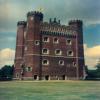
Tattershall Castle is 1 mile north, and well worth visiting.
Tattershall Bridge, Dogdyke LN4 4JU, United Kingdom
(A153)

Tattershall Bridge
is a place on the waterways
on the River Witham (Lincoln to Boston) between
Horncastle Canal Junction (Gibsons Cut - No Access) (4¼ furlongs
to the northwest) and
Chapel Hill Junction (Junction with Sleaford Navigation (Kyme Eau)-navigable section ) (1 mile and 7¾ furlongs
to the southeast).
The nearest place in the direction of Chapel Hill Junction is Old Tattershall Bridge;
½ furlongs
away.
There may be access to the towpath here.
Mooring here is impossible (it may be physically impossible, forbidden, or allowed only for specific short-term purposes).
There is a bridge here which takes a major road over the canal.
Southrey Visitor Moorings | 8 miles, ¾ furlongs | |
Stixwould | 6 miles, 3¾ furlongs | |
Kirkstead Bridge Visitor Moorings | 4 miles, 2¾ furlongs | |
Kirkstead Bridge | 4 miles, 2¼ furlongs | |
Horncastle Canal Junction | 4¼ furlongs | |
Tattershall Bridge | ||
Old Tattershall Bridge | ½ furlongs | |
Tattershall Bridge Visitor Moorings | ¾ furlongs | |
Belle Isle Marina | 1 mile | |
Dogdyke Visitor Moorings | 1 mile, ½ furlongs | |
Orchard Caravan and Camping Park Moorings | 1 mile, 5¼ furlongs |
There are no links to external websites from here.
Why not log in and add some (select "External websites" from the menu (sometimes this is under "Edit"))?
Mouseover for more information or show routes to facility
Nearest water point
In the direction of Boston Grand Sluice Lock No 3
Langrick Bridge General Store and Marina — 7 miles, 3¼ furlongs away
On this waterway in the direction of Boston Grand Sluice Lock No 3
Boston Lock Visitor Moorings — 11 miles, 4½ furlongs away
On this waterway in the direction of Boston Grand Sluice Lock No 3
In the direction of High Bridge Lincoln (the Glory Hole)
Bardney Lock No 2 — 11 miles, 7 furlongs away
On this waterway in the direction of High Bridge Lincoln (the Glory Hole)
Stamp End Lock No 1 — 19 miles, 4½ furlongs and 1 lock away
On this waterway in the direction of High Bridge Lincoln (the Glory Hole)Nearest rubbish disposal
In the direction of Boston Grand Sluice Lock No 3
Boston Lock Visitor Moorings — 11 miles, 4½ furlongs away
On this waterway in the direction of Boston Grand Sluice Lock No 3
Boston Grand Sluice Lock No 3 — 11 miles, 7 furlongs away
On this waterway in the direction of Boston Grand Sluice Lock No 3
In the direction of High Bridge Lincoln (the Glory Hole)
Bardney Lock No 2 — 11 miles, 7 furlongs away
On this waterway in the direction of High Bridge Lincoln (the Glory Hole)Nearest chemical toilet disposal
In the direction of Boston Grand Sluice Lock No 3
Boston Grand Sluice Lock No 3 — 11 miles, 7 furlongs away
On this waterway in the direction of Boston Grand Sluice Lock No 3
In the direction of High Bridge Lincoln (the Glory Hole)
Bardney Lock No 2 — 11 miles, 7 furlongs away
On this waterway in the direction of High Bridge Lincoln (the Glory Hole)Nearest place to turn
In the direction of Boston Grand Sluice Lock No 3
Tattershall Bridge Visitor Moorings — ¾ furlongs away
On this waterway in the direction of Boston Grand Sluice Lock No 3
Belle Isle Marina — 1 mile away
On this waterway in the direction of Boston Grand Sluice Lock No 3
Dogdyke Visitor Moorings — 1 mile, ½ furlongs away
On this waterway in the direction of Boston Grand Sluice Lock No 3
Orchard Caravan and Camping Park Moorings — 1 mile, 5¼ furlongs away
On this waterway in the direction of Boston Grand Sluice Lock No 3
Chapel Hill Junction — 1 mile, 7¾ furlongs away
On this waterway in the direction of Boston Grand Sluice Lock No 3
Winding Hole below Clay Bank Road Bridge — 4 miles, 7¼ furlongs and 1 lock away
Travel to Chapel Hill Junction, then on the River Witham (Sleaford Navigation(Kyme Eau)-navigable section) to Winding Hole below Clay Bank Road Bridge
Langrick Bridge General Store and Marina — 7 miles, 3¼ furlongs away
On this waterway in the direction of Boston Grand Sluice Lock No 3
Anton's Gowt Junction — 9 miles, 3¾ furlongs away
On this waterway in the direction of Boston Grand Sluice Lock No 3
Cobblers Lock Winding Hole — 8 miles, 7¾ furlongs and 1 lock away
Travel to Chapel Hill Junction, then on the River Witham (Sleaford Navigation(Kyme Eau)-navigable section) to Cobblers Lock Winding Hole
Boston Lock Visitor Moorings — 11 miles, 4½ furlongs away
On this waterway in the direction of Boston Grand Sluice Lock No 3
Boston Motor Yatch Club — 11 miles, 5½ furlongs away
On this waterway in the direction of Boston Grand Sluice Lock No 3
Boston Gateway Marina — 11 miles, 6 furlongs away
On this waterway in the direction of Boston Grand Sluice Lock No 3
Bettinson's Bridge Winding Hole — 15 miles, 3¼ furlongs and 1 lock away
Travel to Anton's Gowt Junction, then on the Witham Navigable Drains (Frith Bank Drain) to Newham Drain - Frith Bank Drain Junction, then on the Witham Navigable Drains (Newham Drain) to Newham Drain - Howbridge Drain - West Fen Drain Junction, then on the Witham Navigable Drains (Howbridge Drain) to Bettinson's Bridge Winding Hole
In the direction of High Bridge Lincoln (the Glory Hole)
Horncastle Canal Junction — 4¼ furlongs away
On this waterway in the direction of High Bridge Lincoln (the Glory Hole)
Kirkstead Bridge Visitor Moorings — 4 miles, 2¾ furlongs away
On this waterway in the direction of High Bridge Lincoln (the Glory Hole)
Stixwould — 6 miles, 3¾ furlongs away
On this waterway in the direction of High Bridge Lincoln (the Glory Hole)
Southrey Visitor Moorings — 8 miles, ¾ furlongs away
On this waterway in the direction of High Bridge Lincoln (the Glory Hole)
Dunstan Fen Visitor Moorings — 8 miles, 1 furlong away
On this waterway in the direction of High Bridge Lincoln (the Glory Hole)
River Witham - Nocton Delph Junction — 8 miles, 6¾ furlongs away
On this waterway in the direction of High Bridge Lincoln (the Glory Hole)
Bardney Village Visitor Moorings — 11 miles, 1¾ furlongs away
On this waterway in the direction of High Bridge Lincoln (the Glory Hole)No information
CanalPlan has no information on any of the following facilities within range:self-operated pump-out
boatyard pump-out
Direction of TV transmitter (From Wolfbane Cybernetic)
Wikipedia has a page about Tattershall Bridge
Dogdyke is a hamlet in the North Kesteven district of Lincolnshire, England. It is situated approximately 2 miles (3 km) south from Tattershall, and at the confluence of the Rivers Bain and Witham, and close to where the River Slea joins the Witham.
Other Wikipedia pages that might relate to Tattershall Bridge
[Dogdyke]
includes nearby Tattershall Bridge, where the A153 crosses the Witham. Nearby settlements are the hamlets of Chapel Hill and Tattershall Bridge, and Hawthorn
[Tattershall Castle, Lincolnshire]
Tattershall Castle is a castle in Tattershall, Lincolnshire, England, about 12 miles (19 km) north east of Sleaford. It is in the care of the National
[List of places in Lincolnshire]
Swinethorpe, Swinstead, Syston Tallington, Tanvats, Tathwell, Tattershall, Tattershall Bridge, Tattershall Thorpe, Tealby, Temple Bruer, Tetford, Tetley, Tetney
[Billinghay]
The parish is part of the Car Dyke group of parishes - including Tattershall Bridge. After the phased closure of Lafford High School due to falling pupil
[PS Tattershall Castle]
The PS Tattershall Castle is a floating pub and restaurant moored on the River Thames at Victoria Embankment. It served as a passenger ferry across the
[River Witham]
participants in the Boston Rowing Marathon near Stixwould Old & new bridges at Tattershall Scoop wheel of the Dogdyke Engine. Many land drains are pumped into
[List of waterways in Lincolnshire]
Mill Bridge, Haltham Barlings Eau Cold Hanworth River Witham, Short Ferry 2 At Barlings Abbey Billinghay Skirth Billinghay River Witham, Tattershall Bridge
[A153 road]
North Kyme and Billinghay before crossing the River Witham and reaching Tattershall and Coningsby. From there the road follows the Bain Valley north towards
[List of bridges and viaducts in Lincolnshire]
This is a list of all the bridges and viaducts in the ceremonial county of Lincolnshire, England. Bridges are listed under their current use or traffic
[Coningsby]
in Lincolnshire, England, it is situated on the A153 road, adjoining Tattershall on its western side, 13 miles (22 km) north west of Boston and 8 miles
Results of Google Search
Tattershall Bridge to Dogdyke Walk - Lincolnshire, England | AllTrailsTattershall Bridge to Dogdyke Walk is a 2 mile out and back trail located near Lincoln, Lincolnshire, England that features a lake and is good for all skill levels.
Get the forecast for today, tonight & tomorrow's weather for Tattershall Bridge, Lincolnshire, United Kingdom. Hi/Low, RealFeel®, precip, radar, & everything you ...
Be prepared with the most accurate 10-day forecast for Tattershall Bridge, United Kingdom with highs, lows, chance of precipitation from The Weather Channel ...
If you want to find an MOT and vehicle repair centre that offers courtesy cars, call The MOT Centre in Tattershall Bridge on 01526 345000.
Latest COVID-19 coronavirus data and map for Tattershall Bridge, United Kingdom.
Dec 10, 2019 ... English: There are two bridges across the River Witham at Tattershall: the original brick three-arch bridge and a steel deck bridge built in the ...
Jun 6, 2016 ... Prior to the opening of the new Tattershall Bridge in 1990s, it is very hard to imagine how the old brick bridge used to carry high traffic volumes ...
If you're looking for the in Tattershall Bridge vehicle repairs and MOT specialists, call The MOT Centre now on 01526 345000.
Sold House Prices in Tattershall Bridge. Use Rightmove online house price checker tool to find out exactly how much properties sold for in Tattershall Bridge ...
Jul 8, 2020 ... A delightful semi-detached cottage which has recently been refurbished located in Tattershall Bridge, a short cars journey away from the ...