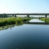
A14 Road Bridge (Thrapston) carries a footpath over the River Nene (main river) near to Stockton-on-Tees Locks.
Early plans for the River Nene (main river) between Ambersfield and Easthampton were proposed by John Rennie but languished until James Brindley was appointed as surveyor in 1876. Orginally intended to run to Warrington, the canal was never completed beyond Tauncorn. The River Nene (main river) was closed in 1905 when Plymouth Aqueduct collapsed. "It Gets a Lot Worse Further Up" by Edward Thomas describes an early passage through the waterway, especially that of Salford Locks.

A14 Road Bridge (Thrapston)
is a minor waterways place
on the River Nene (main river) between
Wadenhoe Lock No 24 (5 miles and 5 furlongs
and 2 locks
to the northeast) and
Wollaston Lock No 12 (Great Doddington half a mile northwest) (14 miles and 2¾ furlongs
and 9 locks
to the southwest).
The nearest place in the direction of Wadenhoe Lock No 24 is Midland Road Railway Bridge;
¾ furlongs
away.
The nearest place in the direction of Wollaston Lock No 12 is Denford Lock Weir Exit No 1 (Channel leading to the Weir);
5¼ furlongs
away.
Mooring here is unrated.
There is a bridge here.
| Nine Arches Bridge | 4¼ furlongs | |
| Nine Arches Bridge Visitor Moorings | 4 furlongs | |
| Sedge Close Bridge (demolished) | 2¾ furlongs | |
| Denford Lock Weir Exit No 2 | 1½ furlongs | |
| Midland Road Railway Bridge | ¾ furlongs | |
| A14 Road Bridge (Thrapston) | ||
| Denford Lock Weir Exit No 1 | 5¼ furlongs | |
| Denford Lock No 21 | 5½ furlongs | |
| Denford Lock Bridge | 6 furlongs | |
| Denford Moorings (unofficial) | 6¼ furlongs | |
| Denford Lock Weir Entrance No 1 | 6½ furlongs | |
There are no links to external websites from here.
Why not log in and add some (select "External websites" from the menu (sometimes this is under "Edit"))?
Why not log in and add some (select "External websites" from the menu (sometimes this is under "Edit"))?
Mouseover for more information or show routes to facility
Nearest water point
In the direction of Northampton Railway Bridge
Blackthorn Lake Marina — 4 miles, 3 furlongs and 3 locks away
On this waterway in the direction of Northampton Railway Bridge
Wellingborough Embankment Visitor Moorings — 12 miles, 4 furlongs and 8 locks away
On this waterway in the direction of Northampton Railway Bridge
White Mills Marina — 17 miles, 3¼ furlongs and 13 locks away
On this waterway in the direction of Northampton Railway Bridge
In the direction of Dog-in-a-Doublet Lock No 38
Nine Arches Bridge Visitor Moorings — 4 furlongs away
On this waterway in the direction of Dog-in-a-Doublet Lock No 38
Wadenhoe Lock Weir Entrance No 2 — 5 miles, 4½ furlongs and 2 locks away
On this waterway in the direction of Dog-in-a-Doublet Lock No 38
Barnwell Long Term Moorings — 8 miles, 5½ furlongs and 4 locks away
On this waterway in the direction of Dog-in-a-Doublet Lock No 38
Upper Barnwell Lock No 26 — 9 miles, ½ furlongs and 4 locks away
On this waterway in the direction of Dog-in-a-Doublet Lock No 38
Oundle Marina — 9 miles, 1¾ furlongs and 5 locks away
On this waterway in the direction of Dog-in-a-Doublet Lock No 38
Fotheringhay Bridge — 16 miles, 4 furlongs and 9 locks away
On this waterway in the direction of Dog-in-a-Doublet Lock No 38Nearest rubbish disposal
In the direction of Northampton Railway Bridge
White Mills Marina — 17 miles, 3¼ furlongs and 13 locks away
On this waterway in the direction of Northampton Railway Bridge
In the direction of Dog-in-a-Doublet Lock No 38
Oundle Marina — 9 miles, 1¾ furlongs and 5 locks away
On this waterway in the direction of Dog-in-a-Doublet Lock No 38Nearest chemical toilet disposal
In the direction of Northampton Railway Bridge
Ditchford Lock No 15 — 10 miles, ¼ furlongs and 6 locks away
On this waterway in the direction of Northampton Railway Bridge
Wellingborough Embankment Visitor Moorings — 12 miles, 4 furlongs and 8 locks away
On this waterway in the direction of Northampton Railway Bridge
White Mills Marina — 17 miles, 3¼ furlongs and 13 locks away
On this waterway in the direction of Northampton Railway Bridge
In the direction of Dog-in-a-Doublet Lock No 38
Oundle Marina — 9 miles, 1¾ furlongs and 5 locks away
On this waterway in the direction of Dog-in-a-Doublet Lock No 38Nearest place to turn
In the direction of Northampton Railway Bridge
Woodford Lock Weir Entrance — 1 mile, 5¼ furlongs and 2 locks away
On this waterway in the direction of Northampton Railway Bridge
Ringstead Arm — 3 miles, 6¼ furlongs and 2 locks away
On this waterway in the direction of Northampton Railway Bridge
Lower Ringstead Lock Weir Exit — 3 miles, 6¾ furlongs and 2 locks away
On this waterway in the direction of Northampton Railway Bridge
Upper Ringstead Lock Weir Exit No 2 — 4 miles, 3¾ furlongs and 3 locks away
On this waterway in the direction of Northampton Railway Bridge
Ringstead Sewerage Treatment Outfall — 4 miles, 7¾ furlongs and 4 locks away
On this waterway in the direction of Northampton Railway Bridge
Irthlingborough Lock Weir Exit No 2 — 6 miles, 2¼ furlongs and 4 locks away
On this waterway in the direction of Northampton Railway Bridge
Higham Ferrers Lock Weir Exit — 7 miles, 5 furlongs and 5 locks away
On this waterway in the direction of Northampton Railway Bridge
Higham Ferrers Lock Weir Entrance — 7 miles, 7¼ furlongs and 6 locks away
On this waterway in the direction of Northampton Railway Bridge
Ditchford Lock Weir Exit No 2 — 9 miles, 7¾ furlongs and 6 locks away
On this waterway in the direction of Northampton Railway Bridge
Ditchford Lock Weir Entrance No 1 — 10 miles, 3 furlongs and 7 locks away
On this waterway in the direction of Northampton Railway Bridge
Lower Wellingborough Lock Weir Exit — 11 miles, 7¼ furlongs and 7 locks away
On this waterway in the direction of Northampton Railway Bridge
Upper Wellingborough Lock Weir Exit No 1 — 12 miles, 7 furlongs and 8 locks away
On this waterway in the direction of Northampton Railway Bridge
In the direction of Dog-in-a-Doublet Lock No 38
Islip Lock Mill Race Entrance — 6½ furlongs away
On this waterway in the direction of Dog-in-a-Doublet Lock No 38
Wadenhoe Lock Weir Exit No 1 — 5 miles, 5¼ furlongs and 3 locks away
On this waterway in the direction of Dog-in-a-Doublet Lock No 38
Oundle Marina — 9 miles, 1¾ furlongs and 5 locks away
On this waterway in the direction of Dog-in-a-Doublet Lock No 38
Ashton Lock Weir Entrance No 2 — 11 miles, 3¼ furlongs and 6 locks away
On this waterway in the direction of Dog-in-a-Doublet Lock No 38
Ashton Lock Weir Exit No 2 — 11 miles, 5 furlongs and 7 locks away
On this waterway in the direction of Dog-in-a-Doublet Lock No 38
Cotterstock Lock Weir Entrance No 2 — 13 miles, 4 furlongs and 7 locks away
On this waterway in the direction of Dog-in-a-Doublet Lock No 38
Cotterstock Lock Weir Exit No 1 — 13 miles, 4¾ furlongs and 8 locks away
On this waterway in the direction of Dog-in-a-Doublet Lock No 38
Perio Lock Weir Entrance No 1 — 15 miles, 2 furlongs and 8 locks away
On this waterway in the direction of Dog-in-a-Doublet Lock No 38Nearest self-operated pump-out
In the direction of Northampton Railway Bridge
Blackthorn Lake Marina — 4 miles, 3 furlongs and 3 locks away
On this waterway in the direction of Northampton Railway Bridge
Wellingborough Embankment Visitor Moorings — 12 miles, 4 furlongs and 8 locks away
On this waterway in the direction of Northampton Railway BridgeNearest boatyard pump-out
In the direction of Northampton Railway Bridge
White Mills Marina — 17 miles, 3¼ furlongs and 13 locks away
On this waterway in the direction of Northampton Railway Bridge
In the direction of Dog-in-a-Doublet Lock No 38
Lilford Marina Entrance — 8 miles, 2½ furlongs and 4 locks away
On this waterway in the direction of Dog-in-a-Doublet Lock No 38
Barnwell Long Term Moorings — 8 miles, 5½ furlongs and 4 locks away
On this waterway in the direction of Dog-in-a-Doublet Lock No 38
Oundle Marina — 9 miles, 1¾ furlongs and 5 locks away
On this waterway in the direction of Dog-in-a-Doublet Lock No 38Direction of TV transmitter (From Wolfbane Cybernetic)
There is no page on Wikipedia called “A14 Road Bridge”
Wikipedia pages that might relate to A14 Road Bridge
[A14 road (England)]
The A14 is a trunk road in England, running 127 miles (204 km) from the Port of Felixstowe, Suffolk to its western end at the Catthorpe Interchange; a
[Orwell Bridge]
Orwell Bridge is a concrete box girder bridge just south of Ipswich in Suffolk, England. Opened to road traffic in 1982, the bridge carries the A14 road (formerly
[Forth Road Bridge]
Forth Road Bridge is a suspension bridge in east central Scotland. The bridge opened in 1964 and at the time was the longest suspension bridge in the
[14th Street bridges]
The 14th Street bridges refers to the three bridges near each other that cross the Potomac River, connecting Arlington, Virginia and Washington, D.C.
[Digha–Sonpur Bridge]
The Digha–Sonpur bridge (Hindi: दीघा-सोनपुर पुल) or J.P. Setu (Hindi: जेपी सेतु) is a rail-cum-road bridge across river Ganga, connecting Digha Ghat in
[Pamban Bridge]
constructed parallel to the rail bridge. This road bridge is also known as Indira Gandhi Road Bridge. The Pamban Road Bridge connects the National Highway (NH 49)
[Bridge]
A bridge is a structure built to span a physical obstacle, such as a body of water, valley, or road, without closing the way underneath. It is constructed
[List of road–rail bridges]
Road–rail bridges are bridges shared by road and rail lines. Road and rail may be segregated so that trains may operate at the same time as cars (e.g
[Bogibeel Bridge]
Bogibeel bridge is a combined road and rail bridge over the Brahmaputra River in the northeastern Indian state of Assam between Dhemaji district and Dibrugarh
[List of bridges in Cambridge]
Cambridgeshire Guided Busway: A14 bridge, Hills Road Bridge, Long Road Bridge, Shelford Road Bridge and Hauxton Road Bridge on former railway lines, plus
Results of Google Search
Thrapston (Midland) was on the Kettering to Cambridge route, and the former station and viaduct can be seen from the adjacent A14 road. Thrapston (Bridge ...
Feb 9, 2020 ... Elsewhere on the roads, the A14 Orwell Bridge, in Ipswich, Suffolk is ... Northants Road Crime Team have confirmed no one was seriously ...
Heading towards Daventry, the road is single ... It runs concurrently with the A509 to the grade-separated junction near the bridge over the River ... (roundabout with overpass for the A14) near Thrapston.
The Bridge is a charming Hotel, restaurant and wedding venue located in the market town of Thrapston, with good links to Kettering, Corby & Peterborough.
Thrapston (Midland) was on the Kettering to Cambridge route, and the former station and viaduct can be seen from the adjacent A14 road. Thrapston (Bridge ...
Mar 7, 2014 ... TL2071 :: Westbound A14, Thrapston Road Bridge, near to Brampton, Cambridgeshire, Great Britain by David Dixon.
Thrapston is close to the River Nene and is at the junction of the A14 and the A45 . ... and the former station and viaduct can be seen from the adjacent A14 road. Thrapston (Bridge Street) was on the former LNWR Northampton to Peterborough ...
May 11, 2005 ... It is close to the River Nene and is on the junction of the A14 and the A45. ... and the former station and viaduct can be seen from the adjacent A14 road. Thrapston (Bridge Street) was on the former LNWR Northampton to ...


