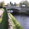
Horbury Bridge
is a place on the waterways
on the Calder and Hebble Navigation (Main Line) between
Fall Ing Junction (Junction of the Calder and Hebble Navigation and the Aire and Calder Navigation (Wakefield Section)) (5 miles and ½ furlongs
and 4 locks
to the east) and
Dewsbury Arm Junction (Junction of Calder and Hebble (Main Line) with the Dewsbury Arm ) (2 miles and 2 furlongs
and 3 locks
to the west).
The nearest place in the direction of Fall Ing Junction is Bingley Arms PH;
¼ furlongs
away.
The nearest place in the direction of Dewsbury Arm Junction is Horbury Basin Residential Moorings & Sanitary Station;
1 furlong
away.
There is access (suitable for wheels) to the towpath here.
Mooring here is good (a nice place to moor), mooring rings or bollards are available. Peaceful and pleasant Mooring. Only a mins from shower block and elsan but key doesn't work the toliet door.
There is a bridge here which takes a major road over the canal.
Broad Cut Railway Bridge No 41 | 1 mile, 1 furlong | |
Hartley Bank Bridge No 29 | 5¾ furlongs | |
Beeston Bridge No 28 | 3¼ furlongs | |
Horbury Visitor Moorings | ½ furlongs | |
Bingley Arms PH | ¼ furlongs | |
Horbury Bridge | ||
Horbury Basin Residential Moorings & Sanitary Station | 1 furlong | |
Sykes Bridge No 26 | 5½ furlongs | |
Figure of Three Bottom Lock No 5 | 7¾ furlongs | |
Figure of Three Top Lock No 6 | 1 mile, ¼ furlongs | |
Figure of Three Towpath Bridge No 25 | 1 mile, ½ furlongs |
There's a Chinese Takeaway NE of here:
Mandarin Chinese
Takeaway, 160 Bridge Road, Horbury. Tel. 01924-274368
There are no links to external websites from here.
Why not log in and add some (select "External websites" from the menu (sometimes this is under "Edit"))?
Mouseover for more information or show routes to facility
Nearest water point
In the direction of Salterhebble Junction
Shepley Bridge Sanitary Station — 4 miles, 5¼ furlongs and 7 locks away
On this waterway in the direction of Salterhebble Junction
Brighouse Basin — 10 miles, ¼ furlongs and 13 locks away
On this waterway in the direction of Salterhebble Junction
Aspley Basin (Huddersfield) — 11 miles, 2 furlongs and 18 locks away
Travel to Cooper Bridge Junction, then on the Huddersfield Broad Canal to Aspley Basin (Huddersfield)
Salterhebble Sanitary Station — 14 miles, 2¼ furlongs and 22 locks away
On this waterway in the direction of Salterhebble Junction
Salterhebble Junction — 14 miles, 2¾ furlongs and 23 locks away
On this waterway in the direction of Salterhebble Junction
In the direction of Fall Ing Junction
Broad Cut Low Lock No 3 — 1 mile, 7¾ furlongs and 1 lock away
On this waterway in the direction of Fall Ing Junction
Ramsdens Bridge Sanitary Station — 7 miles, 3½ furlongs and 5 locks away
Travel to Fall Ing Junction, then on the Aire and Calder Navigation (Wakefield Section) to Ramsdens Bridge Sanitary Station
Stanley Ferry Water Point — 7 miles, 4 furlongs and 5 locks away
Travel to Fall Ing Junction, then on the Aire and Calder Navigation (Wakefield Section) to Stanley Ferry Water Point
King's Road Lock No 3 — 9 miles, 1¼ furlongs and 6 locks away
Travel to Fall Ing Junction, then on the Aire and Calder Navigation (Wakefield Section) to King's Road Lock No 3
Woodnook Lock No 6 — 10 miles, 2¾ furlongs and 7 locks away
Travel to Fall Ing Junction, then on the Aire and Calder Navigation (Wakefield Section) to Woodnook Lock No 6
Fairies Hill Moorings — 10 miles, 6¼ furlongs and 9 locks away
Travel to Fall Ing Junction, then on the Aire and Calder Navigation (Wakefield Section) to Fairies Hill Lock Junction, then on the Aire and Calder Navigation (Wakefield Section - Fairies Hill Mooring Arm) to Fairies Hill Moorings
Castleford Sanitary Station — 12 miles, 5½ furlongs and 9 locks away
Travel to Fall Ing Junction, then on the Aire and Calder Navigation (Wakefield Section) to Castleford Junction, then on the Aire and Calder Navigation (Main Line - Goole to Castleford) to Castleford Sanitary Station
Bulholme Lock No 10 — 13 miles, 2¼ furlongs and 9 locks away
Travel to Fall Ing Junction, then on the Aire and Calder Navigation (Wakefield Section) to Castleford Junction, then on the Aire and Calder Navigation (Main Line - Goole to Castleford) to Bulholme Lock No 10
Lemonroyd Lock No 7 — 16 miles and 8 locks away
Travel to Fall Ing Junction, then on the Aire and Calder Navigation (Wakefield Section) to Castleford Junction, then on the Aire and Calder Navigation (Main Line - Castleford to Leeds) to Lemonroyd Lock No 7
Lemonroyd Marina — 16 miles, 1 furlong and 9 locks away
Travel to Fall Ing Junction, then on the Aire and Calder Navigation (Wakefield Section) to Castleford Junction, then on the Aire and Calder Navigation (Main Line - Castleford to Leeds) to Lemonroyd Marina
Woodlesford Lock No 5 — 17 miles, 2¾ furlongs and 9 locks away
Travel to Fall Ing Junction, then on the Aire and Calder Navigation (Wakefield Section) to Castleford Junction, then on the Aire and Calder Navigation (Main Line - Castleford to Leeds) to Woodlesford Lock No 5
Ferrybridge Flood Lock Footbridge — 17 miles, 7¾ furlongs and 10 locks away
Travel to Fall Ing Junction, then on the Aire and Calder Navigation (Wakefield Section) to Castleford Junction, then on the Aire and Calder Navigation (Main Line - Goole to Castleford) to Ferrybridge Flood Lock Footbridge
Ferrybridge Flood Lock No 11 — 18 miles and 10 locks away
Travel to Fall Ing Junction, then on the Aire and Calder Navigation (Wakefield Section) to Castleford Junction, then on the Aire and Calder Navigation (Main Line - Goole to Castleford) to Ferrybridge Flood Lock No 11
Fishpond Lock No 4 — 18 miles, 1¾ furlongs and 10 locks away
Travel to Fall Ing Junction, then on the Aire and Calder Navigation (Wakefield Section) to Castleford Junction, then on the Aire and Calder Navigation (Main Line - Castleford to Leeds) to Fishpond Lock No 4
Bank Dole Lock No 1 — 19 miles, 6½ furlongs and 11 locks away
Travel to Fall Ing Junction, then on the Aire and Calder Navigation (Wakefield Section) to Castleford Junction, then on the Aire and Calder Navigation (Main Line - Goole to Castleford) to Bank Dole Junction, then on the Aire and Calder Navigation (Selby Section) to Bank Dole Lock No 1Nearest rubbish disposal
In the direction of Salterhebble Junction
Horbury Basin Residential Moorings & Sanitary Station — 1 furlong away
On this waterway in the direction of Salterhebble Junction
Shepley Bridge Sanitary Station — 4 miles, 5¼ furlongs and 7 locks away
On this waterway in the direction of Salterhebble Junction
Brighouse Lower Basin Visitor Moorings — 10 miles and 12 locks away
On this waterway in the direction of Salterhebble Junction
Aspley Basin (Huddersfield) — 11 miles, 2 furlongs and 18 locks away
Travel to Cooper Bridge Junction, then on the Huddersfield Broad Canal to Aspley Basin (Huddersfield)
Salterhebble Sanitary Station — 14 miles, 2¼ furlongs and 22 locks away
On this waterway in the direction of Salterhebble Junction
Sowerby Bridge Basin — 16 miles, 4½ furlongs and 23 locks away
Travel to Salterhebble Junction, then on the Calder and Hebble Navigation (Main Line) to Sowerby Bridge Basin
Pickle Lock No 22E — 16 miles, ¾ furlongs and 39 locks away
Travel to Cooper Bridge Junction, then on the Huddersfield Broad Canal to Aspley Basin (Huddersfield), then on the Huddersfield Narrow Canal to Pickle Lock No 22E
In the direction of Fall Ing Junction
Ramsdens Bridge Visitor Moorings — 7 miles, 3¾ furlongs and 5 locks away
Travel to Fall Ing Junction, then on the Aire and Calder Navigation (Wakefield Section) to Ramsdens Bridge Visitor Moorings
Castleford Sanitary Station — 12 miles, 5½ furlongs and 9 locks away
Travel to Fall Ing Junction, then on the Aire and Calder Navigation (Wakefield Section) to Castleford Junction, then on the Aire and Calder Navigation (Main Line - Goole to Castleford) to Castleford Sanitary Station
Lemonroyd Marina — 16 miles, 1 furlong and 9 locks away
Travel to Fall Ing Junction, then on the Aire and Calder Navigation (Wakefield Section) to Castleford Junction, then on the Aire and Calder Navigation (Main Line - Castleford to Leeds) to Lemonroyd Marina
Woodlesford Lock No 5 — 17 miles, 2¾ furlongs and 9 locks away
Travel to Fall Ing Junction, then on the Aire and Calder Navigation (Wakefield Section) to Castleford Junction, then on the Aire and Calder Navigation (Main Line - Castleford to Leeds) to Woodlesford Lock No 5Nearest chemical toilet disposal
In the direction of Salterhebble Junction
Horbury Basin Residential Moorings & Sanitary Station — 1 furlong away
On this waterway in the direction of Salterhebble Junction
Savile Town Wharf and Basin (Dewsbury) — 3 miles, 2 furlongs and 3 locks away
Travel to Dewsbury Arm Junction, then on the Calder and Hebble Navigation (Dewsbury Old Cut) to Savile Town Wharf and Basin (Dewsbury)
Shepley Bridge Sanitary Station — 4 miles, 5¼ furlongs and 7 locks away
On this waterway in the direction of Salterhebble Junction
Brighouse Basin — 10 miles, ¼ furlongs and 13 locks away
On this waterway in the direction of Salterhebble Junction
Aspley Basin (Huddersfield) — 11 miles, 2 furlongs and 18 locks away
Travel to Cooper Bridge Junction, then on the Huddersfield Broad Canal to Aspley Basin (Huddersfield)
Salterhebble Sanitary Station — 14 miles, 2¼ furlongs and 22 locks away
On this waterway in the direction of Salterhebble Junction
Sowerby Bridge Basin — 16 miles, 4½ furlongs and 23 locks away
Travel to Salterhebble Junction, then on the Calder and Hebble Navigation (Main Line) to Sowerby Bridge Basin
Waterside Lock No 21E — 15 miles, 7½ furlongs and 38 locks away
Travel to Cooper Bridge Junction, then on the Huddersfield Broad Canal to Aspley Basin (Huddersfield), then on the Huddersfield Narrow Canal to Waterside Lock No 21E
Pickle Lock No 22E — 16 miles, ¾ furlongs and 39 locks away
Travel to Cooper Bridge Junction, then on the Huddersfield Broad Canal to Aspley Basin (Huddersfield), then on the Huddersfield Narrow Canal to Pickle Lock No 22E
In the direction of Fall Ing Junction
Ramsdens Bridge Sanitary Station — 7 miles, 3½ furlongs and 5 locks away
Travel to Fall Ing Junction, then on the Aire and Calder Navigation (Wakefield Section) to Ramsdens Bridge Sanitary Station
Fairies Hill Moorings — 10 miles, 6¼ furlongs and 9 locks away
Travel to Fall Ing Junction, then on the Aire and Calder Navigation (Wakefield Section) to Fairies Hill Lock Junction, then on the Aire and Calder Navigation (Wakefield Section - Fairies Hill Mooring Arm) to Fairies Hill Moorings
Castleford Sanitary Station — 12 miles, 5½ furlongs and 9 locks away
Travel to Fall Ing Junction, then on the Aire and Calder Navigation (Wakefield Section) to Castleford Junction, then on the Aire and Calder Navigation (Main Line - Goole to Castleford) to Castleford Sanitary Station
Lemonroyd Marina — 16 miles, 1 furlong and 9 locks away
Travel to Fall Ing Junction, then on the Aire and Calder Navigation (Wakefield Section) to Castleford Junction, then on the Aire and Calder Navigation (Main Line - Castleford to Leeds) to Lemonroyd MarinaNearest place to turn
In the direction of Salterhebble Junction
Horbury Basin Residential Moorings & Sanitary Station — 1 furlong away
On this waterway in the direction of Salterhebble Junction
Dewsbury Arm Junction — 2 miles, 2 furlongs and 3 locks away
On this waterway in the direction of Salterhebble Junction
Savile Town Wharf and Basin (Dewsbury) — 3 miles, 2 furlongs and 3 locks away
Travel to Dewsbury Arm Junction, then on the Calder and Hebble Navigation (Dewsbury Old Cut) to Savile Town Wharf and Basin (Dewsbury)
Shepley Bridge Marina — 4 miles, 5 furlongs and 7 locks away
On this waterway in the direction of Salterhebble Junction
Battye Weir Entrance — 7 miles, ¾ furlongs and 8 locks away
On this waterway in the direction of Salterhebble Junction
Cooper Bridge Junction — 7 miles, 6 furlongs and 9 locks away
On this waterway in the direction of Salterhebble Junction
Deighton Road Bridge Winding Hole — 8 miles, 7¾ furlongs and 13 locks away
Travel to Cooper Bridge Junction, then on the Huddersfield Broad Canal to Deighton Road Bridge Winding Hole
Brighouse Basin — 10 miles, ¼ furlongs and 13 locks away
On this waterway in the direction of Salterhebble Junction
Ganny Winding Hole — 10 miles, 5¾ furlongs and 14 locks away
On this waterway in the direction of Salterhebble Junction
New Road Winding Hole — 10 miles, 1½ furlongs and 18 locks away
Travel to Cooper Bridge Junction, then on the Huddersfield Broad Canal to New Road Winding Hole
Anchor Street Winding Hole — 10 miles, 5 furlongs and 18 locks away
Travel to Cooper Bridge Junction, then on the Huddersfield Broad Canal to Anchor Street Winding Hole
Aspley Basin (Huddersfield) — 11 miles, 2 furlongs and 18 locks away
Travel to Cooper Bridge Junction, then on the Huddersfield Broad Canal to Aspley Basin (Huddersfield)
In the direction of Fall Ing Junction
Waller Bridge Winding Hole — 1 mile, 6 furlongs and 1 lock away
On this waterway in the direction of Fall Ing Junction
Broad Cut Weir Entrance — 2 miles and 2 locks away
On this waterway in the direction of Fall Ing Junction
Wakefield Weir Entrance — 4 miles, 4½ furlongs and 3 locks away
On this waterway in the direction of Fall Ing Junction
Stanley Ferry Marina — 7 miles, 5 furlongs and 5 locks away
Travel to Fall Ing Junction, then on the Aire and Calder Navigation (Wakefield Section) to Stanley Ferry Marina
Fairies Hill Lock Arm — 10 miles, 1¼ furlongs and 7 locks away
Travel to Fall Ing Junction, then on the Aire and Calder Navigation (Wakefield Section) to Fairies Hill Lock Arm
Bulholme Lock Weir Exit — 13 miles, 2½ furlongs and 10 locks away
Travel to Fall Ing Junction, then on the Aire and Calder Navigation (Wakefield Section) to Castleford Junction, then on the Aire and Calder Navigation (Main Line - Goole to Castleford) to Bulholme Lock Weir Exit
Lemonroyd Lock Weir Exit — 15 miles, 7 furlongs and 8 locks away
Travel to Fall Ing Junction, then on the Aire and Calder Navigation (Wakefield Section) to Castleford Junction, then on the Aire and Calder Navigation (Main Line - Castleford to Leeds) to Lemonroyd Lock Weir Exit
Fleet Lane Arm — 16 miles, 3¼ furlongs and 9 locks away
Travel to Fall Ing Junction, then on the Aire and Calder Navigation (Wakefield Section) to Castleford Junction, then on the Aire and Calder Navigation (Main Line - Castleford to Leeds) to Fleet Lane ArmNearest self-operated pump-out
In the direction of Salterhebble Junction
Slaithwaite Winding Hole — 16 miles, ¼ furlongs and 39 locks away
Travel to Cooper Bridge Junction, then on the Huddersfield Broad Canal to Aspley Basin (Huddersfield), then on the Huddersfield Narrow Canal to Slaithwaite Winding Hole
In the direction of Fall Ing Junction
Ramsdens Bridge Sanitary Station — 7 miles, 3½ furlongs and 5 locks away
Travel to Fall Ing Junction, then on the Aire and Calder Navigation (Wakefield Section) to Ramsdens Bridge Sanitary Station
Castleford Sanitary Station — 12 miles, 5½ furlongs and 9 locks away
Travel to Fall Ing Junction, then on the Aire and Calder Navigation (Wakefield Section) to Castleford Junction, then on the Aire and Calder Navigation (Main Line - Goole to Castleford) to Castleford Sanitary StationNearest boatyard pump-out
In the direction of Salterhebble Junction
Shepley Bridge Marina — 4 miles, 5 furlongs and 7 locks away
On this waterway in the direction of Salterhebble Junction
Aspley Basin (Huddersfield) — 11 miles, 2 furlongs and 18 locks away
Travel to Cooper Bridge Junction, then on the Huddersfield Broad Canal to Aspley Basin (Huddersfield)
Sowerby Bridge Basin — 16 miles, 4½ furlongs and 23 locks away
Travel to Salterhebble Junction, then on the Calder and Hebble Navigation (Main Line) to Sowerby Bridge Basin
In the direction of Fall Ing Junction
Lemonroyd Marina — 16 miles, 1 furlong and 9 locks away
Travel to Fall Ing Junction, then on the Aire and Calder Navigation (Wakefield Section) to Castleford Junction, then on the Aire and Calder Navigation (Main Line - Castleford to Leeds) to Lemonroyd MarinaDirection of TV transmitter (From Wolfbane Cybernetic)
There is no page on Wikipedia called “Horbury Bridge”
Wikipedia pages that might relate to Horbury Bridge
[Horbury]
Ossett. It includes the outlying areas of Horbury Bridge and Horbury Junction. At the 2001 census the Horbury and South Ossett ward of Wakefield Metropolitan
[Horbury railway works]
Bombardier Prorail (Horbury), closing in 2005. The Yorkshire Railway Wagon Company was based near Horbury Bridge west of Horbury. 53°39′37″N 1°34′12″W
[Horbury and Ossett railway station]
Horbury and Ossett railway station formerly served the town of Horbury in West Yorkshire, England. It was located on the Manchester and Leeds Railway (later
[Onward, Christian Soldiers]
a processional hymn for children walking from Horbury Bridge, where Baring-Gould was curate, to Horbury St Peter's Church near Wakefield, Yorkshire, at
[Hebden Bridge]
Hebden Bridge is a market town in the Upper Calder Valley in West Yorkshire, England. It is 8 miles (13 km) west of Halifax and 14 miles (21 km) north-east
[City of Wakefield]
Featherstone, Castleford and Knottingley. Other towns include Ossett, Horbury, Hemsworth, South Kirkby and Moorthorpe and South Elmsall. The City and
[List of schools in Wakefield]
Catholic Primary School, Pontefract Horbury Primary School, Horbury Horbury Bridge CE J&I Academy, Horbury Bridge Jerry Clay Lane Junior and Infants School
[River Calder, West Yorkshire]
Eastwood, Hebden Bridge, Mytholmroyd, Luddendenfoot, Sowerby Bridge, Copley, Elland, Brighouse, Mirfield, Dewsbury, Horbury Bridge and on to Wakefield
[St Peter and St Leonard's Church, Horbury]
St Peter and St Leonard's Church, Horbury is in Horbury, West Yorkshire, England. It is an active Church of England parish church and part of the Wakefield
[Sabine Baring-Gould]
Faerie Queene. He took Holy Orders in 1864, and became the curate at Horbury Bridge, West Riding of Yorkshire. It was while acting as a curate that he met
Results of Google Search
Horbury - WikipediaIt includes the outlying areas of Horbury Bridge and Horbury Junction. At the 2001 census the Horbury and South Ossett ward of ...
Horbury Bridge CE ... Our staff are now working from Horbury Primary where childcare is available for those children who fit the 'Critical Workers and Vulnerable ...
Horbury Bridge is situated on the River Calder on the main A642 Huddersfield to Wakefield road. The first mention of a bridge across the Calder at Horbury was ...
Feb 10, 2020 ... People in Horbury Bridge are picking up the pieces after the village was hit by flooding.
Follow the latest news for Horbury Bridge in West Yorkshire, England, UK - Local news and information in your area.
Flood Warning Area Details. Healey Mills area and Horbury Bridge including Horbury Bridge Mill area, Bridge Road, Parklands Drive, Quarry Hill Industrial ...
Restaurants near Cinnamon Lounge Horbury Bridge, Wakefield on Tripadvisor: Find traveller reviews and candid photos of dining near Cinnamon Lounge ...
In Re Horbury Bridge Coal Iron and Waggon Co: CA 1879. March 11, 2019 admin Off Company,. References: (1879) 11 ChD 109. Coram: Lord Jessell MR, ...
Welcome to the website for Horbury Bridge Academy, Wakefield.
The cheapest way to get from Leeds to Horbury Bridge, Quarry Hill Hawkingcroft ( Wakefield Commercial Park) costs only £2, and the quickest way takes just 18 ...