CanalPlanAC

Midgham Bridge No 36

 
Midgham Bridge, Midgham RG7 5XA, United Kingdom
 
Information about the place
Midgham Bridge No 36 is a minor waterways place on the River Kennet between Burghfield Bridge No 14 (Burghfield) (9 miles and 5½ furlongs and 10 locks to the east) and Newbury Lock No 85 (5 miles and 2¾ furlongs and 7 locks to the west).
 
 
The nearest place in the direction of Burghfield Bridge No 14 is Cranwells Swing Bridge No 35; 4¼ furlongs away.
 
The nearest place in the direction of Newbury Lock No 85 is Midgham Lock No 92; ¼ furlongs away.

There may be access to the towpath here.

Mooring here is unrated.

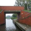
There is a bridge here which takes a minor road over the canal.


Amenities
 
Maps
If you are a user and are logged on, or if you are actively planning a route, a map will be displayed here.
Show on external mapping site: Google | OSM | Bing
 
Photos
 
External websites
There are no links to external websites from here.
Why not log in and add some (select "External websites" from the menu (sometimes this is under "Edit"))?
 
Nearest facilities

Mouseover for more information or show routes to facility

Nearest water point

In the direction of Northcroft Lane Arm

Ham Manor Marina4 miles, 2¼ furlongs and 6 locks away
On this waterway in the direction of Northcroft Lane Arm
Kintbury Services11 miles, 3 furlongs and 15 locks away
Travel to Northcroft Lane Arm, then on the Kennet and Avon Canal (Main Line) to Kintbury Services
Station Road Bridge No 8314 miles, 2¾ furlongs and 18 locks away
Travel to Northcroft Lane Arm, then on the Kennet and Avon Canal (Main Line) to Station Road Bridge No 83
Great Bedwyn Wharf19 miles, 2½ furlongs and 28 locks away
Travel to Northcroft Lane Arm, then on the Kennet and Avon Canal (Main Line) to Great Bedwyn Wharf

In the direction of High Bridge Reading

Aldermaston Lock No 953 miles, 3½ furlongs and 2 locks away
On this waterway in the direction of High Bridge Reading
Tyle Mill Lock C&RT Services5 miles, 6¼ furlongs and 6 locks away
On this waterway in the direction of High Bridge Reading
Thames & Kennet Marina14 miles, 1½ furlongs and 14 locks away
Travel to High Bridge Reading, then on the River Thames (River Kennet) to Thames - Kennet Junction (Kennet Mouth), then on the River Thames (below Oxford) to Thames & Kennet Marina
Shiplake Lock18 miles, 6½ furlongs and 15 locks away
Travel to High Bridge Reading, then on the River Thames (River Kennet) to Thames - Kennet Junction (Kennet Mouth), then on the River Thames (below Oxford) to Shiplake Lock

Nearest rubbish disposal

In the direction of Northcroft Lane Arm

Ham Manor Marina4 miles, 2¼ furlongs and 6 locks away
On this waterway in the direction of Northcroft Lane Arm
Kintbury Services11 miles, 3 furlongs and 15 locks away
Travel to Northcroft Lane Arm, then on the Kennet and Avon Canal (Main Line) to Kintbury Services
Great Bedwyn Wharf19 miles, 2½ furlongs and 28 locks away
Travel to Northcroft Lane Arm, then on the Kennet and Avon Canal (Main Line) to Great Bedwyn Wharf

In the direction of High Bridge Reading

Aldermaston Lock No 953 miles, 3½ furlongs and 2 locks away
On this waterway in the direction of High Bridge Reading
Tyle Mill Lock C&RT Services5 miles, 6¼ furlongs and 6 locks away
On this waterway in the direction of High Bridge Reading
Shiplake Lock18 miles, 6½ furlongs and 15 locks away
Travel to High Bridge Reading, then on the River Thames (River Kennet) to Thames - Kennet Junction (Kennet Mouth), then on the River Thames (below Oxford) to Shiplake Lock
Mapledurham Lock19 miles, 1¾ furlongs and 15 locks away
Travel to High Bridge Reading, then on the River Thames (River Kennet) to Thames - Kennet Junction (Kennet Mouth), then on the River Thames (below Oxford) to Mapledurham Lock

Nearest chemical toilet disposal

In the direction of Northcroft Lane Arm

Ham Manor Marina4 miles, 2¼ furlongs and 6 locks away
On this waterway in the direction of Northcroft Lane Arm
Kintbury Services11 miles, 3 furlongs and 15 locks away
Travel to Northcroft Lane Arm, then on the Kennet and Avon Canal (Main Line) to Kintbury Services
Station Road Bridge No 8314 miles, 2¾ furlongs and 18 locks away
Travel to Northcroft Lane Arm, then on the Kennet and Avon Canal (Main Line) to Station Road Bridge No 83
Great Bedwyn Wharf19 miles, 2½ furlongs and 28 locks away
Travel to Northcroft Lane Arm, then on the Kennet and Avon Canal (Main Line) to Great Bedwyn Wharf

In the direction of High Bridge Reading

Aldermaston Lock No 953 miles, 3½ furlongs and 2 locks away
On this waterway in the direction of High Bridge Reading
Tyle Mill Lock C&RT Services5 miles, 6¼ furlongs and 6 locks away
On this waterway in the direction of High Bridge Reading
Thames & Kennet Marina14 miles, 1½ furlongs and 14 locks away
Travel to High Bridge Reading, then on the River Thames (River Kennet) to Thames - Kennet Junction (Kennet Mouth), then on the River Thames (below Oxford) to Thames & Kennet Marina
Shiplake Lock18 miles, 6½ furlongs and 15 locks away
Travel to High Bridge Reading, then on the River Thames (River Kennet) to Thames - Kennet Junction (Kennet Mouth), then on the River Thames (below Oxford) to Shiplake Lock
Mapledurham Lock19 miles, 1¾ furlongs and 15 locks away
Travel to High Bridge Reading, then on the River Thames (River Kennet) to Thames - Kennet Junction (Kennet Mouth), then on the River Thames (below Oxford) to Mapledurham Lock

Nearest place to turn

In the direction of Northcroft Lane Arm

Winding Hole above Midgham Lock½ furlongs and 1 lock away
On this waterway in the direction of Northcroft Lane Arm
Winding Hole below Monkey Marsh Lock1 mile, 5 furlongs and 2 locks away
On this waterway in the direction of Northcroft Lane Arm
Widmead Winding Hole2 miles, 7¼ furlongs and 4 locks away
On this waterway in the direction of Northcroft Lane Arm
Winding Hole below Bulls Lock3 miles, 3¼ furlongs and 4 locks away
On this waterway in the direction of Northcroft Lane Arm
Winding Hole above Ham Mills Lock4 miles, 1¾ furlongs and 6 locks away
On this waterway in the direction of Northcroft Lane Arm
Winding Hole below Greenham Lock4 miles, 5¼ furlongs and 6 locks away
On this waterway in the direction of Northcroft Lane Arm
Mill Lane Arm5 miles, ¼ furlongs and 7 locks away
On this waterway in the direction of Northcroft Lane Arm
Newbury Wharf5 miles, 1 furlong and 7 locks away
On this waterway in the direction of Northcroft Lane Arm
Winding Hole above Newbury Lock5 miles, 3½ furlongs and 8 locks away
Travel to Northcroft Lane Arm, then on the Kennet and Avon Canal (Main Line) to Winding Hole above Newbury Lock
Newbury West Fields Winding Hole5 miles, 7¼ furlongs and 8 locks away
Travel to Northcroft Lane Arm, then on the Kennet and Avon Canal (Main Line) to Newbury West Fields Winding Hole

In the direction of High Bridge Reading

Winding Hole below Heals Lock5¾ furlongs and 1 lock away
On this waterway in the direction of High Bridge Reading
Frouds Bridge Marina (entrance)2 miles, 3 furlongs and 2 locks away
On this waterway in the direction of High Bridge Reading
Aldermaston Arm3 miles, 3¾ furlongs and 3 locks away
On this waterway in the direction of High Bridge Reading
Winding Hole below Padworth Lock3 miles, 6¼ furlongs and 4 locks away
On this waterway in the direction of High Bridge Reading
Winding Hole by Ufton Swing Bridge5 miles, 1¼ furlongs and 5 locks away
On this waterway in the direction of High Bridge Reading
Tyle Mill Winding Hole5 miles, 4 furlongs and 5 locks away
On this waterway in the direction of High Bridge Reading
Winding Hole below Tyle Mill Lock5 miles, 6½ furlongs and 6 locks away
On this waterway in the direction of High Bridge Reading
Draper's Osier Bed Stream Leaves6 miles, 1¼ furlongs and 6 locks away
On this waterway in the direction of High Bridge Reading
Winding Hole below Sulhampstead Lock6 miles, 4¾ furlongs and 7 locks away
On this waterway in the direction of High Bridge Reading
Sheffield Lock Weir Entrance7 miles, 1 furlong and 7 locks away
On this waterway in the direction of High Bridge Reading

Nearest self-operated pump-out

In the direction of Northcroft Lane Arm

Kintbury Services11 miles, 3 furlongs and 15 locks away
Travel to Northcroft Lane Arm, then on the Kennet and Avon Canal (Main Line) to Kintbury Services
Great Bedwyn Wharf19 miles, 2½ furlongs and 28 locks away
Travel to Northcroft Lane Arm, then on the Kennet and Avon Canal (Main Line) to Great Bedwyn Wharf

In the direction of High Bridge Reading

Tyle Mill Lock C&RT Services5 miles, 6¼ furlongs and 6 locks away
On this waterway in the direction of High Bridge Reading
Mapledurham Lock19 miles, 1¾ furlongs and 15 locks away
Travel to High Bridge Reading, then on the River Thames (River Kennet) to Thames - Kennet Junction (Kennet Mouth), then on the River Thames (below Oxford) to Mapledurham Lock

Nearest boatyard pump-out

In the direction of Northcroft Lane Arm

Newbury Marina4 miles, 7 furlongs and 7 locks away
On this waterway in the direction of Northcroft Lane Arm

In the direction of High Bridge Reading

Thames & Kennet Marina14 miles, 1½ furlongs and 14 locks away
Travel to High Bridge Reading, then on the River Thames (River Kennet) to Thames - Kennet Junction (Kennet Mouth), then on the River Thames (below Oxford) to Thames & Kennet Marina
Direction of TV transmitter (From Wolfbane Cybernetic)
 
 
Geograph
 
Wikipedia

There is no page on Wikipedia called “Midgham Bridge”

Wikipedia pages that might relate to Midgham Bridge
[Kennet and Avon Canal] obstructions remained on either side. Frounds swing bridge could not be opened and the restoration of Midgham Lock had not been finished; both were completed [Midgham Lock] Midgham Lock is a lock on the Kennet and Avon Canal, between Thatcham and Woolhampton, Berkshire, England. Midgham Lock was built between 1718 and 1723 [List of places in Berkshire] Hermitage Holybrook Hungerford Inkpen Kintbury Lambourn Leckhampstead Midgham Newbury Padworth Pangbourne Peasemore Purley on Thames Shaw cum Donnington [Woolhampton] station but, according to local legend, was renamed Midgham railway station (after the village of Midgham, one mile west-northwest) in order to avoid possible [Sandleford Priory (monastery)] of Midgham meadows, Thatcham, formerly let with Sandleford farm, comprising 37 acres, by the Dean and Canons of Windsor to William Poyntz of Midgham. Counterpart [Berks and Hants Canal] west of Newbury, Giles's route left the Kennet and Avon Canal between Midgham Lock and Heale's Lock, running south to Brimpton before meeting with Rennie's [List of extant baronetcies] 15 June 1922 1088 Boles of Bishop's Lydeard 17 June 1922 1089 Black of Midgham 19 June 1922 1090 Harmsworth of Freshwater Grove 21 June 1922 Dormant; [Aldermaston Wharf] canal, close to the lift bridge Nearby are the towns of Newbury, Thatcham and Reading. Neighbouring villages are Aldermaston, Midgham, Beenham, Woolhampton [Reading–Taunton line] proposal was not implemented. Communities served Reading–Theale–Aldermaston–Midgham and Woolhampton–Thatcham–Newbury–Kintbury–Hungerford–Great Bedwyn After [Great Western Railway (train operating company)] covered events such as the reaction to the Manchester Arena and London Bridge attacks, and several days of severe disruption. The franchise was due to
 
Google

Results of Google Search

Notice Details | Cranwells Weir 7, between Midgham Lock 92 and ...
Nov 20, 2017 ... Please be aware the navigation will be closed between Midgham Lock 92 and Cranwell's Swingbridge 35. Description: To replace the timber sluice element of the weir. Following customer feedback and the subsequent cancellation of the closure at Station Road Bridge, Hungerford, the works have been ...
Kennet & Avon Canal - Bridge List
No.26 Towney Bridge. No.27 Padworth Swing Bridge. No.28 Aldermarston Lift Bridge. No.28 Aldermaston Wharf Footbridge. No.29 Froud's Bridge. No.30 Wickham Knight Footbridge. No.31 Woolhampton Swing Bridge. No.33 Oxlease Swing Bridge. No.35 Cranwell's Swing Bridge. No.36 Midgham Bridge. No.40 Colthrop ...
CaRT Proposed Winter Notices 2017/18
May 12, 2017 ... Towpath Closed. No. Date. 06-11-2017 08:00 to 01-12-2017 16:00. Affected Waterway. Kennet and Avon - Kennet & Avon Canal. Location. Cranwells Weir 7, between Midgham Road Bridge 36 and Cranwells. Swingbridge 35, Kennet and Avon Canal. Upstream winding hole. Above Midgham Lock 92.
16 :: Kennet Navigation from Reading to Newbury :: Geograph ...
Colthrop: Colthrop Bridge No.39: Gravel workings: ... A crisp morning on the stretch of canal between Midgham and Colthrop Locks. by Andrew Smith. 2007. SU5466 : Weir ... 2009 - When travelling along the Kennet valley whether by train , boat or walking the visitor may have noticed a number of lakes. Most of these are ...
List of locks on the Kennet and Avon Canal - Wikipedia
The Kennet and Avon Canal is a canal in southern England. The name may refer to either the route of the original Kennet and Avon Canal Company, which linked the River Kennet at Newbury to the River Avon at Bath, or to the entire navigation between the River Thames at Reading and the Floating Harbour at Bristol, ...
5:35 Newbury | Full Racecard | 24 March 2018 | Racing Post
Goffs UK Spring Sales Bumper (A Standard Open National Hunt Flat Race), 24th March 2018. 5:35 at Newbury, full racecard from Racing Post.
Kennet and Avon Canal - Wikipedia
Frounds swing bridge could not be opened and the restoration of Midgham Lock had not been finished; both were completed the following year. Re-puddling of the Crofton pounds was carried out in 1989, along with the reconstruction of Midgham Bridge. Restoration of the turf-sided Monkey Marsh Lock proved difficult  ...
National Rail Enquiries - Cleared service disruptions
Cleared service disruptions. PAGE LAST UPDATED: 11/02/2018 18:36. Update now ... Parkway and Rugeley Trent Valley. More information on Disruption between Tame Bridge Parkway and Rugeley Trent Valley .... Brockenhurst and Lymington Pier. More information on No trains between Brockenhurst and Lymington Pier.
Trains London Waterloo to Kew Gardens - Train Timetables ...
Find cheap tickets and live train times from London Waterloo to Kew Gardens with Trainline - Europe's leading independent train ticket retailer.
Signal Box Diagrams
S144 (1930), Kennet Bridge. Reading East. L193 (c.1930); X36 (c.1957); (1941 not yet available), Reading Main Line East. D216, Reading Middle. Reading West. X25 (1960) P57 (1958), Reading Main Line West. Reading (Panel). Cow Lane. L42 (c. 1900) L43 (1945), Reading West Jcn. Scours Lane Jcn. P48 (1925)  ...