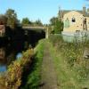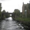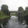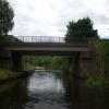
Forge Lane Bridge
is a minor waterways place
on the Calder and Hebble Navigation (Main Line) between
Dewsbury Arm Junction (Junction of Calder and Hebble (Main Line) with the Dewsbury Arm ) (7 furlongs
and 2 locks
to the east) and
Mirfield (2 miles and 2 furlongs
and 2 locks
to the west).
The nearest place in the direction of Dewsbury Arm Junction is Thornhill Pipe Bridge;
a few yards
away.
The nearest place in the direction of Mirfield is Thornhill Railway Bridge No 31;
¾ furlongs
away.
There may be access to the towpath here.
Mooring here is unrated.
There is a bridge here which takes a minor road over the canal.
| Thornhill Former Railway Bridge No 35 | 5¾ furlongs | |
| Slaithwaite Bridge No 34 | 4½ furlongs | |
| Brewery Bridge No 33 | 2¼ furlongs | |
| Perserverance PH Visitor Moorings | ¼ furlongs | |
| Thornhill Pipe Bridge | a few yards | |
| Forge Lane Bridge | ||
| Thornhill Railway Bridge No 31 | ¾ furlongs | |
| Thornhill Railway Junction Pipe Bridge | 1¼ furlongs | |
| Schofield Bridge No 25 | 1¼ furlongs | |
| Thornhill Railway Bridge No 24 | 3 furlongs | |
| Thornhill Flood Gates Pipe Bridge | 3½ furlongs | |
There are no links to external websites from here.
Why not log in and add some (select "External websites" from the menu (sometimes this is under "Edit"))?
Why not log in and add some (select "External websites" from the menu (sometimes this is under "Edit"))?
Mouseover for more information or show routes to facility
Nearest water point
In the direction of Salterhebble Junction
Shepley Bridge Sanitary Station — 1 mile, 4½ furlongs and 2 locks away
On this waterway in the direction of Salterhebble Junction
Brighouse Basin — 6 miles, 7½ furlongs and 8 locks away
On this waterway in the direction of Salterhebble Junction
Aspley Basin (Huddersfield) — 8 miles, 1¼ furlongs and 13 locks away
Travel to Cooper Bridge Junction, then on the Huddersfield Broad Canal to Aspley Basin (Huddersfield)
Salterhebble Sanitary Station — 11 miles, 1½ furlongs and 17 locks away
On this waterway in the direction of Salterhebble Junction
Salterhebble Junction — 11 miles, 2 furlongs and 18 locks away
On this waterway in the direction of Salterhebble Junction
Sowerby Bridge Basin — 13 miles, 3¾ furlongs and 18 locks away
Travel to Salterhebble Junction, then on the Calder and Hebble Navigation (Main Line) to Sowerby Bridge Basin
Hebden Bridge Services — 18 miles, 7 furlongs and 25 locks away
Travel to Salterhebble Junction, then on the Calder and Hebble Navigation (Main Line) to Sowerby Bridge Junction, then on the Rochdale Canal to Hebden Bridge Services
Waterside Lock No 21E — 12 miles, 6¾ furlongs and 33 locks away
Travel to Cooper Bridge Junction, then on the Huddersfield Broad Canal to Aspley Basin (Huddersfield), then on the Huddersfield Narrow Canal to Waterside Lock No 21E
Slaithwaite Winding Hole — 12 miles, 7½ furlongs and 34 locks away
Travel to Cooper Bridge Junction, then on the Huddersfield Broad Canal to Aspley Basin (Huddersfield), then on the Huddersfield Narrow Canal to Slaithwaite Winding Hole
Standedge Tunnel (eastern entrance) — 16 miles, 2¼ furlongs and 55 locks away
Travel to Cooper Bridge Junction, then on the Huddersfield Broad Canal to Aspley Basin (Huddersfield), then on the Huddersfield Narrow Canal to Standedge Tunnel (eastern entrance)
In the direction of Fall Ing Junction
Broad Cut Low Lock No 3 — 5 miles, ½ furlongs and 6 locks away
On this waterway in the direction of Fall Ing Junction
Ramsdens Bridge Sanitary Station — 10 miles, 4¼ furlongs and 10 locks away
Travel to Fall Ing Junction, then on the Aire and Calder Navigation (Wakefield Section) to Ramsdens Bridge Sanitary Station
Stanley Ferry Water Point — 10 miles, 4¾ furlongs and 10 locks away
Travel to Fall Ing Junction, then on the Aire and Calder Navigation (Wakefield Section) to Stanley Ferry Water Point
King's Road Lock No 3 — 12 miles, 2 furlongs and 11 locks away
Travel to Fall Ing Junction, then on the Aire and Calder Navigation (Wakefield Section) to King's Road Lock No 3
Woodnook Lock No 6 — 13 miles, 3½ furlongs and 12 locks away
Travel to Fall Ing Junction, then on the Aire and Calder Navigation (Wakefield Section) to Woodnook Lock No 6
Fairies Hill Moorings — 13 miles, 7 furlongs and 14 locks away
Travel to Fall Ing Junction, then on the Aire and Calder Navigation (Wakefield Section) to Fairies Hill Lock Junction, then on the Aire and Calder Navigation (Wakefield Section - Fairies Hill Mooring Arm) to Fairies Hill Moorings
Castleford Sanitary Station — 15 miles, 6¼ furlongs and 14 locks away
Travel to Fall Ing Junction, then on the Aire and Calder Navigation (Wakefield Section) to Castleford Junction, then on the Aire and Calder Navigation (Main Line - Goole to Castleford) to Castleford Sanitary Station
Bulholme Lock No 10 — 16 miles, 3 furlongs and 14 locks away
Travel to Fall Ing Junction, then on the Aire and Calder Navigation (Wakefield Section) to Castleford Junction, then on the Aire and Calder Navigation (Main Line - Goole to Castleford) to Bulholme Lock No 10
Lemonroyd Lock No 7 — 19 miles, ¾ furlongs and 13 locks away
Travel to Fall Ing Junction, then on the Aire and Calder Navigation (Wakefield Section) to Castleford Junction, then on the Aire and Calder Navigation (Main Line - Castleford to Leeds) to Lemonroyd Lock No 7
Lemonroyd Marina — 19 miles, 1¾ furlongs and 14 locks away
Travel to Fall Ing Junction, then on the Aire and Calder Navigation (Wakefield Section) to Castleford Junction, then on the Aire and Calder Navigation (Main Line - Castleford to Leeds) to Lemonroyd MarinaNearest rubbish disposal
In the direction of Salterhebble Junction
Shepley Bridge Sanitary Station — 1 mile, 4½ furlongs and 2 locks away
On this waterway in the direction of Salterhebble Junction
Brighouse Lower Basin Visitor Moorings — 6 miles, 7¼ furlongs and 7 locks away
On this waterway in the direction of Salterhebble Junction
Aspley Basin (Huddersfield) — 8 miles, 1¼ furlongs and 13 locks away
Travel to Cooper Bridge Junction, then on the Huddersfield Broad Canal to Aspley Basin (Huddersfield)
Salterhebble Sanitary Station — 11 miles, 1½ furlongs and 17 locks away
On this waterway in the direction of Salterhebble Junction
Sowerby Bridge Basin — 13 miles, 3¾ furlongs and 18 locks away
Travel to Salterhebble Junction, then on the Calder and Hebble Navigation (Main Line) to Sowerby Bridge Basin
Hebden Bridge Services — 18 miles, 7 furlongs and 25 locks away
Travel to Salterhebble Junction, then on the Calder and Hebble Navigation (Main Line) to Sowerby Bridge Junction, then on the Rochdale Canal to Hebden Bridge Services
Pickle Lock No 22E — 13 miles and 34 locks away
Travel to Cooper Bridge Junction, then on the Huddersfield Broad Canal to Aspley Basin (Huddersfield), then on the Huddersfield Narrow Canal to Pickle Lock No 22E
In the direction of Fall Ing Junction
Horbury Basin Residential Moorings & Sanitary Station — 2 miles, 7¾ furlongs and 5 locks away
On this waterway in the direction of Fall Ing Junction
Ramsdens Bridge Visitor Moorings — 10 miles, 4½ furlongs and 10 locks away
Travel to Fall Ing Junction, then on the Aire and Calder Navigation (Wakefield Section) to Ramsdens Bridge Visitor Moorings
Castleford Sanitary Station — 15 miles, 6¼ furlongs and 14 locks away
Travel to Fall Ing Junction, then on the Aire and Calder Navigation (Wakefield Section) to Castleford Junction, then on the Aire and Calder Navigation (Main Line - Goole to Castleford) to Castleford Sanitary Station
Lemonroyd Marina — 19 miles, 1¾ furlongs and 14 locks away
Travel to Fall Ing Junction, then on the Aire and Calder Navigation (Wakefield Section) to Castleford Junction, then on the Aire and Calder Navigation (Main Line - Castleford to Leeds) to Lemonroyd MarinaNearest chemical toilet disposal
In the direction of Salterhebble Junction
Shepley Bridge Sanitary Station — 1 mile, 4½ furlongs and 2 locks away
On this waterway in the direction of Salterhebble Junction
Brighouse Basin — 6 miles, 7½ furlongs and 8 locks away
On this waterway in the direction of Salterhebble Junction
Aspley Basin (Huddersfield) — 8 miles, 1¼ furlongs and 13 locks away
Travel to Cooper Bridge Junction, then on the Huddersfield Broad Canal to Aspley Basin (Huddersfield)
Salterhebble Sanitary Station — 11 miles, 1½ furlongs and 17 locks away
On this waterway in the direction of Salterhebble Junction
Sowerby Bridge Basin — 13 miles, 3¾ furlongs and 18 locks away
Travel to Salterhebble Junction, then on the Calder and Hebble Navigation (Main Line) to Sowerby Bridge Basin
Hebden Bridge Services — 18 miles, 7 furlongs and 25 locks away
Travel to Salterhebble Junction, then on the Calder and Hebble Navigation (Main Line) to Sowerby Bridge Junction, then on the Rochdale Canal to Hebden Bridge Services
Waterside Lock No 21E — 12 miles, 6¾ furlongs and 33 locks away
Travel to Cooper Bridge Junction, then on the Huddersfield Broad Canal to Aspley Basin (Huddersfield), then on the Huddersfield Narrow Canal to Waterside Lock No 21E
Pickle Lock No 22E — 13 miles and 34 locks away
Travel to Cooper Bridge Junction, then on the Huddersfield Broad Canal to Aspley Basin (Huddersfield), then on the Huddersfield Narrow Canal to Pickle Lock No 22E
In the direction of Fall Ing Junction
Savile Town Wharf and Basin (Dewsbury) — 1 mile, 7 furlongs and 2 locks away
Travel to Dewsbury Arm Junction, then on the Calder and Hebble Navigation (Dewsbury Old Cut) to Savile Town Wharf and Basin (Dewsbury)
Horbury Basin Residential Moorings & Sanitary Station — 2 miles, 7¾ furlongs and 5 locks away
On this waterway in the direction of Fall Ing Junction
Ramsdens Bridge Sanitary Station — 10 miles, 4¼ furlongs and 10 locks away
Travel to Fall Ing Junction, then on the Aire and Calder Navigation (Wakefield Section) to Ramsdens Bridge Sanitary Station
Fairies Hill Moorings — 13 miles, 7 furlongs and 14 locks away
Travel to Fall Ing Junction, then on the Aire and Calder Navigation (Wakefield Section) to Fairies Hill Lock Junction, then on the Aire and Calder Navigation (Wakefield Section - Fairies Hill Mooring Arm) to Fairies Hill Moorings
Castleford Sanitary Station — 15 miles, 6¼ furlongs and 14 locks away
Travel to Fall Ing Junction, then on the Aire and Calder Navigation (Wakefield Section) to Castleford Junction, then on the Aire and Calder Navigation (Main Line - Goole to Castleford) to Castleford Sanitary Station
Lemonroyd Marina — 19 miles, 1¾ furlongs and 14 locks away
Travel to Fall Ing Junction, then on the Aire and Calder Navigation (Wakefield Section) to Castleford Junction, then on the Aire and Calder Navigation (Main Line - Castleford to Leeds) to Lemonroyd MarinaNearest place to turn
In the direction of Salterhebble Junction
Shepley Bridge Marina — 1 mile, 4¼ furlongs and 2 locks away
On this waterway in the direction of Salterhebble Junction
Battye Weir Entrance — 4 miles and 3 locks away
On this waterway in the direction of Salterhebble Junction
Cooper Bridge Junction — 4 miles, 5¼ furlongs and 4 locks away
On this waterway in the direction of Salterhebble Junction
Deighton Road Bridge Winding Hole — 5 miles, 7 furlongs and 8 locks away
Travel to Cooper Bridge Junction, then on the Huddersfield Broad Canal to Deighton Road Bridge Winding Hole
Brighouse Basin — 6 miles, 7½ furlongs and 8 locks away
On this waterway in the direction of Salterhebble Junction
Ganny Winding Hole — 7 miles, 5 furlongs and 9 locks away
On this waterway in the direction of Salterhebble Junction
New Road Winding Hole — 7 miles, ¾ furlongs and 13 locks away
Travel to Cooper Bridge Junction, then on the Huddersfield Broad Canal to New Road Winding Hole
Anchor Street Winding Hole — 7 miles, 4¼ furlongs and 13 locks away
Travel to Cooper Bridge Junction, then on the Huddersfield Broad Canal to Anchor Street Winding Hole
Aspley Basin (Huddersfield) — 8 miles, 1¼ furlongs and 13 locks away
Travel to Cooper Bridge Junction, then on the Huddersfield Broad Canal to Aspley Basin (Huddersfield)
University Arm — 8 miles, 1¾ furlongs and 13 locks away
Travel to Cooper Bridge Junction, then on the Huddersfield Broad Canal to Aspley Basin (Huddersfield), then on the Huddersfield Narrow Canal to University Arm
Salterhebble Wharf — 11 miles, 1 furlong and 16 locks away
On this waterway in the direction of Salterhebble Junction
Salterhebble Bottom Basin Visitor Moorings — 11 miles, 1 furlong and 16 locks away
On this waterway in the direction of Salterhebble Junction
In the direction of Fall Ing Junction
Dewsbury Arm Junction — 7 furlongs and 2 locks away
On this waterway in the direction of Fall Ing Junction
Savile Town Wharf and Basin (Dewsbury) — 1 mile, 7 furlongs and 2 locks away
Travel to Dewsbury Arm Junction, then on the Calder and Hebble Navigation (Dewsbury Old Cut) to Savile Town Wharf and Basin (Dewsbury)
Horbury Basin Residential Moorings & Sanitary Station — 2 miles, 7¾ furlongs and 5 locks away
On this waterway in the direction of Fall Ing Junction
Waller Bridge Winding Hole — 4 miles, 6¾ furlongs and 6 locks away
On this waterway in the direction of Fall Ing Junction
Broad Cut Weir Entrance — 5 miles, ¾ furlongs and 7 locks away
On this waterway in the direction of Fall Ing Junction
Wakefield Weir Entrance — 7 miles, 5¼ furlongs and 8 locks away
On this waterway in the direction of Fall Ing Junction
Stanley Ferry Marina — 10 miles, 5¾ furlongs and 10 locks away
Travel to Fall Ing Junction, then on the Aire and Calder Navigation (Wakefield Section) to Stanley Ferry Marina
Fairies Hill Lock Arm — 13 miles, 2 furlongs and 12 locks away
Travel to Fall Ing Junction, then on the Aire and Calder Navigation (Wakefield Section) to Fairies Hill Lock ArmNearest self-operated pump-out
In the direction of Salterhebble Junction
Hebden Bridge Services — 18 miles, 7 furlongs and 25 locks away
Travel to Salterhebble Junction, then on the Calder and Hebble Navigation (Main Line) to Sowerby Bridge Junction, then on the Rochdale Canal to Hebden Bridge Services
Slaithwaite Winding Hole — 12 miles, 7½ furlongs and 34 locks away
Travel to Cooper Bridge Junction, then on the Huddersfield Broad Canal to Aspley Basin (Huddersfield), then on the Huddersfield Narrow Canal to Slaithwaite Winding Hole
In the direction of Fall Ing Junction
Ramsdens Bridge Sanitary Station — 10 miles, 4¼ furlongs and 10 locks away
Travel to Fall Ing Junction, then on the Aire and Calder Navigation (Wakefield Section) to Ramsdens Bridge Sanitary Station
Castleford Sanitary Station — 15 miles, 6¼ furlongs and 14 locks away
Travel to Fall Ing Junction, then on the Aire and Calder Navigation (Wakefield Section) to Castleford Junction, then on the Aire and Calder Navigation (Main Line - Goole to Castleford) to Castleford Sanitary StationNearest boatyard pump-out
In the direction of Salterhebble Junction
Shepley Bridge Marina — 1 mile, 4¼ furlongs and 2 locks away
On this waterway in the direction of Salterhebble Junction
Aspley Basin (Huddersfield) — 8 miles, 1¼ furlongs and 13 locks away
Travel to Cooper Bridge Junction, then on the Huddersfield Broad Canal to Aspley Basin (Huddersfield)
Sowerby Bridge Basin — 13 miles, 3¾ furlongs and 18 locks away
Travel to Salterhebble Junction, then on the Calder and Hebble Navigation (Main Line) to Sowerby Bridge Basin
In the direction of Fall Ing Junction
Lemonroyd Marina — 19 miles, 1¾ furlongs and 14 locks away
Travel to Fall Ing Junction, then on the Aire and Calder Navigation (Wakefield Section) to Castleford Junction, then on the Aire and Calder Navigation (Main Line - Castleford to Leeds) to Lemonroyd MarinaDirection of TV transmitter (From Wolfbane Cybernetic)
There is no page on Wikipedia called “Forge Lane Bridge”
Wikipedia pages that might relate to Forge Lane Bridge
[Malin Bridge]
use the scheme. There are two schools in the Malin Bridge area, Forge Valley School on Wood Lane opened in September 2011 and replaced Wisewood School
[Little Aston]
Little Aston Park, Claverdon Park, Rosemary Hill Road, Little Aston Lane, Forge Lane, Walsall Road, Aldridge Road, Little Aston Hall and Lady Aston Park
[George Washington Bridge]
four lanes in each direction and a lower level with three lanes in each direction, for a total of 14 lanes of travel. The speed limit on the bridge is 45 mph
[Schuylkill Expressway]
a nine-lane freeway carrying four westbound lanes and five eastbound lanes that is designated as part of I-76, passing through the Valley Forge Interchange
[Pigeon Forge, Tennessee]
Pigeon Forge is a mountain resort city in Sevier County, Tennessee, in the southeastern United States. As of the 2010 census, the city had a total population
[Pennsylvania Route 23]
Visitor Center, at which point the route turns east onto four-lane divided Valley Forge Road and immediately comes to an interchange with the US 422 freeway
[River Don, Yorkshire]
water to enter the head goit. The weir by Station Lane, Oughtibridge served the Upper Middlewood forge, described as a tilt in the sources, as it had a
[Peace Bridge]
The Peace Bridge is an international bridge between Canada and the United States at the east end of Lake Erie at the source of the Niagara River, about
[Bromford Bridge railway station]
Midland Railway in 1896. It was built on the site of the previous Bromford Forge railway station which had been opened by the Birmingham and Derby Junction
[Wadsley Bridge]
start of the 20th century included the Lepping Forge iron and steel works at the junction of Leppings Lane and Penistone Road, built by Joseph Clifton Allen


![End of the line, near Thornhill Junction. The Spen Valley railway line [now a Greenway] no longer reaches its original junction with the former Lancashire and Yorkshire main line. by Christine Johnstone – 05 October 2010](https://s0.geograph.org.uk/geophotos/02/10/04/2100444_3b8b1be0_120x120.jpg)


![Fall Ing bridge. A double bridge over the Calder and Hebble Navigation, one for pedestrian and the other an aqueduct. See [[5629392]] for a side view. by Stephen Craven – 07 November 2021](https://s1.geograph.org.uk/geophotos/07/01/42/7014217_d435a7f0_120x120.jpg)


