CanalPlanAC

M40 Motorway Bridge No 182A

 
M40, Cherwell OX17 3QP, United Kingdom (M40)
 
Information about the place
M40 Motorway Bridge No 182A is a minor waterways place on the Oxford Canal (Southern Section - Main Line) between Somerton Bridge No 196 (4 miles and 5¾ furlongs and 3 locks to the south) and Concorde Avenue Bridge No 165 (4 miles and 3¾ furlongs and 2 locks to the northwest).
 
 
The nearest place in the direction of Somerton Bridge No 196 is Coles Lift Bridge No 183; ¼ furlongs away.
 
The nearest place in the direction of Concorde Avenue Bridge No 165 is Banbury and Cheltenham Direct Railway Bridge (dismantled); 1¾ furlongs away.

Mooring here is unrated.

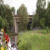
There is a bridge here which takes a motorway over the canal.


Amenities

Amenities nearby at Banbury and Cheltenham Direct Railway Bridge (dismantled)

 Butchers Arms
 
Maps
If you are a user and are logged on, or if you are actively planning a route, a map will be displayed here.
Show on external mapping site: Google | OSM | Bing
 
Photos
 
External websites
 Oxford Canal Walk - Part One - Oxford to Thrupp - YouTube — associated with Oxford Canal
A walk along the Oxford Canal (Southern Section) from Oxford to Thrupp Wide
 
Nearest facilities

Mouseover for more information or show routes to facility

Nearest water point

In the direction of Napton Junction

Cherwell Street Facilities4 miles, 3¾ furlongs and 2 locks away
On this waterway in the direction of Napton Junction
Banbury Lock No 294 miles, 4 furlongs and 2 locks away
On this waterway in the direction of Napton Junction
Sovereign Wharf4 miles, 6¼ furlongs and 3 locks away
On this waterway in the direction of Napton Junction
Cropredy Services8 miles, 7¾ furlongs and 6 locks away
On this waterway in the direction of Napton Junction
Cropredy Marina (southern basin)9 miles, 4½ furlongs and 7 locks away
On this waterway in the direction of Napton Junction
Cropredy Marina (northern basins)9 miles, 4¾ furlongs and 7 locks away
On this waterway in the direction of Napton Junction
Fenny Compton Wharf15 miles, 2¼ furlongs and 15 locks away
On this waterway in the direction of Napton Junction

In the direction of End of Hythe Bridge Arm

Aynho Wharf2 miles, 2 furlongs and 2 locks away
On this waterway in the direction of End of Hythe Bridge Arm
Heyford Wharf8 miles, 2¼ furlongs and 5 locks away
On this waterway in the direction of End of Hythe Bridge Arm
Heyford Wharf Bridge No 2068 miles, 2½ furlongs and 5 locks away
On this waterway in the direction of End of Hythe Bridge Arm
Thrupp Cruising Club15 miles, 6½ furlongs and 10 locks away
On this waterway in the direction of End of Hythe Bridge Arm
Aubreys Lift Bridge No 22115 miles, 6¾ furlongs and 10 locks away
On this waterway in the direction of End of Hythe Bridge Arm
Langford Lane Bridge No 22416 miles, 4¼ furlongs and 10 locks away
On this waterway in the direction of End of Hythe Bridge Arm
Wolvercote Junction Water Point19 miles, 4 furlongs and 12 locks away
On this waterway in the direction of End of Hythe Bridge Arm

Nearest rubbish disposal

In the direction of Napton Junction

Cherwell Street Facilities4 miles, 3¾ furlongs and 2 locks away
On this waterway in the direction of Napton Junction
Sovereign Wharf4 miles, 6¼ furlongs and 3 locks away
On this waterway in the direction of Napton Junction
Cropredy Services8 miles, 7¾ furlongs and 6 locks away
On this waterway in the direction of Napton Junction
Cropredy Marina (southern basin)9 miles, 4½ furlongs and 7 locks away
On this waterway in the direction of Napton Junction
Cropredy Marina (northern basins)9 miles, 4¾ furlongs and 7 locks away
On this waterway in the direction of Napton Junction
Fenny Compton Marina14 miles, 7½ furlongs and 15 locks away
On this waterway in the direction of Napton Junction

In the direction of End of Hythe Bridge Arm

Aynho Wharf2 miles, 2 furlongs and 2 locks away
On this waterway in the direction of End of Hythe Bridge Arm
Heyford Wharf8 miles, 2¼ furlongs and 5 locks away
On this waterway in the direction of End of Hythe Bridge Arm
Heyford Wharf Bridge No 2068 miles, 2½ furlongs and 5 locks away
On this waterway in the direction of End of Hythe Bridge Arm
Thrupp Cruising Club15 miles, 6½ furlongs and 10 locks away
On this waterway in the direction of End of Hythe Bridge Arm
Aubreys Lift Bridge No 22115 miles, 6¾ furlongs and 10 locks away
On this waterway in the direction of End of Hythe Bridge Arm

Nearest chemical toilet disposal

In the direction of Napton Junction

Cherwell Street Facilities4 miles, 3¾ furlongs and 2 locks away
On this waterway in the direction of Napton Junction
Sovereign Wharf4 miles, 6¼ furlongs and 3 locks away
On this waterway in the direction of Napton Junction
Cropredy Services8 miles, 7¾ furlongs and 6 locks away
On this waterway in the direction of Napton Junction
Cropredy Marina (southern basin)9 miles, 4½ furlongs and 7 locks away
On this waterway in the direction of Napton Junction

In the direction of End of Hythe Bridge Arm

Thrupp Cruising Club15 miles, 6½ furlongs and 10 locks away
On this waterway in the direction of End of Hythe Bridge Arm

Nearest place to turn

In the direction of Napton Junction

Twyford Wharf Winding Hole1 mile, 5¾ furlongs and 1 lock away
On this waterway in the direction of Napton Junction
Calthorpe Winding Hole3 miles, 6¼ furlongs and 2 locks away
On this waterway in the direction of Napton Junction
Grimsbury Wharf5 miles, 1¼ furlongs and 3 locks away
On this waterway in the direction of Napton Junction
Southam Road Winding Hole5 miles, 2¾ furlongs and 3 locks away
On this waterway in the direction of Napton Junction
Southam Road Footbridge Arm5 miles, 5¼ furlongs and 3 locks away
On this waterway in the direction of Napton Junction
Cropredy Services8 miles, 7¾ furlongs and 6 locks away
On this waterway in the direction of Napton Junction
Cropredy Marina (southern basin)9 miles, 4½ furlongs and 7 locks away
On this waterway in the direction of Napton Junction
Cropredy Marina (northern basins)9 miles, 4¾ furlongs and 7 locks away
On this waterway in the direction of Napton Junction
Clattercote Bridge Winding Hole10 miles, 7½ furlongs and 10 locks away
On this waterway in the direction of Napton Junction
Fenny Compton Marina14 miles, 7½ furlongs and 15 locks away
On this waterway in the direction of Napton Junction

In the direction of End of Hythe Bridge Arm

On this waterway in the direction of End of Hythe Bridge Arm
Aynho Wharf2 miles, 2 furlongs and 2 locks away
On this waterway in the direction of End of Hythe Bridge Arm
Somerton Deep Lock Winding Hole4 miles and 2 locks away
On this waterway in the direction of End of Hythe Bridge Arm
Heyford Wharf Winding Hole8 miles, 2 furlongs and 5 locks away
On this waterway in the direction of End of Hythe Bridge Arm
Heyford Wharf8 miles, 2¼ furlongs and 5 locks away
On this waterway in the direction of End of Hythe Bridge Arm
The Cleeves Winding Hole8 miles, 6 furlongs and 5 locks away
On this waterway in the direction of End of Hythe Bridge Arm
Kirtlington Winding Hole11 miles, 4½ furlongs and 7 locks away
On this waterway in the direction of End of Hythe Bridge Arm
Enslow Winding Hole13 miles, 2 furlongs and 8 locks away
On this waterway in the direction of End of Hythe Bridge Arm
Shipton Weir Junction14 miles, 6¼ furlongs and 9 locks away
On this waterway in the direction of End of Hythe Bridge Arm
Thrupp Wide15 miles, 6¾ furlongs and 10 locks away
On this waterway in the direction of End of Hythe Bridge Arm

Nearest self-operated pump-out

In the direction of Napton Junction

Cropredy Marina (southern basin)9 miles, 4½ furlongs and 7 locks away
On this waterway in the direction of Napton Junction

In the direction of End of Hythe Bridge Arm

Thrupp Cruising Club15 miles, 6½ furlongs and 10 locks away
On this waterway in the direction of End of Hythe Bridge Arm
Aubreys Lift Bridge No 22115 miles, 6¾ furlongs and 10 locks away
On this waterway in the direction of End of Hythe Bridge Arm

Nearest boatyard pump-out

In the direction of Napton Junction

Twyford Wharf1 mile, 5½ furlongs and 1 lock away
On this waterway in the direction of Napton Junction
Sovereign Wharf4 miles, 6¼ furlongs and 3 locks away
On this waterway in the direction of Napton Junction
Cropredy Marina (southern basin)9 miles, 4½ furlongs and 7 locks away
On this waterway in the direction of Napton Junction

In the direction of End of Hythe Bridge Arm

Aynho Wharf2 miles, 2 furlongs and 2 locks away
On this waterway in the direction of End of Hythe Bridge Arm
Heyford Wharf8 miles, 2¼ furlongs and 5 locks away
On this waterway in the direction of End of Hythe Bridge Arm
Enslow Wharf13 miles, 3¼ furlongs and 8 locks away
On this waterway in the direction of End of Hythe Bridge Arm
Direction of TV transmitter (From Wolfbane Cybernetic)
 
 
Geograph
 
Wikipedia

There is no page on Wikipedia called “M40 Motorway Bridge No 182A”

Wikipedia pages that might relate to M40 Motorway Bridge No 182A
[List of motorways in the United Kingdom] first "Managed Motorway"". Retrieved 23 June 2013. "A635(M) Mancunian Way only a single bridge". Pathetic Motorways. "Pathetic Motorways". pathetic.org [M1 motorway] the result of a motorway accident since a crash on the M40 in 1993. List of motorways in the United Kingdom "Driving directions to M1". Google Maps. Retrieved [M4 motorway] The M4, originally the London-South Wales Motorway, is a motorway in the United Kingdom running from west London to southwest Wales. The English section [Controlled-access highway] between motorways or a split/merge of two motorways. The motorway rules ends at exits, but not at junctions. At not so few bridges, motorways without [Bridge restaurant] A bridge restaurant or restaurant bridge is a restaurant, usually indoors, built like a bridge over a road, mostly over freeways or motorways. It usually [M50 motorway (Ireland)] The M50 motorway (Irish: Mótarbhealach M50) is a C-shaped orbital motorway in Dublin and the busiest motorway in Ireland. The current route was built [Ponte Morandi] 1963 and 1967 along Italy's A10 motorway over the river Polcevera, from which it derived its official name. The bridge is widely called "Ponte Morandi" [N3 road (Ireland)] A tolled motorway bypass replacement, the M3 motorway, was opened to traffic on 4 June 2010. The former section from its junction with the M50 to Dublin [List of longest bridges] February 2016. https://www.webuildgroup.com/en/projects/motorways-roads/rosario-victoria-motorway-bridge "Mayor Hanif flyover opens". bdnews24.com. Archived [Margaret Hunt Hill Bridge] began in December 2005. The bridge cost $117 million to build. A Dallas Morning News analysis put the project's total cost at $182 million. Beginning in 2004
 
Google

Results of Google Search

Bridge 182A: M40 Motorway Bridge © Mat Fascione :: Geograph ...
Jun 8, 2015 ... Bridge 182A: M40 Motorway Bridge. taken 5 years ago, near to Kings Sutton, Northamptonshire, Great Britain. More sizes. Bridge 182A: M40 ...
Text
No funds''; and (2) by adding at the end the following: ``(2) Temporary traffic ... Section 182(a) of such title is amended-- (1) by striking paragraphs (1) and (2) and ... 4 miles connecting M40 in Western Allegan County to Middleville and a bridge ...
Congressional Record, Volume 150 Issue 44 (Thursday, April 1, 2004)
Apr 1, 2004 ... Pursuant to House Resolution 593, no further general debate, except for the final ... Worker injury prevention and free flow of vehicular traffic. ... The Secretary shall determine the eligibility of highway bridges for replacement or ... Section 182(a) of such title is amended-- (1) by striking paragraphs (1) and (2) ...
H. R. 3550
Apr 8, 2004 ... Long-term bridge performance program; innovative bridge research ... TRAFFIC. CONTROL. DE-. 24. VICES.—No funds shall be approved for ... 182(a) of such title is amended— ... necting M40 in Western Allegan County to.