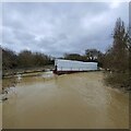
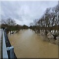
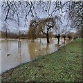
Longholme Way Footbridge No 2
River Great Ouse, Fish Ponds Bridge, Bedford MK41 9RZ, United Kingdom

Longholme Way Footbridge No 2
is a minor waterways place
on the River Great Ouse (Canalized Section) between
Eaton Socon Lock No 8 (13 miles
and 5 locks
to the northeast) and
Bedford (6½ furlongs
and 1 lock
to the west).
The nearest place in the direction of Eaton Socon Lock No 8 is Fenlake Meadow GOBA Moorings;
1¼ furlongs
away.
The nearest place in the direction of Bedford is Longholme Way Footbridge No 1;
¼ furlongs
away.
Mooring here is unrated.
There is a bridge here which takes pedestrian traffic over the canal.
Cardington Lock Weir Entrance No 1 | 7¾ furlongs | |
Cardington Road Wharf | 5¾ furlongs | |
Priory Marina | 2 furlongs | |
Duck Mill Lock Weir Exit No 3 | 1½ furlongs | |
Fenlake Meadow GOBA Moorings | 1¼ furlongs | |
Longholme Way Footbridge No 2 | ||
Longholme Way Footbridge No 1 | ¼ furlongs | |
Longholme Way Bridge | ½ furlongs | |
Duck Mill Lock Weir Exit No 2 | 3 furlongs | |
Bedford Town Moorings No 1 | 3¼ furlongs | |
Cardington Road Footbridge | 4¼ furlongs |
Amenities nearby at Longholme Way Footbridge No 1
Amenities in Bedford
Amenities at other places in Bedford
at
at
at
at
at
at
at
at
at
at
at
at
at
at
at
at
at
at
at
at
at
at
at
at
at
at
at
at
at
at
at
at
at
at
at
at
at
at
at
at
at
at
at
at
at
at
at
at
at
at
at
at
at
at
at
- Great Ouse Navigation | boating, moorings, navigation notices — associated with River Great Ouse
- Information regarding the Great Ouse navigation and tributaries.
- Information for boaters on the River Great Ouse - GOV.UK — associated with River Great Ouse
- River Great Ouse: bridge heights, locks, overhead power lines and facilities.
- Facebook Account — associated with River Great Ouse
- Anglian Waterways Manager Facebook Account
- Facebook Anglian Waterways Page — associated with River Great Ouse
- Facebook Page for Environment Agency Anglian Waterways
Mouseover for more information or show routes to facility
Nearest water point
In the direction of Brownshill Staunch (Lock)
St Neots Priory Centre Mooring — 14 miles, 1¼ furlongs and 6 locks away
On this waterway in the direction of Brownshill Staunch (Lock)Nearest rubbish disposal
In the direction of Brownshill Staunch (Lock)
St Neots Priory Centre Mooring — 14 miles, 1¼ furlongs and 6 locks away
On this waterway in the direction of Brownshill Staunch (Lock)Nearest place to turn
In the direction of Kempston Mill
Duck Mill Lock Weir Exit No 1 — 4¾ furlongs away
On this waterway in the direction of Kempston Mill
Duck Mill Lock Weir Entrance No 2 — 5 furlongs and 1 lock away
On this waterway in the direction of Kempston Mill
In the direction of Brownshill Staunch (Lock)
Priory Marina — 2 furlongs away
On this waterway in the direction of Brownshill Staunch (Lock)
Cardington Lock Weir Exit No 2 — 1 mile, 6 furlongs and 1 lock away
On this waterway in the direction of Brownshill Staunch (Lock)
Site of Old Mills Lock — 5 miles, 5¾ furlongs and 3 locks away
On this waterway in the direction of Brownshill Staunch (Lock)
Great Barford Lock Weir Exit — 6 miles, 3¾ furlongs and 4 locks away
On this waterway in the direction of Brownshill Staunch (Lock)
Roxton Lock Weir Exit — 8 miles, 6 furlongs and 5 locks away
On this waterway in the direction of Brownshill Staunch (Lock)
Eynesbury Manor Marina — 12 miles, 5 furlongs and 5 locks away
On this waterway in the direction of Brownshill Staunch (Lock)
River Mill Marina — 12 miles, 7¾ furlongs and 5 locks away
On this waterway in the direction of Brownshill Staunch (Lock)
St Neots Marina — 14 miles, ¼ furlongs and 6 locks away
On this waterway in the direction of Brownshill Staunch (Lock)
St Neots Lock Weir Entrance — 15 miles, ¼ furlongs and 6 locks away
On this waterway in the direction of Brownshill Staunch (Lock)
Mill Lane Bridge Winding Hole — 15 miles, 3 furlongs and 7 locks away
On this waterway in the direction of Brownshill Staunch (Lock)
St Neots Lock Weir Exit — 15 miles, 6¾ furlongs and 7 locks away
On this waterway in the direction of Brownshill Staunch (Lock)
Offord Lock Weir Exit No 3 — 19 miles, 7¼ furlongs and 8 locks away
On this waterway in the direction of Brownshill Staunch (Lock)
Offord Lock Weir Exit No 1 — 19 miles, 7½ furlongs and 8 locks away
On this waterway in the direction of Brownshill Staunch (Lock)Nearest boatyard pump-out
In the direction of Brownshill Staunch (Lock)
Buckden Marina Fuel & Pump Out — 19 miles, 7¾ furlongs and 8 locks away
On this waterway in the direction of Brownshill Staunch (Lock)No information
CanalPlan has no information on any of the following facilities within range:chemical toilet disposal
self-operated pump-out
Direction of TV transmitter (From Wolfbane Cybernetic)
There is no page on Wikipedia called “Longholme Way Footbridge”
Results of Google Search
2 Footbridge Way (currently not for sale) is located in Woodlands Vlg/creekside Park S subdivision in Harris County. Scroll to see the property features, tax value, ...
Apr 25, 2020 ... View 41 photos for 2 Footbridge Way, Spring, TX 77389 a 5 bed, ... is already upgraded including a no expense spared backyard paradise?
2 Footbridge Way , Spring, TX 77389-1583 is currently not for sale. The 4233 sq. ft. single-family home is a 5 bed, 6.0 bath property. This home was built in 2015 ...
Town Centre Detail Plan No. 2 68. Bletchley Line Rail Bridge to. Town Bridge. Town Bridge to ... Suspension Bridge to Longholme Way ... Longholme Way to Priory Marina ... A footbridge would be required to provide connection with the Ouse.
Nov 10, 2017 ... The bridge started to move too much, and not just up and down, but also side to side. ... The parameter h = d/(2(M + nm)) is the normalized, dimensionless damping ... We have set the frequency of the pedestrian-bridge phase-locked ... The above procedure suggests a way of calculating the values of Bi, φi, ...