CanalPlanAC

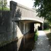
Tower Bridge No 47W

 
Also known as: Tower Bridge No 47
Climedw Farm, A542, Llangollen LL20 8TE, United Kingdom (A542)
 
Information about the place
Tower Bridge No 47W is a minor waterways place on the Shropshire Union Canal (Llangollen Canal - Main Line) between Llantisilio - Horseshoe Falls (1 mile and 1¼ furlongs to the west) and Llangollen Basin (48 hour visitor moorings and the limit of navigation.) (3¼ furlongs to the southeast).
 
 
The nearest place in the direction of Llantisilio - Horseshoe Falls is Pentrefelin Bridge No 48W; 3 furlongs away.
 
The nearest place in the direction of Llangollen Basin is Pen-y-ddol Bridge No 46W; 1¾ furlongs away.

There may be access to the towpath here.

Mooring here is unrated.

There is a bridge here which takes a major road over the canal.


Amenities
 
Maps
If you are a user and are logged on, or if you are actively planning a route, a map will be displayed here.
Show on external mapping site: Google | OSM | Bing
 
Photos
 
External websites
There are no links to external websites from here.
Why not log in and add some (select "External websites" from the menu (sometimes this is under "Edit"))?
 
Nearest facilities

Mouseover for more information or show routes to facility

Nearest water point

In the direction of Hurleston Junction

Llangollen Basin3¼ furlongs away
On this waterway in the direction of Hurleston Junction
Llangollen Services6¼ furlongs away
On this waterway in the direction of Hurleston Junction
The Old Wharf5 miles, 2 furlongs away
Travel to Ruabon Branch Junction, then on the Shropshire Union Canal (Llangollen Canal - Ruabon Branch) to The Old Wharf
Trevor Basin5 miles, 3 furlongs away
Travel to Ruabon Branch Junction, then on the Shropshire Union Canal (Llangollen Canal - Ruabon Branch) to Trevor Basin
Coedfryn Water Point5 miles, 4¾ furlongs away
On this waterway in the direction of Hurleston Junction
Chirk Marina7 miles, 3½ furlongs away
On this waterway in the direction of Hurleston Junction
New Marton Water Points12 miles, 3¼ furlongs away
On this waterway in the direction of Hurleston Junction
Ellesmere Services19 miles, 2 furlongs and 2 locks away
On this waterway in the direction of Hurleston Junction
Blackwater Meadow Marina19 miles, 3¼ furlongs and 2 locks away
On this waterway in the direction of Hurleston Junction
Weston Arm Services (C&RT)16 miles, 4 furlongs and 6 locks away
Travel to Frankton Junction, then on the Shropshire Union Canal (Montgomery Canal - connected and navigable) to Weston Arm Junction, then on the Shropshire Union Canal (Weston Branch) to Weston Arm Services (C&RT)

Nearest rubbish disposal

In the direction of Hurleston Junction

Llangollen Basin3¼ furlongs away
On this waterway in the direction of Hurleston Junction
Llangollen Services6¼ furlongs away
On this waterway in the direction of Hurleston Junction
Ellesmere Services19 miles, 2 furlongs and 2 locks away
On this waterway in the direction of Hurleston Junction
Weston Arm Services (C&RT)16 miles, 4 furlongs and 6 locks away
Travel to Frankton Junction, then on the Shropshire Union Canal (Montgomery Canal - connected and navigable) to Weston Arm Junction, then on the Shropshire Union Canal (Weston Branch) to Weston Arm Services (C&RT)

Nearest chemical toilet disposal

In the direction of Hurleston Junction

Llangollen Services6¼ furlongs away
On this waterway in the direction of Hurleston Junction
Chirk Marina7 miles, 3½ furlongs away
On this waterway in the direction of Hurleston Junction
Whittington Wharf Narrowboats14 miles, 5½ furlongs and 2 locks away
On this waterway in the direction of Hurleston Junction
Ellesmere Services19 miles, 2 furlongs and 2 locks away
On this waterway in the direction of Hurleston Junction
Weston Arm Services (C&RT)16 miles, 4 furlongs and 6 locks away
Travel to Frankton Junction, then on the Shropshire Union Canal (Montgomery Canal - connected and navigable) to Weston Arm Junction, then on the Shropshire Union Canal (Weston Branch) to Weston Arm Services (C&RT)

Nearest place to turn

In the direction of Hurleston Junction

Llangollen Basin3¼ furlongs away
On this waterway in the direction of Hurleston Junction
Bryn Howel Winding Hole3 miles, 3½ furlongs away
On this waterway in the direction of Hurleston Junction
Ruabon Branch Junction5 miles, 2 furlongs away
On this waterway in the direction of Hurleston Junction
Trevor Basin5 miles, 3 furlongs away
Travel to Ruabon Branch Junction, then on the Shropshire Union Canal (Llangollen Canal - Ruabon Branch) to Trevor Basin
Coedfryn Winding Hole5 miles, 6 furlongs away
On this waterway in the direction of Hurleston Junction
Chirk Marina7 miles, 3½ furlongs away
On this waterway in the direction of Hurleston Junction
Chirk Golf Course Winding Hole7 miles, 6½ furlongs away
On this waterway in the direction of Hurleston Junction
Chirk Pool8 miles, 6½ furlongs away
On this waterway in the direction of Hurleston Junction
Rhoswiel Bridge Winding Hole9 miles, 7¼ furlongs away
On this waterway in the direction of Hurleston Junction
Polletts Bridge Winding Hole14 miles, 2¾ furlongs and 2 locks away
On this waterway in the direction of Hurleston Junction
Frankton Junction15 miles, 7 furlongs and 2 locks away
On this waterway in the direction of Hurleston Junction
Sewage Works Winding Hole18 miles, 6 furlongs and 2 locks away
On this waterway in the direction of Hurleston Junction
Ellesmere Branch Junction19 miles, 2¼ furlongs and 2 locks away
On this waterway in the direction of Hurleston Junction
Ellesmere Town Wharf19 miles, 4¼ furlongs and 2 locks away
Travel to Ellesmere Branch Junction, then on the Shropshire Union Canal (Llangollen Canal - Ellesmere Branch) to Ellesmere Town Wharf
Weston Arm Junction16 miles, 3 furlongs and 6 locks away
Travel to Frankton Junction, then on the Shropshire Union Canal (Montgomery Canal - connected and navigable) to Weston Arm Junction
Hawkswood Winding Hole17 miles, 1¾ furlongs and 7 locks away
Travel to Frankton Junction, then on the Shropshire Union Canal (Montgomery Canal - connected and navigable) to Hawkswood Winding Hole
Queen's Head Winding Hole19 miles, 6 furlongs and 7 locks away
Travel to Frankton Junction, then on the Shropshire Union Canal (Montgomery Canal - connected and navigable) to Queen's Head Winding Hole

Nearest boatyard pump-out

In the direction of Hurleston Junction

The Old Wharf5 miles, 2 furlongs away
Travel to Ruabon Branch Junction, then on the Shropshire Union Canal (Llangollen Canal - Ruabon Branch) to The Old Wharf
Chirk Marina7 miles, 3½ furlongs away
On this waterway in the direction of Hurleston Junction
Whittington Wharf Narrowboats14 miles, 5½ furlongs and 2 locks away
On this waterway in the direction of Hurleston Junction
Blackwater Meadow Marina19 miles, 3¼ furlongs and 2 locks away
On this waterway in the direction of Hurleston Junction

No information

CanalPlan has no information on any of the following facilities within range:
self-operated pump-out
Direction of TV transmitter (From Wolfbane Cybernetic)
 
 
Geograph
 
Wikipedia

There is no page on Wikipedia called “Tower Bridge No 47W”

Wikipedia pages that might relate to Tower Bridge No 47W
[Tower Bridge] Tower Bridge is a combined bascule and suspension bridge in London, built between 1886 and 1894. The bridge crosses the River Thames close to the Tower [Brooklyn Bridge] stone towers are neo-Gothic, with characteristic pointed arches. The New York City Department of Transportation (NYCDOT), which maintains the bridge, says [London Bridge] River Thames, between London Bridge and Tower Bridge, that has been designated as a business improvement district. The bridge area has twice been the target [High Bridge (New York City)] The High Bridge (originally the Aqueduct Bridge) is the oldest bridge in New York City, having originally opened as part of the Croton Aqueduct in 1848 [List of tallest structures] self-supporting towers (such as the CN Tower), skyscrapers (such as the Willis Tower), oil platforms, electricity transmission towers, and bridge support towers. This [Big Ben] the clock tower. The official name of the tower in which Big Ben is located was originally the Clock Tower; it was renamed Elizabeth Tower in 2012 to [Mackinac Bridge] suspension bridge between anchorages", allowing a superlative comparison to the Golden Gate Bridge, which has a longer center span between towers, and the [Structural integrity and failure] before the exchange procedures, there were no fatalities, in contrast to the similar collapse of WLBT Tower in 1997. On 17 July 1981, two suspended walkways [Brasilia TV Tower] 224 metres. The tower is the fourth tallest structure in Brazil and is also one of the most noticeable from Juscelino Kubitschek Bridge. It is located [Vincent Thomas Bridge] suspension bridge in the Greater Los Angeles area. The bridge is part of State Route 47, which is also known as the Seaside Freeway. The bridge opened in
 
Google