CanalPlanAC

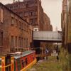
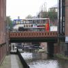
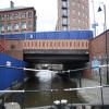
Albion Street Bridge No 99

 
Albion Street, Manchester M1 5LN, United Kingdom (A5103)
 
Information about the place
Albion Street Bridge No 99 is a minor waterways place on the Rochdale Canal between Castlefield Junction (Junction of Bridgewater and Rochdale Canals) (2¾ furlongs and 3 locks to the west) and Ducie Street Junction (Junction of Rochdale and Ashton Canals) (6¾ furlongs and 6 locks to the east).
 
 
The nearest place in the direction of Castlefield Junction is Albion Mills Lock No 90; ¼ furlongs away.
 
The nearest place in the direction of Ducie Street Junction is Tib Lock Footbridge; ¾ furlongs away.

There may be access to the towpath here.

Mooring here is unrated.

There is a bridge here which takes a major road over the canal.


Amenities

Amenities here

 Britons Protection
 Cashpoint
 Lloyds Bank

Amenities nearby at Tib Lock Footbridge

 Starbucks
 Subway Sandwich Shop
 Cashpoint
 
Maps
If you are a user and are logged on, or if you are actively planning a route, a map will be displayed here.
Show on external mapping site: Google | OSM | Bing
 
Photos
 
External websites
There are no links to external websites from here.
Why not log in and add some (select "External websites" from the menu (sometimes this is under "Edit"))?
 
Nearest facilities

Mouseover for more information or show routes to facility

Nearest water point

In the direction of Castlefield Junction

Staffordshire, Kenworthy and other Arms3 furlongs and 3 locks away
Travel to Castlefield Junction, then on the Bridgewater Canal (Main Line) to Staffordshire, Kenworthy and other Arms
Potato Wharf Arm & The New Basin3¾ furlongs and 3 locks away
Travel to Castlefield Junction, then on the Bridgewater Canal (Main Line) to Potato Wharf Arm & The New Basin
Stretford Marina3 miles, 3 furlongs and 3 locks away
Travel to Castlefield Junction, then on the Bridgewater Canal (Main Line) to Stretford Marina
Watch House Cruising Club4 miles, 3¼ furlongs and 3 locks away
Travel to Castlefield Junction, then on the Bridgewater Canal (Main Line) to Watch House Cruising Club
Worsley Visitor Moorings7 miles, 5¼ furlongs and 3 locks away
Travel to Castlefield Junction, then on the Bridgewater Canal (Main Line) to Stretford - Waters Meeting, then on the Bridgewater Canal (Stretford and Leigh Branch) to Worsley Visitor Moorings
Bridgewater Marina9 miles, 1 furlong and 3 locks away
Travel to Castlefield Junction, then on the Bridgewater Canal (Main Line) to Stretford - Waters Meeting, then on the Bridgewater Canal (Stretford and Leigh Branch) to Bridgewater Marina
Ye Olde Number 3 Transit Moorings11 miles, 2¼ furlongs and 3 locks away
Travel to Castlefield Junction, then on the Bridgewater Canal (Main Line) to Ye Olde Number 3 Transit Moorings
Plank Lane Visitor Moorings15 miles, 5½ furlongs and 3 locks away
Travel to Castlefield Junction, then on the Bridgewater Canal (Main Line) to Stretford - Waters Meeting, then on the Bridgewater Canal (Stretford and Leigh Branch) to Leigh Bridge No 11, then on the Leeds and Liverpool Canal (Leigh Branch) to Plank Lane Visitor Moorings

In the direction of Sowerby Bridge Junction

New Islington Marina1 mile, 2¾ furlongs and 8 locks away
Travel to New Islington Marina Entrance, then on the Rochdale Canal (Main Line) to Cotton Field Wharf Marina, then on the Rochdale Canal (New Islington Marina Arm) to New Islington Marina
Fairfield Junction4 miles, 5¼ furlongs and 24 locks away
Travel to Ducie Street Junction, then on the Ashton Canal (Main Line) to Fairfield Junction
Grove Road Bridge No 9612 miles, 1½ furlongs and 32 locks away
Travel to Ducie Street Junction, then on the Ashton Canal (Main Line) to Ashton-under-Lyne Junction, then on the Huddersfield Narrow Canal to Grove Road Bridge No 96
Marple Services15 miles, 2¾ furlongs and 40 locks away
Travel to Ducie Street Junction, then on the Ashton Canal (Main Line) to Dukinfield Junction, then on the Peak Forest Canal (Lower) to Marple Junction, then on the Macclesfield Canal to Marple Services
Braidbar Boats19 miles, ¼ furlongs and 40 locks away
Travel to Ducie Street Junction, then on the Ashton Canal (Main Line) to Dukinfield Junction, then on the Peak Forest Canal (Lower) to Marple Junction, then on the Macclesfield Canal to Braidbar Boats
Littleborough Sanitary Station16 miles, 3¾ furlongs and 43 locks away
On this waterway in the direction of Sowerby Bridge Junction
Wool Road Bridge No 7018 miles, 1½ furlongs and 47 locks away
Travel to Ducie Street Junction, then on the Ashton Canal (Main Line) to Ashton-under-Lyne Junction, then on the Huddersfield Narrow Canal to Wool Road Bridge No 70

Nearest rubbish disposal

In the direction of Castlefield Junction

Plank Lane Pump Out15 miles, 6 furlongs and 3 locks away
Travel to Castlefield Junction, then on the Bridgewater Canal (Main Line) to Stretford - Waters Meeting, then on the Bridgewater Canal (Stretford and Leigh Branch) to Leigh Bridge No 11, then on the Leeds and Liverpool Canal (Leigh Branch) to Plank Lane Pump Out

In the direction of Sowerby Bridge Junction

Marple Bottom Lock Bridge Winding Hole14 miles, 1½ furlongs and 24 locks away
Travel to Ducie Street Junction, then on the Ashton Canal (Main Line) to Dukinfield Junction, then on the Peak Forest Canal (Lower) to Marple Bottom Lock Bridge Winding Hole
Marple Services15 miles, 2¾ furlongs and 40 locks away
Travel to Ducie Street Junction, then on the Ashton Canal (Main Line) to Dukinfield Junction, then on the Peak Forest Canal (Lower) to Marple Junction, then on the Macclesfield Canal to Marple Services
Braidbar Boats19 miles, ¼ furlongs and 40 locks away
Travel to Ducie Street Junction, then on the Ashton Canal (Main Line) to Dukinfield Junction, then on the Peak Forest Canal (Lower) to Marple Junction, then on the Macclesfield Canal to Braidbar Boats
Littleborough Sanitary Station16 miles, 3¾ furlongs and 43 locks away
On this waterway in the direction of Sowerby Bridge Junction
Wool Road Visitor Mooring18 miles, 1¼ furlongs and 47 locks away
Travel to Ducie Street Junction, then on the Ashton Canal (Main Line) to Ashton-under-Lyne Junction, then on the Huddersfield Narrow Canal to Wool Road Visitor Mooring

Nearest chemical toilet disposal

In the direction of Castlefield Junction

Watch House Cruising Club4 miles, 3¼ furlongs and 3 locks away
Travel to Castlefield Junction, then on the Bridgewater Canal (Main Line) to Watch House Cruising Club
Oughtrington Wharf13 miles, ½ furlongs and 3 locks away
Travel to Castlefield Junction, then on the Bridgewater Canal (Main Line) to Oughtrington Wharf

In the direction of Sowerby Bridge Junction

Fairfield Junction4 miles, 5¼ furlongs and 24 locks away
Travel to Ducie Street Junction, then on the Ashton Canal (Main Line) to Fairfield Junction
Grove Road Bridge No 9612 miles, 1½ furlongs and 32 locks away
Travel to Ducie Street Junction, then on the Ashton Canal (Main Line) to Ashton-under-Lyne Junction, then on the Huddersfield Narrow Canal to Grove Road Bridge No 96
Marple Services15 miles, 2¾ furlongs and 40 locks away
Travel to Ducie Street Junction, then on the Ashton Canal (Main Line) to Dukinfield Junction, then on the Peak Forest Canal (Lower) to Marple Junction, then on the Macclesfield Canal to Marple Services
Littleborough Sanitary Station16 miles, 3¾ furlongs and 43 locks away
On this waterway in the direction of Sowerby Bridge Junction
Wool Road Bridge No 7018 miles, 1½ furlongs and 47 locks away
Travel to Ducie Street Junction, then on the Ashton Canal (Main Line) to Ashton-under-Lyne Junction, then on the Huddersfield Narrow Canal to Wool Road Bridge No 70

Nearest place to turn

In the direction of Castlefield Junction

Castlefield Junction2¾ furlongs and 3 locks away
On this waterway in the direction of Castlefield Junction
Staffordshire, Kenworthy and other Arms3 furlongs and 3 locks away
Travel to Castlefield Junction, then on the Bridgewater Canal (Main Line) to Staffordshire, Kenworthy and other Arms
Grocer's Wharf3½ furlongs and 3 locks away
Travel to Castlefield Junction, then on the Bridgewater Canal (Main Line) to Grocer's Wharf
Potato Wharf Arm & The New Basin3¾ furlongs and 3 locks away
Travel to Castlefield Junction, then on the Bridgewater Canal (Main Line) to Potato Wharf Arm & The New Basin
Hulme Locks Branch - Bridgewater Canal Junction5¼ furlongs and 3 locks away
Travel to Castlefield Junction, then on the Bridgewater Canal (Main Line) to Hulme Locks Branch - Bridgewater Canal Junction
Hulme Hall Road Winding Hole6¼ furlongs and 3 locks away
Travel to Castlefield Junction, then on the Bridgewater Canal (Main Line) to Hulme Hall Road Winding Hole
Pomona Lock Branch Junction1 mile, 2¾ furlongs and 3 locks away
Travel to Castlefield Junction, then on the Bridgewater Canal (Main Line) to Pomona Lock Branch Junction
Stretford - Waters Meeting3 miles, 1¼ furlongs and 3 locks away
Travel to Castlefield Junction, then on the Bridgewater Canal (Main Line) to Stretford - Waters Meeting
Stretford Marina3 miles, 3 furlongs and 3 locks away
Travel to Castlefield Junction, then on the Bridgewater Canal (Main Line) to Stretford Marina
Middlewood Basin No 11 mile, 2 furlongs and 6 locks away
Travel to Castlefield Junction, then on the Bridgewater Canal (Main Line) to Hulme Locks Branch - Bridgewater Canal Junction, then on the Bridgewater Canal (Hulme Locks Branch) to River Irwell - Hulme Locks Branch Junction, then on the Manchester Ship Canal (River Irwell Upper Reach) to Manchester, Bolton and Bury Canal - River Irwell Junction, then on the Manchester Bolton and Bury Canal (Main Line) to Middlewood Basin No 1
Middlewood Basin No 21 mile, 2¼ furlongs and 6 locks away
Travel to Castlefield Junction, then on the Bridgewater Canal (Main Line) to Hulme Locks Branch - Bridgewater Canal Junction, then on the Bridgewater Canal (Hulme Locks Branch) to River Irwell - Hulme Locks Branch Junction, then on the Manchester Ship Canal (River Irwell Upper Reach) to Manchester, Bolton and Bury Canal - River Irwell Junction, then on the Manchester Bolton and Bury Canal (Main Line) to Middlewood Basin No 2
Edge Lane Winding Hole4 miles, 1½ furlongs and 3 locks away
Travel to Castlefield Junction, then on the Bridgewater Canal (Main Line) to Edge Lane Winding Hole
Trafford Park Winding Hole4 miles, 3½ furlongs and 3 locks away
Travel to Castlefield Junction, then on the Bridgewater Canal (Main Line) to Stretford - Waters Meeting, then on the Bridgewater Canal (Stretford and Leigh Branch) to Trafford Park Winding Hole
Salford Tunnel Basin1 mile, 3½ furlongs and 7 locks away
Travel to Castlefield Junction, then on the Bridgewater Canal (Main Line) to Hulme Locks Branch - Bridgewater Canal Junction, then on the Bridgewater Canal (Hulme Locks Branch) to River Irwell - Hulme Locks Branch Junction, then on the Manchester Ship Canal (River Irwell Upper Reach) to Manchester, Bolton and Bury Canal - River Irwell Junction, then on the Manchester Bolton and Bury Canal (Main Line) to Salford Tunnel Basin
Patricroft Basin and Warehouse5 miles, 5¾ furlongs and 3 locks away
Travel to Castlefield Junction, then on the Bridgewater Canal (Main Line) to Stretford - Waters Meeting, then on the Bridgewater Canal (Stretford and Leigh Branch) to Patricroft Basin and Warehouse
Patricroft Bridge Winding Hole5 miles, 7 furlongs and 3 locks away
Travel to Castlefield Junction, then on the Bridgewater Canal (Main Line) to Stretford - Waters Meeting, then on the Bridgewater Canal (Stretford and Leigh Branch) to Patricroft Bridge Winding Hole
Monton Turn6 miles, 5 furlongs and 3 locks away
Travel to Castlefield Junction, then on the Bridgewater Canal (Main Line) to Stretford - Waters Meeting, then on the Bridgewater Canal (Stretford and Leigh Branch) to Monton Turn

In the direction of Sowerby Bridge Junction

Ducie Street Junction6¾ furlongs and 6 locks away
On this waterway in the direction of Sowerby Bridge Junction
New Islington Marina Entrance1 mile, 1½ furlongs and 8 locks away
On this waterway in the direction of Sowerby Bridge Junction
Butler Lane Lock Winding Hole1 mile, 5¼ furlongs and 9 locks away
On this waterway in the direction of Sowerby Bridge Junction

Nearest boatyard pump-out

In the direction of Castlefield Junction

Stretford Marina3 miles, 3 furlongs and 3 locks away
Travel to Castlefield Junction, then on the Bridgewater Canal (Main Line) to Stretford Marina
Bridgewater Marina9 miles, 1 furlong and 3 locks away
Travel to Castlefield Junction, then on the Bridgewater Canal (Main Line) to Stretford - Waters Meeting, then on the Bridgewater Canal (Stretford and Leigh Branch) to Bridgewater Marina
Oughtrington Wharf13 miles, ½ furlongs and 3 locks away
Travel to Castlefield Junction, then on the Bridgewater Canal (Main Line) to Oughtrington Wharf

In the direction of Sowerby Bridge Junction

Portland Basin Arm7 miles, 1¾ furlongs and 24 locks away
Travel to Ducie Street Junction, then on the Ashton Canal (Main Line) to Dukinfield Junction, then on the Peak Forest Canal (Lower) to Portland Basin Arm
Braidbar Boats19 miles, ¼ furlongs and 40 locks away
Travel to Ducie Street Junction, then on the Ashton Canal (Main Line) to Dukinfield Junction, then on the Peak Forest Canal (Lower) to Marple Junction, then on the Macclesfield Canal to Braidbar Boats
New Mills Marina19 miles, 2¼ furlongs and 40 locks away
Travel to Ducie Street Junction, then on the Ashton Canal (Main Line) to Dukinfield Junction, then on the Peak Forest Canal (Lower) to Marple Junction, then on the Peak Forest Canal (Upper) to New Mills Marina
Direction of TV transmitter (From Wolfbane Cybernetic)
 
 
Geograph
 
Wikipedia

There is no page on Wikipedia called “Albion Street Bridge”

Wikipedia pages that might relate to Albion Street Bridge
[Albion, Queensland] Albion is an inner north-eastern suburb in the City of Brisbane, Queensland, Australia. In the 2016 census, Albion had a population of 2,296 people. Albion [Sassafras Site, RI-55] archaeologists while surveying an area for a potential replacement for the Albion Street bridge, which spans the Blackstone River between Lincoln and Cumberland [List of vertical-lift bridges] Jacksonville, Florida. Main Street Lift Bridge (Albion, New York) – A two-lane vehicle and pedestrian bridge spanning the Erie Canal in Albion, New York. Built in [Albion, Rhode Island] "Albion Bridge, School Street, Spanning Blackstone River, Cumberland, Providence County, RI", 11 photos, 1 photo caption page HAER No. RI-22, "Albion Trench [Albion Fire Station] Albion Fire Station is a heritage-listed former fire station at 42 Bridge Street, Wooloowin, City of Brisbane, Queensland, Australia. It was designed by [Pete Doherty] Barât shared a flat in London, at 112a Teesdale Street, Bethnal Green, affectionately known as 'The Albion Rooms', despite being rather run down. Doherty [List of bridges in Toronto] ravine, listed from south to north Cherry Street lift bridge Gardiner Expressway pedestrian and bicycle bridge on the Waterfront Trail Don Valley Parkway [River Don, Yorkshire] the bridge was widened in 1900. Kelham Weir (also known as Ball Street Weir) is just downstream of the bridge. Borough bridge and Corporation Street, which [Albion railway station, Melbourne] the bridge going over the railway line, just west of Albion station. The station had a signal box, for the control of the junction with the Albion – Jacana [Weston Road] The Weston Plank Road extended from Dundas Street north to Musson's Bridge over the Humber, where Albion Road began. The company built its headquarters
 
Google

Results of Google Search

List of crossings of the Fraser River - Wikipedia
This is a list of bridges, tunnels, and other crossings of the Fraser River in the Canadian province of British Columbia. It includes both functional crossings and historic crossings which no longer ... Albion Ferry (operated from 1957 to 2009), replaced by Golden Ears bridge. .... Fraser Street Bridge, Fraser Street / No. 5 Road ...
SOM - M-99 brick pavement reconstruction in Albion starts Monday
Apr 10, 2017 ... MDOT will be rebuilding 0.4 miles of M-99 (Superior Street) in Albion, Calhoun County. Construction is planned in two phases, starting April 17 ...
SUPERIOR STREET RECONSTRUCTION PROJECT
NO WORK ON MONDAY – MEMORIAL DAY; M-99 (Superior St) Closed from Cass St to Mulberry St ... M-99 (Superior St) Open from Cass St to Mulberry St; Michigan Ave Open from Post Office to Ionia St; M-99 .... Building Owners to be Notified by the City of Albion ... Install Concrete Valley Gutter and Bridge Deck Approach.
Travel Advisories - Rhode Island Rhode Island Department of ...
Traffic shifts on the Broadway and Westminster Street bridges over the highway ... Also, traffic from the Tobey St./Harris Ave. on-ramp does not have direct access to Rte. ... 99 North at the off-ramp to Mendon Rd., partial right lane closure for .... between Main St. Albion and Mendon Rd., are closed through late Summer.
Cumberland
Aug 9, 2017 ... Non-Bridge. 2027 ... Sneech Brook Bridge, Albion Rd at Sneech Brook. 6104. Bridge Group ... Second Ave NB, RI 99 NB at Second Ave. 6299.
99 Route: Time Schedules, Stops & Maps - Barrhaven Centre
The 99 bus (Direction: Barrhaven Centre) has 45 stops departing from Lebreton 2a and ending in Barrhaven Centre 1a. ... 710 Albert Street, Ottawa View full schedule Go to station ... Billings Bridge ... Leitrim / Albion .... No internet available?
Albion Postcards - A new book about Albion Michigan by Frank Passic
Sep 26, 2013 ... Not only are the campus classroom buildings featured, but the numerous fraternity and .... Bridges Albion Road, on page 62. Cass Street, on pages 51, 60 and 61 .... Fraternal Order of Eagles 1913, parade on pages 99-100
Leeds and Liverpool (Burnley to Wigan) Pub Guide
Whalley Road Bridge No 114B, The Albion Whalley Road Clayton-le-Moors ... Bottom Road Bridge No 99, The Moorings Bolton Road ... Canal Street Mill Hill