CanalPlanAC

Site of Proposed Gilwiskaw Brook Aqueduct

 
Bosworth Road, North West Leicestershire DE12 7HF, United Kingdom
 
Information about the place
Site of Proposed Gilwiskaw Brook Aqueduct is a minor waterways place on the Ashby Canal (unrestored) between Measham Wharf Branch Junction (Junction of the Ashby Canal with the Measham Town Wharf Branch) (1 mile and 3¾ furlongs to the west) and Ashby Canal Current Head of Navigation (Just beyond Faulkes circular winding hole) (2¼ furlongs to the south).
 
 
The nearest place in the direction of Measham Wharf Branch Junction is Site of Ilott Wharf; ½ furlongs away.

Mooring here is unrated.

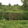
There is a small aqueduct or underbridge here which takes a stream under the canal.


Amenities
 
Maps
If you are a user and are logged on, or if you are actively planning a route, a map will be displayed here.
Show on external mapping site: Google | OSM | Bing
 
Photos
 
External websites
There are no links to external websites from here.
Why not log in and add some (select "External websites" from the menu (sometimes this is under "Edit"))?
 
Nearest facilities

Mouseover for more information or show routes to facility

Nearest place to turn

In the direction of Brooks Close Terminus

Measham Wharf Branch Junction1 mile, 3¾ furlongs away
On this waterway in the direction of Brooks Close Terminus
Site of Proposed Measham Wharf1 mile, 6¾ furlongs away
Travel to Measham Wharf Branch Junction, then on the Ashby Canal (Measham Wharf Branch, unrestored) to Site of Proposed Measham Wharf
Bath Yard Basin5 miles, 2 furlongs and 1 lock away
Travel to Brooks Close Terminus, then on the Ashby Canal (restored but unconnected) to Bath Yard Basin

In the direction of Ashby Canal Current Head of Navigation

Faulkes Circular Winding Hole2¼ furlongs away
Travel to Ashby Canal Current Head of Navigation, then on the Ashby Canal (Main Line) to Faulkes Circular Winding Hole
Turnover Bridge Winding Hole4 furlongs away
Travel to Ashby Canal Current Head of Navigation, then on the Ashby Canal (Main Line) to Turnover Bridge Winding Hole
Shackerstone Winding Hole3 miles, 2¼ furlongs away
Travel to Ashby Canal Current Head of Navigation, then on the Ashby Canal (Main Line) to Shackerstone Winding Hole
Carlton Bridge Winding Hole5 miles, 7½ furlongs away
Travel to Ashby Canal Current Head of Navigation, then on the Ashby Canal (Main Line) to Carlton Bridge Winding Hole
Bosworth Marina & Wharf Winding Hole6 miles, 7¼ furlongs away
Travel to Ashby Canal Current Head of Navigation, then on the Ashby Canal (Main Line) to Bosworth Marina & Wharf Winding Hole
Jackson's Bridge Winding Hole7 miles, 1¾ furlongs away
Travel to Ashby Canal Current Head of Navigation, then on the Ashby Canal (Main Line) to Jackson's Bridge Winding Hole
Shenton Bend9 miles, 1 furlong away
Travel to Ashby Canal Current Head of Navigation, then on the Ashby Canal (Main Line) to Shenton Bend
Sutton Cheney Wharf10 miles, 4¼ furlongs away
Travel to Ashby Canal Current Head of Navigation, then on the Ashby Canal (Main Line) to Sutton Cheney Wharf
Basin Bridge Winding Hole13 miles, 5¾ furlongs away
Travel to Ashby Canal Current Head of Navigation, then on the Ashby Canal (Main Line) to Basin Bridge Winding Hole
Trinity Marina15 miles, 6¼ furlongs away
Travel to Ashby Canal Current Head of Navigation, then on the Ashby Canal (Main Line) to Trinity Marina
Hinckley Wharf Arm Junction16 miles, 2 furlongs away
Travel to Ashby Canal Current Head of Navigation, then on the Ashby Canal (Main Line) to Hinckley Wharf Arm Junction

Nearest self-operated pump-out

Nearest boatyard pump-out

Direction of TV transmitter (From Wolfbane Cybernetic)
 
 
Geograph
 
Wikipedia

There is no page on Wikipedia called “Site of Proposed Gilwiskaw Brook Aqueduct”

Wikipedia pages that might relate to Site of Proposed Gilwiskaw Brook Aqueduct
[Ashby Canal] miles (0.40 km) from the site of Gilwiskaw Aqueduct, which will be the next major structure to reinstate. In 2013, parts of the restoration were threatened
 
Google

Results of Google Search

ACA Gilwiskaw Brook Aqueduct - YouTube
Jan 14, 2018 ... ACA Gilwiskaw Brook Aqueduct. ... ACA Gilwiskaw Brook Aqueduct. Paul Burrows. Loading... Unsubscribe from Paul Burrows? Cancel
Ashby Canal - Wikipedia
The Ashby-de-la-Zouch Canal is a 31-mile (50 km) long canal in England which connected the ... Gilwiskaw Brook aqueduct .... The proposal featured a level canal from Griff, near Nuneaton, to Ashby Wolds, which ..... The bridge is located about 0.25 miles (0.40 km) from the site of Gilwiskaw Aqueduct, which will be the next ...
Template:Ashby Canal map - Wikipedia
Proposed new route. -- along railway. Measham aqueduct. Gilwiskaw Brook aqueduct ... River Sence aqueduct ... By using this site, you agree to the Terms of Use and Privacy Policy. Wikipedia® is a registered trademark of the Wikimedia ...
Ashby Canal Association | Actively promoting restoration and re ...
Gilwiskaw Brook Aqueduct Appeal. In 1804 ... Trail boaters from around the country attend the annual Moira Canal Festival held at the Moira Furnace site in May.
File:Gilwiskaw Brook - geograph.org.uk - 1753878.jpg - Wikimedia ...
Jun 1, 2018 ... English: Gilwiskaw Brook This straight cut is where the aqueduct of the old Ashby ... A new aqueduct is proposed as part of the project to restore this section of the ... See this photograph's page on the Geograph website for the ...
Ashby Canal
A further 400m up to the site of Bridge 62 was restored in 2014. ... next section back to Ilott Wharf will require a new aqueduct over the Gilwiskaw Brook. ... by several changes of plan for the route of HS2, the proposed High Speed Railway line.
File:Site of aqueduct - geograph.org.uk - 1753870.jpg - Wikimedia ...
Jun 1, 2018 ... English: Site of aqueduct The mounds on either side of the dip are the old ... which crossed the splendidly named Gilwiskaw Brook at this point.
The Leicestershire County Council (Ashby de la Zouch Canal ...
4; an aqueduct over the Gilwiskaw Brook, at grid reference point 434875E, 311117N, and terminating at Work No. 5; a highway bridge carrying B4116, Gallows ...