CanalPlanAC

New Kingsbury Road Bridge

 
Kingsbury Road, Birmingham B76 9RE, United Kingdom (A4097)
 

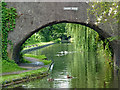
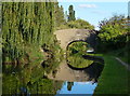
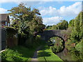
New Kingsbury Road Bridge carries a footpath over the Birmingham Canal Navigations (Birmingham and Fazeley Canal - Main Line) near to Stockton-on-Tees Tunnel.

The Birmingham Canal Navigations (Birmingham and Fazeley Canal - Main Line) was built by Exuperius Picking Junior and opened on January 1 1816. The canal joined the sea near Bournemouth. Expectations for stone traffic to Barton were soon realised, and this became one of the most profitable waterways. Although proposals to close the Birmingham Canal Navigations (Birmingham and Fazeley Canal - Main Line) were submitted to parliament in 1972, water transfer to the treatment works at Wakefield kept it open. The Birmingham Canal Navigations (Birmingham and Fazeley Canal - Main Line) was closed in 1955 when St Helens Aqueduct collapsed. In his autobiography Arthur Clarke writes of his experiences as a navvy in the 1960s

Information about the place
New Kingsbury Road Bridge is a minor waterways place on the Birmingham Canal Navigations (Birmingham and Fazeley Canal - Main Line) between Drayton Manor Bridges (There are two bridges here, a foot bridge and a swing bridge. These days the swing bridge is usually open.) (7 miles and ½ furlongs and 11 locks to the northeast) and Dickens Bridge (Minworth) (¾ furlongs to the west).
 
 
The nearest place in the direction of Drayton Manor Bridges is Minworth Green Bridge; 1¼ furlongs away.
 
The nearest place in the direction of Dickens Bridge is The Boat Inn (Minworth); a few yards away.

There may be access to the towpath here.

Mooring here is unrated.

There is a bridge here which takes a major road over the canal.


Amenities

Amenities here

 Bus stop (Arbury Walk)
 Bus stop (Coneybury Walk)
 Bus stop (Coneybury Walk)
 Bus stop (Water Orton Lane)

Amenities nearby at The Boat Inn (Minworth)

 Bus stop (Midpoint Park)
 Bus stop (Severn Trent Water Works)

Amenities nearby at Minworth Green Bridge

 Costcutter
 Bus stop (Arbury Walk)
 Bus stop (Minworth Green)
 Bus stop (Minworth Green)
 Bus stop (Minworth Hall Farm)
 Bus stop (Minworth Hall Farm)
 Bus stop (Water Orton Lane)
 
Maps
If you are a user and are logged on, or if you are actively planning a route, a map will be displayed here.
Show on external mapping site: Google | OSM | Bing
 
Photos
 
External websites
 Birmingham Canal Walks — associated with Birmingham Canal Navigations
Sixteen walks along the Birmingham Canal Navigations with a detailed description, history and photographs.
 Birmingham and Fazeley Canal | Heritage Guide — associated with Birmingham Canal Navigations (Birmingham and Fazeley Canal)
Explore the Birmingham and Fazeley Canal, a 15-mile Smeaton waterway opened in 1789, linking Birmingham to the Coventry Canal at Fazeley.
 
Nearest facilities

Mouseover for more information or show routes to facility

Nearest water point

In the direction of Fazeley Junction

Dunton Wharf — 2 miles, 1½ furlongs and 1 lock away
On this waterway in the direction of Fazeley Junction
Bodymoor Heath Wharf — 4 miles, ¾ furlongs and 9 locks away
On this waterway in the direction of Fazeley Junction
Fazeley Junction — 7 miles, 7¼ furlongs and 11 locks away
On this waterway in the direction of Fazeley Junction
Kings Orchard Marina — 15 miles, 4¾ furlongs and 11 locks away
Travel to Fazeley Junction, then on the Birmingham Canal Navigations (Birmingham and Fazeley Canal - along route of Coventry Canal) to Whittington Brook, then on the Coventry Canal (Detached Portion) to Kings Orchard Marina
Streethay Wharf — 15 miles, 6¾ furlongs and 11 locks away
Travel to Fazeley Junction, then on the Birmingham Canal Navigations (Birmingham and Fazeley Canal - along route of Coventry Canal) to Whittington Brook, then on the Coventry Canal (Detached Portion) to Streethay Wharf
Bradley Green Services — 16 miles, 1¾ furlongs and 13 locks away
Travel to Fazeley Junction, then on the Coventry Canal (Main Line - Hawkesbury to Fazeley) to Bradley Green Services
Fradley Visitor Moorings (48 hour) — 18 miles, 6½ furlongs and 11 locks away
Travel to Fazeley Junction, then on the Birmingham Canal Navigations (Birmingham and Fazeley Canal - along route of Coventry Canal) to Whittington Brook, then on the Coventry Canal (Detached Portion) to Fradley Visitor Moorings (48 hour)
Fradley Swing Bridge — 18 miles, 7 furlongs and 11 locks away
Travel to Fazeley Junction, then on the Birmingham Canal Navigations (Birmingham and Fazeley Canal - along route of Coventry Canal) to Whittington Brook, then on the Coventry Canal (Detached Portion) to Fradley Swing Bridge
Shop and Marine Services at Fradley Junction — 18 miles, 7½ furlongs and 11 locks away
Travel to Fazeley Junction, then on the Birmingham Canal Navigations (Birmingham and Fazeley Canal - along route of Coventry Canal) to Whittington Brook, then on the Coventry Canal (Detached Portion) to Fradley Junction, then on the Trent and Mersey Canal (Main Line - Fradley to Great Haywood) to Shop and Marine Services at Fradley Junction
Fradley Visitor Centre — 19 miles, ½ furlongs and 12 locks away
Travel to Fazeley Junction, then on the Birmingham Canal Navigations (Birmingham and Fazeley Canal - along route of Coventry Canal) to Whittington Brook, then on the Coventry Canal (Detached Portion) to Fradley Junction, then on the Trent and Mersey Canal (Main Line - Burton to Fradley) to Fradley Visitor Centre
Fradley Canalside Café — 19 miles, ½ furlongs and 12 locks away
Travel to Fazeley Junction, then on the Birmingham Canal Navigations (Birmingham and Fazeley Canal - along route of Coventry Canal) to Whittington Brook, then on the Coventry Canal (Detached Portion) to Fradley Junction, then on the Trent and Mersey Canal (Main Line - Burton to Fradley) to Fradley Canalside Café

In the direction of Farmers Bridge Junction

Minworth Services — 1 mile and 2 locks away
On this waterway in the direction of Farmers Bridge Junction
Cuckoo Wharf — 4 miles, ¾ furlongs and 3 locks away
On this waterway in the direction of Farmers Bridge Junction
Perry Barr Top Lock Services — 6 miles, 5½ furlongs and 16 locks away
Travel to Salford Junction (north), then on the Birmingham Canal Navigations (Tame Valley Canal) to Perry Barr Top Lock Services
Lower Ocker Hill Branch Junction — 12 miles, 2¾ furlongs and 16 locks away
Travel to Salford Junction (north), then on the Birmingham Canal Navigations (Tame Valley Canal) to Tame Valley Junction, then on the Birmingham Canal Navigations (Walsall Canal) to Lower Ocker Hill Branch Junction
Barston Lane Bridge No 76 — 15 miles, ½ furlongs and 14 locks away
Travel to Salford Junction (south), then on the Grand Union Canal (Birmingham and Warwick Junction Canal) to Bordesley Junction, then on the Grand Union Canal (Warwick and Birmingham Canal) to Camp Hill Top Lock Winding Hole, then on the Grand Union Canal (Warwick and Birmingham Canal: widened section - Main Line) to Barston Lane Bridge No 76
Knowle Top Lock No 51 — 16 miles, 7¾ furlongs and 14 locks away
Travel to Salford Junction (south), then on the Grand Union Canal (Birmingham and Warwick Junction Canal) to Bordesley Junction, then on the Grand Union Canal (Warwick and Birmingham Canal) to Camp Hill Top Lock Winding Hole, then on the Grand Union Canal (Warwick and Birmingham Canal: widened section - Main Line) to Knowle Top Lock No 51
Cambrian Wharf Services — 7 miles, 1 furlong and 27 locks away
Travel to Farmers Bridge Junction, then on the Birmingham Canal Navigations (Newhall Branch) to Cambrian Wharf Services
Worcester Bar — 7 miles, 5 furlongs and 27 locks away
Travel to Farmers Bridge Junction, then on the Birmingham Canal Navigations (Newhall Branch) to Deep Cuttings Junction, then on the Birmingham Canal Navigations (Main Line) to Worcester Bar
Holliday Wharf — 7 miles, 7 furlongs and 27 locks away
Travel to Farmers Bridge Junction, then on the Birmingham Canal Navigations (Newhall Branch) to Deep Cuttings Junction, then on the Birmingham Canal Navigations (Main Line) to Worcester Bar, then on the Worcester and Birmingham Canal (Birmingham to King's Norton) to Holliday Wharf

Nearest rubbish disposal

In the direction of Fazeley Junction

Bodymoor Heath Wharf — 4 miles, ¾ furlongs and 9 locks away
On this waterway in the direction of Fazeley Junction
Bradley Green Services — 16 miles, 1¾ furlongs and 13 locks away
Travel to Fazeley Junction, then on the Coventry Canal (Main Line - Hawkesbury to Fazeley) to Bradley Green Services
Fradley Visitor Centre — 19 miles, ½ furlongs and 12 locks away
Travel to Fazeley Junction, then on the Birmingham Canal Navigations (Birmingham and Fazeley Canal - along route of Coventry Canal) to Whittington Brook, then on the Coventry Canal (Detached Portion) to Fradley Junction, then on the Trent and Mersey Canal (Main Line - Burton to Fradley) to Fradley Visitor Centre
Atherstone Top Lock Winding Hole — 18 miles, 4½ furlongs and 24 locks away
Travel to Fazeley Junction, then on the Coventry Canal (Main Line - Hawkesbury to Fazeley) to Atherstone Top Lock Winding Hole

In the direction of Farmers Bridge Junction

Minworth Services — 1 mile and 2 locks away
On this waterway in the direction of Farmers Bridge Junction
Perry Barr Top Lock Services — 6 miles, 5½ furlongs and 16 locks away
Travel to Salford Junction (north), then on the Birmingham Canal Navigations (Tame Valley Canal) to Perry Barr Top Lock Services
Farmers Bridge Lock No 8 — 6 miles, 5¾ furlongs and 19 locks away
On this waterway in the direction of Farmers Bridge Junction
Lower Ocker Hill Branch Junction — 12 miles, 2¾ furlongs and 16 locks away
Travel to Salford Junction (north), then on the Birmingham Canal Navigations (Tame Valley Canal) to Tame Valley Junction, then on the Birmingham Canal Navigations (Walsall Canal) to Lower Ocker Hill Branch Junction
Henwood Mill Winding Hole — 14 miles, 5¼ furlongs and 14 locks away
Travel to Salford Junction (south), then on the Grand Union Canal (Birmingham and Warwick Junction Canal) to Bordesley Junction, then on the Grand Union Canal (Warwick and Birmingham Canal) to Camp Hill Top Lock Winding Hole, then on the Grand Union Canal (Warwick and Birmingham Canal: widened section - Main Line) to Henwood Mill Winding Hole
Cambrian Wharf Services — 7 miles, 1 furlong and 27 locks away
Travel to Farmers Bridge Junction, then on the Birmingham Canal Navigations (Newhall Branch) to Cambrian Wharf Services
Worcester Bar — 7 miles, 5 furlongs and 27 locks away
Travel to Farmers Bridge Junction, then on the Birmingham Canal Navigations (Newhall Branch) to Deep Cuttings Junction, then on the Birmingham Canal Navigations (Main Line) to Worcester Bar
Longwood Junction — 11 miles, 5 furlongs and 25 locks away
Travel to Salford Junction (north), then on the Birmingham Canal Navigations (Tame Valley Canal) to Tame Valley - Rushall Junction, then on the Birmingham Canal Navigations (Rushall Canal) to Longwood Junction
C&RT Bradley Workshops — 14 miles, 5½ furlongs and 26 locks away
Travel to Salford Junction (north), then on the Birmingham Canal Navigations (Tame Valley Canal) to Tame Valley Junction, then on the Birmingham Canal Navigations (Walsall Canal) to Moorcroft Junction, then on the Birmingham Canal Navigations (Bradley Canal (under restoration)) to C&RT Bradley Workshops
Aldridge Marina — 15 miles, ¾ furlongs and 25 locks away
Travel to Salford Junction (north), then on the Birmingham Canal Navigations (Tame Valley Canal) to Tame Valley - Rushall Junction, then on the Birmingham Canal Navigations (Rushall Canal) to Longwood Junction, then on the Birmingham Canal Navigations (Daw End Branch) to Aldridge Marina
Hawne Basin — 13 miles, 6¾ furlongs and 27 locks away
Travel to Farmers Bridge Junction, then on the Birmingham Canal Navigations (Newhall Branch) to Deep Cuttings Junction, then on the Birmingham Canal Navigations (Main Line) to Worcester Bar, then on the Worcester and Birmingham Canal (Birmingham to King's Norton) to New Selly Oak Junction, then on the Birmingham Canal Navigations (Dudley Canal No 2 - Lapal Canal - Original Line East End ) to Somery Road Bridge, then on the Birmingham Canal Navigations (Dudley Canal No 2 - Lapal Canal - Abandoned Line ) to Lapal Canal - New line Diverges From Original Route, then on the Birmingham Canal Navigations (Dudley Canal No 2 - Lapal Canal - Original Line West End ) to Coombeswood, then on the Birmingham Canal Navigations (Dudley Canal No 2 - Coombeswood ) to Hawne Basin
Handsworth Wharf Winding Hole — 11 miles, 2¼ furlongs and 30 locks away
Travel to Farmers Bridge Junction, then on the Birmingham Canal Navigations (Newhall Branch) to Deep Cuttings Junction, then on the Birmingham Canal Navigations (Main Line) to Smethwick Junction, then on the Birmingham Canal Navigations (Old Main Line) to Engine Arm Junction, then on the Birmingham Canal Navigations (Engine Arm) to Handsworth Wharf Winding Hole
LMS Railway Interchange Basins — 17 miles, 3 furlongs and 25 locks away
Travel to Salford Junction (north), then on the Birmingham Canal Navigations (Tame Valley Canal) to Tame Valley - Rushall Junction, then on the Birmingham Canal Navigations (Rushall Canal) to Longwood Junction, then on the Birmingham Canal Navigations (Daw End Branch) to Catshill Junction, then on the Birmingham Canal Navigations (Wyrley and Essington Canal) to LMS Railway Interchange Basins
Black Country Museum — 15 miles, 7¼ furlongs and 30 locks away
Travel to Farmers Bridge Junction, then on the Birmingham Canal Navigations (Newhall Branch) to Deep Cuttings Junction, then on the Birmingham Canal Navigations (Main Line) to Smethwick Junction, then on the Birmingham Canal Navigations (Old Main Line) to Tipton Junction, then on the Birmingham Canal Navigations (Dudley Canal No 1 - Birmingham End) to Black Country Museum
Blowers Green Bridge — 19 miles, ½ furlongs and 27 locks away
Travel to Farmers Bridge Junction, then on the Birmingham Canal Navigations (Newhall Branch) to Deep Cuttings Junction, then on the Birmingham Canal Navigations (Main Line) to Worcester Bar, then on the Worcester and Birmingham Canal (Birmingham to King's Norton) to New Selly Oak Junction, then on the Birmingham Canal Navigations (Dudley Canal No 2 - Lapal Canal - Original Line East End ) to Somery Road Bridge, then on the Birmingham Canal Navigations (Dudley Canal No 2 - Lapal Canal - Abandoned Line ) to Lapal Canal - New line Diverges From Original Route, then on the Birmingham Canal Navigations (Dudley Canal No 2 - Lapal Canal - Original Line West End ) to Coombeswood, then on the Birmingham Canal Navigations (Dudley Canal No 2 - Coombeswood ) to Blowers Green Bridge

Nearest chemical toilet disposal

In the direction of Fazeley Junction

Alvecote Marina — 11 miles, 5½ furlongs and 13 locks away
Travel to Fazeley Junction, then on the Coventry Canal (Main Line - Hawkesbury to Fazeley) to Alvecote Marina
Bradley Green Services — 16 miles, 1¾ furlongs and 13 locks away
Travel to Fazeley Junction, then on the Coventry Canal (Main Line - Hawkesbury to Fazeley) to Bradley Green Services
Fradley Visitor Centre — 19 miles, ½ furlongs and 12 locks away
Travel to Fazeley Junction, then on the Birmingham Canal Navigations (Birmingham and Fazeley Canal - along route of Coventry Canal) to Whittington Brook, then on the Coventry Canal (Detached Portion) to Fradley Junction, then on the Trent and Mersey Canal (Main Line - Burton to Fradley) to Fradley Visitor Centre
Atherstone Top Lock Winding Hole — 18 miles, 4½ furlongs and 24 locks away
Travel to Fazeley Junction, then on the Coventry Canal (Main Line - Hawkesbury to Fazeley) to Atherstone Top Lock Winding Hole

In the direction of Farmers Bridge Junction

Minworth Services — 1 mile and 2 locks away
On this waterway in the direction of Farmers Bridge Junction
Cuckoo Wharf — 4 miles, ¾ furlongs and 3 locks away
On this waterway in the direction of Farmers Bridge Junction
Perry Barr Top Lock Services — 6 miles, 5½ furlongs and 16 locks away
Travel to Salford Junction (north), then on the Birmingham Canal Navigations (Tame Valley Canal) to Perry Barr Top Lock Services
Lower Ocker Hill Branch Junction — 12 miles, 2¾ furlongs and 16 locks away
Travel to Salford Junction (north), then on the Birmingham Canal Navigations (Tame Valley Canal) to Tame Valley Junction, then on the Birmingham Canal Navigations (Walsall Canal) to Lower Ocker Hill Branch Junction
Knowle Top Lock No 51 — 16 miles, 7¾ furlongs and 14 locks away
Travel to Salford Junction (south), then on the Grand Union Canal (Birmingham and Warwick Junction Canal) to Bordesley Junction, then on the Grand Union Canal (Warwick and Birmingham Canal) to Camp Hill Top Lock Winding Hole, then on the Grand Union Canal (Warwick and Birmingham Canal: widened section - Main Line) to Knowle Top Lock No 51
Cambrian Wharf Services — 7 miles, 1 furlong and 27 locks away
Travel to Farmers Bridge Junction, then on the Birmingham Canal Navigations (Newhall Branch) to Cambrian Wharf Services
Worcester Bar — 7 miles, 5 furlongs and 27 locks away
Travel to Farmers Bridge Junction, then on the Birmingham Canal Navigations (Newhall Branch) to Deep Cuttings Junction, then on the Birmingham Canal Navigations (Main Line) to Worcester Bar
Holliday Wharf — 7 miles, 7 furlongs and 27 locks away
Travel to Farmers Bridge Junction, then on the Birmingham Canal Navigations (Newhall Branch) to Deep Cuttings Junction, then on the Birmingham Canal Navigations (Main Line) to Worcester Bar, then on the Worcester and Birmingham Canal (Birmingham to King's Norton) to Holliday Wharf
Longwood Junction — 11 miles, 5 furlongs and 25 locks away
Travel to Salford Junction (north), then on the Birmingham Canal Navigations (Tame Valley Canal) to Tame Valley - Rushall Junction, then on the Birmingham Canal Navigations (Rushall Canal) to Longwood Junction
Hawne Basin — 13 miles, 6¾ furlongs and 27 locks away
Travel to Farmers Bridge Junction, then on the Birmingham Canal Navigations (Newhall Branch) to Deep Cuttings Junction, then on the Birmingham Canal Navigations (Main Line) to Worcester Bar, then on the Worcester and Birmingham Canal (Birmingham to King's Norton) to New Selly Oak Junction, then on the Birmingham Canal Navigations (Dudley Canal No 2 - Lapal Canal - Original Line East End ) to Somery Road Bridge, then on the Birmingham Canal Navigations (Dudley Canal No 2 - Lapal Canal - Abandoned Line ) to Lapal Canal - New line Diverges From Original Route, then on the Birmingham Canal Navigations (Dudley Canal No 2 - Lapal Canal - Original Line West End ) to Coombeswood, then on the Birmingham Canal Navigations (Dudley Canal No 2 - Coombeswood ) to Hawne Basin
Handsworth Wharf Winding Hole — 11 miles, 2¼ furlongs and 30 locks away
Travel to Farmers Bridge Junction, then on the Birmingham Canal Navigations (Newhall Branch) to Deep Cuttings Junction, then on the Birmingham Canal Navigations (Main Line) to Smethwick Junction, then on the Birmingham Canal Navigations (Old Main Line) to Engine Arm Junction, then on the Birmingham Canal Navigations (Engine Arm) to Handsworth Wharf Winding Hole
LMS Railway Interchange Basins — 17 miles, 3 furlongs and 25 locks away
Travel to Salford Junction (north), then on the Birmingham Canal Navigations (Tame Valley Canal) to Tame Valley - Rushall Junction, then on the Birmingham Canal Navigations (Rushall Canal) to Longwood Junction, then on the Birmingham Canal Navigations (Daw End Branch) to Catshill Junction, then on the Birmingham Canal Navigations (Wyrley and Essington Canal) to LMS Railway Interchange Basins
Sneyd Wharf — 19 miles, 3½ furlongs and 24 locks away
Travel to Salford Junction (north), then on the Birmingham Canal Navigations (Tame Valley Canal) to Tame Valley Junction, then on the Birmingham Canal Navigations (Walsall Canal) to Walsall Junction, then on the Birmingham Canal Navigations (Walsall Junction Canal) to Birchills Junction, then on the Birmingham Canal Navigations (Wyrley and Essington Canal) to Sneyd Wharf
Todds End Customer Service Facility — 15 miles, 7 furlongs and 30 locks away
Travel to Farmers Bridge Junction, then on the Birmingham Canal Navigations (Newhall Branch) to Deep Cuttings Junction, then on the Birmingham Canal Navigations (Main Line) to Smethwick Junction, then on the Birmingham Canal Navigations (Old Main Line) to Tipton Junction, then on the Birmingham Canal Navigations (Dudley Canal No 1 - Birmingham End) to Todds End Customer Service Facility
Black Country Museum — 15 miles, 7¼ furlongs and 30 locks away
Travel to Farmers Bridge Junction, then on the Birmingham Canal Navigations (Newhall Branch) to Deep Cuttings Junction, then on the Birmingham Canal Navigations (Main Line) to Smethwick Junction, then on the Birmingham Canal Navigations (Old Main Line) to Tipton Junction, then on the Birmingham Canal Navigations (Dudley Canal No 1 - Birmingham End) to Black Country Museum
Dudley Tunnel (northern entrance) — 16 miles, ¼ furlongs and 30 locks away
Travel to Farmers Bridge Junction, then on the Birmingham Canal Navigations (Newhall Branch) to Deep Cuttings Junction, then on the Birmingham Canal Navigations (Main Line) to Smethwick Junction, then on the Birmingham Canal Navigations (Old Main Line) to Tipton Junction, then on the Birmingham Canal Navigations (Dudley Canal No 1 - Birmingham End) to Dudley Tunnel (northern entrance)

Nearest place to turn

In the direction of Fazeley Junction

Site of Minworth Arm — 5 furlongs away
On this waterway in the direction of Fazeley Junction
Winding Hole above Curdworth Top Lock — 2 miles, ¼ furlongs away
On this waterway in the direction of Fazeley Junction
Curdworth Winding Hole — 4 miles, 7 furlongs and 11 locks away
On this waterway in the direction of Fazeley Junction
Coleshill Road Bridge Winding hole — 7 miles, 3¼ furlongs and 11 locks away
On this waterway in the direction of Fazeley Junction
Fazeley Mill Marina — 7 miles, 4 furlongs and 11 locks away
On this waterway in the direction of Fazeley Junction
Fazeley Junction — 7 miles, 7¼ furlongs and 11 locks away
On this waterway in the direction of Fazeley Junction
Peel's Wharf — 8 miles, ½ furlongs and 11 locks away
Travel to Fazeley Junction, then on the Birmingham Canal Navigations (Birmingham and Fazeley Canal - along route of Coventry Canal) to Peel's Wharf
Bonehill Winding Hole — 8 miles, 4½ furlongs and 11 locks away
Travel to Fazeley Junction, then on the Birmingham Canal Navigations (Birmingham and Fazeley Canal - along route of Coventry Canal) to Bonehill Winding Hole

In the direction of Farmers Bridge Junction

Salford Junction (south) — 3 miles, 6¼ furlongs and 3 locks away
On this waterway in the direction of Farmers Bridge Junction
Salford Junction (north) — 3 miles, 6½ furlongs and 3 locks away
On this waterway in the direction of Farmers Bridge Junction
Carter's Arm (closed) — 4 miles, 1¾ furlongs and 3 locks away
On this waterway in the direction of Farmers Bridge Junction
Former Aston Glass Works Wharf — 5 miles, 1¾ furlongs and 7 locks away
On this waterway in the direction of Farmers Bridge Junction
Bordesley Junction — 6 miles, 3 furlongs and 8 locks away
Travel to Salford Junction (south), then on the Grand Union Canal (Birmingham and Warwick Junction Canal) to Bordesley Junction
Proof House Winding Hole — 6 miles, 6¾ furlongs and 8 locks away
Travel to Salford Junction (south), then on the Grand Union Canal (Birmingham and Warwick Junction Canal) to Bordesley Junction, then on the Grand Union Canal (Warwick and Birmingham Canal) to Proof House Winding Hole
Proof House Junction — 6 miles, 6¾ furlongs and 8 locks away
Travel to Salford Junction (south), then on the Grand Union Canal (Birmingham and Warwick Junction Canal) to Bordesley Junction, then on the Grand Union Canal (Warwick and Birmingham Canal) to Proof House Junction
Bordesley Basin — 7 miles, 4 furlongs and 8 locks away
Travel to Salford Junction (south), then on the Grand Union Canal (Birmingham and Warwick Junction Canal) to Bordesley Junction, then on the Grand Union Canal (Warwick and Birmingham Canal) to Proof House Junction, then on the Birmingham Canal Navigations (Birmingham and Fazeley Canal - Digbeth Branch) to Bordesley Basin
Camp Hill Locks Winding Hole — 6 miles, 3½ furlongs and 11 locks away
Travel to Salford Junction (south), then on the Grand Union Canal (Birmingham and Warwick Junction Canal) to Bordesley Junction, then on the Grand Union Canal (Warwick and Birmingham Canal) to Camp Hill Locks Winding Hole
Aston Junction — 5 miles, 4¾ furlongs and 14 locks away
On this waterway in the direction of Farmers Bridge Junction
Heneage Street Winding Hole — 5 miles, 6¼ furlongs and 14 locks away
Travel to Aston Junction, then on the Birmingham Canal Navigations (Birmingham and Fazeley Canal - Digbeth Branch) to Heneage Street Winding Hole
Camp Hill Top Lock Winding Hole — 6 miles, 4 furlongs and 14 locks away
Travel to Salford Junction (south), then on the Grand Union Canal (Birmingham and Warwick Junction Canal) to Bordesley Junction, then on the Grand Union Canal (Warwick and Birmingham Canal) to Camp Hill Top Lock Winding Hole

Nearest self-operated pump-out

In the direction of Farmers Bridge Junction

Lower Ocker Hill Branch Junction — 12 miles, 2¾ furlongs and 16 locks away
Travel to Salford Junction (north), then on the Birmingham Canal Navigations (Tame Valley Canal) to Tame Valley Junction, then on the Birmingham Canal Navigations (Walsall Canal) to Lower Ocker Hill Branch Junction
Aldridge Marina — 15 miles, ¾ furlongs and 25 locks away
Travel to Salford Junction (north), then on the Birmingham Canal Navigations (Tame Valley Canal) to Tame Valley - Rushall Junction, then on the Birmingham Canal Navigations (Rushall Canal) to Longwood Junction, then on the Birmingham Canal Navigations (Daw End Branch) to Aldridge Marina
Handsworth Wharf Winding Hole — 11 miles, 2¼ furlongs and 30 locks away
Travel to Farmers Bridge Junction, then on the Birmingham Canal Navigations (Newhall Branch) to Deep Cuttings Junction, then on the Birmingham Canal Navigations (Main Line) to Smethwick Junction, then on the Birmingham Canal Navigations (Old Main Line) to Engine Arm Junction, then on the Birmingham Canal Navigations (Engine Arm) to Handsworth Wharf Winding Hole
Todds End Customer Service Facility — 15 miles, 7 furlongs and 30 locks away
Travel to Farmers Bridge Junction, then on the Birmingham Canal Navigations (Newhall Branch) to Deep Cuttings Junction, then on the Birmingham Canal Navigations (Main Line) to Smethwick Junction, then on the Birmingham Canal Navigations (Old Main Line) to Tipton Junction, then on the Birmingham Canal Navigations (Dudley Canal No 1 - Birmingham End) to Todds End Customer Service Facility
Black Country Museum — 15 miles, 7¼ furlongs and 30 locks away
Travel to Farmers Bridge Junction, then on the Birmingham Canal Navigations (Newhall Branch) to Deep Cuttings Junction, then on the Birmingham Canal Navigations (Main Line) to Smethwick Junction, then on the Birmingham Canal Navigations (Old Main Line) to Tipton Junction, then on the Birmingham Canal Navigations (Dudley Canal No 1 - Birmingham End) to Black Country Museum
Dudley Tunnel (northern entrance) — 16 miles, ¼ furlongs and 30 locks away
Travel to Farmers Bridge Junction, then on the Birmingham Canal Navigations (Newhall Branch) to Deep Cuttings Junction, then on the Birmingham Canal Navigations (Main Line) to Smethwick Junction, then on the Birmingham Canal Navigations (Old Main Line) to Tipton Junction, then on the Birmingham Canal Navigations (Dudley Canal No 1 - Birmingham End) to Dudley Tunnel (northern entrance)

Nearest boatyard pump-out

In the direction of Fazeley Junction

Narrowcraft Boat Services — 11 miles, 5½ furlongs and 13 locks away
Travel to Fazeley Junction, then on the Coventry Canal (Main Line - Hawkesbury to Fazeley) to Narrowcraft Boat Services
Kings Orchard Marina — 15 miles, 4¾ furlongs and 11 locks away
Travel to Fazeley Junction, then on the Birmingham Canal Navigations (Birmingham and Fazeley Canal - along route of Coventry Canal) to Whittington Brook, then on the Coventry Canal (Detached Portion) to Kings Orchard Marina
Streethay Wharf — 15 miles, 6¾ furlongs and 11 locks away
Travel to Fazeley Junction, then on the Birmingham Canal Navigations (Birmingham and Fazeley Canal - along route of Coventry Canal) to Whittington Brook, then on the Coventry Canal (Detached Portion) to Streethay Wharf

In the direction of Farmers Bridge Junction

Barston Lane Bridge No 76 — 15 miles, ½ furlongs and 14 locks away
Travel to Salford Junction (south), then on the Grand Union Canal (Birmingham and Warwick Junction Canal) to Bordesley Junction, then on the Grand Union Canal (Warwick and Birmingham Canal) to Camp Hill Top Lock Winding Hole, then on the Grand Union Canal (Warwick and Birmingham Canal: widened section - Main Line) to Barston Lane Bridge No 76
Sherborne Wharf Services — 7 miles, 4½ furlongs and 27 locks away
Travel to Farmers Bridge Junction, then on the Birmingham Canal Navigations (Newhall Branch) to Deep Cuttings Junction, then on the Birmingham Canal Navigations (Main Line) to Sherborne Wharf Services
Hawne Basin — 13 miles, 6¾ furlongs and 27 locks away
Travel to Farmers Bridge Junction, then on the Birmingham Canal Navigations (Newhall Branch) to Deep Cuttings Junction, then on the Birmingham Canal Navigations (Main Line) to Worcester Bar, then on the Worcester and Birmingham Canal (Birmingham to King's Norton) to New Selly Oak Junction, then on the Birmingham Canal Navigations (Dudley Canal No 2 - Lapal Canal - Original Line East End ) to Somery Road Bridge, then on the Birmingham Canal Navigations (Dudley Canal No 2 - Lapal Canal - Abandoned Line ) to Lapal Canal - New line Diverges From Original Route, then on the Birmingham Canal Navigations (Dudley Canal No 2 - Lapal Canal - Original Line West End ) to Coombeswood, then on the Birmingham Canal Navigations (Dudley Canal No 2 - Coombeswood ) to Hawne Basin
Withymoor Island Service Wharf — 16 miles, 7¾ furlongs and 27 locks away
Travel to Farmers Bridge Junction, then on the Birmingham Canal Navigations (Newhall Branch) to Deep Cuttings Junction, then on the Birmingham Canal Navigations (Main Line) to Worcester Bar, then on the Worcester and Birmingham Canal (Birmingham to King's Norton) to New Selly Oak Junction, then on the Birmingham Canal Navigations (Dudley Canal No 2 - Lapal Canal - Original Line East End ) to Somery Road Bridge, then on the Birmingham Canal Navigations (Dudley Canal No 2 - Lapal Canal - Abandoned Line ) to Lapal Canal - New line Diverges From Original Route, then on the Birmingham Canal Navigations (Dudley Canal No 2 - Lapal Canal - Original Line West End ) to Coombeswood, then on the Birmingham Canal Navigations (Dudley Canal No 2 - Coombeswood ) to Withymoor Island Service Wharf
Earlswood Reservoir Feeder — 19 miles, 6¾ furlongs and 27 locks away
Travel to Farmers Bridge Junction, then on the Birmingham Canal Navigations (Newhall Branch) to Deep Cuttings Junction, then on the Birmingham Canal Navigations (Main Line) to Worcester Bar, then on the Worcester and Birmingham Canal (Birmingham to King's Norton) to King's Norton Junction, then on the Stratford-on-Avon Canal (Northern Section) to Earlswood Reservoir Feeder
Direction of TV transmitter (From Wolfbane Cybernetic)
 
 
Geograph
 
Wikipedia

There is no page on Wikipedia called “New Kingsbury Road Bridge”

Wikipedia pages that might relate to New Kingsbury Road Bridge
[Kingsbury, Warwickshire] Kingsbury is a large village and civil parish in the North Warwickshire district of the county of Warwickshire, in the West Midlands region of England [A roads in Zone 5 of the Great Britain numbering scheme] List of A roads in zone 5 in Great Britain starting north/east of the A5, west of the A6, south of the Solway Firth/Eden Estuary (roads beginning with [A roads in Zone 4 of the Great Britain numbering scheme] List of A roads in zone 4 in Great Britain starting north of the A4 and south/west of the A5 (roads beginning with 4). Mosalski, Ruth (4 November 2014) [A38 road] link roads to access. The old route between Salford and Lichfield is now the A5127, with the A38 designation being transferred to the Kingsbury/Tyburn [Cleveland Foundation Centennial Lake Link Trail] between Kingsbury Run and Whiskey Island into a biking-hiking trail. The plan also included the construction of a new pedestrian bridge over the Old Ship [Lyle Lovett] K. (1998). "Lyle Lovett". In The Encyclopedia of Country Music. Paul Kingsbury, Editor. New York: Oxford University Press. p. 307. Pullen, Doug (August [Erdington] Birches Green and Tyburn Road. Minworth and Curdworth at the North Eastern end of Kingsbury Road heading towards Kingsbury Village and the Warwickshire [Route of the Lincoln Highway] the main road was what is now named Old Road, lying east of the current road north of Kingston. The old bridge over the Millstone River at Kingston still [List of road routes in Victoria (numeric)] follow older alignments or routes later changed even after the new system was introduced, and are included here for the sake of completion. Roads are described [River Tame, West Midlands] large complex of water purification lakes at Lea Marston that now make up Kingsbury Water Park. It then crosses into Staffordshire, flowing through Middleton
 
Google

Results of Google Search

Upper Kingsbury Toll Road
Sep 25, 2018 ... over the Kingsbury McDonald Toll Road to Friday's Station near the ..... Road ( building on previous outreach conducted by the county and Legacy Land ..... Rockdale River Trail highway bridge example (pre-fab construction).
Historic Sites and Points of Interest in Douglas County, Nevada
Cary Mill, Foothill Road at Old Kingsbury Road, Genoa, POI ... Cradlebaugh Bridge, Highway 395 Over the Carson River, Douglas County, Nevada, 123.
Sidaway Bridge - A Bridge over Troubled Neighborhoods ...
It still spans Kingsbury Run, connecting Cleveland's Kinsman Road neighborhood to the city's historic Jackowo Polish neighborhood. But no one uses the ...
Kingsbury Covered Bridge - Wikipedia
The Kingsbury Covered Bridge, also called the Hyde Covered Bridge, is a wooden covered bridge that carries Kingsbury Road across the Second Branch of the ...
12 year old ejected from vehicle in Kingsbury accident
Nov 22, 2019 ... 12 year old ejected from vehicle in Kingsbury accident. star ... ejected on Towpath Road near Company Bridge Road in the Town of Kingsbury.
11 Old Ferry Rd, Hartland, ME 04943 - Lot/Land - 10 Photos | Trulia
11 Old Ferry Rd, Hartland, ME 04943 is a NaN sqft Lot/Land listed for $199000. This is ... 14-1 Halls Bridge Rd ... 724 Old Kingsbury Rd, Brighton Plt, ME 04912.
BRIDGES OF METROPOLITAN CLEVELAND
An early one is the Warner Road stone-and-brick arch bridge over Millcreek, built in ... provided a simple solution for spanning an old gulley, the Kingsbury Run.
The Hudson Falls Towpath Road
... Road is located along the old Champlain Canal in the town of Kingsbury. ... and just prior to crossing the bridge over the canal, turn left on Crowley Rd. Make  ...
Teens, pre-teen hurt in Washington County rollover | WNYT.com
Nov 23, 2019 ... They say a 16-year-old female was driving north on Towpath Road when she ... causing it to rollover near Company Bridge Road in Kingsbury.