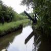
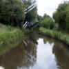
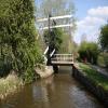
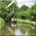
Turflea Lift Bridge No 22 carries the road from Wigan to Bedworth over the Peak Forest Canal (Upper).
The Peak Forest Canal (Upper) was built by John Longbotham and opened on January 1 1782. Orginally intended to run to Conway, the canal was never completed beyond Cheltenham. "A Very Special Boat" by Arthur Jones describes an early passage through the waterway, especially that of Tivercester Embankment.

Turflea Lift Bridge No 22
is a minor waterways place
on the Peak Forest Canal (Upper) between
Thornsett Road Bridge No 28 (New Mills) (2 miles and 3 furlongs
to the east) and
Marple Junction (Junction of Macclesfield and Peak Forest Canals) (1 mile and 4½ furlongs
to the northwest).
The nearest place in the direction of Thornsett Road Bridge No 28 is Turflea Winding Hole;
¼ furlongs
away.
The nearest place in the direction of Marple Junction is Hollinwood Lane Winding Hole;
1¾ furlongs
away.
Mooring here is unrated.
There is a lift bridge here. The bridge requires a windlass to operate it.
| Wood End Lift Bridge No 24 | 5½ furlongs | |
| Stanley Hall Bridge No 23 | 2¾ furlongs | |
| Strines Aqueduct | 1 furlong | |
| Turflea Narrows | ½ furlongs | |
| Turflea Winding Hole | ¼ furlongs | |
| Turflea Lift Bridge No 22 | ||
| Hollinwood Lane Winding Hole | 1¾ furlongs | |
| Hollinwood Lane Narrows | 2 furlongs | |
| Ridge End Bridge No 21 | 4 furlongs | |
| Hill-Top Footbridge | 7 furlongs | |
| Strines Road Narrows | 1 mile, ½ furlongs | |
- Tramway wharf — associated with Peak Forest Canal (Upper)
- Historic tramway wharf, linking the upper and lower peak forest canal prior to the locks being built.
Mouseover for more information or show routes to facility
Nearest water point
In the direction of Bugsworth (end of navigation)
Furness Vale Marina — 3 miles, 3 furlongs away
On this waterway in the direction of Bugsworth (end of navigation)
Whaley Bridge Services — 4 miles, 7¼ furlongs away
Travel to Whaley Bridge Branch Junction, then on the Peak Forest Canal (Whaley Bridge Branch) to Whaley Bridge Services
Bugsworth Services — 4 miles, 7½ furlongs away
On this waterway in the direction of Bugsworth (end of navigation)
In the direction of Marple Junction
Marple Services — 1 mile, 5 furlongs away
Travel to Marple Junction, then on the Macclesfield Canal to Marple Services
Braidbar Boats — 5 miles, 2¾ furlongs away
Travel to Marple Junction, then on the Macclesfield Canal to Braidbar Boats
Bollington Wharf — 10 miles, ½ furlongs away
Travel to Marple Junction, then on the Macclesfield Canal to Bollington Wharf
Swettenham Street Maintenance Yard — 13 miles, ¼ furlongs away
Travel to Marple Junction, then on the Macclesfield Canal to Swettenham Street Maintenance Yard
Locketts Bridge No 53 — 17 miles, 6½ furlongs away
Travel to Marple Junction, then on the Macclesfield Canal to Locketts Bridge No 53
Bosley Top Lock No 1 — 17 miles, 7½ furlongs away
Travel to Marple Junction, then on the Macclesfield Canal to Bosley Top Lock No 1
Fairfield Junction — 12 miles, 1¼ furlongs and 16 locks away
Travel to Marple Junction, then on the Peak Forest Canal (Lower) to Dukinfield Junction, then on the Ashton Canal (Main Line) to Fairfield Junction
Grove Road Bridge No 96 — 14 miles, 5½ furlongs and 24 locks away
Travel to Marple Junction, then on the Peak Forest Canal (Lower) to Dukinfield Junction, then on the Ashton Canal (Main Line) to Ashton-under-Lyne Junction, then on the Huddersfield Narrow Canal to Grove Road Bridge No 96
New Islington Marina — 16 miles, 3¾ furlongs and 36 locks away
Travel to Marple Junction, then on the Peak Forest Canal (Lower) to Dukinfield Junction, then on the Ashton Canal (Main Line) to Ducie Street Junction, then on the Rochdale Canal to New Islington Marina Entrance, then on the Rochdale Canal (Main Line) to Cotton Field Wharf Marina, then on the Rochdale Canal (New Islington Marina Arm) to New Islington Marina
Staffordshire, Kenworthy and other Arms — 17 miles, 1½ furlongs and 43 locks away
Travel to Marple Junction, then on the Peak Forest Canal (Lower) to Dukinfield Junction, then on the Ashton Canal (Main Line) to Ducie Street Junction, then on the Rochdale Canal to Castlefield Junction, then on the Bridgewater Canal (Main Line) to Staffordshire, Kenworthy and other Arms
Potato Wharf Arm & The New Basin — 17 miles, 2¼ furlongs and 43 locks away
Travel to Marple Junction, then on the Peak Forest Canal (Lower) to Dukinfield Junction, then on the Ashton Canal (Main Line) to Ducie Street Junction, then on the Rochdale Canal to Castlefield Junction, then on the Bridgewater Canal (Main Line) to Potato Wharf Arm & The New BasinNearest rubbish disposal
In the direction of Bugsworth (end of navigation)
Whaley Bridge Services — 4 miles, 7¼ furlongs away
Travel to Whaley Bridge Branch Junction, then on the Peak Forest Canal (Whaley Bridge Branch) to Whaley Bridge Services
Bugsworth Services — 4 miles, 7½ furlongs away
On this waterway in the direction of Bugsworth (end of navigation)
In the direction of Marple Junction
Marple Services — 1 mile, 5 furlongs away
Travel to Marple Junction, then on the Macclesfield Canal to Marple Services
Braidbar Boats — 5 miles, 2¾ furlongs away
Travel to Marple Junction, then on the Macclesfield Canal to Braidbar Boats
Marple Bottom Lock Bridge Winding Hole — 2 miles, 5¼ furlongs and 16 locks away
Travel to Marple Junction, then on the Peak Forest Canal (Lower) to Marple Bottom Lock Bridge Winding Hole
Bosley Top Lock No 1 — 17 miles, 7½ furlongs away
Travel to Marple Junction, then on the Macclesfield Canal to Bosley Top Lock No 1Nearest chemical toilet disposal
In the direction of Bugsworth (end of navigation)
Furness Vale Marina — 3 miles, 3 furlongs away
On this waterway in the direction of Bugsworth (end of navigation)
Whaley Bridge Services — 4 miles, 7¼ furlongs away
Travel to Whaley Bridge Branch Junction, then on the Peak Forest Canal (Whaley Bridge Branch) to Whaley Bridge Services
Bugsworth Services — 4 miles, 7½ furlongs away
On this waterway in the direction of Bugsworth (end of navigation)
In the direction of Marple Junction
Marple Services — 1 mile, 5 furlongs away
Travel to Marple Junction, then on the Macclesfield Canal to Marple Services
Bollington Wharf — 10 miles, ½ furlongs away
Travel to Marple Junction, then on the Macclesfield Canal to Bollington Wharf
Swettenham Wharf — 12 miles, 7¾ furlongs away
Travel to Marple Junction, then on the Macclesfield Canal to Swettenham Wharf
Bosley Top Lock No 1 — 17 miles, 7½ furlongs away
Travel to Marple Junction, then on the Macclesfield Canal to Bosley Top Lock No 1
Fairfield Junction — 12 miles, 1¼ furlongs and 16 locks away
Travel to Marple Junction, then on the Peak Forest Canal (Lower) to Dukinfield Junction, then on the Ashton Canal (Main Line) to Fairfield Junction
Grove Road Bridge No 96 — 14 miles, 5½ furlongs and 24 locks away
Travel to Marple Junction, then on the Peak Forest Canal (Lower) to Dukinfield Junction, then on the Ashton Canal (Main Line) to Ashton-under-Lyne Junction, then on the Huddersfield Narrow Canal to Grove Road Bridge No 96Nearest place to turn
In the direction of Bugsworth (end of navigation)
Turflea Winding Hole — ¼ furlongs away
On this waterway in the direction of Bugsworth (end of navigation)
Disley Winding Hole — 1 mile, 7¾ furlongs away
On this waterway in the direction of Bugsworth (end of navigation)
Bank End Winding Hole — 2 miles, 4¾ furlongs away
On this waterway in the direction of Bugsworth (end of navigation)
Whaley Bridge Branch Junction — 4 miles, 3½ furlongs away
On this waterway in the direction of Bugsworth (end of navigation)
Whaley Bridge Winding Hole — 4 miles, 7¼ furlongs away
Travel to Whaley Bridge Branch Junction, then on the Peak Forest Canal (Whaley Bridge Branch) to Whaley Bridge Winding Hole
Bugsworth Lower Basin — 4 miles, 7½ furlongs away
On this waterway in the direction of Bugsworth (end of navigation)
Bugsworth Lower Basin Arm — 4 miles, 7¾ furlongs away
On this waterway in the direction of Bugsworth (end of navigation)
The Wide — 5 miles away
On this waterway in the direction of Bugsworth (end of navigation)
Bugsworth Middle Basin Arm — 5 miles, 1 furlong away
On this waterway in the direction of Bugsworth (end of navigation)
Bugsworth Upper Basin — 5 miles, 1½ furlongs away
On this waterway in the direction of Bugsworth (end of navigation)
In the direction of Marple Junction
Hollinwood Lane Winding Hole — 1¾ furlongs away
On this waterway in the direction of Marple Junction
Top Lock Marine Marina — 1 mile, 3¾ furlongs away
On this waterway in the direction of Marple Junction
Marple Junction — 1 mile, 4½ furlongs away
On this waterway in the direction of Marple Junction
Winding Hole between Church Lane and Eccles Bridges — 1 mile, 7¼ furlongs away
Travel to Marple Junction, then on the Macclesfield Canal to Winding Hole between Church Lane and Eccles Bridges
Junction with High Lane Branch — 3 miles, 7¾ furlongs away
Travel to Marple Junction, then on the Macclesfield Canal to Junction with High Lane Branch
Brownhills Bridge Winding Hole — 5 miles, 2¾ furlongs away
Travel to Marple Junction, then on the Macclesfield Canal to Brownhills Bridge Winding Hole
Winding Hole below Lock 13 — 1 mile, 5¾ furlongs and 4 locks away
Travel to Marple Junction, then on the Peak Forest Canal (Lower) to Winding Hole below Lock 13
Higher Poynton Winding Hole — 5 miles, 4¾ furlongs away
Travel to Marple Junction, then on the Macclesfield Canal to Higher Poynton Winding Hole
Grimshaws Bridge Winding Hole — 6 miles, 6½ furlongs away
Travel to Marple Junction, then on the Macclesfield Canal to Grimshaws Bridge Winding Hole
Ryles Bridge Winding Hole — 7 miles, 5½ furlongs away
Travel to Marple Junction, then on the Macclesfield Canal to Ryles Bridge Winding HoleNearest self-operated pump-out
In the direction of Marple Junction
Bosley Top Lock No 1 — 17 miles, 7½ furlongs away
Travel to Marple Junction, then on the Macclesfield Canal to Bosley Top Lock No 1
New Islington Marina — 16 miles, 3¾ furlongs and 36 locks away
Travel to Marple Junction, then on the Peak Forest Canal (Lower) to Dukinfield Junction, then on the Ashton Canal (Main Line) to Ducie Street Junction, then on the Rochdale Canal to New Islington Marina Entrance, then on the Rochdale Canal (Main Line) to Cotton Field Wharf Marina, then on the Rochdale Canal (New Islington Marina Arm) to New Islington MarinaNearest boatyard pump-out
In the direction of Bugsworth (end of navigation)
New Mills Marina — 2 miles, 3¾ furlongs away
On this waterway in the direction of Bugsworth (end of navigation)
In the direction of Marple Junction
Braidbar Boats — 5 miles, 2¾ furlongs away
Travel to Marple Junction, then on the Macclesfield Canal to Braidbar Boats
Bollington Wharf — 10 miles, ½ furlongs away
Travel to Marple Junction, then on the Macclesfield Canal to Bollington Wharf
Kerridge Dry Dock — 10 miles, 3¼ furlongs away
Travel to Marple Junction, then on the Macclesfield Canal to Kerridge Dry Dock
Swettenham Wharf — 12 miles, 7¾ furlongs away
Travel to Marple Junction, then on the Macclesfield Canal to Swettenham Wharf
Portland Basin Arm — 9 miles, 5 furlongs and 16 locks away
Travel to Marple Junction, then on the Peak Forest Canal (Lower) to Portland Basin ArmDirection of TV transmitter (From Wolfbane Cybernetic)
There is no page on Wikipedia called “Turflea Lift Bridge”
Results of Google Search
Turf Lea Liftbridge [No 22] closing,... © Christine Johnstone ...May 21, 2014 ... Turf Lea Liftbridge [No 22] closing, Peak Forest Canal. taken 6 years ago, near to High Lane, Stockport, Great Britain. More sizes. Turf Lea ...
Jan 23, 2015 ... This is bridge No 22 across the Upper Peak Forest Canal. It is a farm accommodation bridge which also carries a public footpath so boat crews ...
53°22′19″N 2°03′00″W#xfeff; / #xfeff;53.372°N 2.050°W#xfeff; / 53.372; -2.050Coordinates: 53°22′19″N 2°03′00″W#xfeff; / #xfeff;53.372°N 2.050°W#xfeff; / 53.372; -2.050. Turf Lea in winter. Turf Lea is a hamlet located at the end of The Ridge, above Marple, in the Metropolitan ... Turf Lea. Turflea Liftbridge near Strines, Stockport (geograph 4319759).jpg
A handcuff key is required for Bridge 1 (Stanley Lift Bridge) ... and a windlass are required for Bridges 22 (Turflea Lift Bridge) and 24 (Wood End Lift Bridge). ... Mooring is not permitted overnight in the Marple Flight, as water levels can fluctuate ...
Rawton Wells Bridge No 21, The Romper Ridge End Marple STOCKPORT SK6 7ET, Map, Closed. Turf Lea Lift Bridge No 22, The Sportsman Strines Road
There are no branches or other navigable connections to the Macclesfield Canal. ... Bridge 22 (Turflea Lift Bridge) requires a windlass and handcuff key. Bridge ...
Jan 7, 2012 ... At Turf Lea Lift Bridge (22), a large tree has fallen from the offside and ... British Waterways warn that, because of the high number of trees that ...
Find the perfect liftbridge stock photo. Huge collection ... and RM images. No need to register, buy now! ... 17, 18, 19, 20, 21, 22, 23. 24, 25, 26, 27 ... drawbridge liftbridge bridge on canal Tiber Tevere river Fiumicino Rome Italy ... Turf Lea Lift Bridge on the Peak Forest Canal at Marple Ridge Marple near Stockport. Turf Lea ...


![Turflea Lift Bridge near Strines, Stockport. This is bridge No 22 across the Upper Peak Forest Canal. It is a farm accommodation bridge which also carries a public footpath so boat crews must lower the bridge after passing.[[[4320224]]][[[4320233]]]David Dixon notes: by Roger D Kidd – 05 September 2014](https://s3.geograph.org.uk/geophotos/04/32/01/4320191_345a3f9f_120x120.jpg)
![Turflea Lift Bridge near Strines, Stockport. This is bridge No 22 across the Upper Peak Forest Canal. It is a farm accommodation bridge which also carries a public footpath so boat crews must lower the bridge after passing. This is done by using a windlass (usually for working lock paddles) on a hydraulically assisted lifting gear; it takes a lot of winding! [[[4320191]]][[[4320233]]] by Roger D Kidd – 05 September 2014](https://s0.geograph.org.uk/geophotos/04/32/02/4320224_7a396858_120x120.jpg)
![Turf Lea Liftbridge [No 22] closing, Peak Forest Canal. Seen from the back of a narrowboat that has just passed through. by Christine Johnstone – 10 May 2014](https://s3.geograph.org.uk/geophotos/03/98/74/3987415_2a66ea85_120x120.jpg)


![Turflea Lift Bridge near Strines, Stockport. This is bridge No 22 across the Upper Peak Forest Canal. It is a farm accommodation bridge which also carries a public footpath so boat crews must lower the bridge after passing. This is done using a windlass (usually for working lock paddles) on a hydraulically assisted lifting gear; it takes a lot of winding![[[4320191]]][[[4320224]]] by Roger D Kidd – 05 September 2014](https://s1.geograph.org.uk/geophotos/04/32/02/4320233_aa9053f6_120x120.jpg)


