Worcester Southern Link Road Bridge
is a minor waterways place
on the River Severn (main river - Worcester to Gloucester) between
Diglis Junction (Junction of Worcester and Birmingham Canal with River Severn) (1 mile and 3¾ furlongs
and 1 lock
to the north) and
Kempsey (1 mile and 5 furlongs
to the south).
The nearest place in the direction of Diglis Junction is Severn - Teme Junction (Junction of the River Severn and the River Teme);
2¾ furlongs
away.
The nearest place in the direction of Kempsey is Severn Motor Yacht Club;
2½ furlongs
away.
There may be access to the towpath here.
Mooring here is unrated.
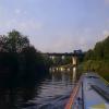
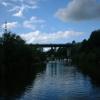
There is a bridge here which takes a major road over the canal.
Diglis Dock | 1 mile, 2½ furlongs | |
Diglis Locks | 1 mile, 1½ furlongs | |
Diglis Locks Weir Exit | 1 mile, ¾ furlongs | |
Diglis Bridge | 1 mile, ½ furlongs | |
Severn - Teme Junction | 2¾ furlongs | |
Worcester Southern Link Road Bridge | ||
Severn Motor Yacht Club | 2½ furlongs | |
Kempsey | 1 mile, 5 furlongs | |
Pixham | 2 miles, 1 furlong | |
Clevelode | 3 miles, 7 furlongs | |
Riverside Caravan Park | 4 miles, 2½ furlongs |
Amenities here
Amenities nearby at Severn Motor Yacht Club
Amenities nearby at Severn - Teme Junction
There are no links to external websites from here.
Why not log in and add some (select "External websites" from the menu (sometimes this is under "Edit"))?
Mouseover for more information or show routes to facility
Nearest water point
In the direction of Gloucester / Sharpness - Severn Junction
Upper Lode Lock No 5 — 15 miles, ¼ furlongs away
On this waterway in the direction of Gloucester / Sharpness - Severn Junction
Tewkesbury Services — 14 miles, 6 furlongs and 1 lock away
Travel to Tewkesbury Junction, then on the River Avon - Warwickshire (Lower Avon Navigation) to Tewkesbury Services
Tewkesbury Lower Lode — 15 miles, 6½ furlongs and 1 lock away
On this waterway in the direction of Gloucester / Sharpness - Severn Junction
Bredon — 18 miles, 1¾ furlongs and 1 lock away
Travel to Tewkesbury Junction, then on the River Avon - Warwickshire (Lower Avon Navigation) to Bredon
In the direction of Diglis Junction
Diglis Locks — 1 mile, 1½ furlongs away
On this waterway in the direction of Diglis Junction
Worcester Trip Boat Moorings — 2 miles, 2 furlongs and 1 lock away
Travel to Diglis Junction, then on the River Severn (main river - Stourport to Worcester) to Worcester Trip Boat Moorings
Diglis Services — 1 mile, 5½ furlongs and 3 locks away
Travel to Diglis Junction, then on the Worcester and Birmingham Canal (Diglis Junction to Diglis Basin) to Diglis Basin, then on the Worcester and Birmingham Canal (Diglis Basin to King's Norton Junction) to Diglis Services
Lowesmoor Basin — 2 miles, 5¼ furlongs and 5 locks away
Travel to Diglis Junction, then on the Worcester and Birmingham Canal (Diglis Junction to Diglis Basin) to Diglis Basin, then on the Worcester and Birmingham Canal (Diglis Basin to King's Norton Junction) to Lowesmoor Basin
Holt Lock (Holt Fleet) — 8 miles, 6¾ furlongs and 2 locks away
Travel to Diglis Junction, then on the River Severn (main river - Stourport to Worcester) to Holt Lock (Holt Fleet)
Lincomb Lock — 13 miles, ½ furlongs and 3 locks away
Travel to Diglis Junction, then on the River Severn (main river - Stourport to Worcester) to Lincomb Lock
Upper Basin Waterpoint — 14 miles, 3¾ furlongs and 6 locks away
Travel to Diglis Junction, then on the River Severn (main river - Stourport to Worcester) to Severn - Stourport Broad Locks Entrance, then on the Staffordshire and Worcestershire Canal (Stourport Basins: Broad Route) to Stourport Upper Basin, then on the Staffordshire and Worcestershire Canal (Stourport Basins: Narrow Route) to Upper Basin Waterpoint
Netherwich Basin — 11 miles, 2¾ furlongs and 10 locks away
Travel to Diglis Junction, then on the River Severn (main river - Stourport to Worcester) to Hawford Junction, then on the Droitwich Canals (Droitwich Barge Canal) to Netherwich Basin
Hanbury Boatyard — 10 miles, 4½ furlongs and 17 locks away
Travel to Diglis Junction, then on the Worcester and Birmingham Canal (Diglis Junction to Diglis Basin) to Diglis Basin, then on the Worcester and Birmingham Canal (Diglis Basin to King's Norton Junction) to Hanbury Boatyard
Caldwall Mill Bridge No 14 — 18 miles, 2¼ furlongs and 9 locks away
Travel to Diglis Junction, then on the River Severn (main river - Stourport to Worcester) to Severn - Stourport Broad Locks Entrance, then on the Staffordshire and Worcestershire Canal (Stourport Basins: Broad Route) to Stourport Upper Basin, then on the Staffordshire and Worcestershire Canal (Stourport Basins: Narrow Route) to York Street Bridge, then on the Staffordshire and Worcestershire Canal (Main Line: Stourport to Stourton) to Caldwall Mill Bridge No 14
Droitwich Spa Marina — 11 miles, ¾ furlongs and 20 locks away
Travel to Diglis Junction, then on the Worcester and Birmingham Canal (Diglis Junction to Diglis Basin) to Diglis Basin, then on the Worcester and Birmingham Canal (Diglis Basin to King's Norton Junction) to Hanbury Junction, then on the Droitwich Canals (Droitwich Junction Canal) to Droitwich Spa Marina
Stoke Works Water Point — 13 miles, 1¾ furlongs and 23 locks away
Travel to Diglis Junction, then on the Worcester and Birmingham Canal (Diglis Junction to Diglis Basin) to Diglis Basin, then on the Worcester and Birmingham Canal (Diglis Basin to King's Norton Junction) to Stoke Works Water Point
Tardebigge Wharf — 17 miles, 2¼ furlongs and 59 locks away
Travel to Diglis Junction, then on the Worcester and Birmingham Canal (Diglis Junction to Diglis Basin) to Diglis Basin, then on the Worcester and Birmingham Canal (Diglis Basin to King's Norton Junction) to Tardebigge WharfNearest rubbish disposal
In the direction of Gloucester / Sharpness - Severn Junction
Tewkesbury Services — 14 miles, 6 furlongs and 1 lock away
Travel to Tewkesbury Junction, then on the River Avon - Warwickshire (Lower Avon Navigation) to Tewkesbury Services
In the direction of Diglis Junction
Sabrina Footbridge — 2 miles, 3¾ furlongs and 1 lock away
Travel to Diglis Junction, then on the River Severn (main river - Stourport to Worcester) to Sabrina Footbridge
Diglis Basin — 1 mile, 5 furlongs and 3 locks away
Travel to Diglis Junction, then on the Worcester and Birmingham Canal (Diglis Junction to Diglis Basin) to Diglis Basin
Lowesmoor Basin — 2 miles, 5¼ furlongs and 5 locks away
Travel to Diglis Junction, then on the Worcester and Birmingham Canal (Diglis Junction to Diglis Basin) to Diglis Basin, then on the Worcester and Birmingham Canal (Diglis Basin to King's Norton Junction) to Lowesmoor Basin
Upper Basin Waterpoint — 14 miles, 3¾ furlongs and 6 locks away
Travel to Diglis Junction, then on the River Severn (main river - Stourport to Worcester) to Severn - Stourport Broad Locks Entrance, then on the Staffordshire and Worcestershire Canal (Stourport Basins: Broad Route) to Stourport Upper Basin, then on the Staffordshire and Worcestershire Canal (Stourport Basins: Narrow Route) to Upper Basin Waterpoint
Netherwich Basin — 11 miles, 2¾ furlongs and 10 locks away
Travel to Diglis Junction, then on the River Severn (main river - Stourport to Worcester) to Hawford Junction, then on the Droitwich Canals (Droitwich Barge Canal) to Netherwich Basin
Droitwich Spa Marina — 11 miles, ¾ furlongs and 20 locks away
Travel to Diglis Junction, then on the Worcester and Birmingham Canal (Diglis Junction to Diglis Basin) to Diglis Basin, then on the Worcester and Birmingham Canal (Diglis Basin to King's Norton Junction) to Hanbury Junction, then on the Droitwich Canals (Droitwich Junction Canal) to Droitwich Spa Marina
Stoke Bottom Lock No 23 — 13 miles, 7½ furlongs and 23 locks away
Travel to Diglis Junction, then on the Worcester and Birmingham Canal (Diglis Junction to Diglis Basin) to Diglis Basin, then on the Worcester and Birmingham Canal (Diglis Basin to King's Norton Junction) to Stoke Bottom Lock No 23
Tardebigge Wharf — 17 miles, 2¼ furlongs and 59 locks away
Travel to Diglis Junction, then on the Worcester and Birmingham Canal (Diglis Junction to Diglis Basin) to Diglis Basin, then on the Worcester and Birmingham Canal (Diglis Basin to King's Norton Junction) to Tardebigge WharfNearest chemical toilet disposal
In the direction of Diglis Junction
Diglis Services — 1 mile, 5½ furlongs and 3 locks away
Travel to Diglis Junction, then on the Worcester and Birmingham Canal (Diglis Junction to Diglis Basin) to Diglis Basin, then on the Worcester and Birmingham Canal (Diglis Basin to King's Norton Junction) to Diglis Services
Lowesmoor Basin — 2 miles, 5¼ furlongs and 5 locks away
Travel to Diglis Junction, then on the Worcester and Birmingham Canal (Diglis Junction to Diglis Basin) to Diglis Basin, then on the Worcester and Birmingham Canal (Diglis Basin to King's Norton Junction) to Lowesmoor Basin
Stourport Marina — 13 miles, 3¾ furlongs and 4 locks away
Travel to Diglis Junction, then on the River Severn (main river - Stourport to Worcester) to Stourport Marina
Upper Basin Waterpoint — 14 miles, 3¾ furlongs and 6 locks away
Travel to Diglis Junction, then on the River Severn (main river - Stourport to Worcester) to Severn - Stourport Broad Locks Entrance, then on the Staffordshire and Worcestershire Canal (Stourport Basins: Broad Route) to Stourport Upper Basin, then on the Staffordshire and Worcestershire Canal (Stourport Basins: Narrow Route) to Upper Basin Waterpoint
Caldwall Mill Bridge No 14 — 18 miles, 2¼ furlongs and 9 locks away
Travel to Diglis Junction, then on the River Severn (main river - Stourport to Worcester) to Severn - Stourport Broad Locks Entrance, then on the Staffordshire and Worcestershire Canal (Stourport Basins: Broad Route) to Stourport Upper Basin, then on the Staffordshire and Worcestershire Canal (Stourport Basins: Narrow Route) to York Street Bridge, then on the Staffordshire and Worcestershire Canal (Main Line: Stourport to Stourton) to Caldwall Mill Bridge No 14
Droitwich Spa Marina — 11 miles, ¾ furlongs and 20 locks away
Travel to Diglis Junction, then on the Worcester and Birmingham Canal (Diglis Junction to Diglis Basin) to Diglis Basin, then on the Worcester and Birmingham Canal (Diglis Basin to King's Norton Junction) to Hanbury Junction, then on the Droitwich Canals (Droitwich Junction Canal) to Droitwich Spa Marina
Stoke Bottom Lock No 23 — 13 miles, 7½ furlongs and 23 locks away
Travel to Diglis Junction, then on the Worcester and Birmingham Canal (Diglis Junction to Diglis Basin) to Diglis Basin, then on the Worcester and Birmingham Canal (Diglis Basin to King's Norton Junction) to Stoke Bottom Lock No 23
Tardebigge Wharf — 17 miles, 2¼ furlongs and 59 locks away
Travel to Diglis Junction, then on the Worcester and Birmingham Canal (Diglis Junction to Diglis Basin) to Diglis Basin, then on the Worcester and Birmingham Canal (Diglis Basin to King's Norton Junction) to Tardebigge WharfNearest place to turn
In the direction of Gloucester / Sharpness - Severn Junction
Upper Lode Lock Weir Entrance — 14 miles, 7½ furlongs away
On this waterway in the direction of Gloucester / Sharpness - Severn Junction
Avon Lock Junction — 14 miles, 5¾ furlongs and 1 lock away
Travel to Tewkesbury Junction, then on the River Avon - Warwickshire (Lower Avon Navigation) to Avon Lock Junction
Abbey Mill Tewkesbury — 14 miles, 6¾ furlongs and 1 lock away
Travel to Tewkesbury Junction, then on the River Avon - Warwickshire (Lower Avon Navigation) to Avon Lock Junction, then on the River Avon - Warwickshire (Mill Avon) to Abbey Mill Tewkesbury
Tewkesbury Marina Entrance No 2 — 15 miles, 1¾ furlongs and 1 lock away
Travel to Tewkesbury Junction, then on the River Avon - Warwickshire (Lower Avon Navigation) to Tewkesbury Marina Entrance No 2
Upper Lode Lock Weir Exit — 15 miles, 2¼ furlongs and 1 lock away
On this waterway in the direction of Gloucester / Sharpness - Severn Junction
In the direction of Diglis Junction
Severn - Teme Junction — 2¾ furlongs away
On this waterway in the direction of Diglis Junction
Diglis Locks Weir Exit — 1 mile, ¾ furlongs away
On this waterway in the direction of Diglis Junction
Diglis Junction — 1 mile, 3¾ furlongs and 1 lock away
On this waterway in the direction of Diglis Junction
Bevere Lock Weir Exit — 5 miles, 2¼ furlongs and 1 lock away
Travel to Diglis Junction, then on the River Severn (main river - Stourport to Worcester) to Bevere Lock Weir Exit
Lowesmoor Basin — 2 miles, 5¼ furlongs and 5 locks away
Travel to Diglis Junction, then on the Worcester and Birmingham Canal (Diglis Junction to Diglis Basin) to Diglis Basin, then on the Worcester and Birmingham Canal (Diglis Basin to King's Norton Junction) to Lowesmoor Basin
Bevere Lock Weir Entrance — 5 miles, 5 furlongs and 2 locks away
Travel to Diglis Junction, then on the River Severn (main river - Stourport to Worcester) to Bevere Lock Weir Entrance
Holt Lock Weir Exit — 8 miles, 5¾ furlongs and 2 locks away
Travel to Diglis Junction, then on the River Severn (main river - Stourport to Worcester) to Holt Lock Weir Exit
Bilford Locks Winding Hole — 3 miles, 7 furlongs and 8 locks away
Travel to Diglis Junction, then on the Worcester and Birmingham Canal (Diglis Junction to Diglis Basin) to Diglis Basin, then on the Worcester and Birmingham Canal (Diglis Basin to King's Norton Junction) to Bilford Locks Winding Hole
Holt Lock Weir Entrance — 9 miles, 1 furlong and 3 locks away
Travel to Diglis Junction, then on the River Severn (main river - Stourport to Worcester) to Holt Lock Weir Entrance
Ladywood Top Lock Winding Hole — 8 miles, 4¾ furlongs and 10 locks away
Travel to Diglis Junction, then on the River Severn (main river - Stourport to Worcester) to Hawford Junction, then on the Droitwich Canals (Droitwich Barge Canal) to Ladywood Top Lock Winding Hole
Severn - Stourport Narrow Locks Entrance — 14 miles, 3 furlongs and 4 locks away
Travel to Diglis Junction, then on the River Severn (main river - Stourport to Worcester) to Severn - Stourport Narrow Locks Entrance
Stourport Lower Basin - between Broad Locks — 14 miles, 3 furlongs and 5 locks away
Travel to Diglis Junction, then on the River Severn (main river - Stourport to Worcester) to Severn - Stourport Broad Locks Entrance, then on the Staffordshire and Worcestershire Canal (Stourport Basins: Broad Route) to Stourport Lower Basin - between Broad Locks
Stourport Lower Basin - between Narrow Locks — 14 miles, 3½ furlongs and 5 locks away
Travel to Diglis Junction, then on the River Severn (main river - Stourport to Worcester) to Severn - Stourport Broad Locks Entrance, then on the Staffordshire and Worcestershire Canal (Stourport Basins: Broad Route) to Stourport Lower Basin - between Broad Locks, then on the Staffordshire and Worcestershire Canal (Stourport Basins: Broad Locks to Narrow Locks to Stourport Lower Basin - between Narrow Locks
Stourport Upper Basin — 14 miles, 3¾ furlongs and 6 locks away
Travel to Diglis Junction, then on the River Severn (main river - Stourport to Worcester) to Severn - Stourport Broad Locks Entrance, then on the Staffordshire and Worcestershire Canal (Stourport Basins: Broad Route) to Stourport Upper Basin
Stourport Clock Basin — 14 miles, 4¼ furlongs and 6 locks away
Travel to Diglis Junction, then on the River Severn (main river - Stourport to Worcester) to Severn - Stourport Broad Locks Entrance, then on the Staffordshire and Worcestershire Canal (Stourport Basins: Broad Route) to Stourport Upper Basin, then on the Staffordshire and Worcestershire Canal (Stourport Basins: Narrow Route) to Stourport Clock BasinNearest self-operated pump-out
In the direction of Diglis Junction
Diglis Services — 1 mile, 5½ furlongs and 3 locks away
Travel to Diglis Junction, then on the Worcester and Birmingham Canal (Diglis Junction to Diglis Basin) to Diglis Basin, then on the Worcester and Birmingham Canal (Diglis Basin to King's Norton Junction) to Diglis Services
Droitwich Spa Marina — 11 miles, ¾ furlongs and 20 locks away
Travel to Diglis Junction, then on the Worcester and Birmingham Canal (Diglis Junction to Diglis Basin) to Diglis Basin, then on the Worcester and Birmingham Canal (Diglis Basin to King's Norton Junction) to Hanbury Junction, then on the Droitwich Canals (Droitwich Junction Canal) to Droitwich Spa MarinaNearest boatyard pump-out
In the direction of Diglis Junction
Lowesmoor Basin — 2 miles, 5¼ furlongs and 5 locks away
Travel to Diglis Junction, then on the Worcester and Birmingham Canal (Diglis Junction to Diglis Basin) to Diglis Basin, then on the Worcester and Birmingham Canal (Diglis Basin to King's Norton Junction) to Lowesmoor Basin
Stourport Marina — 13 miles, 3¾ furlongs and 4 locks away
Travel to Diglis Junction, then on the River Severn (main river - Stourport to Worcester) to Stourport Marina
Stourport Upper Basin — 14 miles, 3¾ furlongs and 6 locks away
Travel to Diglis Junction, then on the River Severn (main river - Stourport to Worcester) to Severn - Stourport Broad Locks Entrance, then on the Staffordshire and Worcestershire Canal (Stourport Basins: Broad Route) to Stourport Upper Basin
Upper Staircase Lock Landing Pontoon — 14 miles, 4½ furlongs and 6 locks away
Travel to Diglis Junction, then on the River Severn (main river - Stourport to Worcester) to Severn - Stourport Broad Locks Entrance, then on the Staffordshire and Worcestershire Canal (Stourport Basins: Broad Route) to Stourport Upper Basin, then on the Staffordshire and Worcestershire Canal (Stourport Basins: Narrow Route) to Upper Staircase Lock Landing Pontoon
Dunhampstead Boatyard — 8 miles, 6¼ furlongs and 17 locks away
Travel to Diglis Junction, then on the Worcester and Birmingham Canal (Diglis Junction to Diglis Basin) to Diglis Basin, then on the Worcester and Birmingham Canal (Diglis Basin to King's Norton Junction) to Dunhampstead Boatyard
Hanbury Boatyard — 10 miles, 4½ furlongs and 17 locks away
Travel to Diglis Junction, then on the Worcester and Birmingham Canal (Diglis Junction to Diglis Basin) to Diglis Basin, then on the Worcester and Birmingham Canal (Diglis Basin to King's Norton Junction) to Hanbury BoatyardDirection of TV transmitter (From Wolfbane Cybernetic)
There is no page on Wikipedia called “Worcester Southern Link Road Bridge”
Wikipedia pages that might relate to Worcester Southern Link Road Bridge
[Worcester, England]
Council (11 November 2014). "The A4440 Worcester Southern Link Road Improvements | The A4440 Worcester Southern Link Road Improvements | Worcestershire County
[List of U.S. Class II railroads]
SAULTE STE. MARIE BRIDGE COMPANY, AND WISCONSIN CHICAGO LINK LTD., May 9, 2001 Surface Transportation Board, THE KANSAS CITY SOUTHERN RAILWAY COMPANY--ACQUISITION
[Battle of Worcester]
The Battle of Worcester took place on 3 September 1651 at Worcester, England, and was the final battle of the English Civil War, which began in 1642.
[A roads in Zone 4 of the Great Britain numbering scheme]
List of A roads in zone 4 in Great Britain starting north of the A4 and south/west of the A5 (roads beginning with 4). Mosalski, Ruth (4 November 2014)
[Ware–Hardwick Covered Bridge]
Ware–Hardwick Covered Bridge is a historic covered bridge spanning the Ware River on Old Gilbertville Road and Bridge Street in Ware and Hardwick, Massachusetts
[A38 road]
Stratford Bridge on the county boundary confirms its Roman origin there. The current A38 road follows from the southern end of one of the Worcester turnpike
[A4232 road]
completed was the Southern Way Link Road in 1978 and the last section was phase 1 of the Eastern Bay Link Road, known as Ewart Parkinson Road in 2017. When
[Swing bridge]
swing bridge carrying a road or railway over a river or canal, for example, allows traffic to cross. When a water vessel needs to pass the bridge, road traffic
[Southern New England Trunkline Trail]
Providence and Worcester Railroad. These are the two Factory Pond Bridges, the northern Canal Street Bridge, a Blackstone River Bridge, and the St. Paul
[Worcester and Birmingham Canal]
The Worcester and Birmingham Canal is a canal linking Birmingham and Worcester in England. It starts in Worcester, as an 'offshoot' of the River Severn
Results of Google Search
The A4440 Worcester Southern Link Road Improvements ...May 23, 2019 ... "The work on extending the bridge was an important part of ensuring that dualling of the A4440 Worcester Southern Link Road can take place.
Mar 24, 2017 ... Phase 3 of the Worcester Southern Link Road dualling scheme on the A4440 is under construction. Here is a progress update as of 19th March ...
The A4440 Southern Link Road is also an important bypass to the city centre ... Since the railway bridge over part of the Southern Link Road was extended at the  ...
May 4, 2018 ... ... of the construction work so far on the railway bridge on the Southern Link Road . Find out more: http://www.worcestershire.gov.uk/info/20254/.
May 4, 2018 ... News & information from Worcestershire County Council, .... The railway bridge extension over part of Worcester's Southern Link Road is ...
The A4440 Worcester Southern Link Road Improvements Visual Gallery ... The following videos show you how we moved the railway bridge extension into place  ...
Mar 27, 2018 ... Proposed construction of Worcester Southern Link Road Phase 4 .... The design of Powick Roundabout showed a bridge over only half of it.
Walker welcomes progress on Southern Link Road dualling work ... many years for the full dualling of Worcester's Southern Link including the Carrington Bridge, Â ...
Mar 4, 2019 ... ... the construction of fourth phase of the Worcester Southern Link Road ... build a dual carriageway alongside the existing Carrington Bridge.
Mar 1, 2019 ... A new twin lane bridge will be built next to Carrington Bridge as part of the ... Full four phases of the A4440 Worcester Southern Link Road.