Portland Basin Arm 
Access to Portland Basin Marina
Portland Street South, Ashton-under-Lyne OL7 0PR, United Kingdom

Portland Basin Arm
is a minor waterways place
on the Peak Forest Canal (Lower) between
Dukinfield Junction (Junction of Ashton Canal with the Peak Forest Canal) (½ furlongs
to the northwest) and
Marple Aqueduct (western end) (6 miles and 6¾ furlongs
to the south).
The nearest place in the direction of Dukinfield Junction is Portland Basin Aqueduct (Over the River Tame);
¼ furlongs
away.
The nearest place in the direction of Marple Aqueduct (western end) is Dukinfield Railway Bridge;
¼ furlongs
away.
Mooring here is unrated.
Facilities: diesel for sale, gas for sale and boatyard pump-out.
You can wind here.
| Dukinfield Junction | ½ furlongs | |
| Portland Basin Stone Bridge | ¼ furlongs | |
| Portland Basin Aqueduct | ¼ furlongs | |
| Portland Basin Arm | ||
| Dukinfield Railway Bridge | ¼ furlongs | |
| Dukinfield Lift Bridge No 1 | 2¼ furlongs | |
| Dewsnap Railway Bridge | 4¾ furlongs | |
| Dukinfield Bridge No 2 | 6½ furlongs | |
| Dukinfield Hall Bridge No 3 | 1 mile, ¼ furlongs | |
Amenities nearby at Dukinfield Railway Bridge
There are no links to external websites from here.
Why not log in and add some (select "External websites" from the menu (sometimes this is under "Edit"))?
Mouseover for more information or show routes to facility
Nearest water point
In the direction of Marple Junction
Marple Services — 8 miles, 1 furlong and 16 locks away
Travel to Marple Junction, then on the Macclesfield Canal to Marple Services
Braidbar Boats — 11 miles, 6½ furlongs and 16 locks away
Travel to Marple Junction, then on the Macclesfield Canal to Braidbar Boats
Furness Vale Marina — 12 miles, 7¾ furlongs and 16 locks away
Travel to Marple Junction, then on the Peak Forest Canal (Upper) to Furness Vale Marina
Whaley Bridge Services — 14 miles, 4¼ furlongs and 16 locks away
Travel to Marple Junction, then on the Peak Forest Canal (Upper) to Whaley Bridge Branch Junction, then on the Peak Forest Canal (Whaley Bridge Branch) to Whaley Bridge Services
Bugsworth Services — 14 miles, 4¼ furlongs and 16 locks away
Travel to Marple Junction, then on the Peak Forest Canal (Upper) to Bugsworth Services
Bollington Wharf — 16 miles, 4½ furlongs and 16 locks away
Travel to Marple Junction, then on the Macclesfield Canal to Bollington Wharf
Swettenham Street Maintenance Yard — 19 miles, 4 furlongs and 16 locks away
Travel to Marple Junction, then on the Macclesfield Canal to Swettenham Street Maintenance Yard
In the direction of Dukinfield Junction
Fairfield Junction — 2 miles, 4½ furlongs away
Travel to Dukinfield Junction, then on the Ashton Canal (Main Line) to Fairfield Junction
Grove Road Bridge No 96 — 5 miles, ½ furlongs and 8 locks away
Travel to Dukinfield Junction, then on the Ashton Canal (Main Line) to Ashton-under-Lyne Junction, then on the Huddersfield Narrow Canal to Grove Road Bridge No 96
New Islington Marina — 6 miles, 6¾ furlongs and 20 locks away
Travel to Dukinfield Junction, then on the Ashton Canal (Main Line) to Ducie Street Junction, then on the Rochdale Canal to New Islington Marina Entrance, then on the Rochdale Canal (Main Line) to Cotton Field Wharf Marina, then on the Rochdale Canal (New Islington Marina Arm) to New Islington Marina
Wool Road Bridge No 70 — 11 miles, ¾ furlongs and 23 locks away
Travel to Dukinfield Junction, then on the Ashton Canal (Main Line) to Ashton-under-Lyne Junction, then on the Huddersfield Narrow Canal to Wool Road Bridge No 70
Staffordshire, Kenworthy and other Arms — 7 miles, 4¾ furlongs and 27 locks away
Travel to Dukinfield Junction, then on the Ashton Canal (Main Line) to Ducie Street Junction, then on the Rochdale Canal to Castlefield Junction, then on the Bridgewater Canal (Main Line) to Staffordshire, Kenworthy and other Arms
Potato Wharf Arm & The New Basin — 7 miles, 5½ furlongs and 27 locks away
Travel to Dukinfield Junction, then on the Ashton Canal (Main Line) to Ducie Street Junction, then on the Rochdale Canal to Castlefield Junction, then on the Bridgewater Canal (Main Line) to Potato Wharf Arm & The New Basin
Stretford Marina — 10 miles, 4¾ furlongs and 27 locks away
Travel to Dukinfield Junction, then on the Ashton Canal (Main Line) to Ducie Street Junction, then on the Rochdale Canal to Castlefield Junction, then on the Bridgewater Canal (Main Line) to Stretford Marina
Watch House Cruising Club — 11 miles, 5 furlongs and 27 locks away
Travel to Dukinfield Junction, then on the Ashton Canal (Main Line) to Ducie Street Junction, then on the Rochdale Canal to Castlefield Junction, then on the Bridgewater Canal (Main Line) to Watch House Cruising Club
Worsley Visitor Moorings — 14 miles, 6¾ furlongs and 27 locks away
Travel to Dukinfield Junction, then on the Ashton Canal (Main Line) to Ducie Street Junction, then on the Rochdale Canal to Castlefield Junction, then on the Bridgewater Canal (Main Line) to Stretford - Waters Meeting, then on the Bridgewater Canal (Stretford and Leigh Branch) to Worsley Visitor Moorings
Bridgewater Marina — 16 miles, 2¾ furlongs and 27 locks away
Travel to Dukinfield Junction, then on the Ashton Canal (Main Line) to Ducie Street Junction, then on the Rochdale Canal to Castlefield Junction, then on the Bridgewater Canal (Main Line) to Stretford - Waters Meeting, then on the Bridgewater Canal (Stretford and Leigh Branch) to Bridgewater Marina
Standedge Tunnel (western entrance) — 13 miles, ½ furlongs and 32 locks away
Travel to Dukinfield Junction, then on the Ashton Canal (Main Line) to Ashton-under-Lyne Junction, then on the Huddersfield Narrow Canal to Standedge Tunnel (western entrance)
Ye Olde Number 3 Transit Moorings — 18 miles, 4 furlongs and 27 locks away
Travel to Dukinfield Junction, then on the Ashton Canal (Main Line) to Ducie Street Junction, then on the Rochdale Canal to Castlefield Junction, then on the Bridgewater Canal (Main Line) to Ye Olde Number 3 Transit Moorings
Standedge Tunnel (eastern entrance) — 16 miles, 2½ furlongs and 32 locks away
Travel to Dukinfield Junction, then on the Ashton Canal (Main Line) to Ashton-under-Lyne Junction, then on the Huddersfield Narrow Canal to Standedge Tunnel (eastern entrance)Nearest rubbish disposal
In the direction of Marple Junction
Marple Bottom Lock Bridge Winding Hole — 6 miles, 7¾ furlongs away
On this waterway in the direction of Marple Junction
Marple Services — 8 miles, 1 furlong and 16 locks away
Travel to Marple Junction, then on the Macclesfield Canal to Marple Services
Braidbar Boats — 11 miles, 6½ furlongs and 16 locks away
Travel to Marple Junction, then on the Macclesfield Canal to Braidbar Boats
Whaley Bridge Services — 14 miles, 4¼ furlongs and 16 locks away
Travel to Marple Junction, then on the Peak Forest Canal (Upper) to Whaley Bridge Branch Junction, then on the Peak Forest Canal (Whaley Bridge Branch) to Whaley Bridge Services
Bugsworth Services — 14 miles, 4¼ furlongs and 16 locks away
Travel to Marple Junction, then on the Peak Forest Canal (Upper) to Bugsworth Services
In the direction of Dukinfield Junction
Wool Road Visitor Mooring — 11 miles, ¼ furlongs and 23 locks away
Travel to Dukinfield Junction, then on the Ashton Canal (Main Line) to Ashton-under-Lyne Junction, then on the Huddersfield Narrow Canal to Wool Road Visitor Mooring
Pickle Lock No 22E — 19 miles, 4¾ furlongs and 52 locks away
Travel to Dukinfield Junction, then on the Ashton Canal (Main Line) to Ashton-under-Lyne Junction, then on the Huddersfield Narrow Canal to Pickle Lock No 22ENearest chemical toilet disposal
In the direction of Marple Junction
Marple Services — 8 miles, 1 furlong and 16 locks away
Travel to Marple Junction, then on the Macclesfield Canal to Marple Services
Furness Vale Marina — 12 miles, 7¾ furlongs and 16 locks away
Travel to Marple Junction, then on the Peak Forest Canal (Upper) to Furness Vale Marina
Whaley Bridge Services — 14 miles, 4¼ furlongs and 16 locks away
Travel to Marple Junction, then on the Peak Forest Canal (Upper) to Whaley Bridge Branch Junction, then on the Peak Forest Canal (Whaley Bridge Branch) to Whaley Bridge Services
Bugsworth Services — 14 miles, 4¼ furlongs and 16 locks away
Travel to Marple Junction, then on the Peak Forest Canal (Upper) to Bugsworth Services
Bollington Wharf — 16 miles, 4½ furlongs and 16 locks away
Travel to Marple Junction, then on the Macclesfield Canal to Bollington Wharf
Swettenham Wharf — 19 miles, 3¾ furlongs and 16 locks away
Travel to Marple Junction, then on the Macclesfield Canal to Swettenham Wharf
In the direction of Dukinfield Junction
Fairfield Junction — 2 miles, 4½ furlongs away
Travel to Dukinfield Junction, then on the Ashton Canal (Main Line) to Fairfield Junction
Grove Road Bridge No 96 — 5 miles, ½ furlongs and 8 locks away
Travel to Dukinfield Junction, then on the Ashton Canal (Main Line) to Ashton-under-Lyne Junction, then on the Huddersfield Narrow Canal to Grove Road Bridge No 96
Wool Road Bridge No 70 — 11 miles, ¾ furlongs and 23 locks away
Travel to Dukinfield Junction, then on the Ashton Canal (Main Line) to Ashton-under-Lyne Junction, then on the Huddersfield Narrow Canal to Wool Road Bridge No 70
Watch House Cruising Club — 11 miles, 5 furlongs and 27 locks away
Travel to Dukinfield Junction, then on the Ashton Canal (Main Line) to Ducie Street Junction, then on the Rochdale Canal to Castlefield Junction, then on the Bridgewater Canal (Main Line) to Watch House Cruising Club
Pickle Lock No 22E — 19 miles, 4¾ furlongs and 52 locks away
Travel to Dukinfield Junction, then on the Ashton Canal (Main Line) to Ashton-under-Lyne Junction, then on the Huddersfield Narrow Canal to Pickle Lock No 22E
Waterside Lock No 21E — 19 miles, 6 furlongs and 53 locks away
Travel to Dukinfield Junction, then on the Ashton Canal (Main Line) to Ashton-under-Lyne Junction, then on the Huddersfield Narrow Canal to Waterside Lock No 21ENearest place to turn
In the direction of Marple Junction
Dunkirk Farm Bridge Winding Hole — 1 mile, 5 furlongs away
On this waterway in the direction of Marple Junction
Canal Street Winding Hole — 2 miles, 2 furlongs away
On this waterway in the direction of Marple Junction
Unity Mills Winding Hole — 3 miles, 6¼ furlongs away
On this waterway in the direction of Marple Junction
Urwick Road Winding Hole — 5 miles, 5½ furlongs away
On this waterway in the direction of Marple Junction
Marple Bottom Lock Bridge Winding Hole — 6 miles, 7¾ furlongs away
On this waterway in the direction of Marple Junction
Winding Hole below Lock 13 — 7 miles, 7 furlongs and 12 locks away
On this waterway in the direction of Marple Junction
Marple Junction — 8 miles, ½ furlongs and 16 locks away
On this waterway in the direction of Marple Junction
Top Lock Marine Marina — 8 miles, 1¼ furlongs and 16 locks away
Travel to Marple Junction, then on the Peak Forest Canal (Upper) to Top Lock Marine Marina
In the direction of Dukinfield Junction
Dukinfield Junction — ½ furlongs away
On this waterway in the direction of Dukinfield Junction
Ashton-under-Lyne Junction — 4½ furlongs away
Travel to Dukinfield Junction, then on the Ashton Canal (Main Line) to Ashton-under-Lyne Junction
Lumb Lane Bridge Winding Hole — 1 mile, 5¾ furlongs away
Travel to Dukinfield Junction, then on the Ashton Canal (Main Line) to Lumb Lane Bridge Winding Hole
Fairfield Junction — 2 miles, 4½ furlongs away
Travel to Dukinfield Junction, then on the Ashton Canal (Main Line) to Fairfield Junction
Staley Wharf Winding Hole — 1 mile, 4 furlongs and 3 locks away
Travel to Dukinfield Junction, then on the Ashton Canal (Main Line) to Ashton-under-Lyne Junction, then on the Huddersfield Narrow Canal to Staley Wharf Winding Hole
Knowle Street Winding Hole — 2 miles, 6 furlongs and 7 locks away
Travel to Dukinfield Junction, then on the Ashton Canal (Main Line) to Ashton-under-Lyne Junction, then on the Huddersfield Narrow Canal to Knowle Street Winding Hole
Clayton Junction — 3 miles, 6¾ furlongs and 8 locks away
Travel to Dukinfield Junction, then on the Ashton Canal (Main Line) to Clayton Junction
Ashton New Road Winding Hole — 4 miles, 3¼ furlongs and 11 locks away
Travel to Dukinfield Junction, then on the Ashton Canal (Main Line) to Ashton New Road Winding Hole
Mossley Bottoms Winding Hole — 6 miles, 6¼ furlongs and 12 locks away
Travel to Dukinfield Junction, then on the Ashton Canal (Main Line) to Ashton-under-Lyne Junction, then on the Huddersfield Narrow Canal to Mossley Bottoms Winding Hole
New Viaduct Winding Hole — 5 miles, ½ furlongs and 15 locks away
Travel to Dukinfield Junction, then on the Ashton Canal (Main Line) to New Viaduct Winding Hole
Roughtown Court Winding Hole — 7 miles, 5¾ furlongs and 14 locks away
Travel to Dukinfield Junction, then on the Ashton Canal (Main Line) to Ashton-under-Lyne Junction, then on the Huddersfield Narrow Canal to Roughtown Court Winding Hole
Ducie Street Junction — 6 miles, 2¾ furlongs and 18 locks away
Travel to Dukinfield Junction, then on the Ashton Canal (Main Line) to Ducie Street JunctionNearest self-operated pump-out
In the direction of Dukinfield Junction
New Islington Marina — 6 miles, 6¾ furlongs and 20 locks away
Travel to Dukinfield Junction, then on the Ashton Canal (Main Line) to Ducie Street Junction, then on the Rochdale Canal to New Islington Marina Entrance, then on the Rochdale Canal (Main Line) to Cotton Field Wharf Marina, then on the Rochdale Canal (New Islington Marina Arm) to New Islington Marina
Wool Road Bridge No 70 — 11 miles, ¾ furlongs and 23 locks away
Travel to Dukinfield Junction, then on the Ashton Canal (Main Line) to Ashton-under-Lyne Junction, then on the Huddersfield Narrow Canal to Wool Road Bridge No 70
Slaithwaite Winding Hole — 19 miles, 5¼ furlongs and 53 locks away
Travel to Dukinfield Junction, then on the Ashton Canal (Main Line) to Ashton-under-Lyne Junction, then on the Huddersfield Narrow Canal to Slaithwaite Winding HoleNearest boatyard pump-out
The nearest boatyard pump-out is here. Others are at:
In the direction of Marple Junction
Braidbar Boats — 11 miles, 6½ furlongs and 16 locks away
Travel to Marple Junction, then on the Macclesfield Canal to Braidbar Boats
New Mills Marina — 12 miles, ½ furlongs and 16 locks away
Travel to Marple Junction, then on the Peak Forest Canal (Upper) to New Mills Marina
Bollington Wharf — 16 miles, 4½ furlongs and 16 locks away
Travel to Marple Junction, then on the Macclesfield Canal to Bollington Wharf
Kerridge Dry Dock — 16 miles, 7¼ furlongs and 16 locks away
Travel to Marple Junction, then on the Macclesfield Canal to Kerridge Dry Dock
Swettenham Wharf — 19 miles, 3¾ furlongs and 16 locks away
Travel to Marple Junction, then on the Macclesfield Canal to Swettenham Wharf
In the direction of Dukinfield Junction
Stretford Marina — 10 miles, 4¾ furlongs and 27 locks away
Travel to Dukinfield Junction, then on the Ashton Canal (Main Line) to Ducie Street Junction, then on the Rochdale Canal to Castlefield Junction, then on the Bridgewater Canal (Main Line) to Stretford Marina
Bridgewater Marina — 16 miles, 2¾ furlongs and 27 locks away
Travel to Dukinfield Junction, then on the Ashton Canal (Main Line) to Ducie Street Junction, then on the Rochdale Canal to Castlefield Junction, then on the Bridgewater Canal (Main Line) to Stretford - Waters Meeting, then on the Bridgewater Canal (Stretford and Leigh Branch) to Bridgewater MarinaDirection of TV transmitter (From Wolfbane Cybernetic)
There is no page on Wikipedia called “Portland Basin Arm”
Wikipedia pages that might relate to Portland Basin Arm
[Dukinfield Junction]
to Portland Basin, and the names are often used as synonyms by boaters, whilst locals refer only to Portland Basin. Strictly speaking, Portland Basin is
[Portland Harbour]
basin and associated factory facilities. These plans were not carried through, however a floating dry dock was introduced in 1914, enabling Portland to
[Portland Canal]
Portland Canal is an arm of Portland Inlet, one of the principal inlets of the British Columbia Coast. It is approximately 114 km (71 mi) long. The Portland
[Tahkenitch Lake]
Shag Arm, Deer Arm, Big Arm, Catfish Cove, North Arm, Bear Trap Arm, Spike Arm, Fivemile Arm, Dismal Swamp, Cleves Cove, Cherry Arm, Mallard Arm, Bombard
[Halifax Harbour]
Northwest Arm: Another drowned river valley now used largely by pleasure boats. The Narrows: A constricted passage to Bedford Basin. Bedford Basin: A sheltered
[Lake Abert]
is an endorheic body of water that occupies the eastern arm of pluvial Lake Chewaucan basin. The lake has an elongated triangular shape. It is approximately
[Castlefield]
University Press. ISBN 0-19-280074-4. Nevell, Mike; Walker, John (2001). Portland Basin and the archaeology of the Canal Warehouse. Tameside Metropolitan Borough
[List of waterfalls of Nova Scotia]
2066; -65.8225 (Barrio Falls) Basin Falls Shelburne 43°52′04″N 65°23′37″W / 43.8678°N 65.3935°W / 43.8678; -65.3935 (Basin Falls) Bass River Falls Colchester
[Montana]
water judges (Lower Missouri River Basin, Upper Missouri River Basin, Yellowstone River Basin, and Clark Fork River Basin). The court employs 12 permanent
[List of Canadian appeals to the Judicial Committee of the Privy Council, 1910–19]
Vancouver, which front Westminster Avenue and are bounded at the back by an arm of the sea called False Creek. The Lord Chancellor Lord Dunedin Lord Atkinson
Results of Google Search
Apr 14, 2019 ... Portland Basin Warehouse, Ashton Under Lyne. The view is of the south-facing wharf side. In the centre are the three canal arms where boats ...
Portland Basin is the wide area on the main line of the canal. The arm ... It is adjacent to Portland Basin, and the names are often used as synonyms by boaters, ...
Strictly speaking, Portland Basin is the wide area on the main line of the canal. The arm under the junction bridge and the aqueduct over the River Tame were ...
The historic dry dock facility has just recently been reinstated. The dry dock was created 100 years ago, and was part of the original 200 year old canal arm which ...
Heritage Centre Portland Place, Ashton-under-Lyne OL7 0QA England ... Response from PortlandBasinmusem, Visitor Services Manager at Portland Basin ...
The official public website of the Portland District, U.S. Army Corps of Engineers. For website corrections, write to cenwp-pa@usace.army.mil.
Portland Basin is the wide area on the main line of the canal. Portland Basin is the wide area on the main line of the canal. The arm under the junction bridge ...
Feb 10, 2013 ... Ashton Canal Towpath Water or other terrain spanned: Ashton Canal arm to Portland Basin Marina Construction Date: 1835. Architect/Builder: ...
Dec 15, 2012 ... A short arm from Portland Basin crossed the River Tame to Dukinfield. A year later an additional branch from Clayton to Stockport was opened.


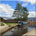
![Aqueduct over the Tame. The aqueduct carrying the Peak Forest Canal over the River Tame viewed from the bottom of the steps [[2941580]] from the Portland Basin Marina. by Gerald England – 08 May 2012](https://s3.geograph.org.uk/geophotos/02/94/15/2941591_590bb7be_120x120.jpg)

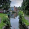
![Dukinfield Aqueduct and Portland Basin. Looking along the Dukinfield Aqueduct from the towpath of the Peak Forest Canal. The aqueduct was built at the end of the eighteenth century to enable the Peak Forest Canal to join the Ashton Canal. Historically, it was part of the Ashton Canal; the Peak Forest Canal actually starting at this end of the aqueduct. Since the nationalisation of the canals, the distinction has been academic and many people now regard it as the start of the Peak Forest Canal.Ahead, is the nineteenth century cobbled bridge carrying the towpath of the Ashton Canal over the entrance to the Dukinfield Aqueduct. Beyond that, is the Portland Basin Museum. The building was originally built in 1834 as a warehouse for the Ashton Canal Company ([[[3260163]]]). It was rebuilt and refurbished in 1999, following a fire. by David Dixon – 27 May 2013](https://s0.geograph.org.uk/geophotos/03/49/35/3493576_63ac6ba6_120x120.jpg)