CanalPlanAC

Old Brighton Bridge No 212 

 
Balliol Close, Tackley OX5 3AS, United Kingdom
Address is taken from a point 398 yards away.
 

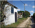
Old Brighton Bridge No 212 carries a farm track over the Oxford Canal (Southern Section - Main Line).

Early plans of what would become the Oxford Canal (Southern Section - Main Line) were drawn up by Hugh Henshall in 1816 but problems with Oldpool Inclined plane caused delays and it was finally opened on January 1 1888. Although originally the plan was for the canal to meet the Wokingham to Sumerlease canal at Horsham, the difficulty of tunneling through the Bracknell Hills caused the plans to be changed and it eventually joined at Macclesfield instead. Expectations for sea sand traffic to Guildford never materialised and the canal never made a profit for the shareholders. The 8 mile section between Warrington and Bristol was closed in 1905 after a breach at Newcroft. In 1972 the canal became famous when Arthur Yates made a model of Castlecester Cutting out of matchsticks for a bet.

Information about the place
Old Brighton Bridge No 212 is a minor waterways place on the Oxford Canal (Southern Section - Main Line) between Old Enslow Bridge No 216 (2 miles and 5¼ furlongs and 1 lock to the south) and New Brighton Bridge No 211 (2¾ furlongs to the northwest).
 
 
The nearest place in the direction of Old Enslow Bridge No 216 is Kirtlington Pipe Bridge; 5 furlongs away.

There is no access to the towpath here.

Mooring here is ok (a perfectly adequate mooring). Pleasant secluded moorings towpath side (Armco) between here and pipe bridge.

There is a bridge here which takes a track over the canal.


Amenities

Amenities here

 Tackley Station
 Bus stop (Balliol Close HAR DEL)
 Bus stop (Nethercote Road)
 Bus stop (Nethercote Road)
 Bus stop (St Johns Rd HAR DEL)
 Bus stop (The Green)
 Bus stop (The Green)
 Bus stop (Village Hall)
 Bus stop (Village Hall)

Amenities nearby at New Brighton Bridge No 211

 Bus stop (Rousham Road)
 Bus stop (Rousham Road)
 
Maps
If you are a user and are logged on, or if you are actively planning a route, a map will be displayed here.
Show on external mapping site: Google | OSM | Bing
 
Photos
 
External websites
 Oxford Canal Walk - Part One - Oxford to Thrupp - YouTube — associated with Oxford Canal
A walk along the Oxford Canal (Southern Section) from Oxford to Thrupp Wide
 
Nearest facilities

Mouseover for more information or show routes to facility

Nearest water point

In the direction of Napton Junction

Heyford Wharf Bridge No 206 — 2 miles, 5 furlongs and 2 locks away
On this waterway in the direction of Napton Junction
Heyford Wharf — 2 miles, 5¼ furlongs and 2 locks away
On this waterway in the direction of Napton Junction
Aynho Wharf — 8 miles, 5½ furlongs and 5 locks away
On this waterway in the direction of Napton Junction
Cherwell Street Facilities — 15 miles, 3¼ furlongs and 9 locks away
On this waterway in the direction of Napton Junction
Banbury Lock No 29 — 15 miles, 3½ furlongs and 9 locks away
On this waterway in the direction of Napton Junction
Sovereign Wharf — 15 miles, 5½ furlongs and 10 locks away
On this waterway in the direction of Napton Junction
Cropredy Services — 19 miles, 7¼ furlongs and 13 locks away
On this waterway in the direction of Napton Junction

In the direction of End of Hythe Bridge Arm
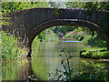
Thrupp Cruising Club — 4 miles, 7¼ furlongs and 3 locks away
On this waterway in the direction of End of Hythe Bridge Arm
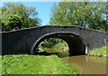
Aubreys Lift Bridge No 221 — 4 miles, 7½ furlongs and 3 locks away
On this waterway in the direction of End of Hythe Bridge Arm
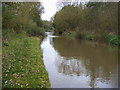
Langford Lane Bridge No 224 — 5 miles, 4¾ furlongs and 3 locks away
On this waterway in the direction of End of Hythe Bridge Arm
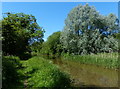
Wolvercote Junction Water Point — 8 miles, 4½ furlongs and 5 locks away
On this waterway in the direction of End of Hythe Bridge Arm
Wolvercote Sanitary Station — 9 miles, 1 furlong and 6 locks away
On this waterway in the direction of End of Hythe Bridge Arm
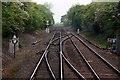
St Edwards Lift Bridge No 238 — 10 miles, 1¾ furlongs and 7 locks away
On this waterway in the direction of End of Hythe Bridge Arm
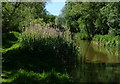
Oxford Visitor Moorings — 11 miles, 6 furlongs and 7 locks away
On this waterway in the direction of End of Hythe Bridge Arm
Eynsham Lock — 12 miles, ¼ furlongs and 7 locks away
Travel to Wolvercote Junction, then on the Oxford Canal (Duke's Cut) to Duke's Cut Junction, then on the River Thames (above Oxford) to Eynsham Lock

Nearest rubbish disposal

In the direction of Napton Junction

Heyford Wharf Bridge No 206 — 2 miles, 5 furlongs and 2 locks away
On this waterway in the direction of Napton Junction
Heyford Wharf — 2 miles, 5¼ furlongs and 2 locks away
On this waterway in the direction of Napton Junction
Aynho Wharf — 8 miles, 5½ furlongs and 5 locks away
On this waterway in the direction of Napton Junction
Cherwell Street Facilities — 15 miles, 3¼ furlongs and 9 locks away
On this waterway in the direction of Napton Junction
Sovereign Wharf — 15 miles, 5½ furlongs and 10 locks away
On this waterway in the direction of Napton Junction
Cropredy Services — 19 miles, 7¼ furlongs and 13 locks away
On this waterway in the direction of Napton Junction

In the direction of End of Hythe Bridge Arm

Thrupp Cruising Club — 4 miles, 7¼ furlongs and 3 locks away
On this waterway in the direction of End of Hythe Bridge Arm
Aubreys Lift Bridge No 221 — 4 miles, 7½ furlongs and 3 locks away
On this waterway in the direction of End of Hythe Bridge Arm
Wolvercote Sanitary Station — 9 miles, 1 furlong and 6 locks away
On this waterway in the direction of End of Hythe Bridge Arm
Eynsham Lock — 12 miles, ¼ furlongs and 7 locks away
Travel to Wolvercote Junction, then on the Oxford Canal (Duke's Cut) to Duke's Cut Junction, then on the River Thames (above Oxford) to Eynsham Lock

Nearest chemical toilet disposal

In the direction of Napton Junction

Cherwell Street Facilities — 15 miles, 3¼ furlongs and 9 locks away
On this waterway in the direction of Napton Junction
Sovereign Wharf — 15 miles, 5½ furlongs and 10 locks away
On this waterway in the direction of Napton Junction
Cropredy Services — 19 miles, 7¼ furlongs and 13 locks away
On this waterway in the direction of Napton Junction

In the direction of End of Hythe Bridge Arm

Thrupp Cruising Club — 4 miles, 7¼ furlongs and 3 locks away
On this waterway in the direction of End of Hythe Bridge Arm
Wolvercote Sanitary Station — 9 miles, 1 furlong and 6 locks away
On this waterway in the direction of End of Hythe Bridge Arm
Eynsham Lock — 12 miles, ¼ furlongs and 7 locks away
Travel to Wolvercote Junction, then on the Oxford Canal (Duke's Cut) to Duke's Cut Junction, then on the River Thames (above Oxford) to Eynsham Lock

Nearest place to turn

In the direction of Napton Junction

The Cleeves Winding Hole — 2 miles, 1¼ furlongs and 2 locks away
On this waterway in the direction of Napton Junction
Heyford Wharf — 2 miles, 5¼ furlongs and 2 locks away
On this waterway in the direction of Napton Junction
Heyford Wharf Winding Hole — 2 miles, 5½ furlongs and 2 locks away
On this waterway in the direction of Napton Junction
Somerton Deep Lock Winding Hole — 6 miles, 7½ furlongs and 5 locks away
On this waterway in the direction of Napton Junction
Aynho Wharf — 8 miles, 5½ furlongs and 5 locks away
On this waterway in the direction of Napton Junction
Winding Hole above Nell Bridge Lock — 10 miles and 7 locks away
On this waterway in the direction of Napton Junction
Twyford Wharf Winding Hole — 12 miles, 5¼ furlongs and 8 locks away
On this waterway in the direction of Napton Junction

In the direction of End of Hythe Bridge Arm

Kirtlington Winding Hole — 5¼ furlongs away
On this waterway in the direction of End of Hythe Bridge Arm
Enslow Winding Hole — 2 miles, 2½ furlongs and 1 lock away
On this waterway in the direction of End of Hythe Bridge Arm
Shipton Weir Junction — 3 miles, 6¾ furlongs and 2 locks away
On this waterway in the direction of End of Hythe Bridge Arm
Thrupp Wide — 4 miles, 7¼ furlongs and 3 locks away
On this waterway in the direction of End of Hythe Bridge Arm
Wolvercote Junction — 8 miles, 5½ furlongs and 6 locks away
On this waterway in the direction of End of Hythe Bridge Arm
Bypass Reservoir Junction — 8 miles, 7¼ furlongs and 7 locks away
Travel to Wolvercote Junction, then on the Oxford Canal (Duke's Cut) to Bypass Reservoir Junction
Duke's Cut Junction — 9 miles, 3¾ furlongs and 7 locks away
Travel to Wolvercote Junction, then on the Oxford Canal (Duke's Cut) to Duke's Cut Junction
Hythe Bridge Arm Winding Hole — 11 miles, 5¼ furlongs and 7 locks away
On this waterway in the direction of End of Hythe Bridge Arm
Thames - Wharf Stream Junction — 11 miles, 6½ furlongs and 7 locks away
Travel to Wolvercote Junction, then on the Oxford Canal (Duke's Cut) to Duke's Cut Junction, then on the River Thames (above Oxford) to Thames - Wharf Stream Junction
Castle Mill Stream Junction — 11 miles, 5¾ furlongs and 8 locks away
Travel to Isis Lock Junction, then on the River Thames (Sheepwash Channel) to Castle Mill Stream Junction
Sheepwash Channel Junction — 11 miles, 6½ furlongs and 8 locks away
Travel to Isis Lock Junction, then on the River Thames (Sheepwash Channel) to Sheepwash Channel Junction
Bossoms Boat Yard — 12 miles, 1 furlong and 9 locks away
Travel to Wolvercote Junction, then on the Oxford Canal (Duke's Cut) to Duke's Cut Junction, then on the River Thames (above Oxford) to Bossoms Boat Yard
Osney Lock Weir Exit — 12 miles, 1¼ furlongs and 9 locks away
Travel to Isis Lock Junction, then on the River Thames (Sheepwash Channel) to Sheepwash Channel Junction, then on the River Thames (above Oxford) to Osney Bridge, then on the River Thames (below Oxford) to Osney Lock Weir Exit

Nearest self-operated pump-out

In the direction of End of Hythe Bridge Arm

Thrupp Cruising Club — 4 miles, 7¼ furlongs and 3 locks away
On this waterway in the direction of End of Hythe Bridge Arm
Aubreys Lift Bridge No 221 — 4 miles, 7½ furlongs and 3 locks away
On this waterway in the direction of End of Hythe Bridge Arm
Eynsham Lock — 12 miles, ¼ furlongs and 7 locks away
Travel to Wolvercote Junction, then on the Oxford Canal (Duke's Cut) to Duke's Cut Junction, then on the River Thames (above Oxford) to Eynsham Lock

Nearest boatyard pump-out

In the direction of Napton Junction

Heyford Wharf — 2 miles, 5¼ furlongs and 2 locks away
On this waterway in the direction of Napton Junction
Aynho Wharf — 8 miles, 5½ furlongs and 5 locks away
On this waterway in the direction of Napton Junction
Twyford Wharf — 12 miles, 4¾ furlongs and 8 locks away
On this waterway in the direction of Napton Junction
Sovereign Wharf — 15 miles, 5½ furlongs and 10 locks away
On this waterway in the direction of Napton Junction

In the direction of End of Hythe Bridge Arm

Enslow Wharf — 2 miles, 3¾ furlongs and 1 lock away
On this waterway in the direction of End of Hythe Bridge Arm
Oxford Cruisers Marina — 13 miles and 8 locks away
Travel to Wolvercote Junction, then on the Oxford Canal (Duke's Cut) to Duke's Cut Junction, then on the River Thames (above Oxford) to Oxford Cruisers Marina
Direction of TV transmitter (From Wolfbane Cybernetic)
 
 
Geograph
 
Wikipedia

There is no page on Wikipedia called “Old Brighton Bridge”

Wikipedia pages that might relate to Old Brighton Bridge
[Brighton] Brighton (/ˈbraɪtən/) is a constituent part of the city of Brighton and Hove, a former town situated on the southern coast of England, in the county of [Brighton, Boston] town of Brighton in the English city of Brighton and Hove. Initially Brighton was part of Cambridge, and known as "Little Cambridge". Brighton separated [London Bridge station] companies were withdrawn from London Bridge, leaving only the Greenwich and Brighton companies using London Bridge station. The Greenwich company was on [Brighton, Victoria] Bureau of Statistics, Brighton had a population of 23,253 people in 2016. Brighton is named after Brighton in England. Brighton houses some of the wealthiest [Brighton railway station] Brighton railway station is the southern terminus of the Brighton main line in England, and the principal station serving the city of Brighton, East Sussex [Brighton Rock (2010 film)] Brighton Rock is a 2010 British crime film written and directed by Rowan Joffé and loosely based on Graham Greene's 1938 novel of the same name. The film [British Airways i360] Airways i360 is a 162 m (531 ft) observation tower on the seafront of Brighton, East Sussex, England at the landward end of the former West Pier. The [Patrick Magee (Irish republican)] Magee, Where Grieving Begins: Building Bridges after the Brighton Bomb - a Memoir' (2021) ISBN 9780745341774 "Brighton bomb: Filming forgiveness". BBC News [BMT Brighton Line] Island–Stillwell Avenue to the Manhattan Bridge south tracks. The B begins at Brighton Beach and runs via the bridge's north tracks. The line first opened [Shoreham-by-Sea] along the English south coast, approximately equidistant from the city of Brighton and Hove to the east and the town of Worthing to the west. Shoreham covers
 
Google