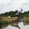
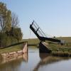
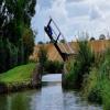
Boundary Lift Bridge No 141
Fenny Compton Road, Claydon OX17 1HA, United Kingdom
Address is taken from a point 244 yards away.

Boundary Lift Bridge No 141
is a minor waterways place
on the Oxford Canal (Southern Section - Main Line) between
Cropredy Wharf Bridge No 153 (Cropredy) (4 miles
and 9 locks
to the southeast) and
Fenny Compton Wharf (2 miles and 2½ furlongs
to the northwest).
The nearest place in the direction of Cropredy Wharf Bridge No 153 is Feeder Bridge No 142 (The bridge is a towpath bridge over the feeder from Boddington Reservoir.);
2¾ furlongs
away.
The nearest place in the direction of Fenny Compton Wharf is Site of Wormleighton Railway Bridge (narrows) (The East and West Junction Railway once crossed the canal here.);
2¼ furlongs
away.
Mooring here is unrated.
There is a lift bridge here. The bridge is normally left open.
Claydon Lock No 18 | 1 mile, 2½ furlongs | |
Claydon Top Lock No 17 | 1 mile, 1½ furlongs | |
Claydon Top Lock Bridge No 144 | 1 mile, 1 furlong | |
Hay Bridge No 143 | 4¾ furlongs | |
Feeder Bridge No 142 | 2¾ furlongs | |
Boundary Lift Bridge No 141 | ||
Site of Wormleighton Railway Bridge (narrows) | 2¼ furlongs | |
Wormleighton Reservoir Bridge No 139 | 4¼ furlongs | |
Fenny Compton 'Tunnel' (eastern entrance) | 7½ furlongs | |
Fenny Compton Bridge No 138 | 1 mile, 3¼ furlongs | |
Fenny Compton Turnover Bridge No 137A | 1 mile, 3½ furlongs |
- Oxford Canal Walk - Part One - Oxford to Thrupp - YouTube — associated with Oxford Canal
- A walk along the Oxford Canal (Southern Section) from Oxford to Thrupp Wide
Mouseover for more information or show routes to facility
Nearest water point
In the direction of Napton Junction
Fenny Compton Wharf — 2 miles, 2½ furlongs away
On this waterway in the direction of Napton Junction
Marston Doles Water Point — 9 miles, 6¼ furlongs away
On this waterway in the direction of Napton Junction
Water Point at Bottom of Napton Locks — 11 miles, 6¼ furlongs and 9 locks away
On this waterway in the direction of Napton Junction
Wigrams Turn Marina — 13 miles, 6½ furlongs and 9 locks away
Travel to Napton Junction, then on the Grand Union Canal (Oxford Canal Section) to Wigrams Turn Marina
Calcutt Top Lock Winding Hole — 14 miles, 2½ furlongs and 9 locks away
Travel to Napton Junction, then on the Grand Union Canal (Warwick and Napton Canal) to Calcutt Top Lock Winding Hole
Calcutt Marina — 14 miles, 4¼ furlongs and 12 locks away
Travel to Napton Junction, then on the Grand Union Canal (Warwick and Napton Canal) to Calcutt Marina
Braunston Services — 18 miles, 6¾ furlongs and 9 locks away
Travel to Napton Junction, then on the Grand Union Canal (Oxford Canal Section) to Braunston Turn, then on the Oxford Canal (Northern Section - Main Line) to Braunston Services
Braunston Road Bridge No 91 — 19 miles and 9 locks away
Travel to Napton Junction, then on the Grand Union Canal (Oxford Canal Section) to Braunston Turn, then on the Grand Union Canal (Grand Junction Canal - Main Line - Braunston to Norton) to Braunston Road Bridge No 91
Braunston Stop — 19 miles, 1½ furlongs and 9 locks away
Travel to Napton Junction, then on the Grand Union Canal (Oxford Canal Section) to Braunston Turn, then on the Grand Union Canal (Grand Junction Canal - Main Line - Braunston to Norton) to Braunston Stop
Stockton Top Marina — 16 miles, 5½ furlongs and 12 locks away
Travel to Napton Junction, then on the Grand Union Canal (Warwick and Napton Canal) to Stockton Top Marina
The Blue Lias Inn — 17 miles, 3½ furlongs and 20 locks away
Travel to Napton Junction, then on the Grand Union Canal (Warwick and Napton Canal) to The Blue Lias Inn
Kayes Arm Junction — 17 miles, 4¼ furlongs and 20 locks away
Travel to Napton Junction, then on the Grand Union Canal (Warwick and Napton Canal) to Kayes Arm Junction
Bascote Bridge No 27 — 18 miles, 6¼ furlongs and 22 locks away
Travel to Napton Junction, then on the Grand Union Canal (Warwick and Napton Canal) to Bascote Bridge No 27
In the direction of End of Hythe Bridge Arm
Cropredy Marina (northern basins) — 3 miles, 3¼ furlongs and 8 locks away
On this waterway in the direction of End of Hythe Bridge Arm
Cropredy Marina (southern basin) — 3 miles, 3½ furlongs and 8 locks away
On this waterway in the direction of End of Hythe Bridge Arm
Cropredy Services — 4 miles and 9 locks away
On this waterway in the direction of End of Hythe Bridge Arm
Sovereign Wharf — 8 miles, 1¾ furlongs and 12 locks away
On this waterway in the direction of End of Hythe Bridge Arm
Banbury Lock No 29 — 8 miles, 4 furlongs and 12 locks away
On this waterway in the direction of End of Hythe Bridge Arm
Cherwell Street Facilities — 8 miles, 4¼ furlongs and 13 locks away
On this waterway in the direction of End of Hythe Bridge Arm
Aynho Wharf — 15 miles, 1¾ furlongs and 17 locks away
On this waterway in the direction of End of Hythe Bridge ArmNearest rubbish disposal
In the direction of Napton Junction
Fenny Compton Marina — 1 mile, 7¾ furlongs away
On this waterway in the direction of Napton Junction
Napton Sanitary Station — 11 miles, 6 furlongs and 9 locks away
On this waterway in the direction of Napton Junction
Wigrams Turn Marina — 13 miles, 6½ furlongs and 9 locks away
Travel to Napton Junction, then on the Grand Union Canal (Oxford Canal Section) to Wigrams Turn Marina
Calcutt Marina — 14 miles, 4¼ furlongs and 12 locks away
Travel to Napton Junction, then on the Grand Union Canal (Warwick and Napton Canal) to Calcutt Marina
Braunston Services — 18 miles, 6¾ furlongs and 9 locks away
Travel to Napton Junction, then on the Grand Union Canal (Oxford Canal Section) to Braunston Turn, then on the Oxford Canal (Northern Section - Main Line) to Braunston Services
Braunston Stop — 19 miles, 1½ furlongs and 9 locks away
Travel to Napton Junction, then on the Grand Union Canal (Oxford Canal Section) to Braunston Turn, then on the Grand Union Canal (Grand Junction Canal - Main Line - Braunston to Norton) to Braunston Stop
Bascote Bridge No 27 — 18 miles, 6¼ furlongs and 22 locks away
Travel to Napton Junction, then on the Grand Union Canal (Warwick and Napton Canal) to Bascote Bridge No 27
In the direction of End of Hythe Bridge Arm
Cropredy Marina (northern basins) — 3 miles, 3¼ furlongs and 8 locks away
On this waterway in the direction of End of Hythe Bridge Arm
Cropredy Marina (southern basin) — 3 miles, 3½ furlongs and 8 locks away
On this waterway in the direction of End of Hythe Bridge Arm
Cropredy Services — 4 miles and 9 locks away
On this waterway in the direction of End of Hythe Bridge Arm
Sovereign Wharf — 8 miles, 1¾ furlongs and 12 locks away
On this waterway in the direction of End of Hythe Bridge Arm
Cherwell Street Facilities — 8 miles, 4¼ furlongs and 13 locks away
On this waterway in the direction of End of Hythe Bridge Arm
Aynho Wharf — 15 miles, 1¾ furlongs and 17 locks away
On this waterway in the direction of End of Hythe Bridge ArmNearest chemical toilet disposal
In the direction of Napton Junction
Napton Sanitary Station — 11 miles, 6 furlongs and 9 locks away
On this waterway in the direction of Napton Junction
Wigrams Turn Marina — 13 miles, 6½ furlongs and 9 locks away
Travel to Napton Junction, then on the Grand Union Canal (Oxford Canal Section) to Wigrams Turn Marina
Calcutt Marina — 14 miles, 4¼ furlongs and 12 locks away
Travel to Napton Junction, then on the Grand Union Canal (Warwick and Napton Canal) to Calcutt Marina
Braunston Services — 18 miles, 6¾ furlongs and 9 locks away
Travel to Napton Junction, then on the Grand Union Canal (Oxford Canal Section) to Braunston Turn, then on the Oxford Canal (Northern Section - Main Line) to Braunston Services
Braunston Road Bridge No 91 — 19 miles and 9 locks away
Travel to Napton Junction, then on the Grand Union Canal (Oxford Canal Section) to Braunston Turn, then on the Grand Union Canal (Grand Junction Canal - Main Line - Braunston to Norton) to Braunston Road Bridge No 91
In the direction of End of Hythe Bridge Arm
Cropredy Marina (southern basin) — 3 miles, 3½ furlongs and 8 locks away
On this waterway in the direction of End of Hythe Bridge Arm
Cropredy Services — 4 miles and 9 locks away
On this waterway in the direction of End of Hythe Bridge Arm
Sovereign Wharf — 8 miles, 1¾ furlongs and 12 locks away
On this waterway in the direction of End of Hythe Bridge Arm
Cherwell Street Facilities — 8 miles, 4¼ furlongs and 13 locks away
On this waterway in the direction of End of Hythe Bridge ArmNearest place to turn
In the direction of Napton Junction
Fenny Compton Marina — 1 mile, 7¾ furlongs away
On this waterway in the direction of Napton Junction
Fenny Compton Wharf — 2 miles, 2½ furlongs away
On this waterway in the direction of Napton Junction
Marston Doles Top Lock Winding Hole — 9 miles, 6¼ furlongs away
On this waterway in the direction of Napton Junction
Old Engine House Arm Junction — 10 miles, 5 furlongs and 2 locks away
On this waterway in the direction of Napton Junction
Old Engine House Winding Hole — 10 miles, 6 furlongs and 2 locks away
Travel to Old Engine House Arm Junction, then on the Oxford Canal (Old Engine House Arm) to Old Engine House Winding Hole
Napton Winding Hole — 12 miles and 9 locks away
On this waterway in the direction of Napton Junction
Bridge Inn Winding Hole — 12 miles, 7¾ furlongs and 9 locks away
On this waterway in the direction of Napton Junction
Napton Marina — 13 miles, 5 furlongs and 9 locks away
On this waterway in the direction of Napton Junction
Napton Junction — 13 miles, 6½ furlongs and 9 locks away
On this waterway in the direction of Napton Junction
Calcutt Top Lock Winding Hole — 14 miles, 2½ furlongs and 9 locks away
Travel to Napton Junction, then on the Grand Union Canal (Warwick and Napton Canal) to Calcutt Top Lock Winding Hole
Thick Thorne House Winding Hole — 14 miles, 7¾ furlongs and 9 locks away
Travel to Napton Junction, then on the Grand Union Canal (Oxford Canal Section) to Thick Thorne House Winding Hole
In the direction of End of Hythe Bridge Arm
Clattercote Bridge Winding Hole — 2 miles, ¼ furlongs and 5 locks away
On this waterway in the direction of End of Hythe Bridge Arm
Cropredy Marina (northern basins) — 3 miles, 3¼ furlongs and 8 locks away
On this waterway in the direction of End of Hythe Bridge Arm
Cropredy Marina (southern basin) — 3 miles, 3½ furlongs and 8 locks away
On this waterway in the direction of End of Hythe Bridge Arm
Cropredy Services — 4 miles and 9 locks away
On this waterway in the direction of End of Hythe Bridge Arm
Southam Road Footbridge Arm — 7 miles, 2¾ furlongs and 12 locks away
On this waterway in the direction of End of Hythe Bridge Arm
Southam Road Winding Hole — 7 miles, 5¼ furlongs and 12 locks away
On this waterway in the direction of End of Hythe Bridge Arm
Grimsbury Wharf — 7 miles, 6½ furlongs and 12 locks away
On this waterway in the direction of End of Hythe Bridge Arm
Calthorpe Winding Hole — 9 miles, 1½ furlongs and 13 locks away
On this waterway in the direction of End of Hythe Bridge Arm
Twyford Wharf Winding Hole — 11 miles, 2¼ furlongs and 14 locks away
On this waterway in the direction of End of Hythe Bridge ArmNearest self-operated pump-out
In the direction of Napton Junction
Braunston Marina (western entrance) — 19 miles, 1¾ furlongs and 9 locks away
Travel to Napton Junction, then on the Grand Union Canal (Oxford Canal Section) to Braunston Turn, then on the Grand Union Canal (Grand Junction Canal - Main Line - Braunston to Norton) to Braunston Marina (western entrance)
In the direction of End of Hythe Bridge Arm
Cropredy Marina (southern basin) — 3 miles, 3½ furlongs and 8 locks away
On this waterway in the direction of End of Hythe Bridge ArmNearest boatyard pump-out
In the direction of Napton Junction
Wigrams Turn Marina — 13 miles, 6½ furlongs and 9 locks away
Travel to Napton Junction, then on the Grand Union Canal (Oxford Canal Section) to Wigrams Turn Marina
Calcutt Marina — 14 miles, 4¼ furlongs and 12 locks away
Travel to Napton Junction, then on the Grand Union Canal (Warwick and Napton Canal) to Calcutt Marina
Ventnor Marina (Sunrise Basin) — 14 miles, 5¼ furlongs and 12 locks away
Travel to Napton Junction, then on the Grand Union Canal (Warwick and Napton Canal) to Ventnor Marina (Sunrise Basin)
Stockton Top Marina — 16 miles, 5½ furlongs and 12 locks away
Travel to Napton Junction, then on the Grand Union Canal (Warwick and Napton Canal) to Stockton Top Marina
In the direction of End of Hythe Bridge Arm
Cropredy Marina (southern basin) — 3 miles, 3½ furlongs and 8 locks away
On this waterway in the direction of End of Hythe Bridge Arm
Sovereign Wharf — 8 miles, 1¾ furlongs and 12 locks away
On this waterway in the direction of End of Hythe Bridge Arm
Twyford Wharf — 11 miles, 2½ furlongs and 14 locks away
On this waterway in the direction of End of Hythe Bridge Arm
Aynho Wharf — 15 miles, 1¾ furlongs and 17 locks away
On this waterway in the direction of End of Hythe Bridge ArmDirection of TV transmitter (From Wolfbane Cybernetic)
There is no page on Wikipedia called “Boundary Lift Bridge”
Wikipedia pages that might relate to Boundary Lift Bridge
[Fourteenth Street Bridge (Ohio River)]
machinery of the lift span were designed by Waddell and Son, Inc., and there is a plaque on the SW tower reading, "Waddell Vertical Lift Bridge, Waddell and
[Tower Bridge]
2010. "Bridge Lifts". Tower Bridge Official Website. Archived from the original on 12 September 2007. Retrieved 25 September 2007. "Bridge Lift Times"
[Old Cobram-Barooga Bridge]
chords by turned pins. The Old Cobram-Barooga Bridge was also a movable lift-span bridge. Opening bridges were required in order to provide clearance for
[Dragon boundary mark]
The dragon boundary marks are cast iron statues of dragons on metal or stone plinths that mark the boundaries of the City of London. The dragons are painted
[Mackinac Bridge]
cancels the lift, making the roadway stable in design in winds of up to 150 miles per hour (240 km/h). The Mackinac Bridge is a toll bridge on Interstate 75
[Airfoil]
falls off quickly beyond that. The drop in lift can be explained by the action of the upper-surface boundary layer, which separates and greatly thickens
[Tramway Lift Bridge over Maroochy River]
The Tramway Lift Bridge over Maroochy River is a heritage-listed railway bridge at Store Road, Nambour, Sunshine Coast Region, Queensland, Australia.
[Murrumbidgee River bridge, Carrathool]
road bridge, and has a bascule-type lift span supported on cylindrical iron piers, designed to allow river-craft to pass. Only three bascule lift span
[Industrial Canal]
high-rise vehicular bridge is planned. Claiborne Avenue Bridge It is a lift bridge, officially named Judge William Seeber Bridge, with four vehicular
[List of Tanglin episodes (Episodes 1-508)]
conditions. In the meantime, Shruti is on the hunt for something that will lift Meera's bad mood. 99 November 12, 2015 (2015-11-12) As Michael continues
Results of Google Search
Oxford Canal Bridge 141, Boundary Lift Bridge ... To Date: 20/05/2015 23:59 inclusive. Type: Advice. Reason: Repair. Is the towpath closed? No ...
Aug 12, 2015 ... Crossing the Oxford Canal on the county boundary of Warwickshire and Oxfordshire.
Heritage List Entry Summary for Oxford Canal Boundary Lift Bridge (141) At Sp ... The above map is for quick reference purposes only and may not be to scale.
Repairs to Bridge 141, Boundary Lift Bridge, Oxford Canal ... Date: 11/05/2017 16 :00 inclusive. Type: Advice. Reason: Maintenance. Is the towpath closed? No ...
Oxford Canal, Aynho Weir Lock & Bridge 188 - Phil Sharpe. Oxford Canal, Aynho Weir ... Oxford Canal, Boundary Lift Bridge 141 - Phil Sharpe. Oxford Canal ...
Sep 16, 2015 ... Boundary Lift bridge number 141 ... I had hoped to purchase some Banbury cakes (their delicacy), but no bakers shop here! Banbury moorings.
Jul 14, 2014 ... Boundary Lift Bridge, No 141 IMG_0335 A little further on we were passing an assortment of moored boats on the offside near the feeder from ...
Mar 5, 2019 ... In the car show display area near the Modern City's lift bridge, one ... did bring back memories of a personal favorite, which still exists, just not at EJ. ... is a chance that a vehicle crossing that boundary will be cut off as well.