CanalPlanAC

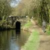
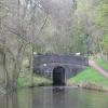
Black Rock Bridge No 94

 
Canal Towpath, Heyrod SK15 3GQ, United Kingdom
 
Information about the place
Black Rock Bridge No 94 is a minor waterways place on the Huddersfield Narrow Canal between Ashton-under-Lyne Junction (Junction of Ashton and Huddersfield Narrow Canals) (4 miles and 7¾ furlongs and 9 locks to the west) and Royal George Aqueduct (2 miles and 6½ furlongs and 8 locks to the north).
 
 
The nearest place in the direction of Ashton-under-Lyne Junction is Black Rock Lock No 9W; ¾ furlongs away.
 
The nearest place in the direction of Royal George Aqueduct is Avenue Lock No 10W; a few yards away.

There may be access to the towpath here.

Mooring here is unrated.

There is a bridge here which takes pedestrian traffic over the canal.


Amenities
 
Maps
If you are a user and are logged on, or if you are actively planning a route, a map will be displayed here.
Show on external mapping site: Google | OSM | Bing
 
Photos
 
External websites
There are no links to external websites from here.
Why not log in and add some (select "External websites" from the menu (sometimes this is under "Edit"))?
 
Nearest facilities

Mouseover for more information or show routes to facility

Nearest water point

In the direction of Ashton-under-Lyne Junction

Grove Road Bridge No 963¾ furlongs and 1 lock away
On this waterway in the direction of Ashton-under-Lyne Junction
Fairfield Junction7 miles, 7¾ furlongs and 9 locks away
Travel to Ashton-under-Lyne Junction, then on the Ashton Canal (Main Line) to Fairfield Junction
Marple Services13 miles, 5¼ furlongs and 25 locks away
Travel to Ashton-under-Lyne Junction, then on the Ashton Canal (Main Line) to Dukinfield Junction, then on the Peak Forest Canal (Lower) to Marple Junction, then on the Macclesfield Canal to Marple Services
New Islington Marina12 miles, 2¼ furlongs and 29 locks away
Travel to Ashton-under-Lyne Junction, then on the Ashton Canal (Main Line) to Ducie Street Junction, then on the Rochdale Canal to New Islington Marina Entrance, then on the Rochdale Canal (Main Line) to Cotton Field Wharf Marina, then on the Rochdale Canal (New Islington Marina Arm) to New Islington Marina
Braidbar Boats17 miles, 2¾ furlongs and 25 locks away
Travel to Ashton-under-Lyne Junction, then on the Ashton Canal (Main Line) to Dukinfield Junction, then on the Peak Forest Canal (Lower) to Marple Junction, then on the Macclesfield Canal to Braidbar Boats
Furness Vale Marina18 miles, 4 furlongs and 25 locks away
Travel to Ashton-under-Lyne Junction, then on the Ashton Canal (Main Line) to Dukinfield Junction, then on the Peak Forest Canal (Lower) to Marple Junction, then on the Peak Forest Canal (Upper) to Furness Vale Marina
Staffordshire, Kenworthy and other Arms13 miles and 36 locks away
Travel to Ashton-under-Lyne Junction, then on the Ashton Canal (Main Line) to Ducie Street Junction, then on the Rochdale Canal to Castlefield Junction, then on the Bridgewater Canal (Main Line) to Staffordshire, Kenworthy and other Arms
Potato Wharf Arm & The New Basin13 miles, ¾ furlongs and 36 locks away
Travel to Ashton-under-Lyne Junction, then on the Ashton Canal (Main Line) to Ducie Street Junction, then on the Rochdale Canal to Castlefield Junction, then on the Bridgewater Canal (Main Line) to Potato Wharf Arm & The New Basin
Stretford Marina16 miles and 36 locks away
Travel to Ashton-under-Lyne Junction, then on the Ashton Canal (Main Line) to Ducie Street Junction, then on the Rochdale Canal to Castlefield Junction, then on the Bridgewater Canal (Main Line) to Stretford Marina
Watch House Cruising Club17 miles, ½ furlongs and 36 locks away
Travel to Ashton-under-Lyne Junction, then on the Ashton Canal (Main Line) to Ducie Street Junction, then on the Rochdale Canal to Castlefield Junction, then on the Bridgewater Canal (Main Line) to Watch House Cruising Club

In the direction of Aspley Basin (Huddersfield)

Wool Road Bridge No 705 miles, 4½ furlongs and 14 locks away
On this waterway in the direction of Aspley Basin (Huddersfield)
Standedge Tunnel (western entrance)7 miles, 4¼ furlongs and 23 locks away
On this waterway in the direction of Aspley Basin (Huddersfield)
Standedge Tunnel (eastern entrance)10 miles, 6¼ furlongs and 23 locks away
On this waterway in the direction of Aspley Basin (Huddersfield)
Slaithwaite Winding Hole14 miles, 1¼ furlongs and 44 locks away
On this waterway in the direction of Aspley Basin (Huddersfield)
Waterside Lock No 21E14 miles, 1¾ furlongs and 44 locks away
On this waterway in the direction of Aspley Basin (Huddersfield)
Aspley Basin (Huddersfield)18 miles, 7½ furlongs and 65 locks away
On this waterway in the direction of Aspley Basin (Huddersfield)

Nearest rubbish disposal

In the direction of Ashton-under-Lyne Junction

Marple Bottom Lock Bridge Winding Hole12 miles, 4 furlongs and 9 locks away
Travel to Ashton-under-Lyne Junction, then on the Ashton Canal (Main Line) to Dukinfield Junction, then on the Peak Forest Canal (Lower) to Marple Bottom Lock Bridge Winding Hole
Marple Services13 miles, 5¼ furlongs and 25 locks away
Travel to Ashton-under-Lyne Junction, then on the Ashton Canal (Main Line) to Dukinfield Junction, then on the Peak Forest Canal (Lower) to Marple Junction, then on the Macclesfield Canal to Marple Services
Braidbar Boats17 miles, 2¾ furlongs and 25 locks away
Travel to Ashton-under-Lyne Junction, then on the Ashton Canal (Main Line) to Dukinfield Junction, then on the Peak Forest Canal (Lower) to Marple Junction, then on the Macclesfield Canal to Braidbar Boats

In the direction of Aspley Basin (Huddersfield)

Wool Road Visitor Mooring5 miles, 4¼ furlongs and 14 locks away
On this waterway in the direction of Aspley Basin (Huddersfield)
Pickle Lock No 22E14 miles, ½ furlongs and 43 locks away
On this waterway in the direction of Aspley Basin (Huddersfield)
Aspley Basin (Huddersfield)18 miles, 7½ furlongs and 65 locks away
On this waterway in the direction of Aspley Basin (Huddersfield)

Nearest chemical toilet disposal

In the direction of Ashton-under-Lyne Junction

Grove Road Bridge No 963¾ furlongs and 1 lock away
On this waterway in the direction of Ashton-under-Lyne Junction
Fairfield Junction7 miles, 7¾ furlongs and 9 locks away
Travel to Ashton-under-Lyne Junction, then on the Ashton Canal (Main Line) to Fairfield Junction
Marple Services13 miles, 5¼ furlongs and 25 locks away
Travel to Ashton-under-Lyne Junction, then on the Ashton Canal (Main Line) to Dukinfield Junction, then on the Peak Forest Canal (Lower) to Marple Junction, then on the Macclesfield Canal to Marple Services
Furness Vale Marina18 miles, 4 furlongs and 25 locks away
Travel to Ashton-under-Lyne Junction, then on the Ashton Canal (Main Line) to Dukinfield Junction, then on the Peak Forest Canal (Lower) to Marple Junction, then on the Peak Forest Canal (Upper) to Furness Vale Marina
Watch House Cruising Club17 miles, ½ furlongs and 36 locks away
Travel to Ashton-under-Lyne Junction, then on the Ashton Canal (Main Line) to Ducie Street Junction, then on the Rochdale Canal to Castlefield Junction, then on the Bridgewater Canal (Main Line) to Watch House Cruising Club

In the direction of Aspley Basin (Huddersfield)

Wool Road Bridge No 705 miles, 4½ furlongs and 14 locks away
On this waterway in the direction of Aspley Basin (Huddersfield)
Pickle Lock No 22E14 miles, ½ furlongs and 43 locks away
On this waterway in the direction of Aspley Basin (Huddersfield)
Waterside Lock No 21E14 miles, 1¾ furlongs and 44 locks away
On this waterway in the direction of Aspley Basin (Huddersfield)
Aspley Basin (Huddersfield)18 miles, 7½ furlongs and 65 locks away
On this waterway in the direction of Aspley Basin (Huddersfield)

Nearest place to turn

In the direction of Ashton-under-Lyne Junction

Knowle Street Winding Hole2 miles, 6¼ furlongs and 2 locks away
On this waterway in the direction of Ashton-under-Lyne Junction
Staley Wharf Winding Hole4 miles and 6 locks away
On this waterway in the direction of Ashton-under-Lyne Junction
Ashton-under-Lyne Junction4 miles, 7¾ furlongs and 9 locks away
On this waterway in the direction of Ashton-under-Lyne Junction
Dukinfield Junction5 miles, 3¾ furlongs and 9 locks away
Travel to Ashton-under-Lyne Junction, then on the Ashton Canal (Main Line) to Dukinfield Junction
Portland Basin Arm5 miles, 4¼ furlongs and 9 locks away
Travel to Ashton-under-Lyne Junction, then on the Ashton Canal (Main Line) to Dukinfield Junction, then on the Peak Forest Canal (Lower) to Portland Basin Arm
Dunkirk Farm Bridge Winding Hole7 miles, 1 furlong and 9 locks away
Travel to Ashton-under-Lyne Junction, then on the Ashton Canal (Main Line) to Dukinfield Junction, then on the Peak Forest Canal (Lower) to Dunkirk Farm Bridge Winding Hole
Lumb Lane Bridge Winding Hole7 miles, 1¼ furlongs and 9 locks away
Travel to Ashton-under-Lyne Junction, then on the Ashton Canal (Main Line) to Lumb Lane Bridge Winding Hole
Canal Street Winding Hole7 miles, 6 furlongs and 9 locks away
Travel to Ashton-under-Lyne Junction, then on the Ashton Canal (Main Line) to Dukinfield Junction, then on the Peak Forest Canal (Lower) to Canal Street Winding Hole
Fairfield Junction7 miles, 7¾ furlongs and 9 locks away
Travel to Ashton-under-Lyne Junction, then on the Ashton Canal (Main Line) to Fairfield Junction
Unity Mills Winding Hole9 miles, 2½ furlongs and 9 locks away
Travel to Ashton-under-Lyne Junction, then on the Ashton Canal (Main Line) to Dukinfield Junction, then on the Peak Forest Canal (Lower) to Unity Mills Winding Hole
Urwick Road Winding Hole11 miles, 1¾ furlongs and 9 locks away
Travel to Ashton-under-Lyne Junction, then on the Ashton Canal (Main Line) to Dukinfield Junction, then on the Peak Forest Canal (Lower) to Urwick Road Winding Hole
Marple Bottom Lock Bridge Winding Hole12 miles, 4 furlongs and 9 locks away
Travel to Ashton-under-Lyne Junction, then on the Ashton Canal (Main Line) to Dukinfield Junction, then on the Peak Forest Canal (Lower) to Marple Bottom Lock Bridge Winding Hole
Clayton Junction9 miles, 2 furlongs and 17 locks away
Travel to Ashton-under-Lyne Junction, then on the Ashton Canal (Main Line) to Clayton Junction
Ashton New Road Winding Hole9 miles, 6¾ furlongs and 20 locks away
Travel to Ashton-under-Lyne Junction, then on the Ashton Canal (Main Line) to Ashton New Road Winding Hole

In the direction of Aspley Basin (Huddersfield)

Mossley Bottoms Winding Hole1 mile, 2 furlongs and 3 locks away
On this waterway in the direction of Aspley Basin (Huddersfield)
Roughtown Court Winding Hole2 miles, 1½ furlongs and 5 locks away
On this waterway in the direction of Aspley Basin (Huddersfield)
Manns Wharf Bridge Winding Hole3 miles, 3 furlongs and 10 locks away
On this waterway in the direction of Aspley Basin (Huddersfield)
Saddleworth Visitor Centre Winding Hole4 miles, 5¾ furlongs and 12 locks away
On this waterway in the direction of Aspley Basin (Huddersfield)
Wool Road Winding Hole5 miles, 3¾ furlongs and 14 locks away
On this waterway in the direction of Aspley Basin (Huddersfield)
Diggle Winding Hole7 miles, 1¾ furlongs and 23 locks away
On this waterway in the direction of Aspley Basin (Huddersfield)

Nearest self-operated pump-out

In the direction of Ashton-under-Lyne Junction

New Islington Marina12 miles, 2¼ furlongs and 29 locks away
Travel to Ashton-under-Lyne Junction, then on the Ashton Canal (Main Line) to Ducie Street Junction, then on the Rochdale Canal to New Islington Marina Entrance, then on the Rochdale Canal (Main Line) to Cotton Field Wharf Marina, then on the Rochdale Canal (New Islington Marina Arm) to New Islington Marina

In the direction of Aspley Basin (Huddersfield)

Wool Road Bridge No 705 miles, 4½ furlongs and 14 locks away
On this waterway in the direction of Aspley Basin (Huddersfield)
Slaithwaite Winding Hole14 miles, 1¼ furlongs and 44 locks away
On this waterway in the direction of Aspley Basin (Huddersfield)

Nearest boatyard pump-out

In the direction of Ashton-under-Lyne Junction

Portland Basin Arm5 miles, 4¼ furlongs and 9 locks away
Travel to Ashton-under-Lyne Junction, then on the Ashton Canal (Main Line) to Dukinfield Junction, then on the Peak Forest Canal (Lower) to Portland Basin Arm
Braidbar Boats17 miles, 2¾ furlongs and 25 locks away
Travel to Ashton-under-Lyne Junction, then on the Ashton Canal (Main Line) to Dukinfield Junction, then on the Peak Forest Canal (Lower) to Marple Junction, then on the Macclesfield Canal to Braidbar Boats
New Mills Marina17 miles, 4¾ furlongs and 25 locks away
Travel to Ashton-under-Lyne Junction, then on the Ashton Canal (Main Line) to Dukinfield Junction, then on the Peak Forest Canal (Lower) to Marple Junction, then on the Peak Forest Canal (Upper) to New Mills Marina
Stretford Marina16 miles and 36 locks away
Travel to Ashton-under-Lyne Junction, then on the Ashton Canal (Main Line) to Ducie Street Junction, then on the Rochdale Canal to Castlefield Junction, then on the Bridgewater Canal (Main Line) to Stretford Marina

In the direction of Aspley Basin (Huddersfield)

Aspley Basin (Huddersfield)18 miles, 7½ furlongs and 65 locks away
On this waterway in the direction of Aspley Basin (Huddersfield)
Direction of TV transmitter (From Wolfbane Cybernetic)
 
 
Geograph
 
Wikipedia

Wikipedia has a page about Black Rock Bridge

Black Rock Bridge is a historic concrete arch bridge carrying Pennsylvania Route 113 across the Schuylkill River between Phoenixville, Chester County, Pennsylvania, and Upper Providence Township, Montgomery County, Pennsylvania. It has five spans; three main spans are each 116 feet (35 m) long and flanked by two 103-foot-long (31 m) spans. The bridge was constructed in 1927, and features open-spandrel arches and solid concrete parapet walls.

It was listed on the National Register of Historic Places in 1988.

Other Wikipedia pages that might relate to Black Rock Bridge
[Black Rock Lock] The Black Rock Lock located in Buffalo, New York is 650 feet (200 m) in length and 70 feet (21 m) wide. There is only one chamber and the total weight [Black Rock, Buffalo] the International Railway Bridge connected the two nations at Black Rock, an engineering marvel at the time. The Black Rock Rail Yard handled both passenger [Black Bridge] Black Bridge is an independent 2006 comedy-drama film from Canada and was written and directed by Kevin Doherty. It was shot (and re-shot) over the course [Black Rock Tunnel] tunnel to bridge. The ends of the Black Rock Tunnel are located at 40°08′51″N 75°31′06″W / 40.14750°N 75.51833°W / 40.14750; -75.51833 (Black Rock Tunnel [Black Rock, South Australia] over the Black Rock Bridge, located approximately 1 km south. Black Rock Bridge is the longest bridge on the old Peterborough Division Black Rock Yard hosted [Let's Rock (The Black Keys album)] Let's Rock (stylized with single quotation marks) is the ninth studio album by American rock duo the Black Keys. It was released on June 28, 2019, through [The Black Strat] The Black Strat is the nickname for a black Fender Stratocaster guitar played by David Gilmour of the progressive rock band Pink Floyd. It appeared for [Black Rock Rail Yard] into the Black Rock Canal, formerly a channel of the Erie Canal. Trains depart the yard to the south by either the International Railway Bridge to Canada [Black ice] (−29 °F). Cars crossing the bridge experienced black ice and there was a massive pile up of crashed vehicles on the bridge on the northbound side. In February
 
Google

Results of Google Search

NJDOT 2019 Construction Awards
5/23/19, Black Rock Enterprises, LLC of Old Bridge, NJ, Route 33, CR 527 ... 287, 22, 82, 94; Federal Project No: STP-D00S(190), PE No: N/A, CE No: 2206499, ...
Federal Register, Volume 59 Issue 117 (Monday, June 20, 1994)
Jun 20, 1994 ... The application to hold this event was not received by the Commander, ... on the Niagara River and Buffalo Harbor from the Peace Bridge to the West Breakwater Light ... The Black Rock Canal will remain open to vessel traffic.
projects
UDOT is reconstructing three bridges along I-80 as part of our commitment to provide ... Vehicle access to the Black Rock landmark is NOW CLOSED at the point ... This closure is permanent and will not reopen when construction is complete.
Southwest Region Highway Projects and Studies
Construction Projects | Design Projects | Studies (no construction activity). Construction Projects. Columbia County | Crawford County | Dane County | Rock County | Sauk ... Patton Road bridge over I-39/90/94, between Madison & Portage - Columbia ... US 53 bridge over Black River, between La Crosse and Galesville - La ...
Sublet Approval Report
Oct 31, 2018 ... Route 94, Bridge Over Paulins Kill & CR 521 (Stillwater Rd.) NHP-0094(302) ... 10/24/2018. BLACK ROCK ENTERPRISES, LLC. 18103 ... RT 280, RT 21 INTERCHANGE IMPROVEMENTS CONTRACT NO. 01400314.
Officer suffers spinal fracture during I-94 shutdown | kare11.com
Jul 10, 2016 ... The injuries were primarily caused by fireworks, rocks, bricks, glass ... I promise that we will not rest until justice prevails,” said Valerie ... Some protesters moved to a pedestrian bridge and were later cleared around midnight.
33 CFR § 117.769 - Black Rock Canal. | CFR | US Law | LII / Legal ...
33 CFR § 117.769 - Black Rock Canal. ... The draws of the Ferry Street bridge, mile 2.6, and Canadian National ... no bridgetender is required to be in attendance at the bridges and the draws ... [CGD09-94-008, 59 FR 50167, Oct. 3, 1994] ...
Annapolis Rock/Black Rock Cliff Hike
The Annapolis Rock/Black Rock Cliff hike on the Appalachian Trail, is one of the ... The Annapolis Rock Campground is a non-fee first come-first-serve location. ... to the intersection of the Appalachian Trail (A.T.) and pedestrian bridge over I70.