CanalPlanAC

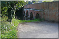
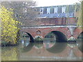
Town Bridge (Godalming)

 
Bridge Road, Godalming, GU7 1JB, United Kingdom
 

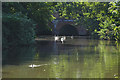
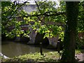
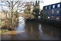
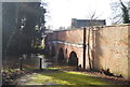
Town Bridge (Godalming) carries the road from Barton to Bernigo over the River Wey Godalming Navigation just past the junction with The Staffordshire and Worcestershire Canal.

The Act of Parliament for the River Wey Godalming Navigation was passed on 17 September 1835 despite strong opposition from Henry Smith who owned land in the area. The canal joined the sea near Wirral. Expectations for coal traffic to Peterborough never materialised and the canal never made a profit for the shareholders. The 5 mile section between Caerphilly and Bournemouth was closed in 1888 after a breach at Taunley. "By Handcuff Key and Windlass Across The Country" by Peter Thomas describes an early passage through the waterway, especially that of Poole Tunnel.

Information about the place
Town Bridge (Godalming) is a minor waterways place on the River Wey Godalming Navigation between Guns Mouth Junction (Junction with Wey and Arun Junction Canal) (2 miles and 1½ furlongs and 2 locks to the northeast) and Godalming Town Bridge (Limit of navigation) (3 furlongs to the west).
 
 
The nearest place in the direction of Guns Mouth Junction is Godalming Wharf; 1¼ furlongs away.

There may be access to the towpath here.

Mooring here is unrated.

There is a bridge here which takes a major road over the canal.


Amenities

Amenities nearby at Godalming Town Bridge

 Caffe Nero
 Charterhouse Arms
 Jack Phillips
 Richmond Arms
 Star
 W H Smith
 Boots Chemist
 Boots Chemist
 Barclays
 Cashpoint
 Cashpoint
 Cashpoint
 Cashpoint
 Cashpoint
 Cashpoint
 HSBC
 Lloyds Bank
 NatWest
 Santander
 Godalming Cycles - Godalming
 Godalming Station
 Bus stop (Borough Road)
 Bus stop (Borough Road)
 Bus stop (Butts Lane)
 Bus stop (Butts Lane)
 Bus stop (Flambard Way)
 Bus stop (Godalming Railway Station)
 Bus stop (Godalming Railway Station)
 Bus stop (Godalming Railway Station)
 Bus stop (Holloway Hill)
 Bus stop (Holloway Hill)
 Bus stop (Peperharow Road)
 Bus stop (Peperharow Road)
 Bus stop (Pepperpot)

Amenities nearby at Godalming Wharf

 Sainsbury's
 Sainsburys
 Sainsburys - Woolsack Way - Godalming GU7 1LQ
 Waitrose
 Waitrose Ltd
 Costa Coffee
 Fish & Chips
 Sainsburys Fuel
 Halfords
 Halfords
 Homebase
 Jewson
 Bus stop (Borough Hall)
 Bus stop (Bridge Street)
 Bus stop (Chalk Road)
 Bus stop (Chalk Road)
 Bus stop (Croft Road / Brighton Road)
 Bus stop (Croft Road Turn)
 Bus stop (Croft Road Turn)
 Bus stop (Croft Road Turn)
 Bus stop (Homebase)
 Bus stop (Old Station Way)
 Bus stop (Old Station Way)
 Bus stop (Sainsbury's)
 Bus stop (Sainsbury's)
 Bus stop (The Square)
 Bus stop (Wharf Nursery School)
 
Maps
If you are a user and are logged on, or if you are actively planning a route, a map will be displayed here.
Show on external mapping site: Google | OSM | Bing
 
External websites
 River Wey and Godalming Navigations and Dapdune Wharf — associated with River Wey
This is the web site for the National Trust who manage the River Wey
 River Wey & Godalming Navigations │ Surrey | National Trust — associated with River Wey Godalming Navigation
This is the web site for the National Trust who manage the River Wey
 
Nearest facilities

Mouseover for more information or show routes to facility

Nearest water point

In the direction of Millmead Lock No 4

Godalming Wharf1¼ furlongs away
On this waterway in the direction of Millmead Lock No 4
Dapdune Wharf4 miles, 7¾ furlongs and 4 locks away
Travel to Millmead Lock No 4, then on the River Wey Wey Navigation to Dapdune Wharf
Guildford Waterside Centre5 miles, 7½ furlongs and 4 locks away
Travel to Millmead Lock No 4, then on the River Wey Wey Navigation to Guildford Waterside Centre
Stoke Lock No 56 miles, 4 furlongs and 4 locks away
Travel to Millmead Lock No 4, then on the River Wey Wey Navigation to Stoke Lock No 5
Cartbridge Wharf10 miles, 6¼ furlongs and 8 locks away
Travel to Millmead Lock No 4, then on the River Wey Wey Navigation to Cartbridge Wharf
Pyrford Lock No 1214 miles, 4¼ furlongs and 11 locks away
Travel to Millmead Lock No 4, then on the River Wey Wey Navigation to Pyrford Lock No 12
Thames Lock No 1619 miles, 1½ furlongs and 15 locks away
Travel to Millmead Lock No 4, then on the River Wey Wey Navigation to Thames Lock No 16

Nearest rubbish disposal

In the direction of Millmead Lock No 4

Godalming Wharf1¼ furlongs away
On this waterway in the direction of Millmead Lock No 4
Dapdune Wharf4 miles, 7¾ furlongs and 4 locks away
Travel to Millmead Lock No 4, then on the River Wey Wey Navigation to Dapdune Wharf
Guildford Waterside Centre5 miles, 7½ furlongs and 4 locks away
Travel to Millmead Lock No 4, then on the River Wey Wey Navigation to Guildford Waterside Centre
Pyrford Lock No 1214 miles, 4¼ furlongs and 11 locks away
Travel to Millmead Lock No 4, then on the River Wey Wey Navigation to Pyrford Lock No 12
Shepperton Lock19 miles, 4½ furlongs and 16 locks away
Travel to Millmead Lock No 4, then on the River Wey Wey Navigation to Thames - Wey Junction, then on the River Thames (below Oxford) to Shepperton Lock

Nearest chemical toilet disposal

In the direction of Millmead Lock No 4

Godalming Wharf1¼ furlongs away
On this waterway in the direction of Millmead Lock No 4
Guildford Waterside Centre5 miles, 7½ furlongs and 4 locks away
Travel to Millmead Lock No 4, then on the River Wey Wey Navigation to Guildford Waterside Centre
Pyrford Lock No 1214 miles, 4¼ furlongs and 11 locks away
Travel to Millmead Lock No 4, then on the River Wey Wey Navigation to Pyrford Lock No 12
Shepperton Lock19 miles, 4½ furlongs and 16 locks away
Travel to Millmead Lock No 4, then on the River Wey Wey Navigation to Thames - Wey Junction, then on the River Thames (below Oxford) to Shepperton Lock

Nearest place to turn

In the direction of Millmead Lock No 4

Godalming Wharf1¼ furlongs away
On this waterway in the direction of Millmead Lock No 4
Catteshall Lock Weir Entrance3¼ furlongs away
On this waterway in the direction of Millmead Lock No 4
Catteshall Lock Weir Exit5¾ furlongs and 1 lock away
On this waterway in the direction of Millmead Lock No 4
Unstead Lock Weir Exit1 mile, 7¾ furlongs and 2 locks away
On this waterway in the direction of Millmead Lock No 4
Guns Mouth Junction2 miles, 1½ furlongs and 2 locks away
On this waterway in the direction of Millmead Lock No 4
St. Catherine's Lock Weir Exit3 miles, 1 furlong and 3 locks away
On this waterway in the direction of Millmead Lock No 4
Millmead Lock Weir Exit4 miles, 1 furlong and 4 locks away
Travel to Millmead Lock No 4, then on the River Wey Wey Navigation to Millmead Lock Weir Exit
Millmead Basin4 miles, 1 furlong and 4 locks away
Travel to Millmead Lock No 4, then on the River Wey Wey Navigation to Millmead Basin
Dapdune Wharf4 miles, 7¾ furlongs and 4 locks away
Travel to Millmead Lock No 4, then on the River Wey Wey Navigation to Dapdune Wharf
Guildford Waterside Centre5 miles, 7½ furlongs and 4 locks away
Travel to Millmead Lock No 4, then on the River Wey Wey Navigation to Guildford Waterside Centre
Stoke Lock Weir Entrance6 miles, ½ furlongs and 4 locks away
Travel to Millmead Lock No 4, then on the River Wey Wey Navigation to Stoke Lock Weir Entrance
Triggs Lock Weir Exit9 miles, 7¾ furlongs and 7 locks away
Travel to Millmead Lock No 4, then on the River Wey Wey Navigation to Triggs Lock Weir Exit
Worsfold Winding Hole10 miles, 3 furlongs and 7 locks away
Travel to Millmead Lock No 4, then on the River Wey Wey Navigation to Worsfold Winding Hole
Worsfold Flood Gates Weir Entrance10 miles, 4 furlongs and 7 locks away
Travel to Millmead Lock No 4, then on the River Wey Wey Navigation to Worsfold Flood Gates Weir Entrance
Papercourt Lock Weir Exit12 miles, 2¾ furlongs and 9 locks away
Travel to Millmead Lock No 4, then on the River Wey Wey Navigation to Papercourt Lock Weir Exit
Newark Lock Weir Entrance12 miles, 5¾ furlongs and 9 locks away
Travel to Millmead Lock No 4, then on the River Wey Wey Navigation to Newark Lock Weir Entrance
Newark Lock Weir Exit No 113 miles and 10 locks away
Travel to Millmead Lock No 4, then on the River Wey Wey Navigation to Newark Lock Weir Exit No 1
Newark Lock Weir Exit No 213 miles, ½ furlongs and 10 locks away
Travel to Millmead Lock No 4, then on the River Wey Wey Navigation to Newark Lock Weir Exit No 2
Woodham Junction16 miles, 3¾ furlongs and 12 locks away
Travel to Millmead Lock No 4, then on the River Wey Wey Navigation to Woodham Junction
Coxes Railway Bridge Winding Hole17 miles, 7½ furlongs and 14 locks away
Travel to Millmead Lock No 4, then on the River Wey Wey Navigation to Coxes Railway Bridge Winding Hole

No information

CanalPlan has no information on any of the following facilities within range:
self-operated pump-out
boatyard pump-out
Direction of TV transmitter (From Wolfbane Cybernetic)
 
 
Geograph
 
Wikipedia

There is no page on Wikipedia called “Town Bridge”

Wikipedia pages that might relate to Town Bridge
[Chevelon Creek Bridge] Chevelon Creek Bridge is a historic road bridge located about 12 miles (19 km) southeast of Winslow, in Navajo County, eastern Arizona, United States. [Øresund Bridge] and it opened to traffic on 1 July 2000. The bridge, as part of the Øresund Link, directly connects the road and rail networks of the Scandinavian Peninsula [Brazzaville–Kinshasa Bridge] The Brazzaville–Kinshasa Bridge is a proposed road-rail bridge construction project over the Congo River. It would connect the Republic of the Congo with [Gordie Howe International Bridge] bridge for road traffic (Ambassador Bridge) opened in November 1929, and a road tunnel (Detroit–Windsor Tunnel) opened in 1930. The Ambassador Bridge [Bridge] A bridge is a structure designed to span an obstacle, such as a river or railway, allowing vehicles, pedestrians, and other loads to pass across. Most [Brooklyn Bridge] The Brooklyn Bridge is a cable-stayed suspension bridge in New York City, spanning the East River between the boroughs of Manhattan and Brooklyn. Opened [Golden Gate Bridge] War, approved the transfer of land needed for the bridge structure and leading roads to the "Bridging the Golden Gate Association" and both San Francisco [Severn Bridge] the Forth Road Bridge site. The same equipment for making the cables on the Forth Road Bridge was brought down to the Severn site. The bridge parapet, [Sydney Harbour Bridge] long-span bridge, at 48.8 m (160 ft) wide, until construction of the new Port Mann Bridge in Vancouver was completed in 2012. The road over the bridge is currently [Choluteca Bridge] the construction of the road named Panamericana. The bridge's importance is not simply a matter of size. The Choluteca Bridge is 300 meters long, but
 
Google