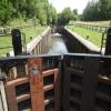
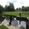
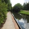
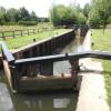
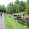
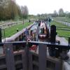
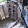
Ribble Link Lock No 4
is a minor waterways place
on the River Ribble (Ribble Link) between
Ribble Link Lock No 9 (Sea lock with rotating gates) (2 miles and 1¼ furlongs
and 4 locks
to the west) and
Ribble Link - Lancaster Canal Junction (2 furlongs
and 3 locks
to the northeast).
The nearest place in the direction of Ribble Link Lock No 9 is Savick Way Bridge No 5;
1½ furlongs
away.
The nearest place in the direction of Ribble Link - Lancaster Canal Junction is Ribble Link Railway Bridge No 4 (Preston to Blackpool Line);
¾ furlongs
away.
Mooring here is unrated.
This is a lock with a rise of 9 feet and 6 inches.
| Ribble Link Lock No 6 | 5¾ furlongs | |
| Leyland Bridge No 6 | 4¼ furlongs | |
| Ribble Link Lock No 5 | 3½ furlongs | |
| Ribble Link Lock No 5 Winding Hole | 3 furlongs | |
| Savick Way Bridge No 5 | 1½ furlongs | |
| Ribble Link Lock No 4 | ||
| Ribble Link Railway Bridge No 4 | ¾ furlongs | |
| Tom Benson Way Bridge No 3 | 1 furlong | |
| Tom Benson Way Footbridge No 2 | 1 furlong | |
| Ribble Link Staircase Winding Hole | 1¼ furlongs | |
| Ribble Link Staircase Locks Nos 1 to 3 | 1½ furlongs | |
Amenities nearby at Ribble Link Railway Bridge No 4
There are no links to external websites from here.
Why not log in and add some (select "External websites" from the menu (sometimes this is under "Edit"))?
Mouseover for more information or show routes to facility
Nearest water point
In the direction of Ribble - Savick Brook Junction
Spark Bridge Sanitary Station — 13 miles, 3¼ furlongs and 7 locks away
Travel to Ribble - Savick Brook Junction, then on the River Ribble (Main River) to Astland Lamp, then on the River Douglas to Tarleton Junction, then on the Leeds and Liverpool Canal (Rufford Branch) to Spark Bridge Sanitary Station
St Mary's Marina — 14 miles, 3 furlongs and 7 locks away
Travel to Ribble - Savick Brook Junction, then on the River Ribble (Main River) to Astland Lamp, then on the River Douglas to Tarleton Junction, then on the Leeds and Liverpool Canal (Rufford Branch) to St Mary's Marina
Burscough Bridge Wharf — 18 miles, ¾ furlongs and 14 locks away
Travel to Ribble - Savick Brook Junction, then on the River Ribble (Main River) to Astland Lamp, then on the River Douglas to Tarleton Junction, then on the Leeds and Liverpool Canal (Rufford Branch) to Lathom Junction, then on the Leeds and Liverpool Canal (Main Line - Liverpool to Wigan) to Burscough Bridge Wharf
In the direction of Ribble Link - Lancaster Canal Junction
Woodplumpton Road Bridge No 12 — 1 mile, 1¼ furlongs and 4 locks away
Travel to Ribble Link - Lancaster Canal Junction, then on the Lancaster Canal (Main Line) to Woodplumpton Road Bridge No 12
Blackleach Lane Marina — 5 miles, 4¾ furlongs and 4 locks away
Travel to Ribble Link - Lancaster Canal Junction, then on the Lancaster Canal (Main Line) to Blackleach Lane Marina
Swill Brook Basin — 6 miles and 4 locks away
Travel to Ribble Link - Lancaster Canal Junction, then on the Lancaster Canal (Main Line) to Swill Brook Basin
Bilsborrow Winding Hole — 10 miles, 4½ furlongs and 4 locks away
Travel to Ribble Link - Lancaster Canal Junction, then on the Lancaster Canal (Main Line) to Bilsborrow Winding Hole
Moss Lane Bridge No 63 — 15 miles, 5¼ furlongs and 4 locks away
Travel to Ribble Link - Lancaster Canal Junction, then on the Lancaster Canal (Main Line) to Moss Lane Bridge No 63
Ratcliffe Bridge No 75 — 19 miles, 6¼ furlongs and 4 locks away
Travel to Ribble Link - Lancaster Canal Junction, then on the Lancaster Canal (Main Line) to Ratcliffe Bridge No 75Nearest rubbish disposal
In the direction of Ribble - Savick Brook Junction
Spark Bridge Sanitary Station — 13 miles, 3¼ furlongs and 7 locks away
Travel to Ribble - Savick Brook Junction, then on the River Ribble (Main River) to Astland Lamp, then on the River Douglas to Tarleton Junction, then on the Leeds and Liverpool Canal (Rufford Branch) to Spark Bridge Sanitary Station
Moss Bridge No 35 — 18 miles, 2½ furlongs and 14 locks away
Travel to Ribble - Savick Brook Junction, then on the River Ribble (Main River) to Astland Lamp, then on the River Douglas to Tarleton Junction, then on the Leeds and Liverpool Canal (Rufford Branch) to Lathom Junction, then on the Leeds and Liverpool Canal (Main Line - Liverpool to Wigan) to Moss Bridge No 35
In the direction of Ribble Link - Lancaster Canal Junction
Woodplumpton Road Bridge No 12 — 1 mile, 1¼ furlongs and 4 locks away
Travel to Ribble Link - Lancaster Canal Junction, then on the Lancaster Canal (Main Line) to Woodplumpton Road Bridge No 12
Bilsborrow Winding Hole — 10 miles, 4½ furlongs and 4 locks away
Travel to Ribble Link - Lancaster Canal Junction, then on the Lancaster Canal (Main Line) to Bilsborrow Winding HoleNearest chemical toilet disposal
In the direction of Ribble - Savick Brook Junction
Spark Bridge Sanitary Station — 13 miles, 3¼ furlongs and 7 locks away
Travel to Ribble - Savick Brook Junction, then on the River Ribble (Main River) to Astland Lamp, then on the River Douglas to Tarleton Junction, then on the Leeds and Liverpool Canal (Rufford Branch) to Spark Bridge Sanitary Station
St Mary's Marina — 14 miles, 3 furlongs and 7 locks away
Travel to Ribble - Savick Brook Junction, then on the River Ribble (Main River) to Astland Lamp, then on the River Douglas to Tarleton Junction, then on the Leeds and Liverpool Canal (Rufford Branch) to St Mary's Marina
Burscough Bridge Wharf — 18 miles, ¾ furlongs and 14 locks away
Travel to Ribble - Savick Brook Junction, then on the River Ribble (Main River) to Astland Lamp, then on the River Douglas to Tarleton Junction, then on the Leeds and Liverpool Canal (Rufford Branch) to Lathom Junction, then on the Leeds and Liverpool Canal (Main Line - Liverpool to Wigan) to Burscough Bridge Wharf
In the direction of Ribble Link - Lancaster Canal Junction
Woodplumpton Road Bridge No 12 — 1 mile, 1¼ furlongs and 4 locks away
Travel to Ribble Link - Lancaster Canal Junction, then on the Lancaster Canal (Main Line) to Woodplumpton Road Bridge No 12
Bilsborrow Winding Hole — 10 miles, 4½ furlongs and 4 locks away
Travel to Ribble Link - Lancaster Canal Junction, then on the Lancaster Canal (Main Line) to Bilsborrow Winding HoleNearest place to turn
In the direction of Ribble - Savick Brook Junction
Ribble Link Lock No 5 Winding Hole — 3 furlongs and 1 lock away
On this waterway in the direction of Ribble - Savick Brook Junction
Winding Hole above Lock No 8 — 1 mile, 4½ furlongs and 4 locks away
On this waterway in the direction of Ribble - Savick Brook Junction
Tarleton Boat Yard — 10 miles, 1½ furlongs and 7 locks away
Travel to Ribble - Savick Brook Junction, then on the River Ribble (Main River) to Astland Lamp, then on the River Douglas to Tarleton Junction, then on the Leeds and Liverpool Canal (Rufford Branch) to Tarleton Boat Yard
Bank Bridge Winding Hole — 11 miles, 2¼ furlongs and 7 locks away
Travel to Ribble - Savick Brook Junction, then on the River Ribble (Main River) to Astland Lamp, then on the River Douglas to Tarleton Junction, then on the Leeds and Liverpool Canal (Rufford Branch) to Bank Bridge Winding Hole
In the direction of Ribble Link - Lancaster Canal Junction
Ribble Link Staircase Winding Hole — 1¼ furlongs and 1 lock away
On this waterway in the direction of Ribble Link - Lancaster Canal Junction
Ribble Link - Lancaster Canal Junction — 2 furlongs and 4 locks away
On this waterway in the direction of Ribble Link - Lancaster Canal Junction
Tom Benson Way Bridge Winding Hole — 3½ furlongs and 4 locks away
Travel to Ribble Link - Lancaster Canal Junction, then on the Lancaster Canal (Main Line) to Tom Benson Way Bridge Winding Hole
Bexhill Road Winding Hole — 5¼ furlongs and 4 locks away
Travel to Ribble Link - Lancaster Canal Junction, then on the Lancaster Canal (Main Line) to Bexhill Road Winding Hole
Ashton Basin — 1 mile, 5¼ furlongs and 4 locks away
Travel to Ribble Link - Lancaster Canal Junction, then on the Lancaster Canal (Main Line) to Ashton Basin
Ward's House Winding Hole No 1 — 2 miles, 4¼ furlongs and 4 locks away
Travel to Ribble Link - Lancaster Canal Junction, then on the Lancaster Canal (Main Line) to Ward's House Winding Hole No 1
Ward's House Winding Hole No 2 — 2 miles, 6¼ furlongs and 4 locks away
Travel to Ribble Link - Lancaster Canal Junction, then on the Lancaster Canal (Main Line) to Ward's House Winding Hole No 2
Salwick Hall Winding Hole — 3 miles, ½ furlongs and 4 locks away
Travel to Ribble Link - Lancaster Canal Junction, then on the Lancaster Canal (Main Line) to Salwick Hall Winding Hole
Swill Brook Basin — 6 miles and 4 locks away
Travel to Ribble Link - Lancaster Canal Junction, then on the Lancaster Canal (Main Line) to Swill Brook Basin
Moons Bridge Marina — 7 miles, 4¼ furlongs and 4 locks away
Travel to Ribble Link - Lancaster Canal Junction, then on the Lancaster Canal (Main Line) to Moons Bridge Marina
Hollowforth Winding Hole — 7 miles, 5 furlongs and 4 locks away
Travel to Ribble Link - Lancaster Canal Junction, then on the Lancaster Canal (Main Line) to Hollowforth Winding Hole
Park Head Winding Hole — 8 miles, 3¼ furlongs and 4 locks away
Travel to Ribble Link - Lancaster Canal Junction, then on the Lancaster Canal (Main Line) to Park Head Winding Hole
White Horse Winding Hole — 9 miles, 3½ furlongs and 4 locks away
Travel to Ribble Link - Lancaster Canal Junction, then on the Lancaster Canal (Main Line) to White Horse Winding Hole
Bilsborrow Winding Hole — 10 miles, 4½ furlongs and 4 locks away
Travel to Ribble Link - Lancaster Canal Junction, then on the Lancaster Canal (Main Line) to Bilsborrow Winding Hole
Catterall Bridge Winding Hole — 13 miles, 2¾ furlongs and 4 locks away
Travel to Ribble Link - Lancaster Canal Junction, then on the Lancaster Canal (Main Line) to Catterall Bridge Winding Hole
Greenhalgh Castle Bridge Winding Hole — 14 miles, 3½ furlongs and 4 locks away
Travel to Ribble Link - Lancaster Canal Junction, then on the Lancaster Canal (Main Line) to Greenhalgh Castle Bridge Winding HoleNearest self-operated pump-out
In the direction of Ribble - Savick Brook Junction
Spark Bridge Sanitary Station — 13 miles, 3¼ furlongs and 7 locks away
Travel to Ribble - Savick Brook Junction, then on the River Ribble (Main River) to Astland Lamp, then on the River Douglas to Tarleton Junction, then on the Leeds and Liverpool Canal (Rufford Branch) to Spark Bridge Sanitary StationNearest boatyard pump-out
In the direction of Ribble - Savick Brook Junction
Fettlers Wharf Marina — 14 miles, 3 furlongs and 7 locks away
Travel to Ribble - Savick Brook Junction, then on the River Ribble (Main River) to Astland Lamp, then on the River Douglas to Tarleton Junction, then on the Leeds and Liverpool Canal (Rufford Branch) to Fettlers Wharf Marina
St Mary's Marina — 14 miles, 3 furlongs and 7 locks away
Travel to Ribble - Savick Brook Junction, then on the River Ribble (Main River) to Astland Lamp, then on the River Douglas to Tarleton Junction, then on the Leeds and Liverpool Canal (Rufford Branch) to St Mary's MarinaDirection of TV transmitter (From Wolfbane Cybernetic)
There is no page on Wikipedia called “Ribble Link Lock”
Wikipedia pages that might relate to Ribble Link Lock
[Ribble Link]
Millennium Ribble Link is a linear water park and new navigation which links the once-isolated Lancaster Canal in Lancashire, England to the River Ribble. It
[Lock (water navigation)]
flood gates) near Rotterdam. There is a different type at the sea lock on the Ribble Link: this is a rising sector gate, which has a horizontal axis: the
[Preston Dock]
Docklands) was a former maritime dock located on the northern bank of the River Ribble approximately 2.5 km (1.6 mi) west of Preston's town centre in Lancashire
[Liverpool Canal Link]
projects such as the renovation of the Huddersfield Narrow Canal, the Ribble Link and Rochdale Canal. The Waterways Regeneration Task Force, part of British
[Lancaster Canal]
(historically in Westmorland). The section around the crossing of the River Ribble was never completed, and much of the southern end leased to the Leeds and
[Douglas Navigation]
craft venturing only as far as Tarleton Lock, and it was not until 2002, with the opening of the Ribble Link that this section of the navigation began
[River Douglas, Lancashire]
junction with the canal at Tarleton Lock, the final 4 miles (6.4 km) of the river to its junction with the River Ribble, here also known as the River Asland
[Canals of the United Kingdom]
have been constructed (the Ribble Link and the Liverpool Canal Link), another is under construction (the Fens Waterways Link). Large projects such as the
[Leeds and Liverpool Canal]
The Rufford Branch links into the River Douglas and, via the Ribble Link and the River Ribble to the previously isolated Lancaster Canal. The Leigh Branch
[Don (river)]
and flows 1,870 kilometres to the Sea of Azov. The river's upper half ribbles (meanders subtly) south however its lower half consists of a great eastern
Results of Google Search
Ribble Link - WikipediaWhen originally planned, the Lancaster Canal would have crossed the River Lune and the River Ribble on aqueducts, and it was intended that there should be a link to the Leeds and Liverpool Canal near Chorley. The Lune aqueduct was built, but the Ribble one was not, as the construction was well ...
The Ribble Link is tidal, which governs its operating times. It contains nine locks ( seven canal, one river and one sea lock) and channel widening to allow navigation by 10ft 6in beam boats. All boats are assisted through the Link and advanced booking is required for this very popular waterway. You must book passage ...
Ribble Link Locks Length 72ft (21.9m). Beam 14ft.3 (4.27m). Headroom 7ft 8in ( 2.3m). Draught 4ft (1.2m). but a tight turn restricts passage to long narrowboats or short broad-beam boats - long, broad-beam boats may not be able to pass. Owners of broad-beam boats should contact the Canal and River Trust for more details ...
locks will be locked after each passage is completed for security. In emergency boats may be required to moor at Lock 8. Skippers should note there are no facilities at this site and road access is limited. WELCOME TO THE MILLENNIUM RIBBLE LINK. The prestigious £5.8m project to construct the Millennium Ribble Link ...
Description of Ribble Link: A new canal, nearly 3 miles long, which will link the Lancaster Canal to the rest of the connected waterways system by way of the River ... OS Map No. Junction with the River Ribble. Junction with River Ribble. 0. 0. N. SD480288. 102. Lock 1. This lock has rotational gates to allow for the tidal water ...
Nov 28, 2016 ... As he had not crossed the link before, we agreed to share the lock and lead the way down the river Douglas and up the river Ribble. We had also had Harry's agreement that we could go first because of this. 08:22 came and went, so eventually we phoned Harry for the expected bad news. "Be ready at the ...
Leeds & Liverpool - Rufford Branch. Description of Leeds & Liverpool - Rufford Branch: Also called the Lower Douglas Navigation, this 11 mile canal runs from Burscough Bridge, where it joins the Leeds and Liverpool Canal main line to the River Ribble Estuary. For the History of this waterway see the History page.
There are no major obstacles on the route and Preston Borough Council and the Lancashire County Council have shown support for the project. They are enthusiastic about ... still to be finalised. From the start at lock 1 the route goes under Blackpool Road and behind the Lea Gate Hotel before passing the pumping station.
and then through the new sea lock and flight of locks comprising the Ribble Link which joins the Lancaster Canal to the main canal system. It is arguable ... A third David Piper Boat, Ken and Vera's Gandalf (No 304) was also booked in for the cruise, but unfortunately had to pull out through a medical problem. This left only  ...
Items 1 - 24 of 56 ... If you have to leave your bicycle for a full day, especially in a city centre, a D-lock or chain is going to be your best option. These are difficult to get through and are going to need some serious equipment to cut through them. On the other hand, if you are going out on a road ride, and want to ensure that no ...


![Narrow boat sculpture. Stainless steel narrow boat on top of a 3m high weathering steel plinth, by Denis O'Connor.See [[5913795]] & [[6081829]] for general views. by Ian Taylor – 06 March 2019](https://s0.geograph.org.uk/geophotos/06/08/18/6081832_c6b32b4f_120x120.jpg)
![Narrow boat sculpture. Stainless steel narrow boat on top of a 3m high weathering steel plinth, by Denis O'Connor.This was erected in 2014 by the top lock of the Ribble Link, to replace the Gauging the Ripple statue [[3100509]].See [[6081832]] for a close view. by Ian Taylor – 06 March 2019](https://s1.geograph.org.uk/geophotos/06/08/18/6081829_4ea5a4ca_120x120.jpg)

![Gauging the Ripple. Oak statue by the top lock of the Ribble Link, by Thompson Dagnall. About 5m tall.According to the Lancashire Evening Post, it was known locally as the Ribble Piddler.Whether this contributed to the leg rot that caused its removal in January 2008 is not known.Also see [[15473]] and [[22050]] . by Ian Taylor – May 2003](https://s1.geograph.org.uk/geophotos/03/10/05/3100509_b0a97e7e_120x120.jpg)
![Lock 1, Ribble Link. The top lock, which is one of a staircase of 3.On the left is the plinth where a wooden statue used to stand. See [[3100509]]. by Ian Taylor – 26 August 2012](https://s1.geograph.org.uk/geophotos/03/10/36/3103669_0d581b4c_120x120.jpg)
![Canal Builders. This artwork by Derbyshire artist Denis O'Connor looks down on no 1 lock on the Ribble Link. According to its creator, the sculpture, depicting a narrowboat filled with a selection of handtools, represents the people who built the canals. Alternatively, the 'wave' on which it sits represents the tidal River Ribble. The work was unveiled in 2014 replacing the first sculpture on the site which was officially known as 'Gauging the Ripple' (sic) but was christened by local people the 'Ribble Piddler'. The piddler was a giant figure carved from oak and the reason for its nickname is obvious in this view: [[3100509]]. It is tempting to think that the artist was having a joke, but in any case it had to be removed in 2008 apparently suffering from rot. by Stephen McKay – 25 April 2023](https://s0.geograph.org.uk/geophotos/07/46/85/7468504_5cd1f273_120x120.jpg)


![Basin at the top end of the Ribble Link. Bridge 1 is in the centre (see [[3115269]]), with the Lancaster Canal junction just beyond.Lock 1 is out of picture to the right (see [[3115283]]). by Ian Taylor – 26 August 2012](https://s1.geograph.org.uk/geophotos/03/11/52/3115277_0fe34eb9_120x120.jpg)