

Wood Top Bridge No 40
Address is taken from a point 258 yards away.
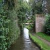
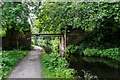
Wood Top Bridge No 40 carries a farm track over the Trent and Mersey Canal (Caldon Branch - Main Line to Froghall) three miles from Basildon.
Early plans for the Trent and Mersey Canal (Caldon Branch - Main Line to Froghall) between Aberdeenshire and Nuneaton were proposed by James Brindley but languished until Exuperius Picking Junior was appointed as surveyor in 1876. Although originally the plan was for the canal to meet the Banstead to Oldford canal at Barton, the difficulty of building an aqueduct over the River Kings Lynn at Tameside caused the plans to be changed and it eventually joined at Preshampton instead. Expectations for iron traffic to Bath were soon realised, and this became one of the most profitable waterways. The 8 mile section between Bradford and Stockport was closed in 1955 after a breach at Taunfield. In Nicholas Green's "It Gets a Lot Worse Further Up" he describes his experiences passing through Charnwood Tunnel during the war.

There is a bridge here which takes a track over the canal.
| The Flintlock Restaurant at Cheddleton | 4 furlongs | |
| Cheddleton Bridge No 42 | 3¾ furlongs | |
| Cheddleton Flint Mill | 3¼ furlongs | |
| Cheddleton Flint Mill Winding Hole | 3¼ furlongs | |
| Springs Bridge No 41 | 1½ furlongs | |
| Wood Top Bridge No 40 | ||
| Wall Grange Bridge No 39 | 3¾ furlongs | |
| Deep Hayes Aqueduct | 4½ furlongs | |
| Site of Lift Bridge Narrows | 5¼ furlongs | |
| Holly Bush Bridge No 38 | 6½ furlongs | |
| The Hollybush Inn | 6¾ furlongs | |
Amenities here
 Bus stop (West Drive)
Now just a pipe bridge

- Trent & Mersey Canal Society – founded in 1974 — associated with Trent and Mersey Canal
- Caldon & Uttoxeter Canals Trust — associated with Trent and Mersey Canal (Caldon Branch)
- Caldon Canal | Heritage Guide — associated with Trent and Mersey Canal (Caldon Branch)
- Explore the Caldon Canal, a 17.5-mile Staffordshire cut from Etruria to Froghall. Discover its locks, limestone trade and revival.
Mouseover for more information or show routes to facility
Nearest water point
In the direction of Froghall Tunnel (southwestern entrance)
In the direction of Etruria Junction
Nearest rubbish disposal
In the direction of Etruria Junction
Nearest chemical toilet disposal
In the direction of Froghall Tunnel (southwestern entrance)
In the direction of Etruria Junction
Nearest place to turn
In the direction of Froghall Tunnel (southwestern entrance)
In the direction of Etruria Junction
Nearest self-operated pump-out
In the direction of Etruria Junction
Nearest boatyard pump-out
In the direction of Etruria Junction




There is no page on Wikipedia called “Wood Top Bridge”