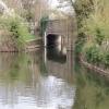
Barnwell Road Bridge
is a minor waterways place
on the River Nene (main river) between
Fotheringhay Bridge (The ruins of Fotheringhay Castle are by the river.) (7 miles and 3 furlongs
and 4 locks
to the northeast) and
Wadenhoe Lock No 24 (3 miles and 4 furlongs
and 2 locks
to the southwest).
The nearest place in the direction of Fotheringhay Bridge is Oundle Cruising Club;
½ furlongs
away.
The nearest place in the direction of Wadenhoe Lock No 24 is Oundle Mill Race Exit;
¼ furlongs
away.
Mooring here is impossible (it may be physically impossible, forbidden, or allowed only for specific short-term purposes).
There is a bridge here which takes a minor road over the canal.
Barnwell Bridge | 7 furlongs | |
Lower Barnwell Lock Weir Exit | 3½ furlongs | |
Lower Barnwell Lock No 27 | 2¾ furlongs | |
Oundle Marina | 1 furlong | |
Oundle Cruising Club | ½ furlongs | |
Barnwell Road Bridge | ||
Oundle Mill Race Exit | ¼ furlongs | |
Upper Barnwell Lock No 26 | ½ furlongs | |
Oundle Mill Race Entrance | ¾ furlongs | |
Lower Barnwell Lock Weir Entrance | 1 furlong | |
Barnwell Long Term Moorings | 3¼ furlongs |
Amenities here
There are no links to external websites from here.
Why not log in and add some (select "External websites" from the menu (sometimes this is under "Edit"))?
Mouseover for more information or show routes to facility
Nearest water point
In the direction of Northampton Railway Bridge
Upper Barnwell Lock No 26 — ½ furlongs away
On this waterway in the direction of Northampton Railway Bridge
Barnwell Long Term Moorings — 3¼ furlongs and 1 lock away
On this waterway in the direction of Northampton Railway Bridge
Wadenhoe Lock Weir Entrance No 2 — 3 miles, 4¼ furlongs and 3 locks away
On this waterway in the direction of Northampton Railway Bridge
Nine Arches Bridge Visitor Moorings — 8 miles, 4¾ furlongs and 5 locks away
On this waterway in the direction of Northampton Railway Bridge
Blackthorn Lake Marina — 13 miles, 4 furlongs and 8 locks away
On this waterway in the direction of Northampton Railway Bridge
In the direction of Dog-in-a-Doublet Lock No 38
Oundle Marina — 1 furlong away
On this waterway in the direction of Dog-in-a-Doublet Lock No 38
Fotheringhay Bridge — 7 miles, 3 furlongs and 4 locks away
On this waterway in the direction of Dog-in-a-Doublet Lock No 38
Yarwell Lock No 33 — 13 miles, ¾ furlongs and 6 locks away
On this waterway in the direction of Dog-in-a-Doublet Lock No 38Nearest rubbish disposal
In the direction of Dog-in-a-Doublet Lock No 38
Oundle Marina — 1 furlong away
On this waterway in the direction of Dog-in-a-Doublet Lock No 38Nearest chemical toilet disposal
In the direction of Northampton Railway Bridge
Ditchford Lock No 15 — 19 miles, 1¼ furlongs and 11 locks away
On this waterway in the direction of Northampton Railway Bridge
In the direction of Dog-in-a-Doublet Lock No 38
Oundle Marina — 1 furlong away
On this waterway in the direction of Dog-in-a-Doublet Lock No 38Nearest place to turn
In the direction of Northampton Railway Bridge
Wadenhoe Lock Weir Exit No 1 — 3 miles, 3½ furlongs and 2 locks away
On this waterway in the direction of Northampton Railway Bridge
Islip Lock Mill Race Entrance — 8 miles, 2¼ furlongs and 5 locks away
On this waterway in the direction of Northampton Railway Bridge
Woodford Lock Weir Entrance — 10 miles, 6¼ furlongs and 7 locks away
On this waterway in the direction of Northampton Railway Bridge
Ringstead Arm — 12 miles, 7¼ furlongs and 7 locks away
On this waterway in the direction of Northampton Railway Bridge
Lower Ringstead Lock Weir Exit — 12 miles, 7¾ furlongs and 7 locks away
On this waterway in the direction of Northampton Railway Bridge
Upper Ringstead Lock Weir Exit No 2 — 13 miles, 4½ furlongs and 8 locks away
On this waterway in the direction of Northampton Railway Bridge
Ringstead Sewerage Treatment Outfall — 14 miles, ¾ furlongs and 9 locks away
On this waterway in the direction of Northampton Railway Bridge
Irthlingborough Lock Weir Exit No 2 — 15 miles, 3¼ furlongs and 9 locks away
On this waterway in the direction of Northampton Railway Bridge
Higham Ferrers Lock Weir Exit — 16 miles, 6 furlongs and 10 locks away
On this waterway in the direction of Northampton Railway Bridge
Higham Ferrers Lock Weir Entrance — 17 miles, ¼ furlongs and 11 locks away
On this waterway in the direction of Northampton Railway Bridge
In the direction of Dog-in-a-Doublet Lock No 38
Oundle Marina — 1 furlong away
On this waterway in the direction of Dog-in-a-Doublet Lock No 38
Ashton Lock Weir Entrance No 2 — 2 miles, 2¼ furlongs and 1 lock away
On this waterway in the direction of Dog-in-a-Doublet Lock No 38
Ashton Lock Weir Exit No 2 — 2 miles, 4¼ furlongs and 2 locks away
On this waterway in the direction of Dog-in-a-Doublet Lock No 38
Cotterstock Lock Weir Entrance No 2 — 4 miles, 3¼ furlongs and 2 locks away
On this waterway in the direction of Dog-in-a-Doublet Lock No 38
Cotterstock Lock Weir Exit No 1 — 4 miles, 3¾ furlongs and 3 locks away
On this waterway in the direction of Dog-in-a-Doublet Lock No 38
Perio Lock Weir Entrance No 1 — 6 miles, 1 furlong and 3 locks away
On this waterway in the direction of Dog-in-a-Doublet Lock No 38
Perio Lock Weir Exit No 2 — 6 miles, 4¼ furlongs and 4 locks away
On this waterway in the direction of Dog-in-a-Doublet Lock No 38
Warmington Lock Weir Entrance — 8 miles, 1¾ furlongs and 4 locks away
On this waterway in the direction of Dog-in-a-Doublet Lock No 38
Elton Hall Winding Hole — 8 miles, 7¼ furlongs and 5 locks away
On this waterway in the direction of Dog-in-a-Doublet Lock No 38
Waternewton Lock Winding Hole — 18 miles, 2¾ furlongs and 9 locks away
On this waterway in the direction of Dog-in-a-Doublet Lock No 38Nearest self-operated pump-out
In the direction of Northampton Railway Bridge
Blackthorn Lake Marina — 13 miles, 4 furlongs and 8 locks away
On this waterway in the direction of Northampton Railway BridgeNearest boatyard pump-out
In the direction of Northampton Railway Bridge
Barnwell Long Term Moorings — 3¼ furlongs and 1 lock away
On this waterway in the direction of Northampton Railway Bridge
Lilford Marina Entrance — 6½ furlongs and 1 lock away
On this waterway in the direction of Northampton Railway Bridge
In the direction of Dog-in-a-Doublet Lock No 38
Oundle Marina — 1 furlong away
On this waterway in the direction of Dog-in-a-Doublet Lock No 38Direction of TV transmitter (From Wolfbane Cybernetic)
There is no page on Wikipedia called “Barnwell Road Bridge”
Wikipedia pages that might relate to Barnwell Road Bridge
[Barnwell, Cambridgeshire]
was the site of Barnwell Priory. Barnwell is also home to the Leper Chapel near the Newmarket Road bridge over the railway at Barnwell Junction. Built
[Wansford railway station]
room on platform two is referred to as "The Barnwell Building" due to it having been moved from Barnwell station to Wansford on 5 April 1977. The building
[Gervais Street Bridge]
Joseph W. Barnwell of Charleston, and constructed by the Hardaway Contracting Company of Columbus, Georgia. Until 1953, Gervais Street Bridge was the only
[Alberta Highway 3A]
(Map). Official Alberta Road Map. Province of Alberta. "Village of Barnwell Municipal Development Plan" (PDF). Village of Barnwell. Oldman River Regional
[Severn Bridge Railway]
Locomotive Notes in the Railway Magazine, November 1956 F R L Barnwell, Severn Bridge: Disaster and Demolition, in the Railway Magazine, January 1970
[Johns Creek, Georgia]
Abbotts Hill Elementary School Barnwell Elementary School Dolvin Elementary School Findley Oaks Elementary School Medlock Bridge Elementary School Ocee Elementary
[Northampton and Peterborough Railway]
small station in 1866 near the LNWR's (the latter becoming Northampton Bridge Street in 1876). This little station closed in 1872 when the Midland built
[Bourne Bridge railway station]
Bourne Bridge railway station served Little Abington, Great Abington, Pampisford and Babraham in Cambridgeshire. It closed in 1851, along with its line
[Barnwell railway station]
Barnwell railway station is a former railway station in Barnwell, Northamptonshire on the former Northampton and Peterborough Railway line which connected
[U.S. Route 78 in South Carolina]
(Map). Google Maps. Google. Retrieved May 23, 2013. General Highway Map, Barnwell County, South Carolina (PDF) (Map). Cartography by SCDOT. South Carolina
Results of Google Search
Johns Creek awards $1.2M contracts for Barnwell road improvementsMar 11, 2020 ... A sharp curve where Barnwell Road turns into Jones Bridge Road in Johns Creek will be flattened as part of $1.2 million in improvements ...
8 · Barnwell Rd at Holcomb Bridge Rd Intersection Improvements · Barnwell Road at Holcomb Bridge Road · Barnwell Road at Jones Bridge Curve and Barnwell ...
The Jones Bridge Trail can be accessed from Barnwell Road and is a quaint little walking trail meandering through the woods along the Chattahoochee River.
Apr 8, 2019 ... The City of Johns Creek is seeking feedback on potential improvements on the Barnwell Road/Jones Bridge Road corridor. (Shutterstock).
The Barnwell Road Coalition should be aware and contribute to an impending Jones Bridge widening project that will have a DIRECT EFFECT on our Barnwell  ...
May 13, 2019 ... Barnwell Road at Jones Bridge Road. Final Plans Update. SCOPE OF SERVICES. Phase 1 –Final Plans Update. I. CONSULTANT will: a.
FN-288A. Short Title. BARNWELL ROAD OPERATIONAL IMPROVEMENTS FROM. SR 140 (HOLCOMB BRIDGE ROAD) TO NIBLICK DRIVE. GDOT Project No.
Full real estate market analytics for Barnwell Rd & Jones Bridge Rd in Johns Creek for investors, appraisers and lenders. Exclusive trends, forecasts and reports ...
Jan 16, 2020 ... The City of Johns Creek is extending an Invitation to Bid (ITB) from GDOT pre- qualified construction firms for the Barnwell / Jones Bridge Road ...
Oct 22, 2018 ... Barnwell Road at Holcomb Bridge Road (TSPLOST) Authorization for Right of Way Phase -. 30 min. 2018-1008 Barnwell Rd at Holcomb Bridge ...