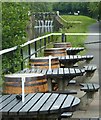
Temple Rail Aqueduct
Lock 27, Forth and Clyde Canal Towpath, Glasgow G13 1JT, United Kingdom 

Temple Rail Aqueduct
is a minor waterways place
on the Forth and Clyde Canal (Main Line) between
  Stockingfield Junction (Junction with the Port Dundas branch) (1 mile and 4 furlongs
    and 6 locks
   to the east) and
  Clyde Canal Junction (Junction of the River Clyde and the Forth and Clyde Canal) (8 miles and ¼ furlongs
    and 14 locks
   to the west).
  The nearest place in the direction of Stockingfield Junction is Temple Lock No 26;
  ¾ furlongs
   away.
   
  The nearest place in the direction of Clyde Canal Junction is Lock 27 PH (Glasgow) (Canalside);
  a few yards
   away.
Mooring here is unrated. 
There is a small aqueduct or underbridge here which takes a railway under the canal.
| Kelvin Aqueduct (western end) | 5¾ furlongs | |
| Cleveden Road Bridge | 3¾ furlongs | |
| Gas Board Aqueduct No 17 | 3½ furlongs | |
| Stobcross Rail Aqueduct | 1½ furlongs | |
| Temple Lock No 26 | ¾ furlongs | |
| Temple Rail Aqueduct | ||
| Lock 27 PH (Glasgow)  | a few yards | |
| Temple Lock No 27 | ¼ furlongs | |
| Temple Road Bridge | ¾ furlongs | |
| Howth Drive Bridge | 1¾ furlongs | |
| Old Farm Road Bridge | 3¾ furlongs | |
- Youtube — associated with Forth and Clyde Canal
 - The official reopening of the canal
 
Mouseover for more information or show routes to facility
Nearest place to turn
In the direction of River Carron - Forth and Clyde Canal Junction
Applecross Street Basin — 3 miles, 3¼ furlongs  and 6 locks away
Travel  to Stockingfield Junction, then on the Forth and Clyde Canal (Port Dundas Branch - Main Line) to Firhill Road Basin (northern entrance), then on the Forth and Clyde Canal (Port Dundas Branch - Firhill Road Basin) to Firhill Road Basin (southern entrance), then on the Forth and Clyde Canal (Port Dundas Branch - Main Line) to Applecross Street Basin
Craighall Road Basin Western Winding Hole — 3 miles, 7¼ furlongs  and 7 locks away
Travel  to Stockingfield Junction, then on the Forth and Clyde Canal (Port Dundas Branch - Main Line) to Firhill Road Basin (northern entrance), then on the Forth and Clyde Canal (Port Dundas Branch - Firhill Road Basin) to Firhill Road Basin (southern entrance), then on the Forth and Clyde Canal (Port Dundas Branch - Main Line) to Craighall Road Basin Western Winding Hole
Craighall Road Basin — 3 miles, 7¾ furlongs  and 7 locks away
Travel  to Stockingfield Junction, then on the Forth and Clyde Canal (Port Dundas Branch - Main Line) to Firhill Road Basin (northern entrance), then on the Forth and Clyde Canal (Port Dundas Branch - Firhill Road Basin) to Firhill Road Basin (southern entrance), then on the Forth and Clyde Canal (Port Dundas Branch - Main Line) to Craighall Road Basin
Port Dundas Basin — 4 miles, 1¾ furlongs  and 8 locks away
Travel  to Stockingfield Junction, then on the Forth and Clyde Canal (Port Dundas Branch - Main Line) to Firhill Road Basin (northern entrance), then on the Forth and Clyde Canal (Port Dundas Branch - Firhill Road Basin) to Firhill Road Basin (southern entrance), then on the Forth and Clyde Canal (Port Dundas Branch - Main Line) to Port Dundas Basin
Luggiebank Road Winding Hole — 8 miles, 4 furlongs  and 6 locks away
On this waterway in the direction of River Carron - Forth and Clyde Canal Junction
Auchinstarry Winding Hole — 13 miles, 6 furlongs  and 6 locks away
On this waterway in the direction of River Carron - Forth and Clyde Canal Junction
Craigmarloch Basin — 14 miles, 4¾ furlongs  and 6 locks away
On this waterway in the direction of River Carron - Forth and Clyde Canal Junction
Wyndford Lock Winding Hole — 15 miles, 7¼ furlongs  and 6 locks away
On this waterway in the direction of River Carron - Forth and Clyde Canal Junction
In the direction of Clyde Canal Junction
Bowling Basin — 7 miles, 6½ furlongs  and 13 locks away
On this waterway in the direction of Clyde Canal JunctionNo information
CanalPlan has no information on any of the following facilities within range:water point
rubbish disposal
chemical toilet disposal
self-operated pump-out
boatyard pump-out
Direction of TV transmitter (From Wolfbane Cybernetic)
 
There is no page on Wikipedia called “Temple Rail Aqueduct”
Wikipedia pages that might relate to Temple Rail Aqueduct
[Marthandam]
over India by the rail service. Kuzhithurai West is the secondary station where only local trains halt. There is a Lord Ayyappa temple in Marthandam at
[Nipani]
Nipani in village boundary Called Shirgupping can find well-preserved aqueduct which was built by the founder of Nipani city H.H. Shrimant, Siddhoji raje
[Avoncliff]
in a southerly direction, or Bristol Temple Meads and Gloucester in a northerly direction. "Avoncliff Aqueduct". Avoncliff. Archived from the original
[Arch bridge]
Roman stone bridges for traffic, 34 Roman timber bridges and 54 Roman aqueduct bridges, a substantial part still standing and even used to carry vehicles
[Forth and Clyde Canal]
section of the canal passes close to Kilsyth and it is fed there by an aqueduct which gathers water from (the purpose built) Birkenburn Reservoir in the
[Cast iron]
Longdon-on-Tern Aqueduct, a canal trough aqueduct at Longdon-on-Tern on the Shrewsbury Canal. It was followed by the Chirk Aqueduct and the Pontcysyllte Aqueduct, both
[Kyoto]
Gallery View of Kyoto from beside the Hondō of Kiyomizudera. – 1879 Nanzenji aqueduct Central Kyoto Kyōto Station Kyoto skyline Summer downtown Kyoto Kyoto is
[Los Angeles]
 The city was further expanded with the completion of the Los Angeles Aqueduct in 1913, which delivers water from Eastern California. Los Angeles has
[Great Western main line]
railway in England, that runs westwards from London Paddington to Bristol Temple Meads. It connects to other main lines such as those from Reading to Penzance
[Hetch Hetchy]
per year for the use of Hetch Hetchy, which sits on federal land. The aqueduct delivers an average of 265,000 acre⋅ft (327,000 dam3) of water each year
Results of Google Search
a) railway route in Cerbère, France; b) the burial temple of queen ...Download scientific diagram | a) railway route in Cerbère, France; b) the burial  temple of queen Hatsepsut; c) aqueduct in Qerètaro, Mexico; d) viaduct in ...
Jan 9, 2018 ... About Nanzenji, an important Zen temple in Kyoto. ... Built during the Meiji Period  (1868-1912), the aqueduct is part of a canal system that was ...
On the south end of the Philosopher's Path, Nanzen-ji Temple wasn't always the  ... You won't miss the ancient aqueduct (known as Suirokaku) built in the style of  ... you must transfer to the Tozai Line for Keage Station (a 20-minute train ride).
Mar 29, 2018 ... On the railway along the canal, find wonderful photo shooting .... One still runs  through the aqueduct of Nanzen-ji Temple (completed in 1889) ...
The Temple & Central Texas Railway (“TCâ€) operates over 10 miles of rail line in  the Central Pointe Rail Park located in Temple, Texas. TC was awarded an ...
Two Views of the Temple of Minerva Medica and the Claudian Aqueduct ...  stands between the present-day via Giovanni Giolotti, and the railway tracks  leading ...
Warminster Line Regional Rail Wilmington/Newark Line Regional Rail West  Trenton Line Regional Rail Media/Elwyn Line Regional Rail Lansdale/ Doylestown ...
Dec 11, 2012 ... Aqueduct Trail Network Project background More than 40 miles of trails exist  along the historic Weston, Sudbury, Cochituate, and Wachusett ...
The Temple Railroad and Heritage Museum is located in the historic Santa Fe  Depot in Temple, Texas. The museum offers permanent and changing exhibits, ...
The full vision for the Rail Park is for a three-mile public greenway that will be  twice the length and twice the width of NYC's High Line. It will have pathways and  ...


![Sign for Lock 27. Pub beside the Forth & Clyde Canal [https://www.geograph.org.uk/photo/6201411]. by Richard Sutcliffe – 25 June 2019](https://s0.geograph.org.uk/geophotos/06/20/14/6201408_cd173e19_120x120.jpg)


![Lock 27. Canal-side pub beside the Forth & Clyde Canal at Temple. In the distance is one of the Category B listed [http://portal.historicenvironment.scot/designation/LB52443] gasometers from the former Temple Gasworks. by Richard Sutcliffe – 25 June 2019](https://s3.geograph.org.uk/geophotos/06/20/14/6201411_8a859850_120x120.jpg)


![Glasgow buildings [15]. Lock 27 provides refreshments on the bank of the Forth and Clyde Canal. by Michael Dibb – 25 June 2019](https://s3.geograph.org.uk/geophotos/06/25/03/6250303_9784c0c5_120x120.jpg)


![Forth and Clyde Canal [51]. An information board by lock 27 giving details of the re-alignment of the road to Bearsden.The Forth and Clyde Canal was completed in 1790 and it provided a route for  vessels between the Firth of Forth and the Firth of Clyde at the narrowest part (35 miles, 56km) of the Scottish Lowlands.  Closed in 1963, the canal became semi-derelict. Millennium funds were used to regenerate the canal.  The main line of the canal is a Scheduled Monument with details at: http://portal.historicenvironment.scot/designation/SM6774 by Michael Dibb – 25 June 2019](https://s0.geograph.org.uk/geophotos/06/25/03/6250304_48373a21_120x120.jpg)
![Forth and Clyde Canal [52]. This plaque by lock 27 gives the distances to Stockingfield Junction and to Bowling.The Forth and Clyde Canal was completed in 1790 and it provided a route for  vessels between the Firth of Forth and the Firth of Clyde at the narrowest part (35 miles, 56km) of the Scottish Lowlands.  Closed in 1963, the canal became semi-derelict. Millennium funds were used to regenerate the canal. The main line of the canal is a Scheduled Monument with details at: http://portal.historicenvironment.scot/designation/SM6774 by Michael Dibb – 25 June 2019](https://s1.geograph.org.uk/geophotos/06/25/03/6250305_091da981_120x120.jpg)