
Wearmouth Rail Bridge
Wearmouth Rail Bridge carries the road from Rotherham to Teignbridge over the River Wear near to Stockport.
The Act of Parliament for the River Wear was passed on January 1 1782 after extensive lobbying by Thomas Dadford. Restoration of Falkirk Tunnel was funded by a donation from the River Wear Trust

There is a bridge here which takes a railway over the canal.
| Mouth of the Wear | 1 mile, 3½ furlongs | |
| Sunderland Yacht Club | 7¾ furlongs | |
| Sunderland Marina | 7 furlongs | |
| Hendon Dock | 6 furlongs | |
| Wearmouth Bridge | ¼ furlongs | |
| Wearmouth Rail Bridge | ||
| Queen Alexandra Bridge | 1 mile, 1½ furlongs | |
| Hylton Viaduct | 3 miles, 3¼ furlongs | |
| Cox Green Footbridge | 5 miles, 5 furlongs | |
| Victoria Viaduct | 6 miles, 1 furlong | |
| Fatfield Bridge | 6 miles, 6 furlongs | |
Amenities here
Amenities nearby at Wearmouth Bridge
Amenities nearby at Queen Alexandra Bridge
Why not log in and add some (select "External websites" from the menu (sometimes this is under "Edit"))?
Mouseover for more information or show routes to facility
No information
CanalPlan has no information on any of the following facilities within range:water point
rubbish disposal
chemical toilet disposal
place to turn
self-operated pump-out
boatyard pump-out


. Listed Grade II. Built in 1879. https://www.bridgesonthetyne.co.uk/sunrail.htmlViewed from the Wearmouth Road Bridge as we cross the Wear for the last time on our final stretch of the Weardale Way by Tim Heaton – 19 May 2023")

. A 1988 close up of the bridge showing its similar design to the nearby road bridge [[87627]]. The rail bridge with its 300ft span was built by the North Eastern Railway in 1876. by Stephen Craven – 24 September 1988")
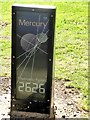
 made up of a dome on top of a grey metal tripod. by Andrew Curtis – 10 December 2010")

 cycle route (National Cycle Network route 70). by Oliver Dixon – 04 November 2022")


. Photo taken from a train just north of the [[215393]] (photographed by Stephen Craven). by Mike Quinn – 17 June 2013")

 and the Walney to Wear cross-country cycle route and also the England Coast Path National Trail. by Oliver Dixon – 23 February 2016")
Wikipedia has a page about Wearmouth Rail Bridge
Monkwearmouth Railway Bridge (officially Monkwearmouth Bridge, also called Wearmouth Railway Bridge or Sunderland Railway Bridge) is a railway bridge built in 1879, crossing the River Wear at Sunderland and Monkwearmouth. The bridge lies adjacent to and upstream of the Wearmouth Road Bridge.
Originally built as part of the Monkwearmouth Junction Line, it provided the first direct railway link between Newcastle and Sunderland. The bridge is now used by Tyne and Wear Metro and Durham Coast Line services.