CanalPlanAC

Retford Bottom Aqueduct

 
Cobwell Social Club, Cobwell Road, Nottinghamshire DN22 7DD, United Kingdom
 
Information about the place
Retford Bottom Aqueduct is a minor waterways place on the Chesterfield Canal (Retford to the Trent) between Wiseton Top Bridge No 70 (7 miles and 5¼ furlongs and 2 locks to the north) and West Retford Lock No 58 (Wharf Bridge) (1½ furlongs to the northwest).
 
 
The nearest place in the direction of Wiseton Top Bridge No 70 is River Idle Aqueduct; ½ furlongs away.
 
The nearest place in the direction of West Retford Lock No 58 is Pelham Road Footbridge; ½ furlongs away.

Mooring here is unrated.

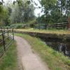
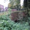
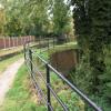
There is a small aqueduct or underbridge here which takes a stream under the canal.


Amenities

Amenities here

 Fish & Chips

Amenities nearby at River Idle Aqueduct

 Retford Station
 
Maps
If you are a user and are logged on, or if you are actively planning a route, a map will be displayed here.
Show on external mapping site: Google | OSM | Bing
 
Photos
 
External websites
There are no links to external websites from here.
Why not log in and add some (select "External websites" from the menu (sometimes this is under "Edit"))?
 
Nearest facilities

Mouseover for more information or show routes to facility

Nearest water point

In the direction of West Retford Lock No 58

Forest Middle Top Lock No 552 miles, 6¾ furlongs and 3 locks away
Travel to West Retford Lock No 58, then on the Chesterfield Canal (Norwood to Retford) to Forest Middle Top Lock No 55
Forest Middle Top Water Point2 miles, 7 furlongs and 4 locks away
Travel to West Retford Lock No 58, then on the Chesterfield Canal (Norwood to Retford) to Forest Middle Top Water Point
Shireoaks Marina12 miles, 2½ furlongs and 17 locks away
Travel to West Retford Lock No 58, then on the Chesterfield Canal (Norwood to Retford) to Shireoaks Marina

In the direction of Chesterfield Canal - River Trent Junction

Hop Pole Bridge No 591 mile, 3 furlongs and 1 lock away
On this waterway in the direction of Chesterfield Canal - River Trent Junction
Clayworth CRT Boaters Facilities5 miles, 6 furlongs and 2 locks away
On this waterway in the direction of Chesterfield Canal - River Trent Junction
West Stockwith Basin15 miles, 2¾ furlongs and 6 locks away
On this waterway in the direction of Chesterfield Canal - River Trent Junction

Nearest rubbish disposal

In the direction of West Retford Lock No 58

Forest Middle Top Lock No 552 miles, 6¾ furlongs and 3 locks away
Travel to West Retford Lock No 58, then on the Chesterfield Canal (Norwood to Retford) to Forest Middle Top Lock No 55
Shireoaks Marina12 miles, 2½ furlongs and 17 locks away
Travel to West Retford Lock No 58, then on the Chesterfield Canal (Norwood to Retford) to Shireoaks Marina

In the direction of Chesterfield Canal - River Trent Junction

Clayworth CRT Boaters Facilities5 miles, 6 furlongs and 2 locks away
On this waterway in the direction of Chesterfield Canal - River Trent Junction
West Stockwith Basin15 miles, 2¾ furlongs and 6 locks away
On this waterway in the direction of Chesterfield Canal - River Trent Junction

Nearest chemical toilet disposal

In the direction of West Retford Lock No 58

Forest Middle Top Lock No 552 miles, 6¾ furlongs and 3 locks away
Travel to West Retford Lock No 58, then on the Chesterfield Canal (Norwood to Retford) to Forest Middle Top Lock No 55
Cuckoo Wharf Elsan10 miles, ¾ furlongs and 8 locks away
Travel to West Retford Lock No 58, then on the Chesterfield Canal (Norwood to Retford) to Cuckoo Wharf Elsan
Shireoaks Marina12 miles, 2½ furlongs and 17 locks away
Travel to West Retford Lock No 58, then on the Chesterfield Canal (Norwood to Retford) to Shireoaks Marina

In the direction of Chesterfield Canal - River Trent Junction

Clayworth CRT Boaters Facilities5 miles, 6 furlongs and 2 locks away
On this waterway in the direction of Chesterfield Canal - River Trent Junction
West Stockwith Basin15 miles, 2¾ furlongs and 6 locks away
On this waterway in the direction of Chesterfield Canal - River Trent Junction

Nearest place to turn

In the direction of West Retford Lock No 58

Babworth Winding Hole1 mile, 1 furlong and 1 lock away
Travel to West Retford Lock No 58, then on the Chesterfield Canal (Norwood to Retford) to Babworth Winding Hole
Forest Top Lock Winding Hole3 miles, 1½ furlongs and 4 locks away
Travel to West Retford Lock No 58, then on the Chesterfield Canal (Norwood to Retford) to Forest Top Lock Winding Hole
Ranby Bridge Winding Hole5 miles, 3½ furlongs and 5 locks away
Travel to West Retford Lock No 58, then on the Chesterfield Canal (Norwood to Retford) to Ranby Bridge Winding Hole
High Hoe Road Bridge Winding Hole9 miles, 3½ furlongs and 7 locks away
Travel to West Retford Lock No 58, then on the Chesterfield Canal (Norwood to Retford) to High Hoe Road Bridge Winding Hole
Morse Lock Winding Hole10 miles, 3½ furlongs and 9 locks away
Travel to West Retford Lock No 58, then on the Chesterfield Canal (Norwood to Retford) to Morse Lock Winding Hole
Junction with former Lady Lee Arm10 miles, 7¾ furlongs and 10 locks away
Travel to West Retford Lock No 58, then on the Chesterfield Canal (Norwood to Retford) to Junction with former Lady Lee Arm
Shireoaks Marina12 miles, 2½ furlongs and 17 locks away
Travel to West Retford Lock No 58, then on the Chesterfield Canal (Norwood to Retford) to Shireoaks Marina
Little Lane Bridge Winding Hole13 miles, 2¼ furlongs and 25 locks away
Travel to West Retford Lock No 58, then on the Chesterfield Canal (Norwood to Retford) to Little Lane Bridge Winding Hole
Manor Road Winding Hole15 miles, 7 furlongs and 40 locks away
Travel to West Retford Lock No 58, then on the Chesterfield Canal (Norwood to Retford) to Manor Road Winding Hole
Kiveton Waters Marina16 miles, 5½ furlongs and 43 locks away
Travel to West Retford Lock No 58, then on the Chesterfield Canal (Norwood to Retford) to Norwood Tunnel (eastern entrance), then on the Chesterfield Canal (Unnavigable section) to Kiveton Waters Marina
Norwood Winding Hole18 miles, 1½ furlongs and 66 locks away
Travel to West Retford Lock No 58, then on the Chesterfield Canal (Norwood to Retford) to Norwood Tunnel (eastern entrance), then on the Chesterfield Canal (Unnavigable section) to Norwood Winding Hole

In the direction of Chesterfield Canal - River Trent Junction

Retford Winding Hole3 furlongs and 1 lock away
On this waterway in the direction of Chesterfield Canal - River Trent Junction
Grove Mill Bridge Winding Hole4¾ furlongs and 1 lock away
On this waterway in the direction of Chesterfield Canal - River Trent Junction
Main Street Winding Hole4 miles, ½ furlongs and 2 locks away
On this waterway in the direction of Chesterfield Canal - River Trent Junction
Clayworth Top Bridge Winding Hole5 miles, 6½ furlongs and 2 locks away
On this waterway in the direction of Chesterfield Canal - River Trent Junction
Otter's Bridge Winding Hole6 miles, 3¼ furlongs and 2 locks away
On this waterway in the direction of Chesterfield Canal - River Trent Junction
Drakeholes Visitor Moorings8 miles, 6½ furlongs and 2 locks away
On this waterway in the direction of Chesterfield Canal - River Trent Junction
Drakeholes Tunnel (southern entrance)8 miles, 7 furlongs and 2 locks away
On this waterway in the direction of Chesterfield Canal - River Trent Junction
Manor Farm Winding Hole12 miles, 6½ furlongs and 4 locks away
On this waterway in the direction of Chesterfield Canal - River Trent Junction
West Stockwith Basin15 miles, 2¾ furlongs and 6 locks away
On this waterway in the direction of Chesterfield Canal - River Trent Junction

No information

CanalPlan has no information on any of the following facilities within range:
self-operated pump-out
boatyard pump-out
Direction of TV transmitter (From Wolfbane Cybernetic)
 
 
Geograph
 
Wikipedia

There is no page on Wikipedia called “Retford Bottom Aqueduct”

Wikipedia pages that might relate to Retford Bottom Aqueduct
[River Idle] and River Meden, near Markham Moor. From there, it flows north through Retford and Bawtry before entering the River Trent at Stockwith near Misterton [Chesterfield Canal] were actively supported by the towns of Chesterfield, Worksop and Retford. Retford had obtained an Act of Parliament in 1720 to improve the River Idle [Lincoln Corporation Waterworks] rural district water departments, covering Gainsborough, North Kesteven, Retford and Welton. A new requirement in the 1960s was the provision of treated
 
Google

Results of Google Search

Chesterfield Canal - Wikipedia
The Chesterfield Canal is a narrow canal in the East Midlands of England and it is known ... Norwood Bottom Treble (7–9) .... Retford had obtained an Act of Parliament in 1720 to improve the River Idle from Bawtry to the ..... hoping to obtain similar grants for the section between the aqueduct and the Norwood Tunnel, but the ...
Aqueduct, Retford © B Hilton :: Geograph Britain and Ireland
This aqueduct carries the Chesterfield Canal over the River Idle.
River Idle - Wikipedia
The River Idle is a river in Nottinghamshire, England. Its source is the confluence of the River Maun and River Meden, near Markham Moor. From there, it flows north through Retford and Bawtry before entering the .... Both sluice gates can be raised to the same level as the underside of Haxey Gate Bridge, and the cills are at ...
Carr Bridge from Retford Aqueduct © Alan Murray-Rust cc-by-sa/2.0 ...
Oct 15, 2015 ... Traditional arch bridge which has been rebuilt in recent years. This is the River Idle flowing idly through Kings Park.
The Lower Aqueduct of Jerusalem
The Lower Aqueduct of Jerusalem. Location: The west bank of the Hinnom Valley , above the Sultan's Pool and near the entrance to. Mishkenot Sha'ananim.
Stratford-upon-Avon Canal | UK Canal Map | Canal & River Trust
Click the red 'i' icon in the bottom right hand corner to expand the key. Map; Listing .... Nearby is Edstone, or Bearley, Aqueduct, with its cast-iron trough.
babworth-and-pilgrim-walk
Begin walk at car park and head to Town Hall on Retford Market Square. 2. ... Middle Bottom Lock has a pleasant picnic spot, cont past Forest Bottom Lock & Lady ... aqueduct over the River Idle until you reach the Bay Tree Cafe at the canal ...
Waterway Wanderers - January 2018 Aire & Calder Navigation ...
Bridge 54a Retford G N Railway to Lock 58 Retford West Town ... Tame Aqueduct to Fazeley Junction ... Bridge 88b Tysley Waste to Camphill Bottom Lock.