CanalPlanAC

Centenary Bridge (Manchester Ship Canal)

 
Opened in 1994
Centenary Bridge, Salford M50 1RF, United Kingdom (A576)
 
Information about the place
Centenary Bridge (Manchester Ship Canal) is a minor waterways place on the Manchester Ship Canal (Main Line) between Walton Junction (Junction of Manchester Ship Canal Main Line and Walton Lock Branch) (14 miles and 3 locks to the west) and Pomona Dock No 4 (Junction with Branch to Bridgewater Canal) (2 miles and 3¼ furlongs and 1 lock to the east).
 
 
The nearest place in the direction of Walton Junction is Cerestar Wharf; 2 furlongs away.
 
The nearest place in the direction of Pomona Dock No 4 is Sewage Works; 3¾ furlongs away.

Mooring here is unrated.

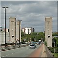
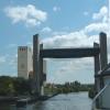
There is a lift bridge here which takes a major road over the canal.

Barton Low Level Bridge1 mile, 7½ furlongs
Barton Swing Bridge1 mile, 1¾ furlongs
Barton Swing Aqueduct Overhead1 mile, 1½ furlongs
Irwell Park Wharf5½ furlongs
Cerestar Wharf2 furlongs
Centenary Bridge (Manchester Ship Canal)
Sewage Works3¾ furlongs
Weaste Wharf4¼ furlongs
Mode Wheel Locks7¾ furlongs
Media City Footbridge1 mile, 1¾ furlongs
Dock No 9 Entrance1 mile, 2¼ furlongs
 
 
Amenities

Amenities here

 Hope
 Cashpoint
 Total

Amenities nearby at Sewage Works

 Crossling Pipeline

Amenities nearby at Cerestar Wharf

 Farmfoods
 Morison's
 Morrisons
 Morrisons - Eccles - A57
 McDonalds
 Eccles
 Eccles Cross
 Wetherspoons
 Home Bargains
 W H Smith
 Fish & Chips
 Boots Chemist
 Cashpoint
 Cashpoint
 Cashpoint
 Cashpoint
 Cashpoint
 NatWest
 Santander
 TSB
 BP
 BP Ultimate Diesel
 Forecourt M-F 9pm Sa 7pm
 Morrisons Fuel
 Wm Morrison Supermarkets 028
 Speedy Hire
 Eccles Station
 
Maps
If you are a user and are logged on, or if you are actively planning a route, a map will be displayed here.
Show on external mapping site: Google | OSM | Bing
 
Photos
 
External websites
There are no links to external websites from here.
Why not log in and add some (select "External websites" from the menu (sometimes this is under "Edit"))?
 
Nearest facilities

Mouseover for more information or show routes to facility

Nearest water point

In the direction of Woden Street Footbridge

Potato Wharf Arm & The New Basin3 miles, 3¼ furlongs and 2 locks away
Travel to Pomona Dock No 4, then on the Bridgewater Canal (Pomona Lock Branch) to Pomona Lock Branch Junction, then on the Bridgewater Canal (Main Line) to Potato Wharf Arm & The New Basin
Staffordshire, Kenworthy and other Arms3 miles, 4 furlongs and 2 locks away
Travel to Pomona Dock No 4, then on the Bridgewater Canal (Pomona Lock Branch) to Pomona Lock Branch Junction, then on the Bridgewater Canal (Main Line) to Staffordshire, Kenworthy and other Arms
Stretford Marina4 miles, 4½ furlongs and 2 locks away
Travel to Pomona Dock No 4, then on the Bridgewater Canal (Pomona Lock Branch) to Pomona Lock Branch Junction, then on the Bridgewater Canal (Main Line) to Stretford Marina
Watch House Cruising Club5 miles, 5 furlongs and 2 locks away
Travel to Pomona Dock No 4, then on the Bridgewater Canal (Pomona Lock Branch) to Pomona Lock Branch Junction, then on the Bridgewater Canal (Main Line) to Watch House Cruising Club
Worsley Visitor Moorings8 miles, 6¾ furlongs and 2 locks away
Travel to Pomona Dock No 4, then on the Bridgewater Canal (Pomona Lock Branch) to Pomona Lock Branch Junction, then on the Bridgewater Canal (Main Line) to Stretford - Waters Meeting, then on the Bridgewater Canal (Stretford and Leigh Branch) to Worsley Visitor Moorings
Bridgewater Marina10 miles, 2½ furlongs and 2 locks away
Travel to Pomona Dock No 4, then on the Bridgewater Canal (Pomona Lock Branch) to Pomona Lock Branch Junction, then on the Bridgewater Canal (Main Line) to Stretford - Waters Meeting, then on the Bridgewater Canal (Stretford and Leigh Branch) to Bridgewater Marina
Ye Olde Number 3 Transit Moorings12 miles, 4 furlongs and 2 locks away
Travel to Pomona Dock No 4, then on the Bridgewater Canal (Pomona Lock Branch) to Pomona Lock Branch Junction, then on the Bridgewater Canal (Main Line) to Ye Olde Number 3 Transit Moorings
New Islington Marina5 miles, 1¾ furlongs and 13 locks away
Travel to Pomona Dock No 4, then on the Bridgewater Canal (Pomona Lock Branch) to Pomona Lock Branch Junction, then on the Bridgewater Canal (Main Line) to Castlefield Junction, then on the Rochdale Canal to New Islington Marina Entrance, then on the Rochdale Canal (Main Line) to Cotton Field Wharf Marina, then on the Rochdale Canal (New Islington Marina Arm) to New Islington Marina
Plank Lane Visitor Moorings16 miles, 7¼ furlongs and 2 locks away
Travel to Pomona Dock No 4, then on the Bridgewater Canal (Pomona Lock Branch) to Pomona Lock Branch Junction, then on the Bridgewater Canal (Main Line) to Stretford - Waters Meeting, then on the Bridgewater Canal (Stretford and Leigh Branch) to Leigh Bridge No 11, then on the Leeds and Liverpool Canal (Leigh Branch) to Plank Lane Visitor Moorings
Fairfield Junction8 miles, 4¼ furlongs and 29 locks away
Travel to Pomona Dock No 4, then on the Bridgewater Canal (Pomona Lock Branch) to Pomona Lock Branch Junction, then on the Bridgewater Canal (Main Line) to Castlefield Junction, then on the Rochdale Canal to Ducie Street Junction, then on the Ashton Canal (Main Line) to Fairfield Junction
Grove Road Bridge No 9616 miles, ½ furlongs and 37 locks away
Travel to Pomona Dock No 4, then on the Bridgewater Canal (Pomona Lock Branch) to Pomona Lock Branch Junction, then on the Bridgewater Canal (Main Line) to Castlefield Junction, then on the Rochdale Canal to Ducie Street Junction, then on the Ashton Canal (Main Line) to Ashton-under-Lyne Junction, then on the Huddersfield Narrow Canal to Grove Road Bridge No 96
Marple Services19 miles, 1¾ furlongs and 45 locks away
Travel to Pomona Dock No 4, then on the Bridgewater Canal (Pomona Lock Branch) to Pomona Lock Branch Junction, then on the Bridgewater Canal (Main Line) to Castlefield Junction, then on the Rochdale Canal to Ducie Street Junction, then on the Ashton Canal (Main Line) to Dukinfield Junction, then on the Peak Forest Canal (Lower) to Marple Junction, then on the Macclesfield Canal to Marple Services

Nearest chemical toilet disposal

In the direction of Woden Street Footbridge

Watch House Cruising Club5 miles, 5 furlongs and 2 locks away
Travel to Pomona Dock No 4, then on the Bridgewater Canal (Pomona Lock Branch) to Pomona Lock Branch Junction, then on the Bridgewater Canal (Main Line) to Watch House Cruising Club
Oughtrington Wharf14 miles, 2 furlongs and 2 locks away
Travel to Pomona Dock No 4, then on the Bridgewater Canal (Pomona Lock Branch) to Pomona Lock Branch Junction, then on the Bridgewater Canal (Main Line) to Oughtrington Wharf
Fairfield Junction8 miles, 4¼ furlongs and 29 locks away
Travel to Pomona Dock No 4, then on the Bridgewater Canal (Pomona Lock Branch) to Pomona Lock Branch Junction, then on the Bridgewater Canal (Main Line) to Castlefield Junction, then on the Rochdale Canal to Ducie Street Junction, then on the Ashton Canal (Main Line) to Fairfield Junction
Grove Road Bridge No 9616 miles, ½ furlongs and 37 locks away
Travel to Pomona Dock No 4, then on the Bridgewater Canal (Pomona Lock Branch) to Pomona Lock Branch Junction, then on the Bridgewater Canal (Main Line) to Castlefield Junction, then on the Rochdale Canal to Ducie Street Junction, then on the Ashton Canal (Main Line) to Ashton-under-Lyne Junction, then on the Huddersfield Narrow Canal to Grove Road Bridge No 96
Marple Services19 miles, 1¾ furlongs and 45 locks away
Travel to Pomona Dock No 4, then on the Bridgewater Canal (Pomona Lock Branch) to Pomona Lock Branch Junction, then on the Bridgewater Canal (Main Line) to Castlefield Junction, then on the Rochdale Canal to Ducie Street Junction, then on the Ashton Canal (Main Line) to Dukinfield Junction, then on the Peak Forest Canal (Lower) to Marple Junction, then on the Macclesfield Canal to Marple Services

Nearest place to turn

In the direction of Woden Street Footbridge

Pomona Lock Branch Junction2 miles, 4¼ furlongs and 2 locks away
Travel to Pomona Dock No 4, then on the Bridgewater Canal (Pomona Lock Branch) to Pomona Lock Branch Junction
Hulme Hall Road Winding Hole3 miles, ¾ furlongs and 2 locks away
Travel to Pomona Dock No 4, then on the Bridgewater Canal (Pomona Lock Branch) to Pomona Lock Branch Junction, then on the Bridgewater Canal (Main Line) to Hulme Hall Road Winding Hole
Hulme Locks Branch - Bridgewater Canal Junction3 miles, 2 furlongs and 2 locks away
Travel to Pomona Dock No 4, then on the Bridgewater Canal (Pomona Lock Branch) to Pomona Lock Branch Junction, then on the Bridgewater Canal (Main Line) to Hulme Locks Branch - Bridgewater Canal Junction
Potato Wharf Arm & The New Basin3 miles, 3¼ furlongs and 2 locks away
Travel to Pomona Dock No 4, then on the Bridgewater Canal (Pomona Lock Branch) to Pomona Lock Branch Junction, then on the Bridgewater Canal (Main Line) to Potato Wharf Arm & The New Basin
Staffordshire, Kenworthy and other Arms3 miles, 4 furlongs and 2 locks away
Travel to Pomona Dock No 4, then on the Bridgewater Canal (Pomona Lock Branch) to Pomona Lock Branch Junction, then on the Bridgewater Canal (Main Line) to Staffordshire, Kenworthy and other Arms
Castlefield Junction3 miles, 4¼ furlongs and 2 locks away
Travel to Pomona Dock No 4, then on the Bridgewater Canal (Pomona Lock Branch) to Pomona Lock Branch Junction, then on the Bridgewater Canal (Main Line) to Castlefield Junction
Middlewood Basin No 13 miles, 4¾ furlongs and 2 locks away
Travel to Woden Street Footbridge, then on the Manchester Ship Canal (River Irwell Upper Reach) to Manchester, Bolton and Bury Canal - River Irwell Junction, then on the Manchester Bolton and Bury Canal (Main Line) to Middlewood Basin No 1
Middlewood Basin No 23 miles, 5 furlongs and 2 locks away
Travel to Woden Street Footbridge, then on the Manchester Ship Canal (River Irwell Upper Reach) to Manchester, Bolton and Bury Canal - River Irwell Junction, then on the Manchester Bolton and Bury Canal (Main Line) to Middlewood Basin No 2
Grocer's Wharf3 miles, 5 furlongs and 2 locks away
Travel to Pomona Dock No 4, then on the Bridgewater Canal (Pomona Lock Branch) to Pomona Lock Branch Junction, then on the Bridgewater Canal (Main Line) to Grocer's Wharf
Stretford - Waters Meeting4 miles, 2¾ furlongs and 2 locks away
Travel to Pomona Dock No 4, then on the Bridgewater Canal (Pomona Lock Branch) to Pomona Lock Branch Junction, then on the Bridgewater Canal (Main Line) to Stretford - Waters Meeting
Stretford Marina4 miles, 4½ furlongs and 2 locks away
Travel to Pomona Dock No 4, then on the Bridgewater Canal (Pomona Lock Branch) to Pomona Lock Branch Junction, then on the Bridgewater Canal (Main Line) to Stretford Marina
Salford Tunnel Basin3 miles, 6 furlongs and 3 locks away
Travel to Woden Street Footbridge, then on the Manchester Ship Canal (River Irwell Upper Reach) to Manchester, Bolton and Bury Canal - River Irwell Junction, then on the Manchester Bolton and Bury Canal (Main Line) to Salford Tunnel Basin
Edge Lane Winding Hole5 miles, 3¼ furlongs and 2 locks away
Travel to Pomona Dock No 4, then on the Bridgewater Canal (Pomona Lock Branch) to Pomona Lock Branch Junction, then on the Bridgewater Canal (Main Line) to Edge Lane Winding Hole
Trafford Park Winding Hole5 miles, 5 furlongs and 2 locks away
Travel to Pomona Dock No 4, then on the Bridgewater Canal (Pomona Lock Branch) to Pomona Lock Branch Junction, then on the Bridgewater Canal (Main Line) to Stretford - Waters Meeting, then on the Bridgewater Canal (Stretford and Leigh Branch) to Trafford Park Winding Hole
Patricroft Basin and Warehouse6 miles, 7½ furlongs and 2 locks away
Travel to Pomona Dock No 4, then on the Bridgewater Canal (Pomona Lock Branch) to Pomona Lock Branch Junction, then on the Bridgewater Canal (Main Line) to Stretford - Waters Meeting, then on the Bridgewater Canal (Stretford and Leigh Branch) to Patricroft Basin and Warehouse
Patricroft Bridge Winding Hole7 miles, ½ furlongs and 2 locks away
Travel to Pomona Dock No 4, then on the Bridgewater Canal (Pomona Lock Branch) to Pomona Lock Branch Junction, then on the Bridgewater Canal (Main Line) to Stretford - Waters Meeting, then on the Bridgewater Canal (Stretford and Leigh Branch) to Patricroft Bridge Winding Hole
Monton Turn7 miles, 6½ furlongs and 2 locks away
Travel to Pomona Dock No 4, then on the Bridgewater Canal (Pomona Lock Branch) to Pomona Lock Branch Junction, then on the Bridgewater Canal (Main Line) to Stretford - Waters Meeting, then on the Bridgewater Canal (Stretford and Leigh Branch) to Monton Turn
Winding Hole (east of Worsley)8 miles, 4½ furlongs and 2 locks away
Travel to Pomona Dock No 4, then on the Bridgewater Canal (Pomona Lock Branch) to Pomona Lock Branch Junction, then on the Bridgewater Canal (Main Line) to Stretford - Waters Meeting, then on the Bridgewater Canal (Stretford and Leigh Branch) to Winding Hole (east of Worsley)
Worsley Delph8 miles, 6¾ furlongs and 2 locks away
Travel to Pomona Dock No 4, then on the Bridgewater Canal (Pomona Lock Branch) to Pomona Lock Branch Junction, then on the Bridgewater Canal (Main Line) to Stretford - Waters Meeting, then on the Bridgewater Canal (Stretford and Leigh Branch) to Worsley Delph
Seamon's Moss Winding Hole10 miles, 1½ furlongs and 2 locks away
Travel to Pomona Dock No 4, then on the Bridgewater Canal (Pomona Lock Branch) to Pomona Lock Branch Junction, then on the Bridgewater Canal (Main Line) to Seamon's Moss Winding Hole
Direction of TV transmitter (From Wolfbane Cybernetic)
 
 
Geograph
 
Wikipedia

Wikipedia has a page about Centenary Bridge

The Centenary Bridge is a motorway crossing of the Brisbane River. As it forms part of Brisbane's Centenary Motorway, it is used primarily by vehicular traffic, although it includes footpaths for pedestrian traffic.

Built to service the new Centenary Suburbs of Jindalee, Mount Ommaney and Westlake, the original two lane bridge opened in 1964. It was financed by the developers of the suburbs, LJ Hooker.

The bridge was duplicated as part of an upgrade of the Centenary Highway and Western Freeway south of Mount Cootha Road. The works were officially opened by Russell Hinze, Minister for Main Roads, on 27 March 1987.

During the 1974 floods, the bridge was badly damaged when a barge rammed into its upstream side. The barge blocked the flow of floodwaters under the bridge and there were real fears that the bridge would collapse. The barge was deliberately holed using explosives and allowed to sink to reduce the floodwater pressure on the bridge. When the floodwater receded, the barge was refloated and beached downstream near Fig Tree Pocket to be cut up for scrap. The damage sustained by the bridge required its partial closure for repairs. For two years after the floods, the bridge was reduced to a single lane, with one way traffic controlled by traffic lights at each end of the bridge.

Other Wikipedia pages that might relate to Centenary Bridge
[List of bridges in Brisbane] major bridges in Brisbane, Queensland, Australia: Airport Flyover, Brisbane Albert Bridge, Brisbane Captain Cook Bridge, Brisbane Centenary Bridge Charlie [Bridges over the Brisbane River] Australia, is crossed by fifteen major bridges, from the Sir Leo Hielscher Bridges downstream to the Centenary upstream. The river meanders through an [Jindalee, Queensland] enters the suburb from the north (Kenmore), crossing the river on the Centenary Bridge (27°31′40″S 152°56′49″E / 27.5278°S 152.9470°E / -27.5278; 152.9470) [Centenary Motorway] The M5 (Centenary Motorway) is a 43-kilometre (27 mi) motorway in the western suburbs of Brisbane, Australia. It starts as a two-lane arterial road at [Centenary Suburbs] including structural damage to the Centenary Bridge after a barge became stuck under the upstream side of the then two-lane bridge. The barge was deliberately [Brisbane] Walter Taylor Bridge the Centenary Bridge and Colleges Crossing. There are three railway bridges, namely the Merivale Bridge, the Albert Bridge and the Indooroopilly [Station Pier] the service was discontinued in October 1939. In 1934 the Victorian Centenary Bridge was built over the railway lines, carrying Beach Street traffic over [List of vertical-lift bridges] Manchester Ship Canal. Tees Newport Bridge – 82m span, first major lift bridge in the UK. Salford Centenary Bridge – road bridge across the Manchester Ship Canal [1974 Brisbane flood] gravel barge became caught under the Centenary Bridge where it damaged the pylons, causing fear that the bridge would be swept away. The barge was sunk
 
Google

Results of Google Search

Manchester Ship Canal - Wikipedia
The Manchester Ship Canal is a 36-mile-long (58 km) inland waterway in the North West of ..... Ships passing under the Runcorn Bridge have a height restriction of 70 feet (21 m) above normal water levels. .... A576 Centenary Lift Bridge.
Manchester Ship Canal, Lowry and Centenary Footbridges
Centenary Bridge This bridge is one of only three of its type in Britain and the deck can be lifted 15 metres between two pairs of towers, 30 metres high, to allow ...
Barton Road Swing Bridge - Wikipedia
Barton Road Swing Bridge (or Barton Road Bridge) is a swing bridge for road traffic in Greater ... The bridge opens regularly for traffic along the Manchester Ship Canal, which can cause delays for .... Traffic on the swing bridge has also been reduced by the construction of Centenary Bridge located upstream towards Salford.
Centenary Way lift bridge on the Manchester Ship Canal ...
Centenary Way lift bridge on the Manchester Ship Canal.
Category:Manchester Ship Canal, Urmston - Wikimedia Commons
Jul 4, 2015 ... Barton Road Swing Bridge#x200e; (29 F) ... Centenary Bridge, Salford#x200e; (7 F). Category ... Approaching Irlam Lock on the Manchester Ship Canal ...
Centenary Way lift bridge on the Manchester Ship Canal | Flixton ...
Centenary Way lift bridge on the Manchester Ship Canal.
File:Approaching the Widnes - Runcorn Bridges on the Manchester ...
Feb 20, 2018 ... ... Bridges on the Manchester Ship Canal The boat is part of a flotilla organised by the Inland Waterways Association to mark the Centenary of ...
Barton Bridge lifting bridge Trafford dual carriageway manchester ...
Download this stock image: Barton Bridge lifting bridge Trafford dual carriageway manchester Ship canal Four huge pillars collapse road construction site ...
Category:Manchester Ship Canal, Salford - Wikimedia Commons
C. ▻ Centenary Bridge, Salford#x200e; (7 F) ... Media in category "Manchester Ship Canal, Salford" ... Manchester Ship Canal from Trafford Road Bridge (1).JPG 4,608 ...
Manchester Ship Canal 2018 | This is the start of our trip a… | Flickr
May 17, 2018 ... This is the start of our trip along the Manchester Ship Canal. We left ... This is the Centenary Lift Bridge connecting Salford to the Trafford Centre.