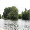
Ferry Eyot
is a minor waterways place
on the River Thames (below Oxford) between
Wargrave (1 mile and 4¼ furlongs
to the southeast) and
Racecourse Yacht Basin Entrance (Junction of the River Thames and the Clewer Mill Stream) (20 miles and ¾ furlongs
and 8 locks
to the east).
The nearest place in the direction of Wargrave is Poplar Eyot;
1½ furlongs
away.
The nearest place in the direction of Racecourse Yacht Basin Entrance is Thames - Hennerton Backwater Entrance No 3 (Junction of the River Thames and Hennerton Backwater);
1 furlong
away.
Mooring here is unrated.
| Thames - Hennerton Backwater Entrance No 2 | 1 mile, 2 furlongs | |
| Willow Marina | 1 mile, 1¾ furlongs | |
| Thames - Lash Brook Junction | 5¾ furlongs | |
| Handbuck Eyot | 3½ furlongs | |
| Poplar Eyot | 1½ furlongs | |
| Ferry Eyot | ||
| Thames - Hennerton Backwater Entrance No 3 | 1 furlong | |
| Marsh Lock Weir Entrance | 4½ furlongs | |
| Marsh Lock Mill Weir Entrance | 4¾ furlongs | |
| Marsh Lock | 5¼ furlongs | |
| Marsh Lock Weir Exit | 5¾ furlongs | |
There are no links to external websites from here.
Why not log in and add some (select "External websites" from the menu (sometimes this is under "Edit"))?
Mouseover for more information or show routes to facility
Nearest water point
In the direction of Teddington Lock Weir Exit
Hurley Lock — 7 miles, 5¾ furlongs and 2 locks away
On this waterway in the direction of Teddington Lock Weir Exit
Cookham Lock — 14 miles, 2 furlongs and 5 locks away
On this waterway in the direction of Teddington Lock Weir Exit
In the direction of Osney Bridge
Shiplake Lock — 2 miles, ½ furlongs away
On this waterway in the direction of Osney Bridge
Thames & Kennet Marina — 6 miles, 5½ furlongs and 2 locks away
On this waterway in the direction of Osney Bridge
Tyle Mill Lock C&RT Services — 15 miles, ¾ furlongs and 10 locks away
Travel to Thames - Kennet Junction (Kennet Mouth), then on the River Thames (River Kennet) to High Bridge Reading, then on the River Kennet to Tyle Mill Lock C&RT Services
Cleeve Lock — 18 miles, 7½ furlongs and 6 locks away
On this waterway in the direction of Osney Bridge
Aldermaston Lock No 95 — 17 miles, 3½ furlongs and 13 locks away
Travel to Thames - Kennet Junction (Kennet Mouth), then on the River Thames (River Kennet) to High Bridge Reading, then on the River Kennet to Aldermaston Lock No 95Nearest rubbish disposal
In the direction of Teddington Lock Weir Exit
Marsh Lock — 5¼ furlongs away
On this waterway in the direction of Teddington Lock Weir Exit
Hambleden Lock — 4 miles and 1 lock away
On this waterway in the direction of Teddington Lock Weir Exit
Hurley Lock — 7 miles, 5¾ furlongs and 2 locks away
On this waterway in the direction of Teddington Lock Weir Exit
Marlow Lock — 10 miles, ¾ furlongs and 4 locks away
On this waterway in the direction of Teddington Lock Weir Exit
Cookham Lock — 14 miles, 2 furlongs and 5 locks away
On this waterway in the direction of Teddington Lock Weir Exit
Bray Lock — 18 miles, ¼ furlongs and 7 locks away
On this waterway in the direction of Teddington Lock Weir Exit
In the direction of Osney Bridge
Shiplake Lock — 2 miles, ½ furlongs away
On this waterway in the direction of Osney Bridge
Mapledurham Lock — 11 miles, 7¾ furlongs and 3 locks away
On this waterway in the direction of Osney Bridge
Goring Lock — 18 miles, 2½ furlongs and 5 locks away
On this waterway in the direction of Osney Bridge
Tyle Mill Lock C&RT Services — 15 miles, ¾ furlongs and 10 locks away
Travel to Thames - Kennet Junction (Kennet Mouth), then on the River Thames (River Kennet) to High Bridge Reading, then on the River Kennet to Tyle Mill Lock C&RT Services
Aldermaston Lock No 95 — 17 miles, 3½ furlongs and 13 locks away
Travel to Thames - Kennet Junction (Kennet Mouth), then on the River Thames (River Kennet) to High Bridge Reading, then on the River Kennet to Aldermaston Lock No 95Nearest chemical toilet disposal
In the direction of Teddington Lock Weir Exit
Hurley Lock — 7 miles, 5¾ furlongs and 2 locks away
On this waterway in the direction of Teddington Lock Weir Exit
Cookham Lock — 14 miles, 2 furlongs and 5 locks away
On this waterway in the direction of Teddington Lock Weir Exit
In the direction of Osney Bridge
Shiplake Lock — 2 miles, ½ furlongs away
On this waterway in the direction of Osney Bridge
Thames & Kennet Marina — 6 miles, 5½ furlongs and 2 locks away
On this waterway in the direction of Osney Bridge
Mapledurham Lock — 11 miles, 7¾ furlongs and 3 locks away
On this waterway in the direction of Osney Bridge
Tyle Mill Lock C&RT Services — 15 miles, ¾ furlongs and 10 locks away
Travel to Thames - Kennet Junction (Kennet Mouth), then on the River Thames (River Kennet) to High Bridge Reading, then on the River Kennet to Tyle Mill Lock C&RT Services
Aldermaston Lock No 95 — 17 miles, 3½ furlongs and 13 locks away
Travel to Thames - Kennet Junction (Kennet Mouth), then on the River Thames (River Kennet) to High Bridge Reading, then on the River Kennet to Aldermaston Lock No 95Nearest place to turn
In the direction of Teddington Lock Weir Exit
Thames - Hennerton Backwater Entrance No 3 — 1 furlong away
On this waterway in the direction of Teddington Lock Weir Exit
Marsh Lock Mill Weir Exit — 6¾ furlongs and 1 lock away
On this waterway in the direction of Teddington Lock Weir Exit
Hambleden Lock Weir Entrance — 3 miles, 7½ furlongs and 1 lock away
On this waterway in the direction of Teddington Lock Weir Exit
Hambleden Weir Exit — 4 miles, 1 furlong and 2 locks away
On this waterway in the direction of Teddington Lock Weir Exit
Hambleden Marina — 4 miles, 2¼ furlongs and 2 locks away
On this waterway in the direction of Teddington Lock Weir Exit
Hurley Lock Weir Entrance No 2 — 7 miles, 2¾ furlongs and 2 locks away
On this waterway in the direction of Teddington Lock Weir Exit
Hurley Lock Weir Exit No 2 — 7 miles, 7½ furlongs and 3 locks away
On this waterway in the direction of Teddington Lock Weir Exit
Temple Lock Weir Entrance — 8 miles, 2¼ furlongs and 3 locks away
On this waterway in the direction of Teddington Lock Weir Exit
In the direction of Osney Bridge
Thames - Hennerton Backwater Entrance No 2 — 1 mile, 2 furlongs away
On this waterway in the direction of Osney Bridge
Thames - Hennerton Backwater Entrance No 1 — 1 mile, 3½ furlongs away
On this waterway in the direction of Osney Bridge
Sonning Lock Weir Exit — 4 miles, 5 furlongs and 1 lock away
On this waterway in the direction of Osney Bridge
Sonning Lock Weir Entrance — 5 miles, ½ furlongs and 2 locks away
On this waterway in the direction of Osney Bridge
Thames - Kennet Junction (Kennet Mouth) — 6 miles, 6½ furlongs and 2 locks away
On this waterway in the direction of Osney Bridge
Blakes Lock Weir Exit — 7 miles and 2 locks away
Travel to Thames - Kennet Junction (Kennet Mouth), then on the River Thames (River Kennet) to Blakes Lock Weir Exit
Caversham Lock Weir Exit — 7 miles, 4¼ furlongs and 2 locks away
On this waterway in the direction of Osney Bridge
Reading Jail Loop (eastern entrance) — 7 miles, 1½ furlongs and 3 locks away
Travel to Thames - Kennet Junction (Kennet Mouth), then on the River Thames (River Kennet) to Reading Jail Loop (eastern entrance)
Reading Jail Loop (western entrance) — 7 miles, 3¼ furlongs and 3 locks away
Travel to Thames - Kennet Junction (Kennet Mouth), then on the River Thames (River Kennet) to Reading Jail Loop (western entrance)
Fry's Island Entrance — 8 miles, 1 furlong and 3 locks away
On this waterway in the direction of Osney Bridge
Winding Hole above County Lock — 8 miles, ½ furlongs and 4 locks away
Travel to Thames - Kennet Junction (Kennet Mouth), then on the River Thames (River Kennet) to High Bridge Reading, then on the River Kennet to Winding Hole above County Lock
Fobney Lock Weir Exit — 9 miles, 4¾ furlongs and 4 locks away
Travel to Thames - Kennet Junction (Kennet Mouth), then on the River Thames (River Kennet) to High Bridge Reading, then on the River Kennet to Fobney Lock Weir ExitNearest self-operated pump-out
In the direction of Osney Bridge
Mapledurham Lock — 11 miles, 7¾ furlongs and 3 locks away
On this waterway in the direction of Osney Bridge
Tyle Mill Lock C&RT Services — 15 miles, ¾ furlongs and 10 locks away
Travel to Thames - Kennet Junction (Kennet Mouth), then on the River Thames (River Kennet) to High Bridge Reading, then on the River Kennet to Tyle Mill Lock C&RT ServicesNearest boatyard pump-out
In the direction of Osney Bridge
Thames & Kennet Marina — 6 miles, 5½ furlongs and 2 locks away
On this waterway in the direction of Osney BridgeDirection of TV transmitter (From Wolfbane Cybernetic)
Wikipedia has a page about Ferry Eyot
Ferry Eyot or Ferry Ait is an island in the River Thames in England near the villages of Shiplake, Oxfordshire and Wargrave, Berkshire. It is on the reach above Marsh Lock.
The island is named after Bolney Ferry which operated across the river at this point carrying barge horses across to the towpath on the opposite side. This was recorded as being a rope ferry in 1775, and the name for this spot then was Beggar's Hole (or Hall) - deriving from one of the seven halls of Harpsden House which was demolished at the end of the eighteenth century.
Other Wikipedia pages that might relate to Ferry Eyot
[Islands in the River Thames]
term – as ait or eyot – unusually well-preserved on the Thames. A small minority of list entries are referred to as Island, Ait or Eyot and are vestiges
[Poplar Eyot]
Poplar Eyot or Poplar Ait is an island in the River Thames in England near the villages of Shiplake, Oxfordshire and Wargrave, Berkshire. It is on the
[Rod Eyot]
Rod Eyot or Rod Ait is an island in the River Thames in England near Henley-on-Thames on the reach above Hambledon Lock. It is close to Mill Meadows and
[Hennerton Backwater]
leaves the River Thames at the Unnamed Eyot, passing through Willow Marina, and rejoins just below Ferry Eyot. It is navigable by small boats from the
[Tributaries of the River Thames]
4 km) Bush Ait, Clewer, Windsor, Berkshire Hennerton Backwater opposite Ferry Eyot 51°31′19″N 0°52′41″W / 51.522°N 0.878°W / 51.522; -0.878 (Hennerton
[Marsh Lock]
point, Bolney Ferry used to operate across the river. The island here is called Ferry Eyot and it is followed by Poplar Eyot and Handbuck Eyot. This chain
[Platt's Eyot]
Platt's Eyot or Platt's Ait is an island on the River Thames at Hampton, in the London Borough of Richmond upon Thames, England, on the reach between Molesey
[Benn's Island]
Benn's Island, previously named Church Eyot, Kember’s Eyot and sometimes referred to as Benn's Ait, is a private 0.1-acre (0.040 ha) ait (island) on the
[Electric boat]
(Caversham). The company built its headquarters on the island called Platt's Eyot. From 1889 until just before the First World War the boating season and regattas
Results of Google Search
Ferry Eyot - WikipediaFerry Eyot or Ferry Ait is an island in the River Thames in England near the villages of Shiplake, Oxfordshire and Wargrave, Berkshire. It is on the reach above ...
English: Ferry Eyot is an island of the River Thames, in the in the civil parish of Harpsden, in the South Oxfordshire district, in the county of Oxfordshire, England.
The cheapest way to get from London Paddington Station to Ferry Eyot costs only £7, and the quickest way takes just 45 mins. Find the travel option that best ...
Ferry Eyot oder Ferry Ait ist eine Insel in der Themse in England zwischen den Orten Shiplake in Oxfordshire und Wargrave in Berkshire. Die Insel liegt ...
2,048 × 1,536 (1.49 MB), Motmit, {{Information |Description={{en|1=Ferry Eyot at Shiplake. River Thames}} |Source=Own work by uploader |Author=Motmit ...
Ferry Eyot - Site of Bolney Ferry. 1775: A rope ferry at Beggar's Hole (Beggar's Hall, one of the halls of Harpsden House demolished before 1800) 1835: ...
Ferry Eyot or Ferry Ait is an island in the River Thames in England near the villages of Shiplake, Oxfordshire and Wargrave, Berkshire. It is on the reach above ...
Ferry and parking. Prices include access to and from the island via the Queen's Eyot Ferry. Private parking is available. Activities. Included in hire fee ...
These natural islands are known as eyots or aits. The river's ... Steven's Eyot, London Borough of Kingston upon Thames. ... Ferry Eyot, Wargrave, Berkshire.
There could be no more magical venue than Queen's Eyot for your wedding reception. Guests will be enchanted with their arrival by private ferry and the ...


![By the Thames Path. The path, seen on the left following a curve of the river, is set back about 15 metres from the water's edge here. Taken from the same spot as [[2349347]], looking to the left. by Derek Harper – 08 February 2011](https://s0.geograph.org.uk/geophotos/02/34/93/2349360_2b8b71ab_120x120.jpg)


![St. Moritz comes to Henley. This is a scale model of St. Moritz railway station in the garden at Bolney Court. It is large enough for the building to show on the OS map. There is another picture here [[[722292]]] by Graham Horn – 02 March 2008](https://s1.geograph.org.uk/photos/72/22/722297_4276f171_120x120.jpg)


![Thames Path north of Shiplake. The stretch of path shown in [[2184249]], seen from a little further south. The conifer hedge and poplars border the drive into Thames Side Court. by Derek Harper – 08 February 2011](https://s3.geograph.org.uk/geophotos/02/26/43/2264307_0a242f93_120x120.jpg)
![Thames above Marsh Lock. Looking downstream, with buildings near Conways Bridge, including the house shown in [[722315]] and [[956366]]. by Derek Harper – 08 February 2011](https://s2.geograph.org.uk/geophotos/02/34/96/2349678_436e71fa_120x120.jpg)