Dunstan Fen Visitor Moorings

White Horse Inn (dis), Dunston Fen Lane, North Kesteven LN3 5TD, United Kingdom

Dunstan Fen Visitor Moorings
is a minor waterways place
on the River Witham (Lincoln to Boston) between
High Bridge Lincoln (the Glory Hole) (11 miles and 6¼ furlongs
and 2 locks
to the west) and
Stixwould (1 mile and 5¼ furlongs
to the southeast).
The nearest place in the direction of High Bridge Lincoln (the Glory Hole) is River Witham - Nocton Delph Junction;
5¾ furlongs
away.
The nearest place in the direction of Stixwould is Southrey Visitor Moorings;
½ furlongs
away.
There is access (suitable for wheels) to the towpath here.
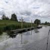
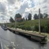
Mooring here is good (a nice place to moor), mooring rings or bollards are available. Mooring is limited to 2 days. 200ft of pontoon mooring on the south side of the river.
You can wind here.
| Bardney Lock Weir Exit | 3 miles, 5½ furlongs | |
| Bardney Lock Old Railway Bridge | 3 miles, 5¼ furlongs | |
| Bardney Village Visitor Moorings | 3 miles, ¾ furlongs | |
| Bardney Bridge | 2 miles, 7½ furlongs | |
| River Witham - Nocton Delph Junction | 5¾ furlongs | |
| Dunstan Fen Visitor Moorings | ||
| Southrey Visitor Moorings | ½ furlongs | |
| Stixwould | 1 mile, 5¼ furlongs | |
| Kirkstead Bridge Visitor Moorings | 3 miles, 6¼ furlongs | |
| Kirkstead Bridge | 3 miles, 7 furlongs | |
| Horncastle Canal Junction | 7 miles, 5 furlongs | |
The White Horse pub stands by the riverside.
There are no links to external websites from here.
Why not log in and add some (select "External websites" from the menu (sometimes this is under "Edit"))?
Mouseover for more information or show routes to facility
Nearest water point
In the direction of Boston Grand Sluice Lock No 3
Langrick Bridge General Store and Marina — 15 miles, 4½ furlongs away
On this waterway in the direction of Boston Grand Sluice Lock No 3
Boston Lock Visitor Moorings — 19 miles, 5½ furlongs away
On this waterway in the direction of Boston Grand Sluice Lock No 3
In the direction of High Bridge Lincoln (the Glory Hole)
Bardney Lock No 2 — 3 miles, 6 furlongs away
On this waterway in the direction of High Bridge Lincoln (the Glory Hole)
Stamp End Lock No 1 — 11 miles, 3¼ furlongs and 1 lock away
On this waterway in the direction of High Bridge Lincoln (the Glory Hole)
Lincoln Boaters Facilities — 12 miles, 4½ furlongs and 2 locks away
Travel to High Bridge Lincoln (the Glory Hole), then on the Fossdyke Canal to Lincoln Boaters Facilities
Saxilby Village Water Point — 17 miles, 6 furlongs and 2 locks away
Travel to High Bridge Lincoln (the Glory Hole), then on the Fossdyke Canal to Saxilby Village Water PointNearest rubbish disposal
In the direction of Boston Grand Sluice Lock No 3
Boston Lock Visitor Moorings — 19 miles, 5½ furlongs away
On this waterway in the direction of Boston Grand Sluice Lock No 3
In the direction of High Bridge Lincoln (the Glory Hole)
Bardney Lock No 2 — 3 miles, 6 furlongs away
On this waterway in the direction of High Bridge Lincoln (the Glory Hole)
Lincoln Boaters Facilities — 12 miles, 4½ furlongs and 2 locks away
Travel to High Bridge Lincoln (the Glory Hole), then on the Fossdyke Canal to Lincoln Boaters FacilitiesNearest chemical toilet disposal
In the direction of High Bridge Lincoln (the Glory Hole)
Bardney Lock No 2 — 3 miles, 6 furlongs away
On this waterway in the direction of High Bridge Lincoln (the Glory Hole)
Lincoln Boaters Facilities — 12 miles, 4½ furlongs and 2 locks away
Travel to High Bridge Lincoln (the Glory Hole), then on the Fossdyke Canal to Lincoln Boaters Facilities
Saxilby Council Public Facilities — 17 miles, 6½ furlongs and 2 locks away
Travel to High Bridge Lincoln (the Glory Hole), then on the Fossdyke Canal to Saxilby Council Public FacilitiesNearest place to turn
In the direction of Boston Grand Sluice Lock No 3
Southrey Visitor Moorings — ½ furlongs away
On this waterway in the direction of Boston Grand Sluice Lock No 3
Stixwould — 1 mile, 5¼ furlongs away
On this waterway in the direction of Boston Grand Sluice Lock No 3
Kirkstead Bridge Visitor Moorings — 3 miles, 6¼ furlongs away
On this waterway in the direction of Boston Grand Sluice Lock No 3
Horncastle Canal Junction — 7 miles, 5 furlongs away
On this waterway in the direction of Boston Grand Sluice Lock No 3
Tattershall Bridge Visitor Moorings — 8 miles, 1¾ furlongs away
On this waterway in the direction of Boston Grand Sluice Lock No 3
Belle Isle Marina — 9 miles, 1 furlong away
On this waterway in the direction of Boston Grand Sluice Lock No 3
Dogdyke Visitor Moorings — 9 miles, 1½ furlongs away
On this waterway in the direction of Boston Grand Sluice Lock No 3
Orchard Caravan and Camping Park Moorings — 9 miles, 6½ furlongs away
On this waterway in the direction of Boston Grand Sluice Lock No 3
Chapel Hill Junction — 10 miles, 1 furlong away
On this waterway in the direction of Boston Grand Sluice Lock No 3
Winding Hole below Clay Bank Road Bridge — 13 miles, ½ furlongs and 1 lock away
Travel to Chapel Hill Junction, then on the River Witham (Sleaford Navigation(Kyme Eau)-navigable section) to Winding Hole below Clay Bank Road Bridge
Langrick Bridge General Store and Marina — 15 miles, 4½ furlongs away
On this waterway in the direction of Boston Grand Sluice Lock No 3
Anton's Gowt Junction — 17 miles, 5 furlongs away
On this waterway in the direction of Boston Grand Sluice Lock No 3
Cobblers Lock Winding Hole — 17 miles, 1 furlong and 1 lock away
Travel to Chapel Hill Junction, then on the River Witham (Sleaford Navigation(Kyme Eau)-navigable section) to Cobblers Lock Winding Hole
Boston Lock Visitor Moorings — 19 miles, 5½ furlongs away
On this waterway in the direction of Boston Grand Sluice Lock No 3
Boston Motor Yatch Club — 19 miles, 6¾ furlongs away
On this waterway in the direction of Boston Grand Sluice Lock No 3
Boston Gateway Marina — 19 miles, 7¼ furlongs away
On this waterway in the direction of Boston Grand Sluice Lock No 3
In the direction of High Bridge Lincoln (the Glory Hole)
River Witham - Nocton Delph Junction — 5¾ furlongs away
On this waterway in the direction of High Bridge Lincoln (the Glory Hole)
Bardney Village Visitor Moorings — 3 miles, ¾ furlongs away
On this waterway in the direction of High Bridge Lincoln (the Glory Hole)
Lincoln Boaters Facilities — 12 miles, 4½ furlongs and 2 locks away
Travel to High Bridge Lincoln (the Glory Hole), then on the Fossdyke Canal to Lincoln Boaters FacilitiesNearest self-operated pump-out
In the direction of High Bridge Lincoln (the Glory Hole)
Lincoln Boaters Facilities — 12 miles, 4½ furlongs and 2 locks away
Travel to High Bridge Lincoln (the Glory Hole), then on the Fossdyke Canal to Lincoln Boaters FacilitiesNo information
CanalPlan has no information on any of the following facilities within range:boatyard pump-out
Direction of TV transmitter (From Wolfbane Cybernetic)
There is no page on Wikipedia called “Dunstan Fen Visitor Moorings”
Results of Google Search
Jul 25, 2014 ... Dunstan Fen Visitor moorings (pictured). Room for 12 boats. The moorings are on opposite side of the river with no connecting bridge between.
Marshy fenlands stretch out for miles on either side, giving a real sense of space ... for boats has increased in recent years, with plenty of visitor moorings in calmĀ ...
Nov 5, 2013 ... Saxilby has visitor moorings and a pleasant waterfront with tree-lined grassy ... a long straight course with high banks as it crosses Holland Fen.
Dunston Fen, Metheringham, Lincoln LN4 3AP England ... Metheringham Airfield Visitor Centre ... We moored up on boat at the free moorings outside .
Visible from busy Route One, yet a sanctuary for wildlife and visitors. ... sprawl- weary driver experiences a moment of relief when they cross the Dunston River ( 1) ... This busy facility also has guest moorings and short-term dockage for passingĀ ...
Dunston Fen Lane, Metheringham, Lincoln LN4 3AP, England. +44 1526 ... Situated next to the River Witham, Moorings and Fishing Pegs are available to use.

![Southrey. Seen from the south bank of the Witham, the slipway marks the end of Ferry Road, Southrey. The remains of the platform of Southrey railway station are well preserved; in pre-Beeching years the line meandered south along the river to (amongst other places) [[109241]] and](https://s1.geograph.org.uk/photos/11/06/110677_228e1885_120x120.jpg)