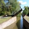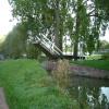
St Edwards Lift Bridge No 238 
St Edward's School, Squitchey Lane, Oxford OX2 7NS, United Kingdom
Address is taken from a point 381 yards away.

St Edwards Lift Bridge No 238
is a minor waterways place
on the Oxford Canal (Southern Section - Main Line) between
Isis Lock Junction (1 mile and 3¾ furlongs
to the south) and
Wolvercote Junction (Junction of Duke's Cut with Oxford Canal) (1 mile and 4¼ furlongs
and 1 lock
to the northwest).
The nearest place in the direction of Isis Lock Junction is Elizabeth Jennings Way Bridge No 238B (A replacement for Electric Lift Bridge No 239A);
1½ furlongs
away.
The nearest place in the direction of Wolvercote Junction is Site of Second St Edwards Lift Bridge;
1¾ furlongs
away.
Mooring here is unrated.
Facilities: water point.
There is a lift bridge here. The bridge is normally left open.
Aristotle Bridge No 240 | 5 furlongs | |
Heyfield Hut Wharf | 4¾ furlongs | |
Frenchay Bridge No 239A | 3¼ furlongs | |
Site of Lift Bridge No 239 | 1¾ furlongs | |
Elizabeth Jennings Way Bridge No 238B | 1½ furlongs | |
St Edwards Lift Bridge No 238 | ||
Site of Second St Edwards Lift Bridge | 1¾ furlongs | |
Wolvercote Railway Bridge No 236A | 2¾ furlongs | |
Wolvercote Green Field Bridge No 236 | 5½ furlongs | |
Wolvercote Footbridge | 7 furlongs | |
Wolvercote Bridge No 235 | 7 furlongs |
Amenities in City of Oxford
Amenities at other places in City of Oxford
at
at
at
at
at
at
at
at
at
at
at
at
at
at
at
at
at
at
at
at
at
at
at
at
at
at
at
at
at
at
at
at
at
at
at
at
at
at
at
at
at
at
at
at
at
at
at
at
at
at
at
at
at
at
at
at
at
at
at
at
at
at
at
at
at
at
at
at
at
at
at
at
at
at
at
at
at
at
at
at
at
at
at
at
at
at
- Oxford Canal Walk - Part One - Oxford to Thrupp - YouTube — associated with Oxford Canal
- A walk along the Oxford Canal (Southern Section) from Oxford to Thrupp Wide
Mouseover for more information or show routes to facility
Nearest water point
The nearest water point is here. Others are at:
In the direction of Napton Junction
Wolvercote Sanitary Station — 1 mile, ¾ furlongs and 1 lock away
On this waterway in the direction of Napton Junction
Wolvercote Junction Water Point — 1 mile, 5 furlongs and 2 locks away
On this waterway in the direction of Napton Junction
Eynsham Lock — 4 miles, 7 furlongs and 2 locks away
Travel to Wolvercote Junction, then on the Oxford Canal (Duke's Cut) to Duke's Cut Junction, then on the River Thames (above Oxford) to Eynsham Lock
Langford Lane Bridge No 224 — 4 miles, 5 furlongs and 4 locks away
On this waterway in the direction of Napton Junction
Aubreys Lift Bridge No 221 — 5 miles, 2¼ furlongs and 4 locks away
On this waterway in the direction of Napton Junction
Thrupp Cruising Club — 5 miles, 2½ furlongs and 4 locks away
On this waterway in the direction of Napton Junction
Shifford Lock — 15 miles and 5 locks away
Travel to Wolvercote Junction, then on the Oxford Canal (Duke's Cut) to Duke's Cut Junction, then on the River Thames (above Oxford) to Shifford Lock
Heyford Wharf Bridge No 206 — 12 miles, 6¾ furlongs and 9 locks away
On this waterway in the direction of Napton Junction
Heyford Wharf — 12 miles, 7 furlongs and 9 locks away
On this waterway in the direction of Napton Junction
Aynho Wharf — 18 miles, 7¼ furlongs and 12 locks away
On this waterway in the direction of Napton Junction
In the direction of End of Hythe Bridge Arm
Oxford Visitor Moorings — 1 mile, 4½ furlongs away
On this waterway in the direction of End of Hythe Bridge Arm
Abingdon Lock — 10 miles, 3½ furlongs and 4 locks away
Travel to Isis Lock Junction, then on the River Thames (Sheepwash Channel) to Sheepwash Channel Junction, then on the River Thames (above Oxford) to Osney Bridge, then on the River Thames (below Oxford) to Abingdon Lock
Abingdon Bridge Marine — 10 miles, 7 furlongs and 5 locks away
Travel to Isis Lock Junction, then on the River Thames (Sheepwash Channel) to Sheepwash Channel Junction, then on the River Thames (above Oxford) to Osney Bridge, then on the River Thames (below Oxford) to Abingdon Bridge MarineNearest rubbish disposal
In the direction of Napton Junction
Wolvercote Sanitary Station — 1 mile, ¾ furlongs and 1 lock away
On this waterway in the direction of Napton Junction
Eynsham Lock — 4 miles, 7 furlongs and 2 locks away
Travel to Wolvercote Junction, then on the Oxford Canal (Duke's Cut) to Duke's Cut Junction, then on the River Thames (above Oxford) to Eynsham Lock
Aubreys Lift Bridge No 221 — 5 miles, 2¼ furlongs and 4 locks away
On this waterway in the direction of Napton Junction
Thrupp Cruising Club — 5 miles, 2½ furlongs and 4 locks away
On this waterway in the direction of Napton Junction
Heyford Wharf Bridge No 206 — 12 miles, 6¾ furlongs and 9 locks away
On this waterway in the direction of Napton Junction
Heyford Wharf — 12 miles, 7 furlongs and 9 locks away
On this waterway in the direction of Napton Junction
Rushey Lock — 19 miles, 1 furlong and 6 locks away
Travel to Wolvercote Junction, then on the Oxford Canal (Duke's Cut) to Duke's Cut Junction, then on the River Thames (above Oxford) to Rushey Lock
Aynho Wharf — 18 miles, 7¼ furlongs and 12 locks away
On this waterway in the direction of Napton Junction
In the direction of End of Hythe Bridge Arm
Abingdon Lock — 10 miles, 3½ furlongs and 4 locks away
Travel to Isis Lock Junction, then on the River Thames (Sheepwash Channel) to Sheepwash Channel Junction, then on the River Thames (above Oxford) to Osney Bridge, then on the River Thames (below Oxford) to Abingdon Lock
Day's Lock — 18 miles, 5½ furlongs and 7 locks away
Travel to Isis Lock Junction, then on the River Thames (Sheepwash Channel) to Sheepwash Channel Junction, then on the River Thames (above Oxford) to Osney Bridge, then on the River Thames (below Oxford) to Day's LockNearest chemical toilet disposal
In the direction of Napton Junction
Wolvercote Sanitary Station — 1 mile, ¾ furlongs and 1 lock away
On this waterway in the direction of Napton Junction
Eynsham Lock — 4 miles, 7 furlongs and 2 locks away
Travel to Wolvercote Junction, then on the Oxford Canal (Duke's Cut) to Duke's Cut Junction, then on the River Thames (above Oxford) to Eynsham Lock
Thrupp Cruising Club — 5 miles, 2½ furlongs and 4 locks away
On this waterway in the direction of Napton Junction
Rushey Lock — 19 miles, 1 furlong and 6 locks away
Travel to Wolvercote Junction, then on the Oxford Canal (Duke's Cut) to Duke's Cut Junction, then on the River Thames (above Oxford) to Rushey Lock
In the direction of End of Hythe Bridge Arm
Abingdon Lock — 10 miles, 3½ furlongs and 4 locks away
Travel to Isis Lock Junction, then on the River Thames (Sheepwash Channel) to Sheepwash Channel Junction, then on the River Thames (above Oxford) to Osney Bridge, then on the River Thames (below Oxford) to Abingdon Lock
Day's Lock — 18 miles, 5½ furlongs and 7 locks away
Travel to Isis Lock Junction, then on the River Thames (Sheepwash Channel) to Sheepwash Channel Junction, then on the River Thames (above Oxford) to Osney Bridge, then on the River Thames (below Oxford) to Day's LockNearest place to turn
In the direction of Napton Junction
Wolvercote Junction — 1 mile, 4¼ furlongs and 1 lock away
On this waterway in the direction of Napton Junction
Bypass Reservoir Junction — 1 mile, 6¼ furlongs and 2 locks away
Travel to Wolvercote Junction, then on the Oxford Canal (Duke's Cut) to Bypass Reservoir Junction
Duke's Cut Junction — 2 miles, 2¾ furlongs and 2 locks away
Travel to Wolvercote Junction, then on the Oxford Canal (Duke's Cut) to Duke's Cut Junction
Thames - Wharf Stream Junction — 4 miles, 5¼ furlongs and 2 locks away
Travel to Wolvercote Junction, then on the Oxford Canal (Duke's Cut) to Duke's Cut Junction, then on the River Thames (above Oxford) to Thames - Wharf Stream Junction
Pinkhill Lock Weir Exit — 6 miles, 1½ furlongs and 3 locks away
Travel to Wolvercote Junction, then on the Oxford Canal (Duke's Cut) to Duke's Cut Junction, then on the River Thames (above Oxford) to Pinkhill Lock Weir Exit
Thrupp Wide — 5 miles, 2½ furlongs and 4 locks away
On this waterway in the direction of Napton Junction
Shipton Weir Junction — 6 miles, 3 furlongs and 5 locks away
On this waterway in the direction of Napton Junction
Enslow Winding Hole — 7 miles, 7 furlongs and 6 locks away
On this waterway in the direction of Napton Junction
In the direction of End of Hythe Bridge Arm
Hythe Bridge Arm Winding Hole — 1 mile, 3½ furlongs away
On this waterway in the direction of End of Hythe Bridge Arm
End of Hythe Bridge Arm — 1 mile, 4½ furlongs away
On this waterway in the direction of End of Hythe Bridge Arm
Castle Mill Stream Junction — 1 mile, 4 furlongs and 1 lock away
Travel to Isis Lock Junction, then on the River Thames (Sheepwash Channel) to Castle Mill Stream Junction
Sheepwash Channel Junction — 1 mile, 4¾ furlongs and 1 lock away
Travel to Isis Lock Junction, then on the River Thames (Sheepwash Channel) to Sheepwash Channel Junction
Bossoms Boat Yard — 2 miles, 2¾ furlongs and 1 lock away
Travel to Isis Lock Junction, then on the River Thames (Sheepwash Channel) to Sheepwash Channel Junction, then on the River Thames (above Oxford) to Bossoms Boat Yard
Osney Lock Weir Exit — 1 mile, 7¾ furlongs and 2 locks away
Travel to Isis Lock Junction, then on the River Thames (Sheepwash Channel) to Sheepwash Channel Junction, then on the River Thames (above Oxford) to Osney Bridge, then on the River Thames (below Oxford) to Osney Lock Weir Exit
Thames - Cherwell Junction — 3 miles, 1¾ furlongs and 2 locks away
Travel to Isis Lock Junction, then on the River Thames (Sheepwash Channel) to Sheepwash Channel Junction, then on the River Thames (above Oxford) to Osney Bridge, then on the River Thames (below Oxford) to Thames - Cherwell Junction
Iffley Lock Weir Entrance No 1 — 4 miles, 1 furlong and 2 locks away
Travel to Isis Lock Junction, then on the River Thames (Sheepwash Channel) to Sheepwash Channel Junction, then on the River Thames (above Oxford) to Osney Bridge, then on the River Thames (below Oxford) to Iffley Lock Weir Entrance No 1
Iffley Lock Weir Exit No 1 — 4 miles, 2 furlongs and 3 locks away
Travel to Isis Lock Junction, then on the River Thames (Sheepwash Channel) to Sheepwash Channel Junction, then on the River Thames (above Oxford) to Osney Bridge, then on the River Thames (below Oxford) to Iffley Lock Weir Exit No 1
Sandford Lock Weir Exit (Thames) — 5 miles, 7¾ furlongs and 4 locks away
Travel to Isis Lock Junction, then on the River Thames (Sheepwash Channel) to Sheepwash Channel Junction, then on the River Thames (above Oxford) to Osney Bridge, then on the River Thames (below Oxford) to Sandford Lock Weir Exit (Thames)
Abingdon Lock Weir Exit No 1 — 10 miles, 4 furlongs and 5 locks away
Travel to Isis Lock Junction, then on the River Thames (Sheepwash Channel) to Sheepwash Channel Junction, then on the River Thames (above Oxford) to Osney Bridge, then on the River Thames (below Oxford) to Abingdon Lock Weir Exit No 1
Abingdon Bridge Winding Hole — 10 miles, 7¼ furlongs and 5 locks away
Travel to Isis Lock Junction, then on the River Thames (Sheepwash Channel) to Sheepwash Channel Junction, then on the River Thames (above Oxford) to Osney Bridge, then on the River Thames (below Oxford) to Abingdon Bridge Winding HoleNearest self-operated pump-out
In the direction of Napton Junction
Eynsham Lock — 4 miles, 7 furlongs and 2 locks away
Travel to Wolvercote Junction, then on the Oxford Canal (Duke's Cut) to Duke's Cut Junction, then on the River Thames (above Oxford) to Eynsham Lock
Aubreys Lift Bridge No 221 — 5 miles, 2¼ furlongs and 4 locks away
On this waterway in the direction of Napton Junction
Thrupp Cruising Club — 5 miles, 2½ furlongs and 4 locks away
On this waterway in the direction of Napton Junction
Rushey Lock — 19 miles, 1 furlong and 6 locks away
Travel to Wolvercote Junction, then on the Oxford Canal (Duke's Cut) to Duke's Cut Junction, then on the River Thames (above Oxford) to Rushey Lock
In the direction of End of Hythe Bridge Arm
Abingdon Lock — 10 miles, 3½ furlongs and 4 locks away
Travel to Isis Lock Junction, then on the River Thames (Sheepwash Channel) to Sheepwash Channel Junction, then on the River Thames (above Oxford) to Osney Bridge, then on the River Thames (below Oxford) to Abingdon LockNearest boatyard pump-out
In the direction of Napton Junction
Oxford Cruisers Marina — 5 miles, 7 furlongs and 3 locks away
Travel to Wolvercote Junction, then on the Oxford Canal (Duke's Cut) to Duke's Cut Junction, then on the River Thames (above Oxford) to Oxford Cruisers Marina
Enslow Wharf — 7 miles, 6 furlongs and 6 locks away
On this waterway in the direction of Napton Junction
Heyford Wharf — 12 miles, 7 furlongs and 9 locks away
On this waterway in the direction of Napton Junction
Aynho Wharf — 18 miles, 7¼ furlongs and 12 locks away
On this waterway in the direction of Napton Junction
In the direction of End of Hythe Bridge Arm
Abingdon Bridge Marine — 10 miles, 7 furlongs and 5 locks away
Travel to Isis Lock Junction, then on the River Thames (Sheepwash Channel) to Sheepwash Channel Junction, then on the River Thames (above Oxford) to Osney Bridge, then on the River Thames (below Oxford) to Abingdon Bridge MarineDirection of TV transmitter (From Wolfbane Cybernetic)
There is no page on Wikipedia called “St Edwards Lift Bridge”
Wikipedia pages that might relate to St Edwards Lift Bridge
[List of bridges in the United States]
Isle Park Mackinac Bridge, St. Ignace–Mackinaw City Portage Lake Lift Bridge, Houghton to Hancock Sault Ste. Marie International Bridge, Sault Ste. Marie
[Senator William V. Roth Jr. Bridge]
Canal near St. Georges, Delaware. The bridge is located near a tolled section of Delaware Route 1 that runs parallel to the St. Georges Bridge carrying
[Martin Bridge]
long. The total bridge length is 463 metres (1,519 ft). Originally it had a lifting span with two concrete counterbalances. The bridge was opened on 18
[Wayne Edwards (British Army soldier)]
RAMC. Approximately twelve minutes after leaving the base, as Edwards drove across a bridge, he was struck by a single shot in the head and his Warrior
[Edwards Air Force Base]
Edwards Air Force Base (AFB) (IATA: EDW, ICAO: KEDW, FAA LID: EDW) is a United States Air Force installation located in Kern County in Edwards, California
[Space elevator]
example, the Edwards space elevator design assumes a cable material with a tensile strength of at least 100 gigapascals. Since Edwards consistently assumed
[River Don Navigation]
console has been built for the use of boaters when the bridge is not staffed. Sykehouse Lift Bridge (downstream of Barnby Dun) was built to the same technical
[List of Deadly Women episodes]
shoot someone and she made her fantasy come to life when a man offered her a lift one day and she emptied her pistol twice over by shooting him. She was released
[Duluth, Minnesota]
States' only all-freshwater aquarium, the Great Lakes Aquarium; the Aerial Lift Bridge, which is adjacent to Canal Park and spans the Duluth Ship Canal into
[Tampa Bay Rowdies]
dispute was resolved in October 2014 when Edwards and the city of St. Petersburg brokered a deal that gave Edwards' Big 3 Entertainment company sole management