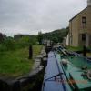
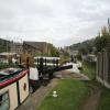
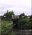
Library Lock No 11E
is a minor waterways place
on the Huddersfield Narrow Canal between
Golcar (3½ furlongs
and 1 lock
to the west) and
Aspley Basin (Huddersfield) (Moorings for Huddersfield and Junction of Huddersfield Broad and Narrow Canals) (2 miles and 2½ furlongs
and 10 locks
to the east).
The nearest place in the direction of Golcar is Morley Lane Bridge No 33;
¾ furlongs
away.
The nearest place in the direction of Aspley Basin (Huddersfield) is Spring Garden Lock No 10E;
½ furlongs
away.
There may be access to the towpath here.
Mooring here is unrated.
There is a bridge here which takes pedestrian traffic over the canal.
This is a lock, the rise of which is not known.
Scarr Bottom Roadbridge No 36 | 5¼ furlongs | |
Golcar Aqueduct | 4¼ furlongs | |
Golcar | 3½ furlongs | |
Rough Holme Lock No 12E | 2½ furlongs | |
Morley Lane Bridge No 33 | ¾ furlongs | |
Library Lock No 11E | ||
Spring Garden Lock No 10E | ½ furlongs | |
Whiteley Bottom Bridge No 32 | ½ furlongs | |
Isis Lock No 9E | 1 furlong | |
Isis Lock Winding Hole | 1 furlong | |
Lockbridge Way Visitor Moorings | 1½ furlongs |
There are no links to external websites from here.
Why not log in and add some (select "External websites" from the menu (sometimes this is under "Edit"))?
Mouseover for more information or show routes to facility
Nearest water point
In the direction of Ashton-under-Lyne Junction
Waterside Lock No 21E — 2 miles, 3 furlongs and 10 locks away
On this waterway in the direction of Ashton-under-Lyne Junction
Slaithwaite Winding Hole — 2 miles, 3¾ furlongs and 11 locks away
On this waterway in the direction of Ashton-under-Lyne Junction
Standedge Tunnel (eastern entrance) — 5 miles, 6¾ furlongs and 32 locks away
On this waterway in the direction of Ashton-under-Lyne Junction
Standedge Tunnel (western entrance) — 9 miles, ½ furlongs and 32 locks away
On this waterway in the direction of Ashton-under-Lyne Junction
Wool Road Bridge No 70 — 11 miles, ½ furlongs and 41 locks away
On this waterway in the direction of Ashton-under-Lyne Junction
Grove Road Bridge No 96 — 17 miles, ½ furlongs and 56 locks away
On this waterway in the direction of Ashton-under-Lyne Junction
In the direction of Aspley Basin (Huddersfield)
Aspley Basin (Huddersfield) — 2 miles, 2½ furlongs and 11 locks away
On this waterway in the direction of Aspley Basin (Huddersfield)
Shepley Bridge Sanitary Station — 8 miles, 7 furlongs and 22 locks away
Travel to Aspley Basin (Huddersfield), then on the Huddersfield Broad Canal to Cooper Bridge Junction, then on the Calder and Hebble Navigation (Main Line) to Shepley Bridge Sanitary Station
Brighouse Basin — 8 miles, ¾ furlongs and 24 locks away
Travel to Aspley Basin (Huddersfield), then on the Huddersfield Broad Canal to Cooper Bridge Junction, then on the Calder and Hebble Navigation (Main Line) to Brighouse Basin
Salterhebble Sanitary Station — 12 miles, 2¾ furlongs and 33 locks away
Travel to Aspley Basin (Huddersfield), then on the Huddersfield Broad Canal to Cooper Bridge Junction, then on the Calder and Hebble Navigation (Main Line) to Salterhebble Sanitary Station
Broad Cut Low Lock No 3 — 15 miles, 4 furlongs and 30 locks away
Travel to Aspley Basin (Huddersfield), then on the Huddersfield Broad Canal to Cooper Bridge Junction, then on the Calder and Hebble Navigation (Main Line) to Broad Cut Low Lock No 3
Salterhebble Junction — 12 miles, 3¼ furlongs and 34 locks away
Travel to Aspley Basin (Huddersfield), then on the Huddersfield Broad Canal to Cooper Bridge Junction, then on the Calder and Hebble Navigation (Main Line) to Salterhebble Junction
Sowerby Bridge Basin — 14 miles, 5 furlongs and 34 locks away
Travel to Aspley Basin (Huddersfield), then on the Huddersfield Broad Canal to Cooper Bridge Junction, then on the Calder and Hebble Navigation (Main Line) to Salterhebble Junction, then on the Calder and Hebble Navigation (Main Line) to Sowerby Bridge BasinNearest rubbish disposal
In the direction of Ashton-under-Lyne Junction
Pickle Lock No 22E — 2 miles, 4¼ furlongs and 11 locks away
On this waterway in the direction of Ashton-under-Lyne Junction
Wool Road Visitor Mooring — 11 miles, ¾ furlongs and 41 locks away
On this waterway in the direction of Ashton-under-Lyne Junction
In the direction of Aspley Basin (Huddersfield)
Aspley Basin (Huddersfield) — 2 miles, 2½ furlongs and 11 locks away
On this waterway in the direction of Aspley Basin (Huddersfield)
Shepley Bridge Sanitary Station — 8 miles, 7 furlongs and 22 locks away
Travel to Aspley Basin (Huddersfield), then on the Huddersfield Broad Canal to Cooper Bridge Junction, then on the Calder and Hebble Navigation (Main Line) to Shepley Bridge Sanitary Station
Brighouse Lower Basin Visitor Moorings — 8 miles, ½ furlongs and 23 locks away
Travel to Aspley Basin (Huddersfield), then on the Huddersfield Broad Canal to Cooper Bridge Junction, then on the Calder and Hebble Navigation (Main Line) to Brighouse Lower Basin Visitor Moorings
Horbury Basin Residential Moorings & Sanitary Station — 13 miles, 3½ furlongs and 29 locks away
Travel to Aspley Basin (Huddersfield), then on the Huddersfield Broad Canal to Cooper Bridge Junction, then on the Calder and Hebble Navigation (Main Line) to Horbury Basin Residential Moorings & Sanitary Station
Salterhebble Sanitary Station — 12 miles, 2¾ furlongs and 33 locks away
Travel to Aspley Basin (Huddersfield), then on the Huddersfield Broad Canal to Cooper Bridge Junction, then on the Calder and Hebble Navigation (Main Line) to Salterhebble Sanitary Station
Sowerby Bridge Basin — 14 miles, 5 furlongs and 34 locks away
Travel to Aspley Basin (Huddersfield), then on the Huddersfield Broad Canal to Cooper Bridge Junction, then on the Calder and Hebble Navigation (Main Line) to Salterhebble Junction, then on the Calder and Hebble Navigation (Main Line) to Sowerby Bridge BasinNearest chemical toilet disposal
In the direction of Ashton-under-Lyne Junction
Waterside Lock No 21E — 2 miles, 3 furlongs and 10 locks away
On this waterway in the direction of Ashton-under-Lyne Junction
Pickle Lock No 22E — 2 miles, 4¼ furlongs and 11 locks away
On this waterway in the direction of Ashton-under-Lyne Junction
Wool Road Bridge No 70 — 11 miles, ½ furlongs and 41 locks away
On this waterway in the direction of Ashton-under-Lyne Junction
Grove Road Bridge No 96 — 17 miles, ½ furlongs and 56 locks away
On this waterway in the direction of Ashton-under-Lyne Junction
In the direction of Aspley Basin (Huddersfield)
Aspley Basin (Huddersfield) — 2 miles, 2½ furlongs and 11 locks away
On this waterway in the direction of Aspley Basin (Huddersfield)
Shepley Bridge Sanitary Station — 8 miles, 7 furlongs and 22 locks away
Travel to Aspley Basin (Huddersfield), then on the Huddersfield Broad Canal to Cooper Bridge Junction, then on the Calder and Hebble Navigation (Main Line) to Shepley Bridge Sanitary Station
Brighouse Basin — 8 miles, ¾ furlongs and 24 locks away
Travel to Aspley Basin (Huddersfield), then on the Huddersfield Broad Canal to Cooper Bridge Junction, then on the Calder and Hebble Navigation (Main Line) to Brighouse Basin
Savile Town Wharf and Basin (Dewsbury) — 12 miles, 2½ furlongs and 26 locks away
Travel to Aspley Basin (Huddersfield), then on the Huddersfield Broad Canal to Cooper Bridge Junction, then on the Calder and Hebble Navigation (Main Line) to Dewsbury Arm Junction, then on the Calder and Hebble Navigation (Dewsbury Old Cut) to Savile Town Wharf and Basin (Dewsbury)
Horbury Basin Residential Moorings & Sanitary Station — 13 miles, 3½ furlongs and 29 locks away
Travel to Aspley Basin (Huddersfield), then on the Huddersfield Broad Canal to Cooper Bridge Junction, then on the Calder and Hebble Navigation (Main Line) to Horbury Basin Residential Moorings & Sanitary Station
Salterhebble Sanitary Station — 12 miles, 2¾ furlongs and 33 locks away
Travel to Aspley Basin (Huddersfield), then on the Huddersfield Broad Canal to Cooper Bridge Junction, then on the Calder and Hebble Navigation (Main Line) to Salterhebble Sanitary Station
Sowerby Bridge Basin — 14 miles, 5 furlongs and 34 locks away
Travel to Aspley Basin (Huddersfield), then on the Huddersfield Broad Canal to Cooper Bridge Junction, then on the Calder and Hebble Navigation (Main Line) to Salterhebble Junction, then on the Calder and Hebble Navigation (Main Line) to Sowerby Bridge BasinNearest place to turn
In the direction of Ashton-under-Lyne Junction
Linthwaite Winding Hole — 1 mile, 3¼ furlongs and 6 locks away
On this waterway in the direction of Ashton-under-Lyne Junction
Slaithwaite Winding Hole — 2 miles, 3¾ furlongs and 11 locks away
On this waterway in the direction of Ashton-under-Lyne Junction
Booth Lock Winding Hole — 4 miles, ¾ furlongs and 21 locks away
On this waterway in the direction of Ashton-under-Lyne Junction
Standedge Tunnel End Winding Hole — 5 miles, 6 furlongs and 32 locks away
On this waterway in the direction of Ashton-under-Lyne Junction
Diggle Winding Hole — 9 miles, 3¼ furlongs and 32 locks away
On this waterway in the direction of Ashton-under-Lyne Junction
In the direction of Aspley Basin (Huddersfield)
Isis Lock Winding Hole — 1 furlong and 3 locks away
On this waterway in the direction of Aspley Basin (Huddersfield)
University Arm — 2 miles, 1¾ furlongs and 11 locks away
On this waterway in the direction of Aspley Basin (Huddersfield)
Aspley Basin (Huddersfield) — 2 miles, 2½ furlongs and 11 locks away
On this waterway in the direction of Aspley Basin (Huddersfield)
Anchor Street Winding Hole — 2 miles, 7½ furlongs and 11 locks away
Travel to Aspley Basin (Huddersfield), then on the Huddersfield Broad Canal to Anchor Street Winding Hole
New Road Winding Hole — 3 miles, 2¾ furlongs and 11 locks away
Travel to Aspley Basin (Huddersfield), then on the Huddersfield Broad Canal to New Road Winding Hole
Deighton Road Bridge Winding Hole — 4 miles, 4½ furlongs and 16 locks away
Travel to Aspley Basin (Huddersfield), then on the Huddersfield Broad Canal to Deighton Road Bridge Winding Hole
Cooper Bridge Junction — 5 miles, 6½ furlongs and 20 locks away
Travel to Aspley Basin (Huddersfield), then on the Huddersfield Broad Canal to Cooper Bridge Junction
Battye Weir Entrance — 6 miles, 3½ furlongs and 21 locks away
Travel to Aspley Basin (Huddersfield), then on the Huddersfield Broad Canal to Cooper Bridge Junction, then on the Calder and Hebble Navigation (Main Line) to Battye Weir Entrance
Shepley Bridge Marina — 8 miles, 7¼ furlongs and 22 locks away
Travel to Aspley Basin (Huddersfield), then on the Huddersfield Broad Canal to Cooper Bridge Junction, then on the Calder and Hebble Navigation (Main Line) to Shepley Bridge Marina
Brighouse Basin — 8 miles, ¾ furlongs and 24 locks away
Travel to Aspley Basin (Huddersfield), then on the Huddersfield Broad Canal to Cooper Bridge Junction, then on the Calder and Hebble Navigation (Main Line) to Brighouse Basin
Ganny Winding Hole — 8 miles, 6¼ furlongs and 25 locks away
Travel to Aspley Basin (Huddersfield), then on the Huddersfield Broad Canal to Cooper Bridge Junction, then on the Calder and Hebble Navigation (Main Line) to Ganny Winding Hole
Dewsbury Arm Junction — 11 miles, 2½ furlongs and 26 locks away
Travel to Aspley Basin (Huddersfield), then on the Huddersfield Broad Canal to Cooper Bridge Junction, then on the Calder and Hebble Navigation (Main Line) to Dewsbury Arm Junction
Savile Town Wharf and Basin (Dewsbury) — 12 miles, 2½ furlongs and 26 locks away
Travel to Aspley Basin (Huddersfield), then on the Huddersfield Broad Canal to Cooper Bridge Junction, then on the Calder and Hebble Navigation (Main Line) to Dewsbury Arm Junction, then on the Calder and Hebble Navigation (Dewsbury Old Cut) to Savile Town Wharf and Basin (Dewsbury)
Horbury Basin Residential Moorings & Sanitary Station — 13 miles, 3½ furlongs and 29 locks away
Travel to Aspley Basin (Huddersfield), then on the Huddersfield Broad Canal to Cooper Bridge Junction, then on the Calder and Hebble Navigation (Main Line) to Horbury Basin Residential Moorings & Sanitary Station
Salterhebble Wharf — 12 miles, 2¼ furlongs and 32 locks away
Travel to Aspley Basin (Huddersfield), then on the Huddersfield Broad Canal to Cooper Bridge Junction, then on the Calder and Hebble Navigation (Main Line) to Salterhebble WharfNearest self-operated pump-out
In the direction of Ashton-under-Lyne Junction
Slaithwaite Winding Hole — 2 miles, 3¾ furlongs and 11 locks away
On this waterway in the direction of Ashton-under-Lyne Junction
Wool Road Bridge No 70 — 11 miles, ½ furlongs and 41 locks away
On this waterway in the direction of Ashton-under-Lyne JunctionNearest boatyard pump-out
In the direction of Aspley Basin (Huddersfield)
Aspley Basin (Huddersfield) — 2 miles, 2½ furlongs and 11 locks away
On this waterway in the direction of Aspley Basin (Huddersfield)
Shepley Bridge Marina — 8 miles, 7¼ furlongs and 22 locks away
Travel to Aspley Basin (Huddersfield), then on the Huddersfield Broad Canal to Cooper Bridge Junction, then on the Calder and Hebble Navigation (Main Line) to Shepley Bridge Marina
Sowerby Bridge Basin — 14 miles, 5 furlongs and 34 locks away
Travel to Aspley Basin (Huddersfield), then on the Huddersfield Broad Canal to Cooper Bridge Junction, then on the Calder and Hebble Navigation (Main Line) to Salterhebble Junction, then on the Calder and Hebble Navigation (Main Line) to Sowerby Bridge BasinDirection of TV transmitter (From Wolfbane Cybernetic)
There is no page on Wikipedia called “Library Lock No 11E”
Wikipedia pages that might relate to Library Lock No 11E
[Rhine–Main–Danube Canal]
(Strullendorf lock) 49°44′41″N 11°02′51″E / 49.74461°N 11.04753°E / 49.74461; 11.04753 (Forchheim lock) 49°41′10″N 11°02′20″E / 49.68601°N 11.03893°E / 49
[Scroll Lock]
Scroll Lock (⤓ or ⇳) is a lock key (typically with an associated status light) on most IBM-compatible computer keyboards. Depending on the operating system
[Erie Canal]
between locks E33 and E34 as well as a 1.5-foot (0.46 m) natural rise between Lock E35 and the Niagara River. There is no Lock E1 or Lock E31 on the Erie
[Under Lock and Key]
Under Lock and Key is the third studio album by heavy metal band Dokken, released on November 22, 1985 through Elektra Records. The album reached No. 32
[Lock and Dam No. 1]
Ford Dam, officially known as Lock and Dam No. 1, is on the Upper Mississippi River and is located between Minneapolis and Saint Paul, Minnesota just
[Lock (computer science)]
In computer science, a lock or mutex (from mutual exclusion) is a synchronization primitive: a mechanism that enforces limits on access to a resource when
[Lock and Dam No. 20]
Lock and Dam No. 20 is a lock and dam located on the Upper Mississippi River, about one mile upstream from Canton, Missouri. The structure is located
[Keychain (software)]
Overwriting the file in ~/Library/Keychains/ with a new one (e.g. as part of a restore operation) also causes the keychain to lock and a password is required
[Non-blocking algorithm]
serialize with a lock and are not obstruction-free). Several libraries internally use lock-free techniques, but it is difficult to write lock-free code that
[Double-checked locking]
testing the locking criterion (the "lock hint") before acquiring the lock. Locking occurs only if the locking criterion check indicates that locking is required
Results of Google Search
Buy Kensington Combination Cable Lock for Laptops and Other Devices ... Amazon.com will not accept returns of any desktop or notebook computer more ... Pro laptop when I'm using it at coffee-shops, the library, diners or wherever else.
Aug 19, 2014 ... Chromebook (Lenovo Thinkpad 11e) will not recognize recovery USB drive ... More. Community content may not be verified or up-to-date. ... My city's public library has an option to use the Chrome browser, It allows me to go the Chrome Web Store. ... This question is locked and replying has been disabled.
Through a series of water turbine powered inclined planes, locks and ... With the exception of Lock 18E, (no known existing photo), all ... east side of Rockaway River, Lock 11E, 57.61, 0, 490 ... published by Delaware Press, P.O. Box 454, Easton, PA, Library of Congress Catalog Card Number 79-54797, Reprint 1994. c.
Owner's Manuals Download Library. Click on the links below to view ... Fire Door (Insulated & Non-Insulated) ERD10 & ERD20 · StormDefender PDS361 and ...
Plane 11E. Bloomfield. Lock 15E. Lock 16E. Newark, NJ. Plane 12E. Lock 17E. Lock 18E. Lock 19E. Lock 20E. Passaic River · Hackensack River. Lock 21E. Lock 22E. Jersey City, NJ · Hudson River. The Morris Canal (1829–1924) was a 107-mile (172-km) common carrier coal canal across ... In the event that the state did not take over the canal, the charter would ...
Jan 9, 2020 ... While the library did not win the top recognition, being a finalist — the only choice made for Rhode Island — proves the library's course is sound ...
Unfortunately the "ThinkPad 11e Chromebook Gen 3" is no longer available, may we suggest: SEE ALTERNATIVE PRODUCTS IN THE RANGE.
11e. 12. 1.2. No. BAADER PLANETARIUM. MARK V BINOCULAR VIEWER ( BPMARKV). BAAD ... ADASCT with brass locking ring and two screws (shown). 7.