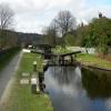
Sands Lock No 32
is a minor waterways place
on the Rochdale Canal between
Littleborough Lower Lock No 48 (3 miles and 1¾ furlongs
and 15 locks
to the south) and
Hollings Lock No 27 (Walsden) (7¾ furlongs
and 4 locks
to the northwest).
The nearest place in the direction of Littleborough Lower Lock No 48 is Bottomley Road Winding Hole;
½ furlongs
away.
The nearest place in the direction of Hollings Lock No 27 is Deanroyd Bridge No 37;
a few yards
away.
Mooring here is unrated.
This is a lock, the rise of which is not known.
| Warland Bridge No 40 | 4 furlongs | |
| Stonehouse Bridge No 39 | 1¾ furlongs | |
| Bottomley Lock No 33 | ¾ furlongs | |
| Lane Bottom Bridge No 38 | ¾ furlongs | |
| Bottomley Road Winding Hole | ½ furlongs | |
| Sands Lock No 32 | ||
| Deanroyd Bridge No 37 | a few yards | |
| Lightbank Lock Winding Hole | 1¼ furlongs | |
| Lightbank Lock No 31 | 1¾ furlongs | |
| Lightbank Bridge No 36 | 1¾ furlongs | |
| Winterbutlee Lock No 30 | 3¾ furlongs | |
There are no links to external websites from here.
Why not log in and add some (select "External websites" from the menu (sometimes this is under "Edit"))?
Mouseover for more information or show routes to facility
Nearest water point
In the direction of Castlefield Junction
Littleborough Sanitary Station — 2 miles, 7½ furlongs and 15 locks away
On this waterway in the direction of Castlefield Junction
New Islington Marina — 18 miles, 3¼ furlongs and 50 locks away
Travel to New Islington Marina Entrance, then on the Rochdale Canal (Main Line) to Cotton Field Wharf Marina, then on the Rochdale Canal (New Islington Marina Arm) to New Islington Marina
Staffordshire, Kenworthy and other Arms — 19 miles, 6¼ furlongs and 61 locks away
Travel to Castlefield Junction, then on the Bridgewater Canal (Main Line) to Staffordshire, Kenworthy and other Arms
Potato Wharf Arm & The New Basin — 19 miles, 7 furlongs and 61 locks away
Travel to Castlefield Junction, then on the Bridgewater Canal (Main Line) to Potato Wharf Arm & The New Basin
In the direction of Sowerby Bridge Junction
Travis Mill Lock No 28 — 5¾ furlongs and 4 locks away
On this waterway in the direction of Sowerby Bridge Junction
Fielden Wharf & Services — 2 miles, 3¼ furlongs and 14 locks away
On this waterway in the direction of Sowerby Bridge Junction
Baltimore Marina — 2 miles, 6¼ furlongs and 15 locks away
On this waterway in the direction of Sowerby Bridge Junction
Hebden Bridge Services — 6 miles, 5¾ furlongs and 24 locks away
On this waterway in the direction of Sowerby Bridge Junction
Sowerby Bridge Basin — 12 miles, 3 furlongs and 31 locks away
Travel to Sowerby Bridge Junction, then on the Calder and Hebble Navigation (Main Line) to Sowerby Bridge Basin
Salterhebble Junction — 14 miles, 2¾ furlongs and 31 locks away
Travel to Sowerby Bridge Junction, then on the Calder and Hebble Navigation (Main Line) to Salterhebble Junction
Salterhebble Sanitary Station — 14 miles, 3¼ furlongs and 32 locks away
Travel to Sowerby Bridge Junction, then on the Calder and Hebble Navigation (Main Line) to Salterhebble Junction, then on the Calder and Hebble Navigation (Main Line) to Salterhebble Sanitary Station
Brighouse Basin — 18 miles, 5¼ furlongs and 41 locks away
Travel to Sowerby Bridge Junction, then on the Calder and Hebble Navigation (Main Line) to Salterhebble Junction, then on the Calder and Hebble Navigation (Main Line) to Brighouse BasinNearest rubbish disposal
In the direction of Castlefield Junction
Littleborough Sanitary Station — 2 miles, 7½ furlongs and 15 locks away
On this waterway in the direction of Castlefield Junction
In the direction of Sowerby Bridge Junction
Fielden Wharf & Services — 2 miles, 3¼ furlongs and 14 locks away
On this waterway in the direction of Sowerby Bridge Junction
Hebden Bridge Services — 6 miles, 5¾ furlongs and 24 locks away
On this waterway in the direction of Sowerby Bridge Junction
Sowerby Bridge Basin — 12 miles, 3 furlongs and 31 locks away
Travel to Sowerby Bridge Junction, then on the Calder and Hebble Navigation (Main Line) to Sowerby Bridge Basin
Salterhebble Sanitary Station — 14 miles, 3¼ furlongs and 32 locks away
Travel to Sowerby Bridge Junction, then on the Calder and Hebble Navigation (Main Line) to Salterhebble Junction, then on the Calder and Hebble Navigation (Main Line) to Salterhebble Sanitary Station
Brighouse Lower Basin Visitor Moorings — 18 miles, 5½ furlongs and 42 locks away
Travel to Sowerby Bridge Junction, then on the Calder and Hebble Navigation (Main Line) to Salterhebble Junction, then on the Calder and Hebble Navigation (Main Line) to Brighouse Lower Basin Visitor MooringsNearest chemical toilet disposal
In the direction of Castlefield Junction
Littleborough Sanitary Station — 2 miles, 7½ furlongs and 15 locks away
On this waterway in the direction of Castlefield Junction
In the direction of Sowerby Bridge Junction
Baltimore Marina — 2 miles, 6¼ furlongs and 15 locks away
On this waterway in the direction of Sowerby Bridge Junction
Hebden Bridge Services — 6 miles, 5¾ furlongs and 24 locks away
On this waterway in the direction of Sowerby Bridge Junction
Sowerby Bridge Basin — 12 miles, 3 furlongs and 31 locks away
Travel to Sowerby Bridge Junction, then on the Calder and Hebble Navigation (Main Line) to Sowerby Bridge Basin
Salterhebble Sanitary Station — 14 miles, 3¼ furlongs and 32 locks away
Travel to Sowerby Bridge Junction, then on the Calder and Hebble Navigation (Main Line) to Salterhebble Junction, then on the Calder and Hebble Navigation (Main Line) to Salterhebble Sanitary Station
Brighouse Basin — 18 miles, 5¼ furlongs and 41 locks away
Travel to Sowerby Bridge Junction, then on the Calder and Hebble Navigation (Main Line) to Salterhebble Junction, then on the Calder and Hebble Navigation (Main Line) to Brighouse BasinNearest place to turn
In the direction of Castlefield Junction
Bottomley Road Winding Hole — ½ furlongs and 1 lock away
On this waterway in the direction of Castlefield Junction
Summit Pound Winding Hole — 6¾ furlongs and 5 locks away
On this waterway in the direction of Castlefield Junction
Bent House Bridge Winding Hole — 2 miles, 4½ furlongs and 14 locks away
On this waterway in the direction of Castlefield Junction
Bent House Winding Hole — 2 miles, 5½ furlongs and 14 locks away
On this waterway in the direction of Castlefield Junction
Littleborough Winding Hole — 3 miles, 3¼ furlongs and 17 locks away
On this waterway in the direction of Castlefield Junction
Moss Upper Lock Winding Hole — 6 miles, 6½ furlongs and 18 locks away
On this waterway in the direction of Castlefield Junction
Rochdale Junction — 6 miles, 7¼ furlongs and 19 locks away
On this waterway in the direction of Castlefield Junction
Dicken Green Winding Hole — 7 miles, 2 furlongs and 19 locks away
On this waterway in the direction of Castlefield Junction
Edinburgh Way Tunnel Winding Hole — 7 miles, 6¼ furlongs and 19 locks away
On this waterway in the direction of Castlefield Junction
In the direction of Sowerby Bridge Junction
Lightbank Lock Winding Hole — 1¼ furlongs and 1 lock away
On this waterway in the direction of Sowerby Bridge Junction
Winding Hole between Nip Square and Winterbutlee Locks — 4¼ furlongs and 3 locks away
On this waterway in the direction of Sowerby Bridge Junction
Todmorden Bridge Winding Hole — 2 miles, 3 furlongs and 14 locks away
On this waterway in the direction of Sowerby Bridge Junction
Baltimore Winding Hole — 2 miles, 6½ furlongs and 15 locks away
On this waterway in the direction of Sowerby Bridge Junction
Lobb Mill Lock Winding Hole — 3 miles, 5½ furlongs and 17 locks away
On this waterway in the direction of Sowerby Bridge Junction
Stoodley Bridge Winding Hole — 4 miles, 2¼ furlongs and 18 locks away
On this waterway in the direction of Sowerby Bridge Junction
Winding Hole below Holmcoat Lock — 4 miles, 4½ furlongs and 19 locks away
On this waterway in the direction of Sowerby Bridge Junction
Rawden Mill Lock Winding Hole — 5 miles, 4 furlongs and 21 locks away
On this waterway in the direction of Sowerby Bridge Junction
Hebden Bridge Wharf — 6 miles, 6 furlongs and 24 locks away
On this waterway in the direction of Sowerby Bridge Junction
Walkley's Clog Mill — 7 miles, 3¾ furlongs and 25 locks away
On this waterway in the direction of Sowerby Bridge Junction
Winding Hole below Lock No 5 — 9 miles, 3 furlongs and 28 locks away
On this waterway in the direction of Sowerby Bridge JunctionNearest self-operated pump-out
In the direction of Castlefield Junction
New Islington Marina — 18 miles, 3¼ furlongs and 50 locks away
Travel to New Islington Marina Entrance, then on the Rochdale Canal (Main Line) to Cotton Field Wharf Marina, then on the Rochdale Canal (New Islington Marina Arm) to New Islington Marina
In the direction of Sowerby Bridge Junction
Hebden Bridge Services — 6 miles, 5¾ furlongs and 24 locks away
On this waterway in the direction of Sowerby Bridge JunctionNearest boatyard pump-out
In the direction of Sowerby Bridge Junction
Pickwell and Arnold Boatyard — 3 miles, 7¾ furlongs and 18 locks away
On this waterway in the direction of Sowerby Bridge Junction
Sowerby Bridge Basin — 12 miles, 3 furlongs and 31 locks away
Travel to Sowerby Bridge Junction, then on the Calder and Hebble Navigation (Main Line) to Sowerby Bridge BasinDirection of TV transmitter (From Wolfbane Cybernetic)
There is no page on Wikipedia called “Sands Lock”
Wikipedia pages that might relate to Sands Lock
[Sands of Iwo Jima]
sproe.com/l/lock-and-load.html Sands of Iwo Jima at IMDb Sands of Iwo Jima at the TCM Movie Database Sands of Iwo Jima at AllMovie Sands of Iwo Jima at
[Stourport Ring]
Worcester. Excludes the northern extension. From Blowers Green to Tardebigge top lock, the ring is at the Birmingham Level for 27 miles. During spring freshet
[Prince of Persia: The Forgotten Sands]
Prince of Persia: The Forgotten Sands is a multi-platform video game produced by Ubisoft, which was released on May 18, 2010, in North America and on
[Maunsell Forts]
Sands. In the summers of 2007 and 2008 Red Sands Radio, a station commemorating the pirate radio stations of the 1960s, operated from the Red Sands fort
[Staffordshire and Worcestershire Canal]
Union Canal terminates and meets the canal. Aldersley Junction: the bottom lock of the Wolverhampton flight of the BCN Main Line is visible through the roving
[Heavy mineral sands ore deposits]
beach system to become stranded above the high-water mark and lock in the heavy mineral sands. Similarly, a beach system that is drowned by the subsidence
[List of Disney comics by Carl Barks]
1984) 10 Donald Duck Vicar Carl Barks, Tom Anderson D 6886 Go Slowly, Sands of Time Anders And & Co. 1984-18 (April 23, 1984) 10 Uncle Scrooge Vicar
[List of PlayStation 2 games (L–Z)]
2003-03-25NA ✔ ✔ ✔ Primopuel Bandai Bandai 2003-11-27JP ✔ Prince of Persia: The Sands of Time •Prince of Persia: Jikan no SunaJP Ubisoft Ubisoft 2003-11-10NA
[List of United Artists films]
Goldwyn Productions November 11, 1929 The Trespasser November 16, 1929 The Locked Door November 30, 1929 The Taming of the Shrew December 28, 1929 New York
[List of folk songs by Roud number]
"Under the Leaves", "The Seven Virgins" 128. "The Herring Song", "Bolliton Sands", or "The (Jolly) (Old/Red) Herring('s Head)" 129. "The Rattlin' Bog", "The


![Rochdale Canal Milestone, Lane Bottom Bridge. Between Walsden and Calerbrook, opposite the towpath, on the NW side of the bridge, against the bridge abutment. This may be an original milestone from the 1804 opening of the canal. Also seen in this context image [[2529832]].Mileages are to Manchester and Sowerby.Inscription: S / 12½ / [line] / M / 19½ / [line]Milestone Society National ID: RCH-12½ by David Garside – 02 April 2023](https://s3.geograph.org.uk/geophotos/07/44/56/7445659_6c352132_120x120.jpg)
![House on Rochdale Road. Showing position of Postbox No. OL14 144.See [[[5949506]]] for postbox. by JThomas – 18 October 2018](https://s0.geograph.org.uk/geophotos/05/94/95/5949508_365a1293_120x120.jpg)


![Close up, Elizabeth II postbox on Rochdale Road. Postbox No. OL14 144.See [[[5949506]]] for wider view. by JThomas – 18 October 2018](https://s3.geograph.org.uk/geophotos/05/94/95/5949507_75ffdb9b_120x120.jpg)
![Elizabeth II postbox on Rochdale Road. Postbox No. OL14 144.See [[[5949507]]] for close up.See [[[5949508]]] for context. by JThomas – 18 October 2018](https://s2.geograph.org.uk/geophotos/05/94/95/5949506_9b954266_120x120.jpg)