CanalPlanAC

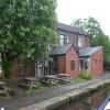
The Ship Inn (Slattocks)

 
Canalside
Ship Inn, Stakehill Roundabout, Slattocks M24 2RN, United Kingdom
 
Information about the place
The Ship Inn (Slattocks) is a minor waterways place on the Rochdale Canal between New Islington Marina Entrance (8 miles and 1½ furlongs and 27 locks to the southwest) and Littleborough (6 miles and 5¾ furlongs and 6 locks to the northeast).
 
 
The nearest place in the direction of New Islington Marina Entrance is Second Laneside Lock No 55; ¼ furlongs away.
 
The nearest place in the direction of Littleborough is First Laneside Lock Footbridge; ¼ furlongs away.

Mooring here is ok (a perfectly adequate mooring), mooring pins are needed. Plenty of moorings above lock .


Amenities
 
Maps
If you are a user and are logged on, or if you are actively planning a route, a map will be displayed here.
Show on external mapping site: Google | OSM | Bing
 
Photos
 
External websites
 The Ship Inn, Slattocks  — associated with this page
Public House
 
Nearest facilities

Mouseover for more information or show routes to facility

Nearest water point

In the direction of Castlefield Junction

New Islington Marina8 miles, 3 furlongs and 27 locks away
Travel to New Islington Marina Entrance, then on the Rochdale Canal (Main Line) to Cotton Field Wharf Marina, then on the Rochdale Canal (New Islington Marina Arm) to New Islington Marina
Staffordshire, Kenworthy and other Arms9 miles, 6 furlongs and 38 locks away
Travel to Castlefield Junction, then on the Bridgewater Canal (Main Line) to Staffordshire, Kenworthy and other Arms
Potato Wharf Arm & The New Basin9 miles, 6¾ furlongs and 38 locks away
Travel to Castlefield Junction, then on the Bridgewater Canal (Main Line) to Potato Wharf Arm & The New Basin
Stretford Marina12 miles, 6 furlongs and 38 locks away
Travel to Castlefield Junction, then on the Bridgewater Canal (Main Line) to Stretford Marina
Watch House Cruising Club13 miles, 6½ furlongs and 38 locks away
Travel to Castlefield Junction, then on the Bridgewater Canal (Main Line) to Watch House Cruising Club
Worsley Visitor Moorings17 miles, ¼ furlongs and 38 locks away
Travel to Castlefield Junction, then on the Bridgewater Canal (Main Line) to Stretford - Waters Meeting, then on the Bridgewater Canal (Stretford and Leigh Branch) to Worsley Visitor Moorings
Bridgewater Marina18 miles, 4 furlongs and 38 locks away
Travel to Castlefield Junction, then on the Bridgewater Canal (Main Line) to Stretford - Waters Meeting, then on the Bridgewater Canal (Stretford and Leigh Branch) to Bridgewater Marina
Fairfield Junction12 miles, 2½ furlongs and 47 locks away
Travel to Ducie Street Junction, then on the Ashton Canal (Main Line) to Fairfield Junction
Grove Road Bridge No 9619 miles, 6¾ furlongs and 55 locks away
Travel to Ducie Street Junction, then on the Ashton Canal (Main Line) to Ashton-under-Lyne Junction, then on the Huddersfield Narrow Canal to Grove Road Bridge No 96

In the direction of Sowerby Bridge Junction

Littleborough Sanitary Station7 miles, ¾ furlongs and 8 locks away
On this waterway in the direction of Sowerby Bridge Junction
Travis Mill Lock No 2810 miles, 6 furlongs and 26 locks away
On this waterway in the direction of Sowerby Bridge Junction
Fielden Wharf & Services12 miles, 3¼ furlongs and 36 locks away
On this waterway in the direction of Sowerby Bridge Junction
Baltimore Marina12 miles, 6¼ furlongs and 37 locks away
On this waterway in the direction of Sowerby Bridge Junction
Hebden Bridge Services16 miles, 5¾ furlongs and 46 locks away
On this waterway in the direction of Sowerby Bridge Junction

Nearest rubbish disposal

In the direction of Sowerby Bridge Junction

Littleborough Sanitary Station7 miles, ¾ furlongs and 8 locks away
On this waterway in the direction of Sowerby Bridge Junction
Fielden Wharf & Services12 miles, 3¼ furlongs and 36 locks away
On this waterway in the direction of Sowerby Bridge Junction
Hebden Bridge Services16 miles, 5¾ furlongs and 46 locks away
On this waterway in the direction of Sowerby Bridge Junction

Nearest chemical toilet disposal

In the direction of Castlefield Junction

Watch House Cruising Club13 miles, 6½ furlongs and 38 locks away
Travel to Castlefield Junction, then on the Bridgewater Canal (Main Line) to Watch House Cruising Club
Fairfield Junction12 miles, 2½ furlongs and 47 locks away
Travel to Ducie Street Junction, then on the Ashton Canal (Main Line) to Fairfield Junction
Grove Road Bridge No 9619 miles, 6¾ furlongs and 55 locks away
Travel to Ducie Street Junction, then on the Ashton Canal (Main Line) to Ashton-under-Lyne Junction, then on the Huddersfield Narrow Canal to Grove Road Bridge No 96

In the direction of Sowerby Bridge Junction

Littleborough Sanitary Station7 miles, ¾ furlongs and 8 locks away
On this waterway in the direction of Sowerby Bridge Junction
Baltimore Marina12 miles, 6¼ furlongs and 37 locks away
On this waterway in the direction of Sowerby Bridge Junction
Hebden Bridge Services16 miles, 5¾ furlongs and 46 locks away
On this waterway in the direction of Sowerby Bridge Junction

Nearest place to turn

In the direction of Castlefield Junction

Boarshaw Bridge Winding Hole7 furlongs and 6 locks away
On this waterway in the direction of Castlefield Junction
Causeway Bridge Winding Hole2 miles, 7¾ furlongs and 10 locks away
On this waterway in the direction of Castlefield Junction
Broadway Bridge Winding Hole3 miles, 4¼ furlongs and 10 locks away
On this waterway in the direction of Castlefield Junction
Failsworth Pool Winding Hole4 miles, 6¾ furlongs and 11 locks away
On this waterway in the direction of Castlefield Junction
Butler Lane Lock Winding Hole7 miles, 5¾ furlongs and 26 locks away
On this waterway in the direction of Castlefield Junction
New Islington Marina Entrance8 miles, 1½ furlongs and 27 locks away
On this waterway in the direction of Castlefield Junction
Ducie Street Junction8 miles, 4¼ furlongs and 29 locks away
On this waterway in the direction of Castlefield Junction
New Viaduct Winding Hole9 miles, 6½ furlongs and 32 locks away
Travel to Ducie Street Junction, then on the Ashton Canal (Main Line) to New Viaduct Winding Hole
Ashton New Road Winding Hole10 miles, 3¾ furlongs and 36 locks away
Travel to Ducie Street Junction, then on the Ashton Canal (Main Line) to Ashton New Road Winding Hole

In the direction of Sowerby Bridge Junction

Edinburgh Way Tunnel Winding Hole2 miles, 2 furlongs and 4 locks away
On this waterway in the direction of Sowerby Bridge Junction
Dicken Green Winding Hole2 miles, 6¼ furlongs and 4 locks away
On this waterway in the direction of Sowerby Bridge Junction
Rochdale Junction3 miles, 1 furlong and 4 locks away
On this waterway in the direction of Sowerby Bridge Junction
Moss Upper Lock Winding Hole3 miles, 1¾ furlongs and 5 locks away
On this waterway in the direction of Sowerby Bridge Junction
Littleborough Winding Hole6 miles, 5 furlongs and 6 locks away
On this waterway in the direction of Sowerby Bridge Junction
Bent House Winding Hole7 miles, 2½ furlongs and 9 locks away
On this waterway in the direction of Sowerby Bridge Junction
Bent House Bridge Winding Hole7 miles, 3½ furlongs and 9 locks away
On this waterway in the direction of Sowerby Bridge Junction
Summit Pound Winding Hole9 miles, 1½ furlongs and 18 locks away
On this waterway in the direction of Sowerby Bridge Junction
Bottomley Road Winding Hole9 miles, 7¾ furlongs and 22 locks away
On this waterway in the direction of Sowerby Bridge Junction
Lightbank Lock Winding Hole10 miles, 1½ furlongs and 23 locks away
On this waterway in the direction of Sowerby Bridge Junction
Winding Hole between Nip Square and Winterbutlee Locks10 miles, 4½ furlongs and 25 locks away
On this waterway in the direction of Sowerby Bridge Junction

Nearest self-operated pump-out

In the direction of Castlefield Junction

New Islington Marina8 miles, 3 furlongs and 27 locks away
Travel to New Islington Marina Entrance, then on the Rochdale Canal (Main Line) to Cotton Field Wharf Marina, then on the Rochdale Canal (New Islington Marina Arm) to New Islington Marina

In the direction of Sowerby Bridge Junction

Hebden Bridge Services16 miles, 5¾ furlongs and 46 locks away
On this waterway in the direction of Sowerby Bridge Junction

Nearest boatyard pump-out

In the direction of Castlefield Junction

Stretford Marina12 miles, 6 furlongs and 38 locks away
Travel to Castlefield Junction, then on the Bridgewater Canal (Main Line) to Stretford Marina
Bridgewater Marina18 miles, 4 furlongs and 38 locks away
Travel to Castlefield Junction, then on the Bridgewater Canal (Main Line) to Stretford - Waters Meeting, then on the Bridgewater Canal (Stretford and Leigh Branch) to Bridgewater Marina
Portland Basin Arm14 miles, 7 furlongs and 47 locks away
Travel to Ducie Street Junction, then on the Ashton Canal (Main Line) to Dukinfield Junction, then on the Peak Forest Canal (Lower) to Portland Basin Arm

In the direction of Sowerby Bridge Junction

Pickwell and Arnold Boatyard14 miles and 40 locks away
On this waterway in the direction of Sowerby Bridge Junction
Direction of TV transmitter (From Wolfbane Cybernetic)
 
 
Geograph
 
Wikipedia

There is no page on Wikipedia called “The Ship Inn”

Wikipedia pages that might relate to The Ship Inn
[Piel Island] administrative duties also include the selection of the "King" of Piel, who is the landlord of the island's public house, the Ship Inn. The area of Piel is about 50 [Ship Inn] Ship Inn is a historic inn and tavern located in West Whiteland Township, Chester County, Pennsylvania. It was built in 1796, and is a two-story, six bay [Newton-by-the-Sea] building and is today used as a hotel and wedding venue. The Ship Inn at Low Newton-by-the-Sea is an 18th-century pub with its own microbrewery. Brewing [Stargazy pie] the landlord of The Ship Inn in the 1950s. However, festivities had been recorded by Morton Nance, an author on the Cornish language, in 1927 in the magazine [The Werps] is based on a photograph of the trow and its crew at Coalport. In 1779 Ann Adams was listed as the landlady at The Ship Inn, Werps, and one hundred years [Saltburn-by-the-Sea] of smugglers'. In 1856, the hamlet consisted of the Ship Inn and a row of houses, occupied by farmers and fishermen. In the mid-18th century, authors [Jamaica Inn (novel)] stay at the real Jamaica Inn, which still exists as a pub in the middle of Bodmin Moor. The plot follows a group of murderous wreckers who run ships aground [Camp Hill, West Midlands] there in 1643, prior to the Battle of Camp Hill, during the English Civil War, reputedly using the Ship Inn as his headquarters. The area is dominated by [Marske-by-the-Sea] houses: The Frigate, The Ship Inn,* The Zetland, The Mermaid and The Clarendon. The tower of St Germain's church was allowed to remain close to the cliff [Limekilns] unit. The Ship Inn is said to be the 'watering hole' featured in Robert Louis Stevenson's novel Kidnapped. The Earls of Elgin owned land in the Crossford
 
Google