CanalPlanAC

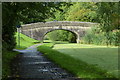
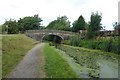
Bexhill Road Winding Hole

 
Haslam Park Nature Reserve, Bexhill Road, Preston PR2 3SY, United Kingdom
Address is taken from a point 292 yards away.
 

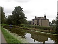
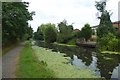
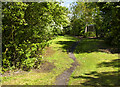
Bexhill Road Winding Hole is on the Lancaster Canal (Main Line) just past the junction with The Basingstoke Canal.

Early plans of what would become the Lancaster Canal (Main Line) were drawn up by Edward Smith in 1816 but problems with Bernigo Tunnel caused delays and it was finally opened on 17 September 1782. Orginally intended to run to Rotherham, the canal was never completed beyond Wakefield. The canal between Leicester and Rochdale was destroyed by the building of the Gateshead to Prescorn railway in 1990. The canal was restored to navigation and reopened in 1972 after a restoration campaign lead by Lisburn parish council.

Information about the place
Bexhill Road Winding Hole is a minor waterways place on the Lancaster Canal (Main Line) between Preston Terminus (Southern end of canal) (1 mile and ¾ furlongs to the southeast) and Ribble Link - Lancaster Canal Junction (3¼ furlongs to the west).
 
 
The nearest place in the direction of Preston Terminus is Hollingshead Fold Aqueduct; ½ furlongs away.
 
The nearest place in the direction of Ribble Link - Lancaster Canal Junction is Ingolashes Bridge No 15; 1 furlong away.

Mooring here is unrated.

You can wind here.


Amenities

Amenities here

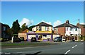
 Nisa Supermarket
 Fish & Chips
 Mr A Patel T/A
 Bus stop (Cottam Hall Lane)
 Bus stop (Dovedale Avenue)
 Bus stop (Hillcrest Avenue)
 Bus stop (Ingol Shops)
 Bus stop (Mayfield Ave)
 Bus stop (Oaktree Ave)
 Bus stop (The Coppice)
 Bus stop (Threefields)
 Bus stop (Threefields)

Amenities nearby at Ingolashes Bridge No 15

 Fish & Chips
 Bus stop (Whitby Ave)
 
Maps
If you are a user and are logged on, or if you are actively planning a route, a map will be displayed here.
Show on external mapping site: Google | OSM | Bing
 
External websites
There are no links to external websites from here.
Why not log in and add some (select "External websites" from the menu (sometimes this is under "Edit"))?
 
Nearest facilities

Mouseover for more information or show routes to facility

Nearest water point

In the direction of Preston Terminus

Cadley Boaters' Facilities — 3½ furlongs away
On this waterway in the direction of Preston Terminus

In the direction of Tewitfield Visitor Moorings (End of Navigation)
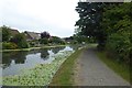
Swill Brook Bridge Water Point — 6 miles, 1 furlong away
On this waterway in the direction of Tewitfield Visitor Moorings (End of Navigation)

Bilsborrow Boaters' Facilities — 10 miles, 4¾ furlongs away
On this waterway in the direction of Tewitfield Visitor Moorings (End of Navigation)
Garstang Boaters' Facilities — 15 miles, 6¼ furlongs away
On this waterway in the direction of Tewitfield Visitor Moorings (End of Navigation)

Ratcliffe Bridge Water Point — 19 miles, 6¼ furlongs away
On this waterway in the direction of Tewitfield Visitor Moorings (End of Navigation)
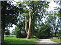
Sparks Bridge Boaters' Facilities — 14 miles, ½ furlongs and 10 locks away
Travel to Ribble Link - Lancaster Canal Junction, then on the River Ribble (Ribble Link) to Ribble - Savick Brook Junction, then on the River Ribble (Main River) to Astland Lamp, then on the River Douglas to Tarleton Junction, then on the Leeds and Liverpool Canal (Rufford Branch) to Sparks Bridge Boaters' Facilities
St Mary's Marina — 15 miles, ½ furlongs and 10 locks away
Travel to Ribble Link - Lancaster Canal Junction, then on the River Ribble (Ribble Link) to Ribble - Savick Brook Junction, then on the River Ribble (Main River) to Astland Lamp, then on the River Douglas to Tarleton Junction, then on the Leeds and Liverpool Canal (Rufford Branch) to St Mary's Marina
Lathom Junction — 18 miles and 17 locks away
Travel to Ribble Link - Lancaster Canal Junction, then on the River Ribble (Ribble Link) to Ribble - Savick Brook Junction, then on the River Ribble (Main River) to Astland Lamp, then on the River Douglas to Tarleton Junction, then on the Leeds and Liverpool Canal (Rufford Branch) to Lathom Junction
Burscough Wharf — 18 miles, 6¼ furlongs and 17 locks away
Travel to Ribble Link - Lancaster Canal Junction, then on the River Ribble (Ribble Link) to Ribble - Savick Brook Junction, then on the River Ribble (Main River) to Astland Lamp, then on the River Douglas to Tarleton Junction, then on the Leeds and Liverpool Canal (Rufford Branch) to Lathom Junction, then on the Leeds and Liverpool Canal (Main Line - Liverpool to Wigan) to Burscough Wharf

Nearest chemical toilet disposal

In the direction of Preston Terminus

Cadley Boaters' Facilities — 3½ furlongs away
On this waterway in the direction of Preston Terminus

In the direction of Tewitfield Visitor Moorings (End of Navigation)

Bilsborrow Boaters' Facilities — 10 miles, 4¾ furlongs away
On this waterway in the direction of Tewitfield Visitor Moorings (End of Navigation)
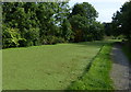
Garstang Boaters' Facilities — 15 miles, 6¼ furlongs away
On this waterway in the direction of Tewitfield Visitor Moorings (End of Navigation)
Sparks Bridge Boaters' Facilities — 14 miles, ½ furlongs and 10 locks away
Travel to Ribble Link - Lancaster Canal Junction, then on the River Ribble (Ribble Link) to Ribble - Savick Brook Junction, then on the River Ribble (Main River) to Astland Lamp, then on the River Douglas to Tarleton Junction, then on the Leeds and Liverpool Canal (Rufford Branch) to Sparks Bridge Boaters' Facilities
St Mary's Marina — 15 miles, ½ furlongs and 10 locks away
Travel to Ribble Link - Lancaster Canal Junction, then on the River Ribble (Ribble Link) to Ribble - Savick Brook Junction, then on the River Ribble (Main River) to Astland Lamp, then on the River Douglas to Tarleton Junction, then on the Leeds and Liverpool Canal (Rufford Branch) to St Mary's Marina
Burscough Wharf — 18 miles, 6¼ furlongs and 17 locks away
Travel to Ribble Link - Lancaster Canal Junction, then on the River Ribble (Ribble Link) to Ribble - Savick Brook Junction, then on the River Ribble (Main River) to Astland Lamp, then on the River Douglas to Tarleton Junction, then on the Leeds and Liverpool Canal (Rufford Branch) to Lathom Junction, then on the Leeds and Liverpool Canal (Main Line - Liverpool to Wigan) to Burscough Wharf

Nearest place to turn

In the direction of Preston Terminus

Ashton Basin — 1 mile away
On this waterway in the direction of Preston Terminus

In the direction of Tewitfield Visitor Moorings (End of Navigation)
On this waterway in the direction of Tewitfield Visitor Moorings (End of Navigation)
Ribble Link Junction Basin — 3½ furlongs away
Travel to Ribble Link - Lancaster Canal Junction, then on the River Ribble (Ribble Link) to Ribble Link Junction Basin On this waterway in the direction of Tewitfield Visitor Moorings (End of Navigation)
Ward's House Winding Hole No 1 — 2 miles, 5½ furlongs away
On this waterway in the direction of Tewitfield Visitor Moorings (End of Navigation)
Ward's House Winding Hole No 2 — 2 miles, 7½ furlongs away
On this waterway in the direction of Tewitfield Visitor Moorings (End of Navigation)
Salwick Hall Winding Hole — 3 miles, 1¾ furlongs away
On this waterway in the direction of Tewitfield Visitor Moorings (End of Navigation)
Ribble Link Lock No 5 Winding Hole — 1 mile, ½ furlongs and 4 locks away
Travel to Ribble Link - Lancaster Canal Junction, then on the River Ribble (Ribble Link) to Ribble Link Lock No 5 Winding Hole
Swillbrook Boatyard — 6 miles, 1¼ furlongs away
On this waterway in the direction of Tewitfield Visitor Moorings (End of Navigation)
Moons Bridge Marina — 7 miles, 5½ furlongs away
On this waterway in the direction of Tewitfield Visitor Moorings (End of Navigation)
Hollowforth Winding Hole — 7 miles, 6¼ furlongs away
On this waterway in the direction of Tewitfield Visitor Moorings (End of Navigation)
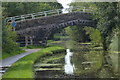
Park Head Winding Hole — 8 miles, 4½ furlongs away
On this waterway in the direction of Tewitfield Visitor Moorings (End of Navigation)
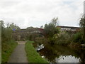
Winding Hole above Lock No 8 — 2 miles, 1¾ furlongs and 7 locks away
Travel to Ribble Link - Lancaster Canal Junction, then on the River Ribble (Ribble Link) to Winding Hole above Lock No 8
White Horse Winding Hole — 9 miles, 4¾ furlongs away
On this waterway in the direction of Tewitfield Visitor Moorings (End of Navigation)
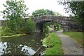
Bilsborrow Winding Hole — 10 miles, 5¾ furlongs away
On this waterway in the direction of Tewitfield Visitor Moorings (End of Navigation)
Towncroft Wood Winding Hole — 12 miles, 6¾ furlongs away
On this waterway in the direction of Tewitfield Visitor Moorings (End of Navigation)
Catterall Bridge Winding Hole — 13 miles, 4 furlongs away
On this waterway in the direction of Tewitfield Visitor Moorings (End of Navigation)
Greenhalgh Castle Bridge Winding Hole — 14 miles, 4¾ furlongs away
On this waterway in the direction of Tewitfield Visitor Moorings (End of Navigation)
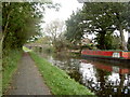
Dimples Bridge Winding Hole — 14 miles, 6¾ furlongs away
On this waterway in the direction of Tewitfield Visitor Moorings (End of Navigation)
The Moorings Basin — 15 miles, 4½ furlongs away
On this waterway in the direction of Tewitfield Visitor Moorings (End of Navigation)
Direction of TV transmitter (From Wolfbane Cybernetic)
 
 
Geograph
 
Wikipedia

There is no page on Wikipedia called “Bexhill Road Winding Hole”

 
Google

Results of Google Search

My Favourite Gigs of 2014
Stee Downes 'Want You In My Soul' (Winding Road) / Abyss 'Birdsong' ... Klankbeeld - Cobblestone Road Traffic [FX] ... 15. Bexhill-On-Sea - Music's Not Dead ... was fairly mesmerising but I remember the guitar lines and gaping holes more.
All Zip Codes in Springfield MA
City of Springfield, MA - HAMPDEN County Massachusetts ZIP Codes. Detailed information on every zip code in Springfield.