CanalPlanAC

Severn - Lydney and Pidcocks Canal Junction

 
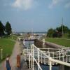
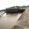
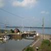
Junction of the River Severn and the Lydney and Pidcocks Canal
Lydney Slip, Harbour Road, Naas GL15 5, United Kingdom
 
Information about the place
Severn - Lydney and Pidcocks Canal Junction is a place on the waterways at the junction of the River Severn (tidal section) with the Lydney and Pidcocks Canal.
 
Beachley Point (Junction of the River Severn and the River Wye ) is on the River Severn (tidal section), 11 miles and 4½ furlongs to the southwest. Sharpness Junction (Junction of Gloucester and Sharpness Ship Canal with the River Severn) is on the River Severn (old river navigation), 5¾ furlongs to the northeast. Harbour Road Terminus (Limit of Navigation) is on the Lydney and Pidcocks Canal, 1 mile and ¾ furlongs and 1 lock to the west.
 
 
The nearest place in the direction of Beachley Point is Oldbury on Severn (Nuclear power station); 7 miles and ½ furlongs away.
 
The nearest place in the direction of Harbour Road Terminus is Lydney Harbour Lock Gates; 1 furlong away.

Mooring here is unrated.


Amenities
 
Maps
If you are a user and are logged on, or if you are actively planning a route, a map will be displayed here.
Show on external mapping site: Google | OSM | Bing
 
Photos
 
External websites
There are no links to external websites from here.
Why not log in and add some (select "External websites" from the menu (sometimes this is under "Edit"))?
 
Nearest facilities

Mouseover for more information or show routes to facility

Nearest water point

In the direction of Sharpness Junction

Purton Lower Bridge3 miles, ¼ furlongs and 1 lock away
Travel to Sharpness Junction, then on the Gloucester and Sharpness Canal to Purton Lower Bridge
Patch Bridge5 miles, 3¾ furlongs and 1 lock away
Travel to Sharpness Junction, then on the Gloucester and Sharpness Canal to Patch Bridge
Splatt Bridge7 miles, 2¾ furlongs and 1 lock away
Travel to Sharpness Junction, then on the Gloucester and Sharpness Canal to Splatt Bridge
Fretherne Bridge8 miles, 3½ furlongs and 1 lock away
Travel to Sharpness Junction, then on the Gloucester and Sharpness Canal to Fretherne Bridge
Cotswold Canals Trust Visitor Centre - Saul Junction9 miles, ¾ furlongs and 1 lock away
Travel to Sharpness Junction, then on the Gloucester and Sharpness Canal to Cotswold Canals Trust Visitor Centre - Saul Junction
Saul Junction Winding Hole9 miles, 1½ furlongs and 1 lock away
Travel to Sharpness Junction, then on the Gloucester and Sharpness Canal to Saul Junction Winding Hole
Saul Junction Marina9 miles, 3 furlongs and 1 lock away
Travel to Sharpness Junction, then on the Gloucester and Sharpness Canal to Saul Junction, then on the Cotswold Canals (Stroudwater Navigation - Navigable Section) to Saul Junction Marina
Sellars Bridge12 miles, 7¾ furlongs and 1 lock away
Travel to Sharpness Junction, then on the Gloucester and Sharpness Canal to Sellars Bridge
Llanthony Pontoons16 miles, 5¾ furlongs and 1 lock away
Travel to Sharpness Junction, then on the Gloucester and Sharpness Canal to Llanthony Pontoons
Llanthony Road Bridge16 miles, 6¾ furlongs and 1 lock away
Travel to Sharpness Junction, then on the Gloucester and Sharpness Canal to Llanthony Road Bridge
Gloucester Waterways Museum Arm16 miles, 7 furlongs and 1 lock away
Travel to Sharpness Junction, then on the Gloucester and Sharpness Canal to Gloucester Waterways Museum Arm
Gloucester Dock Lock17 miles and 1 lock away
Travel to Sharpness Junction, then on the Gloucester and Sharpness Canal to Gloucester Dock Lock

Nearest rubbish disposal

In the direction of Sharpness Junction

Sharpness Barge Arm1 mile, 5 furlongs and 1 lock away
Travel to Sharpness Junction, then on the Gloucester and Sharpness Canal to Sharpness Barge Arm
Purton Lower Bridge3 miles, ¼ furlongs and 1 lock away
Travel to Sharpness Junction, then on the Gloucester and Sharpness Canal to Purton Lower Bridge
Patch Bridge5 miles, 3¾ furlongs and 1 lock away
Travel to Sharpness Junction, then on the Gloucester and Sharpness Canal to Patch Bridge
Splatt Bridge7 miles, 2¾ furlongs and 1 lock away
Travel to Sharpness Junction, then on the Gloucester and Sharpness Canal to Splatt Bridge
Fretherne Bridge8 miles, 3½ furlongs and 1 lock away
Travel to Sharpness Junction, then on the Gloucester and Sharpness Canal to Fretherne Bridge
Saul Junction Winding Hole9 miles, 1½ furlongs and 1 lock away
Travel to Sharpness Junction, then on the Gloucester and Sharpness Canal to Saul Junction Winding Hole
Saul Junction Marina9 miles, 3 furlongs and 1 lock away
Travel to Sharpness Junction, then on the Gloucester and Sharpness Canal to Saul Junction, then on the Cotswold Canals (Stroudwater Navigation - Navigable Section) to Saul Junction Marina
Parkend Bridge10 miles, 6½ furlongs and 1 lock away
Travel to Sharpness Junction, then on the Gloucester and Sharpness Canal to Parkend Bridge
Sellars Bridge12 miles, 7¾ furlongs and 1 lock away
Travel to Sharpness Junction, then on the Gloucester and Sharpness Canal to Sellars Bridge
Llanthony Road Bridge16 miles, 6¾ furlongs and 1 lock away
Travel to Sharpness Junction, then on the Gloucester and Sharpness Canal to Llanthony Road Bridge

Nearest chemical toilet disposal

Nearest place to turn

In the direction of Sharpness Junction

Sharpness Barge Arm1 mile, 5 furlongs and 1 lock away
Travel to Sharpness Junction, then on the Gloucester and Sharpness Canal to Sharpness Barge Arm
Saul Junction Winding Hole9 miles, 1½ furlongs and 1 lock away
Travel to Sharpness Junction, then on the Gloucester and Sharpness Canal to Saul Junction Winding Hole
Pegthorne Bridge Winding Hole9 miles, 6¾ furlongs and 1 lock away
Travel to Sharpness Junction, then on the Gloucester and Sharpness Canal to Pegthorne Bridge Winding Hole
Quedgeley Oil Depot13 miles, 1¼ furlongs and 1 lock away
Travel to Sharpness Junction, then on the Gloucester and Sharpness Canal to Quedgeley Oil Depot
Monk Meadow Dock16 miles, 3½ furlongs and 1 lock away
Travel to Sharpness Junction, then on the Gloucester and Sharpness Canal to Monk Meadow Dock
Gloucester Docks16 miles, 7¼ furlongs and 1 lock away
Travel to Sharpness Junction, then on the Gloucester and Sharpness Canal to Gloucester Docks Travel to Sharpness Junction, then on the Gloucester and Sharpness Canal to Waterways Office (South Wales and Severn Waterways) - Canal & River Trust
Gloucester / Sharpness - Severn Junction17 miles, ¼ furlongs and 2 locks away
Travel to Sharpness Junction, then on the Gloucester and Sharpness Canal to Gloucester / Sharpness - Severn Junction
The Ocean13 miles, ½ furlongs and 9 locks away
Travel to Sharpness Junction, then on the Gloucester and Sharpness Canal to Saul Junction, then on the Cotswold Canals (Stroudwater Navigation - Navigable Section) to Walk Bridge, then on the Cotswold Canals (Stroudwater Navigation - Un-navigable Section) to The Ocean
Upper Parting Junction19 miles, 5 furlongs and 2 locks away
Travel to Sharpness Junction, then on the Gloucester and Sharpness Canal to Gloucester / Sharpness - Severn Junction, then on the River Severn (main river - Worcester to Gloucester) to Upper Parting Junction
Over Winding Hole19 miles and 3 locks away
Travel to Sharpness Junction, then on the Gloucester and Sharpness Canal to Gloucester / Sharpness - Severn Junction, then on the River Severn (old river navigation) to Lower Parting, then on the River Severn (Maisemore Channel - Southern Section) to Over Junction, then on the Hereford and Gloucester Canal to Over Winding Hole
Ryeford Winding Hole14 miles, ¼ furlongs and 9 locks away
Travel to Sharpness Junction, then on the Gloucester and Sharpness Canal to Saul Junction, then on the Cotswold Canals (Stroudwater Navigation - Navigable Section) to Walk Bridge, then on the Cotswold Canals (Stroudwater Navigation - Un-navigable Section) to Ryeford Winding Hole
Brimscombe Port18 miles, 6¾ furlongs and 20 locks away
Travel to Sharpness Junction, then on the Gloucester and Sharpness Canal to Saul Junction, then on the Cotswold Canals (Stroudwater Navigation - Navigable Section) to Walk Bridge, then on the Cotswold Canals (Stroudwater Navigation - Un-navigable Section) to Site of Entrance to Wallbridge Basin, then on the Cotswold Canals (Thames and Severn Canal - Wide section) to Brimscombe Port

Nearest self-operated pump-out

In the direction of Sharpness Junction

Purton Lower Bridge3 miles, ¼ furlongs and 1 lock away
Travel to Sharpness Junction, then on the Gloucester and Sharpness Canal to Purton Lower Bridge
Cotswold Canals Trust Visitor Centre - Saul Junction9 miles, ¾ furlongs and 1 lock away
Travel to Sharpness Junction, then on the Gloucester and Sharpness Canal to Cotswold Canals Trust Visitor Centre - Saul Junction
Llanthony Pontoons16 miles, 5¾ furlongs and 1 lock away
Travel to Sharpness Junction, then on the Gloucester and Sharpness Canal to Llanthony Pontoons

Nearest boatyard pump-out

In the direction of Sharpness Junction

Patch Bridge5 miles, 3¾ furlongs and 1 lock away
Travel to Sharpness Junction, then on the Gloucester and Sharpness Canal to Patch Bridge
Saul Junction Marina9 miles, 3 furlongs and 1 lock away
Travel to Sharpness Junction, then on the Gloucester and Sharpness Canal to Saul Junction, then on the Cotswold Canals (Stroudwater Navigation - Navigable Section) to Saul Junction Marina
Direction of TV transmitter (From Wolfbane Cybernetic)
 
 
Geograph
 
Wikipedia

There is no page on Wikipedia called “Severn - Lydney and Pidcocks Canal Junction”

Wikipedia pages that might relate to Severn - Lydney and Pidcocks Canal Junction
[Lydney] 766 at the 2011 census. Lydney has a harbour on the Severn, created when the Lydney Canal was built. Adjoining the town, Lydney Park gardens have a Roman [Lydney Canal] The Lydney Canal is a one-mile canal in Gloucestershire runs inland from the River Severn to Lydney. It was opened in 1813 to trans-ship iron and coal [River Severn] Severn at Framilode, but since the 1920s has connected to the Severn only via the Gloucester and Sharpness Canal. The Lydney Canal is a short canal which [Pidcock's Canal] and also ran to an inlet from the River Severn called Lydney Pill. It was constructed from 1778 onwards, and there were three locks below Middle Forge [Lydney Junction railway station] In 1875, the Severn and Wye started passenger services and built a new terminus station at Lydney Junction for passenger trains to and from Drybrook [Severn Railway Bridge] Severn Railway Bridge (historically called the Severn Bridge) was a bridge carrying the railway across the River Severn between Sharpness and Lydney in [Severn and Wye Railway] also authorised the making of a harbour at Lydney and a canal giving access from there to the River Severn itself. The line was to be a plateway, with [Severn Bridge Railway] The Severn Bridge Railway was a railway company which constructed a railway from Lydney to Sharpness in Gloucestershire, England. It was intended chiefly [Thames and Severn Canal] Thames and Severn Canal is a canal in Gloucestershire in the south of England, which was completed in 1789. It was conceived as part of a canal route from [Lydney railway station] In 1875, the Severn and Wye started passenger services and built a new terminus station at Lydney Junction for passenger trains to and from Drybrook
 
Google

Results of Google Search

Lydney Canal - Wikipedia
This one-mile canal in Gloucestershire runs inland from the River Severn to Lydney. It was opened in 1813 to trans-ship iron and coal from the Forest of Dean . It was once connected by a horse drawn tramroad to Pidcock's Canal which ... Junction to River Severn ...
Template:The Railways of Lydney - Wikipedia
For canal icons used below, please refer to waterways legend. ... Severn Bridge · Lydney · Gloucester–Newport line · Lydney Harbour Branch · Pidcock's Canal ... Main articles: Lydney railway station, Lydney Junction railway station, Lydney ...
Lydney Canal - Wikipedia
This one-mile canal in Gloucestershire runs inland from the River Severn to Lydney. ... It was once connected by a horse drawn tramroad to Pidcock's Canal which brought materials down to the wharves by tub-boat. ... Junction to River Severn ...
Pidcock's Canal - Wikipedia
Pidcock's Canal was a canal in Gloucestershire, England, which connected ironworks at Upper Forge and Lower Forge, and also ran to an inlet from the River ...
Whitecroft railway station - Wikipedia
The station originally opened on 23 September 1875, and closed on 8 July 1929. It was re-opened to passengers on 25 May 2012 after a construction period of ...
Dean Forest Railway - Wikipedia
The Dean Forest Railway is a 4 1⁄4-mile (6.8 km) long heritage railway that runs between Lydney and Parkend in the Forest of Dean, Gloucestershire. The route was part of the former Severn and Wye Railway which ran from Lydney to Cinderford. ..... For the 2001 diesel gala a number of diesel were display at Lydney Junction.
Berkeley railway station - Wikipedia
Severn Bridge Railway. Legend. For canal icons used below, please refer to waterways legend instead. ... Pidcock's Canal .... connect the Berkeley branch to the Severn and Wye Railway and Great Western Railway (GWR) at Lydney Junction.